The Loe

Last updated

The Loe
Loe Pool.jpg
Cornwall UK relief location map.jpg
Red pog.svg
The Loe
Location Cornwall
Coordinates 50°04′35″N5°17′22″W / 50.07639°N 5.28944°W / 50.07639; -5.28944
Lake type Eutrophic
Primary inflows River Cober
Primary outflows Mine adit
Infiltration
Basin  countries United Kingdom
Max. length2 km (1.2 mi)
Max. width0.8 km (0.50 mi)
Surface area 50 ha (120 acres)
Max. depth6 m (20 ft)
Surface elevation0 m (0 ft)
Islands None
Settlements Helston

The Loe (Cornish : An Logh), also known as Loe Pool, is the largest natural freshwater lake (50 hectares (120 acres)) in Cornwall, United Kingdom. The earliest recorded appearance of this simple name form was in 1337, when it was called "La Loo", [1] but is mentioned as 'the lake' in 1302; [2] Situated between Porthleven and Gunwalloe and downstream of Helston, it is separated from Mount's Bay by the shingle bank of Loe Bar. Both the Loe (including the southern arm known as Carminowe Creek) and Loe Bar are situated within the Penrose Estate, which is administered by the National Trust, [3] and are designated as a Site of Special Scientific Interest by Natural England. [4] It is within the Cornwall Area of Outstanding Natural Beauty [5] and is considered a classic Geological Conservation Review Site. [6] The South West Coast Path, which follows the coast of south-west England from Somerset to Dorset passes over Loe Bar. [7]

Contents

Formation of Loe Bar

The Loe was originally the estuary of the River Cober, a ria or drowned river valley now blocked by a sand and shingle bar with a freshwater lake behind. The valley can be traced several miles out to sea. [8] The age of the bar is disputed, with estimates ranging from several thousand years to c. 700 years. With the melting of ice-sheets and glaciers after the last ice age, sea levels rose and reached their present levels about 6,000 years ago during what is known as the Flandrian Marine Trangression. [9] The most likely origin is a barrier beach, (formed by wave action rather than by tides) that gradually moved onshore, as the sea level rose during the Holocene. [10] The shingle coming from drowned terraces of the former river that flowed down the English Channel (the nearest onshore source is 120 miles away in East Devon). [6] It is thought that longshore drift plays an important part in the maintenance of the Bar, with a strong current flowing to the south-east from Porthleven to Gunwalloe, depositing shingle along the Bar. The ebb flow is not a simple reverse flow and is not strong enough to remove all the deposits. [11] The bar itself is a sediment sink as far as the overall beach budget is concerned. [6] The deposits have been tentatively dated as Eocene [11] and compared with Gunwalloe beach material, very little of the Loe Bar shingle is locally derived. The composition of the Bar deposits are: chalk flint 86%, quartz 9%, gritstone 2.6%, greensand chert 2% and serpentine 0.5%. [11]

The bar has increased significantly in historic times. Leland who visited the west country in 1542, reported that the bar was breached once in 3–4 years by storms causing sea water to mix with fresh in the pool, but it soon reinstated. [12] Carew's Survey of Cornwall (1602) warns wayfarers using the bar as a footpath against times when the bar is washed away by the river's force "and some have so miscarried". [13] Early maps such as Speed (1674) and Tindal (1732) do not show the bar but Martyn's 'New and Accurate Map of the County of Cornwall' (1784) shows the 'Loe Bar'. However seawater still accumulated in the Loe from gales in the nineteenth century and had to be released by cutting the bar. [14] The deepest sediments retrieved from the pool date from the first quarter of the 19th century. [15] Cutting the bar would often reduce the height in the pool by 6.2 metres (20 ft) because of the strong rush of water exiting from the pool (so that the breach in the bar was at least that deep) leaving much of the lake empty, and 1875 on was probably the first time in its history that the pool was predominantly fresh throughout the year rather than salt or brackish, producing significant changes in the lake ecology. [16]

Daniel Defoe in his tour around Great Britain writes that the River Cober 'makes a tolerable good harbour and several ships are loaded with tin', although over one hundred years before Defoe, Richard Carew (1602) described Loe Bar as "The shingle was relatively porous and fresh water could leave and seawater enter depending, on the relative heights of the pool and sea" [17] [18] Defoe, writing in the early 18th century, appears to state that ships were then able to trade up the Cober to Helston; this would seem to be the origin of other documentary sources claiming a port for the town in the historic period. [19] There is no known archaeological evidence for the existence of a port at Helston* and there is no primary evidence to support Defoe's account. [19]

To prevent flooding in parts of Helston, the Bar has occasionally been breached, a practice known locally as "cutting", with the last occurring in 1984. [20] The Bar has always resealed itself. [21]

The 2013 investigations by the Camborne School of Mines project team, [22] show a chart of a cross-section of part of the valley between Loe Bar and Helston as being built up from a depth of twenty-five feet of silt, upon a belt seven feet deep of sea sand, above layers of peat from the remains of vegetation or of the ancient forest, that once covered Mount's Bay. [23]

Historical records

Mining

The extraction of metals in the Cober valley was carried out for centuries with silver and lead being mined at Wheal Pool (also known as Castle Wary mine) in 1780. In the mid-19th century tin-waste (leavings) from mines on Porkellis Moor was reducing the porosity of the bar. From Trenear to the Loe tinners, were able to work-up (i.e. extract) the waste, as recorded in October 1880, following heavy rain the week before. [33] Twenty-two tons of black tin was sold that year from the Loe Pool stream for £759, although the owner Samuel Stephens later sold some of his machinery as sales were not as expected. [34] The auction took place on Wednesday, 6 September 1882 at the Loe Pool Steam Works of ″Materials And Other Effects Thereof″. Included was a 14 feet (4.3 m) x 5 feet (1.5 m) water wheel, two large pulverizer's (under patent to Mr Stephens), wooden buildings, timber and launders (raised, wooden leats). [35]

Mining activity ceased in the Cober valley in 1938.

Site of Special Scientific Interest

Loe Bar Loe Bar2004.jpg
Loe Bar

The beach from Porthleven to Gunwalloe is important for coastal geomorphology as it is formed by a barrier beach moving onshore during the Holocene and maintained by a predominantly south-west wave regime. During storms the Bar can be overrun by the sea forming a series of washover fans resulting in, annual laminated sediments, which are unique in Great Britain. The habitat is unique in Cornwall with rare species of plants, bryophytes, algae and insects. It is also an important overwintering site for nearly eighty species of birds and up to 1,200 wildfowl. At the last assessment on 8 September 2010 the lake was found to be unfavourable condition, with no change from the previous assessment. The reasons being inappropriate water levels and water pollution, due to agriculture run off and discharge from the sewage treatment works below Helston. [36]

Flora

The pool provides a scarce habitat in Cornwall with rare species of algae, bryophytes and flowering plants. Aquatic plants include amphibious bistort ( Persicaria amphibia ), horned pondweed ( Zannichellia palustris ), perfoliate pondweed ( Potamogeton perfoliatus ), shore-weed ( Littorella uniflora ) and six-stamened waterwort ( Elatine hexandra ). [37] In 1898 a stonewort ( Nitella hyalina ) was first discovered in Britain at Penrose Creek by Canon G R Bullock-Webster. [38] The last record was in 1914. [39]

An area on the east side of Loe Pool has been cleared for the re-introduction of strapwort ( Corrigiola litoralis ), a plant identified by Natural England as a plant at high risk of going extinct by 2020. The plant was first recorded on the beach near the tin mine at Helston (which is on Loe Pool) by F Borone in 1800. [38] By 1908 it was becoming rarer and was last recorded here in 1915, its loss was believed to have been caused by a lack of fluctuating water levels following work to the adit (outflow from the lake). [40] By the 20th-century strapwort was only growing, within the UK, at Slapton Ley in south Devon. Seed was grown in a greenhouse at Paignton Zoo, Devon by the Whitley Wildlife Conservation Trust (WWCT), and in May 2015 over 1,000 seedlings were planted on the east side of Loe Pool. [41] [42]

Fauna

Loe Bar is the only site in Britain where the subspecies leechi of the sandhill rustic (Luperina nickerlii) moth is found. [37] Two pupae were found in the sand by the lepidopterists' Barry Goater and M Leech in September 1974. The larvae of leechi feed on the base of the stems and the roots of sand couch-grass ( Elymus farctus ), from September to early-July. The moths fly from late-July to September. Four sub-species of the sandhill rustic occur in the British Isles. [43] [44]

Porcellio dilatatus is an uncommon species of woodlouse with scattered records from most of the British Isles. Loe Pool is the only Cornish site. Also found on each of the inhabited islands of the Isles of Scilly. [45]

Folklore

The Loe is reputed to be the lake in which Sir Bedivere cast King Arthur's sword, Excalibur, [21] Dozmary Pool on Bodmin Moor shares this legend which is comparatively recent, Tennyson choosing Loe Pool in his Idylls of the King . [46]

A local legend states that the giant Tregeagle was doomed to remove the sand from Gunwalloe to Porthleven, from which the sea would return it. In the course of one of his journeys he is said to have dropped a bag of sand at the entrance of Helston harbour and so to have formed the Bar. [21] [24] Local superstition also warns that the Loe claims a victim every seven years, a legend shared with other waters such as the River Dart. [21] [46]

See also

Related Research Articles

<span class="mw-page-title-main">The Lizard</span> Peninsula in southern Cornwall, England

The Lizard is a peninsula in southern Cornwall, England, United Kingdom. The most southerly point of the British mainland is near Lizard Point at SW 701115; Lizard village, also known as The Lizard, is the most southerly on the British mainland, and is in the civil parish of Landewednack, the most southerly parish. The valleys of the River Helford and Loe Pool form the northern boundary, with the rest of the peninsula surrounded by sea. The area measures about 14 by 14 miles. The Lizard is one of England's natural regions and has been designated as a National Character Area 157 by Natural England. The peninsula is known for its geology and for its rare plants and lies within the Cornwall Area of Outstanding Natural Beauty (AONB).

<span class="mw-page-title-main">Helston</span> Town in Cornwall, England

Helston is a town and civil parish in Cornwall, England, United Kingdom. It is situated at the northern end of the Lizard Peninsula approximately 12 miles (19 km) east of Penzance and 9 miles (14 km) south-west of Falmouth. Helston is the most southerly town on the island of Great Britain and is around 1.5 miles (2.4 km) farther south than Penzance. The population in 2011 was 11,700.

<span class="mw-page-title-main">Porthleven</span> Port in England

Porthleven is a town, civil parish and fishing port near Helston, Cornwall, England, United Kingdom. The most southerly port in Great Britain, it was a harbour of refuge when this part of the Cornish coastline was infamous for wrecks in the days of sail. The South West Coast Path from Somerset to Dorset passes through the town. The population at the 2011 census was 3,059.

<span class="mw-page-title-main">Mount's Bay</span> Bay on the south coast of Cornwall, England

Mount's Bay is a bay on the English Channel coast of Cornwall, England, stretching from the Lizard Point to Gwennap Head. In the north of the bay, near Marazion, is St Michael's Mount; the origin of name of the bay. In summer, it is a generally benign natural harbour. However, in winter, onshore gales present maritime risks, particularly for sailing ships. There are more than 150 known wrecks from the nineteenth century in the area. The eastern side of the bay centred around Marazion and St Michael's Mount was designated as a Marine Conservation Zone in January 2016.

<span class="mw-page-title-main">Gweek</span> Human settlement in England

Gweek is a civil parish and village in Cornwall, England, United Kingdom. It is situated approximately three miles (5 km) east of Helston. The civil parish was created from part of the parish of Constantine by boundary revision in 1986. The name Gweek is first recorded as Gwyk in 1358 and is derived from the Cornish word gwig, meaning "forest village", cognate with the Welsh gwig and Old Breton guic. Gweek village has a pub, the Black Swan, and a combined shop and post office. The village is also home to the Cornish Seal Sanctuary.

<span class="mw-page-title-main">Gunwalloe</span> Human settlement in England

Gunwalloe is a coastal civil parish in Cornwall, England, United Kingdom. It is situated on the Lizard Peninsula three miles (4.8 km) south of Helston and partly contains The Loe, the largest natural freshwater lake in Cornwall. The parish population including Berepper at the 2011 census was 219. The hamlets in the parish are Chyanvounder, Berepper and Chyvarloe. To the east are the Halzephron cliffs and further east the parish church.
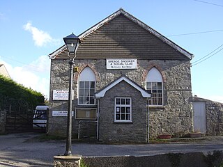
<span class="mw-page-title-main">Wendron</span> Human settlement in England

Wendron is a village and civil parish in Cornwall, England, United Kingdom. It is approximately 3 miles (5 km) to the north of Helston and 6 miles (10 km) to the west of Penryn. The parish population at the 2011 census was 2,743. The electoral ward of Wendron had a 2011 population of 4,936.

<span class="mw-page-title-main">Slapton Ley</span> Lake on the south coast of Devon, England

Slapton Ley is a lake on the south coast of Devon, England, separated from Start Bay by a shingle beach, known as Slapton Sands.

<span class="mw-page-title-main">River Cober</span> River in west Cornwall, United Kingdom

The River Cober is a short river in west Cornwall, England, United Kingdom. The river runs to the west of Helston into The Loe, Cornwall's largest natural lake.

<span class="mw-page-title-main">Degibna</span> Hamlet and farm in Cornwall, England

Degibna is a hamlet and farm in the parish of Helston, Cornwall, England, UK. It lies on the eastern bank of the largest natural freshwater lake in Cornwall, The Loe, and forms part of the Penrose Estate.

<span class="mw-page-title-main">Nine Maidens Downs</span>

Nine Maidens Downs is a moorland southwest of Four Lanes in Cornwall, England, UK.

<span class="mw-page-title-main">Penrose, Cornwall</span> National Trust estate in England

Penrose is a house and National Trust estate amounting to 1536 acres, east of Porthleven and in the civil parish of Sithney, Cornwall, England. The estate includes Loe Pool and Loe Bar which was given into the ownership of the National Trust in 1974 by Lt. Cdr. J. P. Rogers, and stretches along the coast to Gunwalloe. The estate was owned by the Penrose family for several hundred years before 1771 when it was bought for £11,000 by the Rogers family, whose descendants still reside in Penrose House.

<span class="mw-page-title-main">Rinsey</span> Hamlet in Cornwall, England

Rinsey is a hamlet in Cornwall, England, United Kingdom. It is located off the main A394 road between Helston and Penzance in the civil parish of Breage. The nearby hamlet of Rinsey Croft is located 1 km to the north-east. The nearby cliffs and beach are owned and managed by the National Trust and part of Rinsey East Cliff is designated as the Porthcew Site of Special Scientific Interest (SSSI) for its geological interest. The South West Coast Path passes through the property. Rinsey lies within the Cornwall Area of Outstanding Natural Beauty (AONB).

<span class="mw-page-title-main">Porth Hellick</span> Human settlement in England

Porth Hellick is a tidal inlet on the south coast of St Mary’s, the largest island in the Isles of Scilly.

<span class="mw-page-title-main">Outline of Cornwall</span> Overview of and topical guide to Cornwall

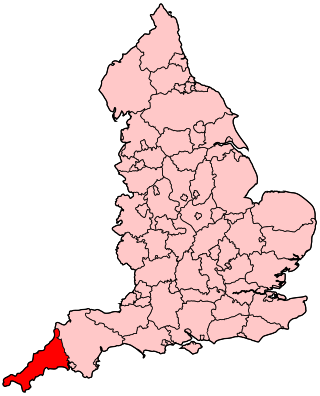
The following outline is provided as an overview of and topical guide to Cornwall: Cornwall – ceremonial county and unitary authority area of England within the United Kingdom. Cornwall is a peninsula bordered to the north and west by the Celtic Sea, to the south by the English Channel, and to the east by the county of Devon, over the River Tamar. Cornwall is also a royal duchy of the United Kingdom. It has an estimated population of half a million and it has its own distinctive history and culture.

<span class="mw-page-title-main">John Jope Rogers</span>

John Jope Rogers was the owner of Penrose, a house and estate near the Cornish town of Helston. The estate included Loe Pool, the largest lake in Cornwall, now owned by the National Trust. He was also an author and Conservative MP for Helston, Cornwall from 1859 to 1865.

Presented below is an alphabetical index of articles related to Cornwall:

References

  1. Padel, O. J. Cornish Place Names, p. 122.
  2. Toy's History of Helston, pp. 384 - 394.
  3. National Trust. Penrose Estate: Gunwalloe and Loe Pool. Retrieved 28 November 2010.
  4. Natural England. SSSI units for Loe Pool. Retrieved 28 November 2010.
  5. Cornwall Area of Outstanding Natural Beauty. http://www.cornwall-aonb.gov.uk/
  6. 1 2 3 May, V.J. Loe Bar. In May, V.J. and Hansom, J.D. (2003) Coastal Geomorphology of Great Britain, Geological Conservation Review Series, No. 28, Joint Nature Conservation Committee, Peterborough, 754 pp.
  7. Explorer Map 103. The Lizard. Ordnance Survey. 2010. ISBN   978-031924-117-2.
  8. "Archived copy" (PDF). Archived from the original (PDF) on 5 October 2011. Retrieved 24 July 2011.{{cite web}}: CS1 maint: archived copy as title (link)
  9. Bird, Eric (1998). The Coasts of Cornwall. Fowey: Alexander Associates. ISBN   1-899526-01-3.
  10. "JNCC - Adviser to Government on Nature Conservation" (PDF).
  11. 1 2 3 4 5 6 7 8 9 Murphy, R.J., (1986). A Study of Loe Bar. In Cornish Studies 14:23–33.
  12. Leland, John (1745). Itinerary. Vol. iii (2nd ed.). pp. 11–12.
  13. Quoted in Toy, H Spencer (January 1934). "The Loe Bar near Helston, Cornwall". The Geographical Journal. 83 (1): 40–47. doi:10.2307/1786663. JSTOR   1786663.
  14. Toy 1934, p. 46.
  15. Coard, Martin Andrew (1987). Paleolimnological study of the history of Loe Pool. Helston, and its catchment (PDF). Ph.D. Thesis. Dept of Environmental Studies, Plymouth Polytechnic. p. 169. Retrieved 7 November 2015.
  16. Coard 1987, p. 177.
  17. Defoe, Daniel (1991). A Tour Through the Whole Island of Great Britain . New Haven and London: Yale University Press. ISBN   0-300-04980-3.
  18. Martin, B (c. 1770). The Natural History of Cornwall and Devonshire.
  19. 1 2 Russell, Stephanie. "Historic characterisation for regeneration - Helston" (PDF). Cornwall & Scilly Urban Survey. Cornwall Archaeological Unit. Retrieved 13 August 2014.
  20. Davies, David. "Loe Bar: A Geomorphological Analysis" . Retrieved 26 March 2012.
  21. 1 2 3 4 5 6 7 8 9 10 11 Le. Messurier, B. and Luck, L. (1998) Loe Pool and Mount's Bay. No. 12 in The National Trust Coast of Cornwall series of leaflets.
  22. Peter Nicholls. "Could Helston have historically been a port settlement? : An analysis of available evidence and LiDAR remote sensing data cross referenced with a survey of the lower Cober/Loe valley" (PDF). Loepoolforum.files.wordpress.com. Retrieved 9 July 2022.
  23. DVD on 'Could Helston have been a port?'
  24. 1 2 Toy, H. S. (1936) The History of Helston. Oxford University Press
  25. Chope, R. P. (Ed.) (1918). Early Tours in Devon and Cornwall. Itinerary of John Leland (1534–43), pp. 30–1, cited in Murphy, R. J. (1986). A Study of Loe Bar. In Cornish Studies 14:23–33.
  26. Martin, B. (c. 1770). The Natural History of Cornwall and Devonshire.
  27. Rendle, J. M. (1837). Report on the practicability of forming a Harbour at the mouth of Loe Pool, in Mount's Bay, near Helston in the County of Cornwall. Plymouth: J. B. Rowe, cited in Murphy, R. J. (1986). A Study of Loe Bar. In Cornish Studies 14:23–33.
  28. Esquiros, A. (1865). Cornwall and its Coasts. Chapman and Hall, cited in Murphy, R. J. (1986). A Study of Loe Bar. In Cornish Studies 14:23–33.
  29. Chapman, V. J. (1964). Coastal Vegetation. Pergamon Press, cited in Murphy, R. J. (1986). A Study of Loe Bar. In Cornish Studies 14:23–33.
  30. "The Loe Pool". The Cornishman. No. 133. 27 January 1881. p. 8.
  31. West Briton, 22 Feb 1979, cited in Murphy, R. J. (1986). A Study of Loe Bar. In Cornish Studies 14:23–33.
  32. Vergnault, Olivier (26 January 2018). "Huge water pumping operation underway to protect homes from flooding". cornwalllive. Retrieved 29 January 2018.
  33. "Helston". The Cornishman. No. 118. 14 October 1880. p. 5.
  34. "Professor Hunt's Statistics". The Cornishman. No. 168. 29 September 1881. p. 5.
  35. "Loe Pool Stream Works. (Advertisement)". The Cornishman. No. 215. p. 1.
  36. "Diversity of lake life is harmed by water pollution". West Briton. Retrieved 27 February 2016.
  37. 1 2 Natural England. Loe Pool SSSI Designation Archived 10 May 2012 at the Wayback Machine . Retrieved 27 February 2016.
  38. 1 2 Hamilton Davy, Frederick (1909). Flora of Cornwall. Penryn: F Chegwidden.
  39. Moore, J A; Greene, D M (1983). Provisional Atlas and Catalogue of British Museum (Natural History) specimens of the Characeae. Abbots Ripton: Institute of Terrestrial Ecology.
  40. Bennallick, Ian J; French, Colin N; Parslow, Rosemary E (2009). Vascular Plants. In CISFBR Red Data Book for Cornwall and the Isles of Scilly (2nd ed.). Praze-an-Beeble: Croceago Press. pp. 105–157. ISBN   978-1901685-01-5.
  41. Graeme (26 March 2015). "Bid to save extremely rare plant strapwort at Loe Pool Helston by National Trust". West Briton. Archived from the original on 2 April 2015. Retrieved 27 February 2016.
  42. "Strapwort comes home to Loe Pool". Lizard and Penrose NT Blog. 2 June 2015. Retrieved 27 February 2016.
  43. Smith, Frank H N (1997). The Moths and Butterflies of Cornwall and the Isles of Scilly. Wallingford: Gem Publishing Company. ISBN   0-906802-07-5.
  44. Waring, Paul; Townsend, Martin (2003). Field Guide to the Moths of Great Britain and Ireland. Rotherwick: British Wildlife Publishing. ISBN   0-9531399-1-3.
  45. Gainey, P.A., Neil, C.J. and Turk, S.M. (2009) Freshwater and Terrestrial Crustacea. In CISFBR, Red Data Book for Cornwall and the Isles of Scilly. 2nd Edition. Praze-an-Beeble: Croceago Press.
  46. 1 2 Weatherhill, Craig; Devereux, Paul (1994). Myths and Legends of Cornwall. Wilmslow: Sigma Press. p. 170. ISBN   1-85058-317-X.