
Drexel Heights is a census-designated place (CDP) in Pima County, Arizona, United States. The population was 27,749 at the 2010 census.

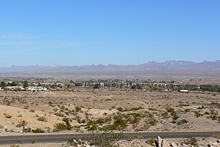
Florence is a town, 61 miles (98 km) southeast of Phoenix, in Pinal County, Arizona, United States. Florence, which is the county seat of Pinal County, is one of the oldest towns in that county and is regarded as a National Historic District with over 25 buildings listed on the National Register of Historic Places. The population of Florence was 30,770 at the 2015 census.

The Goodricke-Pigott Observatory is a private astronomical observatory in Tucson, Arizona. It was formally dedicated on October 26, 1996, and observations began that evening with imaging of Comet Hale–Bopp.

Central Arizona College (CAC) is a public community college located in Coolidge, Arizona. CAC serves the population of Pinal County.
Rillito is a census-designated place (CDP) as well as a populated place in Pima County, Arizona, United States, completely surrounded by the town of Marana. The largest business in the community is Arizona Portland Cement and the community has had a post office since the 1920s. There is a regional park and recreation center in the middle of the community. Rillito has the ZIP Code of 85654; in 2000, the population of the 85654 ZCTA was 148.
The Black Mountains of northwest Arizona are an extensive, mostly linear, north-south 75-mile (121 km) long mountain range. It forms the north-south border of southwest Mohave County as it borders the eastern shore of the south-flowing Colorado River from Hoover Dam.

The Muggins Mountains is a mountain range in southwest Arizona east of Yuma, Arizona, northeast of the Gila Mountains, and east of the Laguna Mountains. The Castle Dome Mountains lie to the northeast across the broad Castle Dome Plain. The Muggins Mountains Wilderness occupies the southwest portion of the range.
The San Cristobal Wash is an ephemeral wash and watercourse of the San Cristobal Valley, flowing north into the Gila River Valley of the southwestern desert region of Arizona. Besides Death Valley, the Chihuahuan Desert area, and regions of Baja Peninsula North America, the southeast California deserts along the Lower Colorado River Valley, this drainage region is in the harshest desert regions of North America.

Centennial Wash is an ephemeral dry wash that forms the final watershed of the Gila River in central Arizona — before the river turns south. From the Centennial Wash confluence, the Gila turns south, then southwest to exit Arizona on the California border adjacent Yuma.
Tenmile Wash is an ephemeral wash and watercourse about 85 miles (137 km) long in the northern Sonoran Desert of south-central Arizona. It forms the eastern drainage of a two drainage system of dry washes into the Gila River Valley; both flow northwesterly, and the western drainage is the San Cristobal Wash Drainage of approximately the same length.
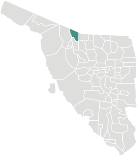
Sáric Municipality is a municipality in Sonora in north-western Mexico. Its northern boundary is the U.S. state of Arizona. The population of the municipality was 2,703 in 2010 living in an area of 1,676.23 square kilometers. The elevation is around 800 meters. At the municipal seat it is 780 meters.
Bar X Wash is a stream located in Graham County, Arizona. The name was collected by the United States Geological Survey between 1976 and 1980, and entered into the Geographic Names Information System on February 8, 1980.
Bis Ii Ah Wash is a stream located in Apache County, Arizona, southwest of the census-designated place of Nazlini. The name was collected by the United States Geological Survey between 1976 and 1980, and entered into the Geographic Names Information System on February 8, 1980.

Brawley Wash is an ephemeral stream, tributary to the Santa Cruz River, located in Pima County. Its source is in the Altar Valley between the Sierrita and Coyote Mountains at 31°58′20″N111°23′29″W, at the confluence of the Altar and Alambre washes along Arizona State Route 286. It flows north-north east through the Altar Valley and turns north as it enters Avra Valley near Robles Junction where Arizona State Route 86 crosses the streambed. The wash traverses the Avra Valley between the Roskruge Mountains and the Tucson Mountains. It joins the Santa Cruz east of the Samaniego Hills of the Silver Bell Mountains. The wash is known as the Los Robles Wash near its junction with the Santa Cruz approximately six miles west of Avra and Interstate 10.

Adamsville was a populated place in Pinal County, Arizona. Once a thriving farm town, it became a ghost town by the 1920s. Adamsville is located at an elevation is 1,450 feet, on the south bank of the Gila River, west of Florence, Arizona.
San Simon River is an ephemeral river, or stream running through the San Simon Valley in Graham and Cochise County, Arizona and Hidalgo County, New Mexico. Its mouth is at its confluence with the Gila River at Safford in Graham County. Its source is located at 31°51′21″N109°01′27″W.
Tres Alamos Wash, an ephemeral stream tributary to the San Pedro River, in Cochise County, Arizona. It runs southwesterly to meet the San Pedro River, across the river from the former settlement of Tres Alamos, Arizona. Tres Alamos Wash passes east and northeastward between the Little Dragoon Mountains and Johnny Lyon Hills to where it arises in a valley east of those heights and west of Allen Flat and the Steele Hills. It has its source at 32°07′45″N110°02′59″W.

Comobabi is both a census-designated place (CDP) and a populated place in Pima County, Arizona, United States. The population was 8 at the 2010 census. It is located within the Tohono O'odham Indian Reservation.
Ko Vaya is a census-designated place (CDP) in Pima County, Arizona, United States. The population was 46 at the 2010 census.
Nolic is a census-designated place (CDP) located on the Tohono O'odham Indian Reservation in Pima County, Arizona, United States. The population was 37 at the 2010 census.


