
Chiricahua is a band of Apache Native Americans.
Malpai Borderlands is a region, or areal feature, along the U.S.-Mexico border at the Arizona and New Mexico state line. It encompasses the extreme southeast corner of Arizona and the southwest corner of New Mexico describe the general vicinity. It includes areas inside the U.S. states of Arizona and New Mexico as well as the Mexican states of Chihuahua and Sonora.

Bavispe is a small town and a municipality in the northeast part of the Mexican state of Sonora.

The Yaqui sucker is a species of ray-finned fish in the family Catostomidae. It is found the Aridoamerica region of northern Mexico and south-western United States. Catostomus bernardini or Yaqui sucker belongs to the family Catostomidae. The Yaqui sucker is related to the Sonora sucker and could possibly be a subspecies of the Gila sucker.

The beautiful shiner is a species of ray-finned fish in the family Cyprinidae. It is found in Mexico and Arizona and New Mexico in the United States. It is one of 22 species of Cyprinella found in North America.

The Yaqui chub is a species of freshwater fish in the family Cyprinidae. It is found in northern Mexico and the United States. The Yaqui chub is a medium-sized minnow fish that historically occurred in streams of Rios Matape, Sonora, and the Yaqui systems of Sonora, Mexico. It is one of the five species of the genus Gila in Arizona. The Yaqui chub is closely related to G. ditaenia, and G. orcutti ; and shares several physical characteristics with the G. orcutti, but proves different by having a black wedge near the base of the caudal fin.

Ictalurus pricei, the Yaqui catfish, is a species of North American freshwater catfish native to Mexico and Arizona.
The Rio Bavispe or Bavispe River is a river in Mexico which flows briefly north then mainly south by southwest until it joins with the Aros River to become the Yaqui River, eventually joining the Gulf of California.

The San Bernardino National Wildlife Refuge is located on the U.S.-Mexico border in Cochise County, Arizona. Situated at 3,720 to 3,920 feet (1,130–1,190 m) elevation in the bottom of a wide valley, the refuge encompasses a portion of the headwaters of the Yaqui River, which drains primarily western Chihuahua and eastern Sonora, Mexico. The 2,309-acre (9.34 km2) ranch was acquired by the U.S. Fish and Wildlife Service in 1982 to protect the water resources and provide habitat for endangered native fishes.
The Yaqui longfin dace is a small fish of the American Southwest and northern Mexico, and considered a form of the longfin dace. It is often referred to as Agosia chrysogaster sp 1.
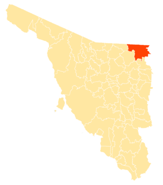
Agua Prieta Municipality is a municipality in the Mexican state of Sonora in north-western Mexico. As of 2015, the municipality had a total population of 82,918.
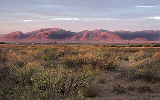
The Sierra San Luis range is a mountain range in northwest Chihuahua, northeast Sonora, Mexico at the northern region of the Sierra Madre Occidental cordillera. The region contains sky island mountain ranges, called the Madrean Sky Islands, some separated from the Sierra Madre Occidental proper, and occurring in the northeastern Sonoran Desert, and extreme west-northwestern Chihuahuan Desert. Many of the ranges occur in southeast Arizona.
Sierra del Tigre is a mountain range in northeastern Sonora, Mexico at the northern region of the Sierra Madre Occidental. The region contains sky island mountain ranges, called the Madrean Sky Islands, some separated from the Sierra Madre Occidental proper, and occurring in the northeastern Sonoran Desert, and extreme west-northwestern Chihuahuan Desert. Many of the ranges occur in southeast Arizona.

The San Bernardino Valley of Arizona is a 35 mi (56 km) northeast-by-southwest trending valley in extreme southeast Cochise County, Arizona. The north end of the valley merges into the northwest-by-southeast trending San Simon Valley; both merge in western perimeter Hidaldgo County, New Mexico. The valley is an asymmetric graben.

The Sulphur Springs Valley is a valley in the eastern half of Cochise County, Arizona. The valley covers an approximated vertical rectangle west of the Chiricahua Mountains–Dos Cabezas Mountains complex. The Sulphur Springs Valley is the large flatland to the west.
Whitewater Draw, originally Rio de Agua Prieta, [Spanish: river of dark water], is a tributary stream of the Rio de Agua Prieta in Cochise County, Arizona. It was called Blackwater Creek by Philip St. George Cooke when his command, the Mormon Battalion, camped at a spring on its course on December 5, 1846.
The Agua Prieta pipeline is a natural gas pipeline project by Sempra Energy that aims to move natural gas from the U.S. state of Arizona to the Mexican states of Sonora and Sinaloa. The pipeline will cross the Yaqui River, the main water source for the Yaqui, an indigenous tribe. The pipeline has an approximate length of 833 km upon completion, approximately 90 km of which will go through Yaqui territory. Some of the Yaqui community strongly oppose the pipeline and have campaigned against it.
