Truxton, New York

Last updated

Truxton, New York
TruxtonNYMainSt.jpg
Main St. (Rt. 13)
Cortland County NY Truxton town highlighted.svg
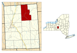
Location within Cortland County and New York
Usa edcp location map.svg
Red pog.svg
Truxton
Location in the United States
USA New York location map.svg
Red pog.svg
Truxton
Truxton (New York)
Coordinates: 42°42′33″N76°1′25″W / 42.70917°N 76.02361°W / 42.70917; -76.02361
Country United States
State New York
County Cortland
Government
  Type Town Council
   Town Supervisor Lloyd Sutton
   Town Council
Members' List
Area
[1]
  Total
44.73 sq mi (115.84 km2)
  Land44.65 sq mi (115.64 km2)
  Water0.08 sq mi (0.20 km2)
Elevation
1,142 ft (348 m)
Population
 (2010)
  Total
1,133
  Estimate 
(2016) [2]
1,093
  Density24.48/sq mi (9.45/km2)
Time zone UTC-5 (Eastern (EST))
  Summer (DST) UTC-4 (EDT)
ZIP Codes
Area code 607
FIPS code 36-023-75550
GNIS feature ID0979560
Website www.townoftruxton.com

Truxton is a town in Cortland County, New York, United States. The population was 1,133 at the 2010 census. [3] The town is named for Commodore Thomas Truxtun, a privateer in the American Revolution and one of the US Navy's first commanding officers.

Contents

Truxton is in the northeastern part of the county, northeast of the city of Cortland.

History

The region that includes Cortland County was part of the Central New York Military Tract.

The first settler arrived around 1793. The town of Truxton was formed from part of the town of Fabius (in Onondaga County) when Cortland County was created in 1808. An addition was made in 1811 to Truxton from the town of Solon. In 1858, the eastern part of Truxton was used to form the town of Cuyler.

In 1865, the population was 1,689.

The Truxton Depot was listed on the National Register of Historic Places in 2008. [4]

Truxton Depot, now the town hall of Truxton Truxton Town Hall.jpg
Truxton Depot, now the town hall of Truxton

Notable people

Geography

According to the United States Census Bureau, the town has a total area of 44.7 square miles (115.8 km2), of which 44.6 square miles (115.6 km2) is land and 0.077 square miles (0.2 km2), or 0.17%, is water. [3]

The northern town line is the border of Onondaga County.

The East Branch of the Tioughnioga River passes through the town.

New York State Route 13 intersects New York State Route 91 at Truxton village.

Demographics

Historical population
CensusPop.Note
1820 2,956
1830 3,88831.5%
1840 3,587−7.7%
1850 3,444−4.0%
1860 1,914−44.4%
1870 1,618−15.5%
1880 1,550−4.2%
1890 1,328−14.3%
1900 1,217−8.4%
1910 1,132−7.0%
1920 920−18.7%
1930 9978.4%
1940 1,0081.1%
1950 922−8.5%
1960 907−1.6%
1970 9555.3%
1980 9883.5%
1990 1,0647.7%
2000 1,22515.1%
2010 1,133−7.5%
2016 (est.)1,093 [2] −3.5%
U.S. Decennial Census [5]

As of the census [6] of 2000, there were 1,225 people, 440 households, and 337 families residing in the town. The population density was 27.4 inhabitants per square mile (10.6/km2). There were 536 housing units at an average density of 12.0 per square mile (4.6/km2). The racial makeup of the town was 97.55% White, 0.57% Black or African American, 0.16% Native American, 0.16% Asian, and 1.55% from two or more races. Hispanic or Latino of any race were 0.65% of the population.

There were 440 households, out of which 37.5% had children under the age of 18 living with them, 61.4% were married couples living together, 11.1% had a female householder with no husband present, and 23.2% were non-families. 16.4% of all households were made up of individuals, and 7.0% had someone living alone who was 65 years of age or older. The average household size was 2.77 and the average family size was 3.08.

In the town, the population was spread out, with 29.6% under the age of 18, 6.3% from 18 to 24, 31.3% from 25 to 44, 22.0% from 45 to 64, and 10.9% who were 65 years of age or older. The median age was 36 years. For every 100 females, there were 99.5 males. For every 100 females age 18 and over, there were 97.0 males.

The median income for a household in the town was $39,115, and the median income for a family was $41,000. Males had a median income of $29,306 versus $21,384 for females. The per capita income for the town was $16,516. About 8.9% of families and 11.6% of the population were below the poverty line, including 13.3% of those under age 18 and 12.0% of those age 65 or over.

Communities and locations in Truxton

References

  1. "2016 U.S. Gazetteer Files". United States Census Bureau. Retrieved July 4, 2017.
  2. 1 2 "Population and Housing Unit Estimates" . Retrieved June 9, 2017.
  3. 1 2 "Geographic Identifiers: 2010 Demographic Profile Data (G001): Truxton town, Cortland County, New York". U.S. Census Bureau, American Factfinder. Archived from the original on February 12, 2020. Retrieved December 16, 2014.
  4. "National Register Information System". National Register of Historic Places . National Park Service. July 9, 2010.
  5. "Census of Population and Housing". Census.gov. Retrieved June 4, 2015.
  6. "U.S. Census website". United States Census Bureau . Retrieved January 31, 2008.

42°42′43″N76°01′43″W / 42.71194°N 76.02861°W / 42.71194; -76.02861