Uniontown, Kansas

Last updated

Uniontown, Kansas
Bourbon County Kansas Incorporated and Unincorporated areas Uniontown Highlighted.svg
Location within Bourbon County and Kansas
Map of Bourbon Co, Ks, USA.png
Coordinates: 37°50′50″N94°58′32″W / 37.84722°N 94.97556°W / 37.84722; -94.97556 [1]
Country United States
State Kansas
County Bourbon
Incorporated 1895
Named for Union
Area
[2]
  Total0.21 sq mi (0.55 km2)
  Land0.21 sq mi (0.55 km2)
  Water0.00 sq mi (0.00 km2)
Elevation
[1]
889 ft (271 m)
Population
 (2020) [3]
  Total293
  Density1,400/sq mi (530/km2)
Time zone UTC-6 (CST)
  Summer (DST) UTC-5 (CDT)
ZIP code
66779
Area code 620
FIPS code 20-72525
GNIS ID 2397088 [1]
Website cityofuniontown.net

Uniontown is a city in Bourbon County, Kansas, United States. [1] As of the 2020 census, the population of the city was 293. [3]

Contents

History

A post office was established in 1856 about two miles east of the present town. Uniontown was moved to its present site about 1865. [4] The early settlers being loyal to the Union in the Civil War caused the name to be selected. [5] Throughout the twentieth century the town was served by the Missouri Pacific Railroad.

Geography

Uniontown is located along the Marmaton River.

According to the United States Census Bureau, the city has a total area of 0.22 square miles (0.57 km2), all of it land. [6]

Climate

The climate in this area is characterized by hot, humid summers and generally mild to cool winters. According to the Köppen Climate Classification system, Uniontown has a humid subtropical climate, abbreviated "Cfa" on climate maps. [7]

Demographics

Historical population
CensusPop.Note
1880 136
1890 344152.9%
1900 293−14.8%
1910 256−12.6%
1920 30017.2%
1930 298−0.7%
1940 277−7.0%
1950 232−16.2%
1960 211−9.1%
1970 28635.5%
1980 37129.7%
1990 290−21.8%
2000 288−0.7%
2010 272−5.6%
2020 2937.7%
U.S. Decennial Census

2010 census

As of the census [8] of 2010, there were 272 people, 120 households, and 66 families residing in the city. The population density was 1,236.4 inhabitants per square mile (477.4/km2). There were 142 housing units at an average density of 645.5 per square mile (249.2/km2). The racial makeup of the city was 96.0% White, 0.7% African American, 0.7% Native American, 0.4% Asian, 0.7% from other races, and 1.5% from two or more races. Hispanic or Latino of any race were 0.7% of the population.

There were 120 households, of which 30.0% had children under the age of 18 living with them, 39.2% were married couples living together, 10.0% had a female householder with no husband present, 5.8% had a male householder with no wife present, and 45.0% were non-families. 45.0% of all households were made up of individuals, and 22.5% had someone living alone who was 65 years of age or older. The average household size was 2.27 and the average family size was 3.20.

The median age in the city was 37.4 years. 27.2% of residents were under the age of 18; 7% were between the ages of 18 and 24; 22.8% were from 25 to 44; 25.8% were from 45 to 64; and 17.3% were 65 years of age or older. The gender makeup of the city was 45.2% male and 54.8% female.

2000 census

As of the census [9] of 2000, there were 288 people, 120 households, and 72 families residing in the city. The population density was 1,337.6 inhabitants per square mile (516.5/km2). There were 138 housing units at an average density of 640.9 per square mile (247.5/km2). The racial makeup of the city was 97.22% White, 0.35% African American, 1.04% Native American, 0.35% from other races, and 1.04% from two or more races. Hispanic or Latino of any race were 1.39% of the population.

There were 120 households, out of which 28.3% had children under the age of 18 living with them, 46.7% were married couples living together, 10.8% had a female householder with no husband present, and 40.0% were non-families. 38.3% of all households were made up of individuals, and 22.5% had someone living alone who was 65 years of age or older. The average household size was 2.24 and the average family size was 2.97.

In the city, the population was spread out, with 24.7% under the age of 18, 9.4% from 18 to 24, 16.3% from 25 to 44, 22.2% from 45 to 64, and 27.4% who were 65 years of age or older. The median age was 45 years. For every 100 females, there were 85.8 males. For every 100 females age 18 and over, there were 82.4 males.

The median income for a household in the city was $25,417, and the median income for a family was $33,229. Males had a median income of $21,667 versus $19,464 for females. The per capita income for the city was $13,283. About 12.3% of families and 14.1% of the population were below the poverty line, including 14.5% of those under the age of eighteen and 9.7% of those 65 or over.

Education

The community is served by Uniontown USD 235 public school district.

In 1999, four students at the local high school started the Life in a Jar project honoring Irena Sendler, a Polish humanitarian who rescued over 2500 Jewish children from the Warsaw Ghetto during World War II. The project spread internationally and brought fame to a little-known story of heroism. [10]

Related Research Articles

<span class="mw-page-title-main">Redfield, Kansas</span> City in Kansas, United States

Redfield is a city in Bourbon County, Kansas, United States. As of the 2020 census, the population of the city was 90.

<span class="mw-page-title-main">Horton, Kansas</span> City in Brown County, Kansas

Horton is a city in Brown County, Kansas, United States. As of the 2020 census, the population of the city was 1,523.

<span class="mw-page-title-main">St. Francis, Kansas</span> City in Cheyenne County, Kansas

St. Francis is a city in and the county seat of Cheyenne County, Kansas, United States. As of the 2020 census, the population of the city was 1,263.

<span class="mw-page-title-main">Gridley, Kansas</span> City in Coffey County, Kansas

Gridley is a city in Coffey County, Kansas, United States. As of the 2020 census, the population of the city was 313.

<span class="mw-page-title-main">Waverly, Kansas</span> City in Coffey County, Kansas

Waverly is a city in Coffey County, Kansas, United States. As of the 2020 census, the population of the city was 574.

<span class="mw-page-title-main">Walnut, Kansas</span> City in Crawford County, Kansas

Walnut is a city in Crawford County, Kansas, United States. As of the 2020 census, the population of the city was 187.

<span class="mw-page-title-main">Offerle, Kansas</span> City in Edwards County, Kansas

Offerle is a city in Edwards County, Kansas, United States. As of the 2020 census, the population of the city was 179.

<span class="mw-page-title-main">Gove City, Kansas</span> City in Gove County, Kansas

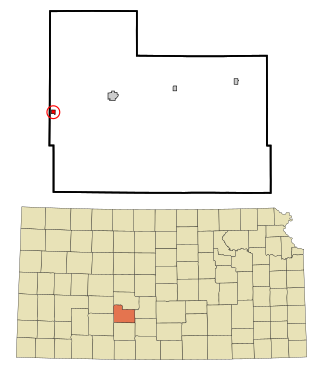
Gove City, more commonly known as Gove, is a city in and the county seat of Gove County, Kansas, United States. As of the 2020 census, the population of the city was 80.

<span class="mw-page-title-main">Virgil, Kansas</span> City in Greenwood County, Kansas

Virgil is a city in Greenwood County, Kansas, United States. As of the 2020 census, the population of the city was 48. It is located approximately 8 miles east of the city of Hamilton.

<span class="mw-page-title-main">Kingman, Kansas</span> City in Kingman County, Kansas

Kingman is a city in and the county seat of Kingman County, Kansas, United States. As of the 2020 census, the population of the city was 3,105.

<span class="mw-page-title-main">Norwich, Kansas</span> City in Kingman County, Kansas

Norwich is a city in Kingman County, Kansas, United States. As of the 2020 census, the population of the city was 444.

<span class="mw-page-title-main">Neosho Rapids, Kansas</span> City in Lyon County, Kansas

Neosho Rapids is a city in Lyon County, Kansas, United States. As of the 2020 census, the population of the city was 229.

<span class="mw-page-title-main">Meade, Kansas</span> City in Meade County, Kansas

Meade is a city in and the county seat of Meade County, Kansas, United States. As of the 2020 census, the population of the city was 1,505.

<span class="mw-page-title-main">Ness City, Kansas</span> City in Ness County, Kansas

Ness City is a city in and the county seat of Ness County, Kansas, United States. As of the 2020 census, the population of the city was 1,329. Ness City is famous for its four-story Old Ness County Bank Building located downtown, and nicknamed Skyscraper of the Plains.

<span class="mw-page-title-main">Lyndon, Kansas</span> City in Osage County, Kansas

Lyndon is a city in, and the county seat of Osage County, Kansas, United States. As of the 2020 census, the population of the city was 1,037.

<span class="mw-page-title-main">Riley, Kansas</span> City in Riley County, Kansas

Riley is a city in Riley County, Kansas, United States. As of the 2020 census, the population of the city was 938.

<span class="mw-page-title-main">Sharon Springs, Kansas</span> City in Wallace County, Kansas

Sharon Springs is a city in and the county seat of Wallace County, Kansas, United States. As of the 2020 census, the population of the city was 751.

<span class="mw-page-title-main">Toronto, Kansas</span> City in Woodson County, Kansas, United States

Toronto is a city in Woodson County, Kansas, United States, along the Verdigris River. As of the 2020 census, the population of the city was 206.

<span class="mw-page-title-main">Yates Center, Kansas</span> City in Woodson County, Kansas, United States

Yates Center is a city in and the county seat of Woodson County, Kansas, United States. As of the 2020 census, the population of the city was 1,352.

<span class="mw-page-title-main">Oliver, Pennsylvania</span> Census-designated place in Pennsylvania, United States

Oliver is a census-designated place (CDP) in Fayette County, Pennsylvania, United States. The population was 2,535 at the 2010 census, down from 2,925 at the 2000 census. Oliver is located in North Union Township.

References

  1. 1 2 3 4 U.S. Geological Survey Geographic Names Information System: Uniontown, Kansas
  2. "2019 U.S. Gazetteer Files". United States Census Bureau. Retrieved July 24, 2020.
  3. 1 2 "Profile of Uniontown, Kansas in 2020". United States Census Bureau. Archived from the original on November 8, 2022. Retrieved November 8, 2022.
  4. Blackmar, Frank Wilson (1912). Kansas: A Cyclopedia of State History, Volume 2. Standard Publishing Company. pp.  826.
  5. Capace, Nancy (June 1, 2000). Encyclopedia of Kansas. North American Book Dist LLC. p. 282. ISBN   978-0-403-09312-0.
  6. "US Gazetteer files 2010". United States Census Bureau. Archived from the original on January 12, 2012. Retrieved July 6, 2012.
  7. Climate Summary for Uniontown, Kansas
  8. "U.S. Census website". United States Census Bureau . Retrieved July 6, 2012.
  9. "U.S. Census website". United States Census Bureau . Retrieved January 31, 2008.
  10. Life in a Jar - The Irene Sendler Story Archived May 17, 2008, at the Wayback Machine , Milken Family Foundation, reproduced with permission by the Turner Foundation, 2002. Accessed 2007-10-13.

Further reading