2018 list
The 2018 ranked list of hazardous volcanoes in the United States below is based on a 24-factor scoring matrix used to calculate overall threat scores and aviation threat scores. [1]
The United States Geological Survey National Volcanic Threat Assessment is a report containing a ranked list of active volcanoes in the United States posing hazardous risks to the American population. [1] The report was published by the United States Geological Survey in 2005 [2] and revised in 2018. [3]
The 2018 ranked list of hazardous volcanoes in the United States below is based on a 24-factor scoring matrix used to calculate overall threat scores and aviation threat scores. [1]
Mackenzie, Muschalik & Broesche (2021) provided comments on the 2018 report in three separately authored sections. [4] Broesche believes that Yellowstone should be ranked higher due to the size of the volcano and the popularity of Yellowstone National Park, and Muschalik considers Mount Rainier to be just as dangerous as Kilauea due to its proximity to large population centers in Washington. Mackenzie considers Yellowstone to be just as hazardous as Kilauea.

A fumarole is a vent in the surface of the Earth or another rocky planet from which hot volcanic gases and vapors are emitted, without any accompanying liquids or solids. Fumaroles are characteristic of the late stages of volcanic activity, but fumarole activity can also precede a volcanic eruption and has been used for eruption prediction. Most fumaroles die down within a few days or weeks of the end of an eruption, but a few are persistent, lasting for decades or longer. An area containing fumaroles is known as a fumarole field.

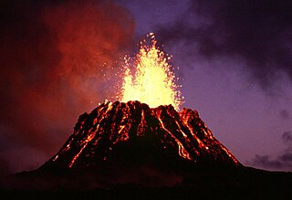
Kīlauea is an active shield volcano in the Hawaiian Islands. It is located along the southeastern shore of Hawaii Island. The volcano is between 210,000 and 280,000 years old and grew above sea level about 100,000 years ago. Since the islands were settled it has been the most active of the five volcanoes that together form the island.

The Yellowstone Caldera, sometimes referred to as the Yellowstone Supervolcano, is a volcanic caldera and supervolcano in Yellowstone National Park in the Western United States. The caldera and most of the park are located in the northwest corner of Wyoming. The caldera measures 43 by 28 miles, and postcaldera lavas spill out a significant distance beyond the caldera proper.

Hualālai is an active volcano on the island of Hawaiʻi in the Hawaiian Islands. It is the westernmost, third-youngest and the third-most active of the five volcanoes that form the island of Hawaiʻi, following Kīlauea and the much larger Mauna Loa. Its peak stands 8,271 feet (2,521 m) above sea level. Hualālai is estimated to have risen above sea level about 300,000 years ago. Despite maintaining a very low level of activity since its last eruption in 1801, and being unusually inactive for the last 2,000 years, Hualālai is still considered active, and is expected to erupt again sometime in the next 100 years. The relative unpreparedness of the residents in the area caused by the lull in activity would worsen an eruption's consequences.

The Hawaiian Volcano Observatory (HVO) is an agency of the U.S. Geological Survey (USGS) and one of five volcano observatories operating under the USGS Volcano Hazards Program. Based in Hilo, Hawaii, the observatory monitors six Hawaiian volcanoes: Kīlauea, Mauna Loa, Kamaʻehuakanaloa, Hualālai, Mauna Kea, and Haleakalā, of which, Kīlauea and Mauna Loa are the most active. The observatory has a worldwide reputation as a leader in the study of active volcanism. Due to the relatively non-explosive nature of Kīlauea's volcanic eruptions for many years, scientists have generally been able to study ongoing eruptions in proximity without being in extreme danger.

Puʻu ʻŌʻō is a volcanic cone on the eastern rift zone of Kīlauea volcano in the Hawaiian Islands. The eruption that created Puʻu ʻŌʻō began on January 3, 1983, and continued nearly continuously until April 30, 2018, making it the longest-lived rift-zone eruption of the last two centuries.

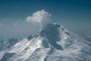
Iliamna Volcano, or Mount Iliamna, is a glacier-covered stratovolcano in the largely volcanic Aleutian Range in southwest Alaska. Located in the Chigmit Mountain subrange in Lake Clark National Park and Preserve, the 10,016-foot (3,053 m) volcano lies approximately 134 miles (215 km) southwest of Anchorage on the west side of lower Cook Inlet. It is the 25th most prominent peak in the United States.

The Volcanic Seven Summits are the highest volcanoes on each of the seven continents, just as the Seven Summits are the highest peaks on each of the seven continents. Two of the Volcanic Seven Summits are also on the Seven Summits list. Kilimanjaro and Mount Elbrus, which were formed volcanically, are the highest peaks of their respective continents.

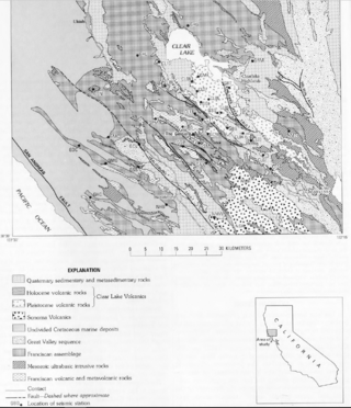
The Clear Lake Volcanic Field is a volcanic field beside Clear Lake in California's northern Coast Ranges. The site of late-Pliocene to early Holocene activity, the volcanic field consists of lava domes, cinder cones, and maars with eruptive products varying from basalt to rhyolite. The site's threat level is ranked "High" at #33 in the top volcanic threats in the United States according to "2018 Update to the U.S. Geological Survey National Volcanic Threat Assessment". The last eruption was about 11,000 years ago. Cobb Mountain and Mount Konocti are the two highest peaks in the volcanic field, at 4,724 feet (1,440 m) and 4,285 feet (1,306 m) respectively.

Chain of Craters Road is a 19-mile (31 km) long winding paved road through the East Rift and coastal area of the Hawaii Volcanoes National Park on the island of Hawaii, in the state of Hawaii, United States. The original road, built in 1928, connected Crater Rim Drive to Makaopuhi Crater. The road was lengthened to reach the tiny town of Kalapana in 1959. As of 2018, the road has had parts covered by lava in 41 of the past 53 years, due to eruptions of Kīlauea volcano.

Halemaʻumaʻu is a pit crater within the much larger Kīlauea Caldera at the summit of Kīlauea volcano on island of Hawaiʻi. The roughly circular crater was 770 meters (2,530 ft) x 900 m (2,950 ft) before collapses that roughly doubled the size of the crater after May 3, 2018. Following the collapses of 2018, the bottom of Halemaʻumaʻu was roughly 600 m (2,000 ft) below the caldera floor. Halemaʻumaʻu is home to Pele, goddess of fire and volcanoes, according to the traditions of Hawaiian religion. Halemaʻumaʻu means "house of the ʻāmaʻu fern".

The David A. Johnston Cascades Volcano Observatory (CVO) is a volcano observatory in the US that monitors volcanoes in the northern Cascade Range. It was established in the summer of 1980, after the eruption of Mount St. Helens. The observatory is named for United States Geological Survey (USGS) volcanologist David A. Johnston, who was swept away in the Mount St. Helens eruption on the morning of May 18, 1980. The observatory's current territory covers Oregon, Washington, and Idaho. The Cascade Range's extent includes northern California, and Cascade volcanoes in that state, such as Mount Shasta and Lassen Peak, previously fell under the CVO's jurisdiction. However, these volcanoes now fall under the jurisdiction of the California Volcano Observatory (CalVO), formed in February 2012 and based in Menlo Park, California, which monitors and researches volcanic activity throughout California and Nevada.

The California Volcano Observatory (CalVO) is the volcano observatory that monitors the volcanic and geologic activity of California and Nevada. It is a part of the Volcano Hazards Program of the United States Geological Survey, a scientific agency of the United States government.

The Yellowstone Volcano Observatory (YVO) is a volcano observatory that primarily monitors the Yellowstone Caldera in Yellowstone National Park in the United States. The observatory's jurisdiction also includes volcanic centers in the states of Colorado, Utah, Arizona, and New Mexico. As with other U.S. volcano observatories, it is funded through the United States Geological Survey Volcano Hazards Program.

On May 4, 2018, an earthquake with a magnitude of Mw 6.9 struck Hawaii island in the Hawaii archipelago at around 12:33 p.m. local time. The earthquake's epicenter was near the south flank of Kīlauea, which has been the site of seismic and volcanic activity since late April of that year. According to the United States Geological Survey the quake was related to the new lava outbreaks at the volcano, and it resulted in the Hilina Slump moving about two feet. It was the largest earthquake to affect Hawaii since the 1975 earthquake, which affected the same region, killing two people and injuring another 28.

The 2018 lower Puna eruption was a volcanic event on the island of Hawaiʻi, on Kīlauea volcano's East Rift Zone that began on May 3, 2018. It is related to the larger eruption of Kīlauea that began on January 3, 1983, though some volcanologists and USGS scientists have discussed whether to classify it as a new eruption. Outbreaks of lava fountains up to 300 feet (90 m) high, lava flows, and volcanic gas in the Leilani Estates subdivision were preceded by earthquakes and ground deformation that created cracks in the roads.
The National Volcano Early Warning and Monitoring System is a U.S. federal program within the U.S. Geological Survey for monitoring volcano activity and providing early warning to threatened areas. It was authorized by the John D. Dingell, Jr. Conservation, Management, and Recreation Act on March 12, 2019.
{{cite journal}}: Cite journal requires |journal= (help)