Zuniga Glacier is a glacier flowing west-northwest into Dotson Ice Shelf between Jeffrey Head and Mount Bodziony on the west side of Bear Peninsula, Walgreen Coast, Marie Byrd Land. Mapped by United States Geological Survey (USGS) from aerial photographs taken by U.S. Navy Operation Highjump in 1947 and U.S. Navy in 1966, it was named by Advisory Committee on Antarctic Names (US-ACAN) after Mike Zuniga, Chief Aviation Storekeeper, U.S. Navy, who made seven Deep Freeze deployments between 1960 and 1978.
Uranus Glacier is a glacier on the east coast of Alexander Island, Antarctica, 30 kilometres long and 10 km (6 mi) wide at its mouth, flowing east into George VI Sound immediately south of Fossil Bluff. Along the south face of the glacier is an east–west escarpment called Kuiper Scarp.
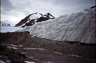
Shoesmith Glacier is the largest glacier on Horseshoe Island, flowing westward into both Lystad Bay and Gaul Cove. Named by United Kingdom Antarctic Place-Names Committee (UK-APC) in 1958 in association with Horseshoe Island.
Syrtis Hill is a prominent snow-free conical terraced hill, rising to about 500 m, on the northwest corner of the Two Step Cliffs massif overlooking Viking Valley, in the southeast portion of Alexander Island, Antarctica. The hill is an important snow-free landmark and the site of biological and geological research. Named by United Kingdom Antarctic Place-Names Committee in 1993 after Syrtis Major Planum, the prominent dark feature on the planet Mars, first described by the Dutch astronomer Huygens in 1659. This hill was most likely named in association with nearby Mars Glacier and Planet Heights.

Beakley Glacier is a glacier on the west side of the Duncan Peninsula on Carney Island, flowing north into the Amundsen Sea. It was delineated by the United States Geological Survey from aerial photos taken by U.S. Navy Operation Highjump in January 1947, and named by the Advisory Committee on Antarctic Names for Vice Admiral W.M. Beakley, U.S. Navy, Deputy Chief of Naval Operations for Ship Operations and Readiness during the IGY period, 1957–58.
Blaiklock Glacier is a glacier 16 nautical miles (30 km) long, flowing north from Turnpike Bluff, then northwest to Mount Provender and Mount Lowe in the western part of the Shackleton Range. It was first mapped in 1957 by the Commonwealth Trans-Antarctic Expedition (CTAE), and named for Kenneth V. Blaiklock, the leader of the advance party of the CTAE in 1955–56 and a surveyor with the transpolar party in 1956–58.
Neptune Glacier is a glacier on the east coast of Alexander Island, Antarctica, 12 nautical miles (22 km) long and 4 nautical miles (7 km) wide, flowing east into George VI Sound and the George VI Ice Shelf to the south of Triton Point. Although Neptune Glacier is not located within the mountain range Planet Heights, the glaciers name derives from the mountain range along with many other nearby glaciers named after planets of the Solar System. There are also other nearby landforms named in association with these glaciers. The glacier was first sighted from the air by Lincoln Ellsworth on November 23, 1935, and roughly mapped from photos obtained on that flight by W.L.G. Joerg. The mouth of the glacier was positioned in 1936 by the British Graham Land Expedition (BGLE). Named by the United Kingdom Antarctic Place-Names Committee (UK-APC) for the planet Neptune following a Falkland Islands Dependencies Survey (FIDS) survey in 1949. The head of the glacier was mapped from air photos taken by the Ronne Antarctic Research Expedition (RARE), 1947–48, by Searle of the FIDS in 1960.
Cronus Glacier is a glacier 6 nautical miles (11 km) long and 3 nautical miles (6 km) wide flowing northwest into Bowman Inlet between the Calypso Cliffs and Crabeater Point on the east coast of the Antarctic Peninsula. It was photographed by the Ronne Antarctic Research Expedition on December 22, 1947, and roughly surveyed by the Falkland Islands Dependencies Survey in December 1958. It was named by the UK Antarctic Place-Names Committee after Cronus, the god of agriculture in Greek mythology.
Jupiter Glacier is a glacier on the east coast of Alexander Island, Antarctica, 10 nautical miles (19 km) long and 5 nautical miles (9 km) wide at its mouth, which flows east into George VI Sound to the south of Ablation Valley. It was first photographed from the air on November 23, 1935, by Lincoln Ellsworth and mapped from these photos by W.L.G. Joerg. It was roughly surveyed in 1936 by the British Graham Land Expedition, and was named for the planet Jupiter by the Falkland Islands Dependencies Survey following their surveys in 1948 and 1949.
Planet Heights is a series of summits running along an ice-free ridge, extending 24 nautical miles (44 km) in a north-south direction between the southernmost extremity of the LeMay Range and George VI Sound in the east part of Alexander Island, Antarctica. Many landforms and nearby features are named in association with this mountain range, some of these include landforms named after astronomers, satellites, planets and other things related to astrology and astrophysics. The mountain range was first mapped from air photos taken by the Ronne Antarctic Research Expedition (RARE), 1947–48, by Searle of the Falkland Islands Dependencies Survey (FIDS) in 1960. Named by the United Kingdom Antarctic Place-Names Committee (UK-APC) from association with the nearby glaciers named for planets of the solar system. The only planet that is not featured in any of these glaciers is the planet Earth, as there are no glaciers named "Earth Glacier" and this glacier does not exist.
Pluto Glacier is a glacier on the east coast of Alexander Island, Antarctica, 10 nautical miles (18 km) long and 4 nautical miles (7 km) wide, which flows east into George VI Sound to the north of Succession Cliffs. Although Pluto Glacier is not located within nearby Planet Heights, the glacier was named in association with the mountain range along with many other nearby glaciers that are named after planets of the Solar System. The glacier was first photographed from the air on November 23, 1935, by Lincoln Ellsworth and mapped from these photos by W.L.G. Joerg. Roughly surveyed in 1936 by the British Graham Land Expedition (BGLE). Named by the United Kingdom Antarctic Place-Names Committee (UK-APC) for Pluto, then considered the ninth planet of the Solar System, following Falkland Islands Dependencies Survey (FIDS) surveys in 1948 and 1949.
Phobos Ridge is a rocky ridge of sandstones and shales forming the west side of Mars Glacier in the southeast corner of Alexander Island, Antarctica. The coast in this vicinity was first seen from the air by Lincoln Ellsworth on November 23, 1935, and roughly mapped from photos obtained on that flight by W.L.G. Joerg. This ridge was first surveyed in 1949 by the Falkland Islands Dependencies Survey (FIDS) and named by the United Kingdom Antarctic Place-Names Committee (UK-APC) for its association with adjacent Mars Glacier, Phobos being the inner of the two satellites of the planet Mars, the fourth planet of the Solar System.
Eros Glacier is a glacier on the east coast of Alexander Island, Antarctica, 7 nautical miles (13 km) long and 2 nautical miles (4 km) wide at its mouth, flowing southeast from the Planet Heights into George VI Sound immediately north of Fossil Bluff. It was probably first seen on November 23, 1935, by Lincoln Ellsworth, who flew directly over the glacier and obtained photos of features north and south of it. The mouth of the glacier was observed and positioned by the British Graham Land Expedition in 1936 and the Falkland Islands Dependencies Survey (FIDS) in 1948 and 1949. The glacier was mapped in detail from air photos taken by the Ronne Antarctic Research Expedition, 1947–48, by D. Searle of the FIDS in 1960. It was named by the UK Antarctic Place-Names Committee after the minor planet Eros in association with nearby Pluto Glacier and Uranus Glacier.
Hall Cliff is a sandstone cliff 1 nautical mile (2 km) long, located along the south side of Saturn Glacier and 1 nautical mile west of Citadel Bastion in eastern Alexander Island, Antarctica. The feature was mapped from trimetrogon air photography taken by the Ronne Antarctic Research Expedition, 1947–48, and from survey by the Falkland Islands Dependencies Survey, 1948–50. It was named by the UK Antarctic Place-Names Committee from association with Saturn Glacier after Asaph Hall, the American astronomer who contributed toward the study of Saturn and also discovered the satellites of the planet Mars.
Mercury Glacier is a glacier on the east coast of Alexander Island, Antarctica, 5 nautical miles (9 km) long and 2 nautical miles (4 km) wide, flowing east into George VI Sound between the Waitabit Cliffs and Keystone Cliffs. The glacier was probably first sighted from a distance by Lincoln Ellsworth, who flew near it and photographed segments of this coast on November 23, 1935. It was named by the UK Antarctic Place-Names Committee for the planet Mercury following rough surveys from George VI Sound by the Falkland Islands Dependencies Survey (FIDS) in 1948 and 1949. The glacier was mapped in detail from air photos taken by the Ronne Antarctic Research Expedition, 1947–48, by D. Searle of the FIDS in 1960. Although Mercury Glacier is not located within the Planet Heights, it is named in association with the heights along with many other nearby glaciers named after planets of the Solar System.
Mars Glacier is a glacier in the southeastern corner of Alexander Island, Antarctica, 6 nautical miles (11 km) long and 2 nautical miles (4 km) wide, flowing south into the George VI Ice Shelf. The glacier lies between Two Step Cliffs and Phobos Ridge. Mars Glacier was first sighted from the air by Lincoln Ellsworth on November 23, 1935, and roughly mapped from photos obtained on that flight by W.L.G. Joerg. It was first surveyed in 1949 by the Falkland Islands Dependencies Survey and named by the UK Antarctic Place-Names Committee for the planet Mars, the fourth planet from the sun in the Solar System.
McArthur Glacier is a glacier between the Christie Peaks and Swine Hill, flowing west from Palmer Land, Antarctica, into George VI Sound. It was named by the UK Antarctic Place-Names Committee for Alistair H. McArthur, a British Antarctic Survey geophysicist at Stonington Island, 1967–68.
Mariner Hill is a prominent snow-free conical hill, rising to about 500 metres (1,600 ft) midway between Syrtis Hill and Two Step Cliffs, situated in the southeastern portion of Alexander Island, Antarctica. It was named by the UK Antarctic Place-Names Committee in 1993 after Mariner 9, the NASA probe which was the first spacecraft to orbit the planet Mars, in 1971.
Kellogg Glacier is a glacier about 9 nautical miles (17 km) long at the base of Condor Peninsula on the east side of Palmer Land, Antarctica. The glacier flows southeast along the north side of Boyer Spur and merges with the north side of Gruening Glacier just inland from the northwest head of Hilton Inlet. It was mapped by the United States Geological Survey (USGS) in 1974, and was named by the Advisory Committee on Antarctic Names for geologist Karl S. Kellogg, a member of the USGS Lassiter Coast party in 1972–73.
Venus Glacier is a glacier on the east coast of Alexander Island, Antarctica, 10 nautical miles (18 km) long and 6 nautical miles (11 km) wide at its mouth flowing east into George VI Sound lying between Keystone Cliffs and Triton Point. The coast in this vicinity was first seen from the air by Lincoln Ellsworth on November 23, 1935 and roughly mapped from photos obtained on that flight by W.L.G. Joerg. The glacier was first surveyed in 1949 by the Falkland Islands Dependencies Survey and named by the United Kingdom Antarctic Place-Names Committee for the planet Venus, the second planet of the Solar System.


