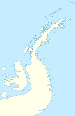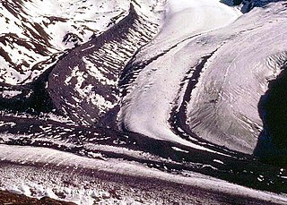
Hammond Glacier is located on the northeast side of the Haines Mountains, flowing northwest for about 40 nautical miles (70 km) to Sulzberger Ice Shelf in the Ford Ranges of Marie Byrd Land, Antarctica. It was discovered in 1934 by the Byrd Antarctic Expedition, and named by Richard E. Byrd for John Hays Hammond, an American mining engineer and philanthropist.

The Yamato Glacier is a glacier about 6 miles (10 km) wide, flowing west between Mount Fukushima and Mount Eyskens in the Queen Fabiola Mountains of Antarctica.

Gain Glacier is a large glacier on the east coast of Palmer Land, Antarctica, flowing northeast from Cat Ridge and entering the Weddell Sea between Imshaug Peninsula and Morency Island. It was mapped by the United States Geological Survey in 1974, and was named by the Advisory Committee on Antarctic Names for Louis Gain, a naturalist on the French Antarctic Expedition, 1908–10, and the author of several of the expedition reports on zoology and botany.

Irwin Glacier is a steep tributary glacier in the Bowers Mountains of Antarctica, draining northeast from Edlin Névé and at the terminus coalescing with Montigny Glacier, with which it enters the larger Graveson Glacier. The glacier was mapped by the United States Geological Survey from surveys and U.S. Navy air photos, 1960–64, and was named by the Advisory Committee on Antarctic Names for Carlisle S. Irwin, a former glaciologist who participated in the study of Meserve Glacier in 1966–67. The glacier lies situated on the Pennell Coast, a portion of Antarctica lying between Cape Williams and Cape Adare.

Atkinson Glacier is a glacier between Findlay Range and Lyttelton Range, Admiralty Mountains, flowing northward into Dennistoun Glacier. Named by the New Zealand Antarctic Place-Names Committee in 1983 after William Atkinson, field assistant, New Zealand Antarctic Division, mechanic with the New Zealand Antarctic Research Program (NZARP) geological party to the area, 1981–82, led by R.H. Findlay.

Posadowsky Glacier is a glacier about 9 nautical miles long, flowing north to Posadowsky Bay immediately east of Gaussberg. Posadowsky Bay is an open embayment, located just east of the West Ice Shelf and fronting on the Davis Sea in Kaiser Wilhelm II Land. Kaiser Wilhelm II Land is the part of East Antarctica lying between Cape Penck, at 87°43'E, and Cape Filchner, at 91°54'E, and is claimed by Australia as part of the Australian Antarctic Territory. Other notable geographic features in this area include Drygalski Island, located 45 mi NNE of Cape Filchner in the Davis Sea, and Mirny Station, a Russian scientific research station.
Willey Glacier is a heavily crevassed glacier north of Creswick Peaks in Palmer Land, flowing west from Creswick Gap into George VI Sound. Named by United Kingdom Antarctic Place-Names Committee (UK-APC) for Lawrence E. Willey, British Antarctic Survey (BAS) geologist at Fossil Bluff and Stonington Island stations, 1966–69 and 1973, and awarded the Polar Medal for services to Antarctic Survey in 1976.

Charybdis Glacier is a large glacier which drains northeast between the Porthos Range and the Aramis Range of the Prince Charles Mountains to the west side of the Amery Ice Shelf. It was discovered by an Australian National Antarctic Research Expeditions southern party led by W.G. Bewsher in December 1956 and named after whirpool monster Charybdis because of the considerable difficulty experienced in traversing this region due to the glacier.
Vivaldi Glacier is a glacier lying between the Colbert Mountains and the Lully Foothills, flowing south from Purcell Snowfield into the head of Schubert Inlet on the west coast of Alexander Island, Antarctica. The feature appears to be first shown on maps of the United States Antarctic Service (USAS) which photographed Alexander Island from the air in 1940. It was mapped from air photos obtained by the Ronne Antarctic Research Expedition in 1947–48, by Searle of the Falkland Islands Dependencies Survey in 1960. Named "Vivaldi Gap" by the United Kingdom Antarctic Place-Names Committee in 1961, after Antonio Vivaldi (1678–1741), Venetian composer. The name was amended to Vivaldi Glacier following review of Landsat program imagery, 1979, displaying flow lines in the feature.
Norman Glacier is a glacier, 5 nautical miles (9 km) long, flowing southwest from Palmer Land to enter George VI Sound just north of Bushell Bluff, in Antarctica. It was named, by the United Kingdom Antarctic Place-Names Committee (UK-APC), for Shaun M. Norman, the base commander with the British Antarctic Survey (BAS) at Stonington Island from 1966 to 1968.
Cordini Glacier is a broad glacier that drains the Mount Bailey vicinity and flows between Lewis Point and James Nunatak to the east coast of Palmer Land. It was named by the Advisory Committee on Antarctic Names after Argentine scientist I. Rafael Cordini, the author of reports on the geology and ice of the Antarctic Peninsula and the Weddell Sea region.
Croom Glacier is a steep, broad glacier flowing to the head of Smith Inlet between Moe Point and Hughes Ice Piedmont, on the east coast of Palmer Land. It was mapped by the United States Geological Survey in 1974, and named by the Advisory Committee on Antarctic Names for John M. Croom, who was a United States Antarctic Research Program biologist at Palmer Station in 1968–69 and a U.S. Exchange Scientist at the Soviet Bellingshausen Station in 1970.

Deadmond Glacier is a glacier about 6 nautical miles (11 km) long, flowing from the east side of Evans Peninsula on Thurston Island into Cadwalader Inlet. It was discovered by the U.S. Navy Bellingshausen Sea Expedition in February 1960, and was named by the Advisory Committee on Antarctic Names for Lieutenant Commander Robert B. Deadmond, executive officer of USS Burton Island, forming part of this expedition.
Delius Glacier is a glacier, 6 nautical miles (11 km) long and 2 nautical miles (4 km) wide, flowing west from the Elgar Uplands into Nichols Snowfield, in the northern part of Alexander Island, Antarctica. It was first seen from the air and roughly mapped by the British Graham Land Expedition in 1937. It was more accurately mapped from air photos taken by the Ronne Antarctic Research Expedition, 1947–48, by D. Searle of the Falkland Islands Dependencies Survey in 1960, and from U.S. Landsat imagery of February 1975. It was named by the UK Antarctic Place-Names Committee after Frederick Delius, the British composer.

Depot Glacier is a well-defined valley glacier, flanked by lateral moraines, which terminates in a high vertical ice cliff at the head of Hope Bay, in the northeast end of the Antarctic Peninsula. It was discovered by the Swedish Antarctic Expedition, 1901–04, under Otto Nordenskiöld, and so named by him because, as seen from Antarctic Sound, it appeared to be a possible site for a depot.
Guard Glacier is a broad tributary glacier that drains east along the southern margin of Parmelee Massif to join Murrish Glacier, on the east side of Palmer Land, Antarctica. It was mapped by the United States Geological Survey in 1974, and was named by the Advisory Committee on Antarctic Names for Charles L. Guard, a United States Antarctic Research Program biologist who made investigations of peripheral vascular control mechanisms in birds in the Antarctic Peninsula region for three seasons, 1972–75.
Transition Glacier is a glacier extending along the east coast of Alexander Island, 8 nautical miles (15 km) long and 2 nautical miles (3.7 km) wide, which flows east into the George VI Ice Shelf that occupies George VI Sound along the north side of Block Mountain and Tilt Rock. The glacier was first photographed from the air on November 23, 1935, by Lincoln Ellsworth and mapped from these photos by W.L.G. Joerg. Surveyed in 1949 by the Falkland Islands Dependencies Survey, and so named by them because this glacier marks the transition between igneous rocks to the north and sedimentary rocks to the south.
Palestrina Glacier is a glacier lying in the northern portion of Alexander Island, Antarctica, 11 nautical miles (20 km) long and 8 nautical miles (15 km) wide, flowing west from Nichols Snowfield into Lazarev Bay. The glacier was mapped from air photos taken by the Ronne Antarctic Research Expedition (RARE), 1947–48, by Searle of the Falkland Islands Dependencies Survey (FIDS) in 1960. Named by the United Kingdom Antarctic Place-Names Committee (UK-APC) for Giovanni da Palestrina (1525–1594), Italian composer.

Levko Glacier is a glacier flowing from Pallid Crest to the eastern end of Thurston Island, Antarctica. It enters Seraph Bay between Tierney Peninsula and Simpson Bluff. The glacier was named by the Advisory Committee on Antarctic Names after G. Levko, Photographer's Mate in the Eastern Group of U.S. Navy Operation Highjump, which obtained aerial photographs of Thurston Island and adjacent coastal areas, 1946–47.
Bishop Glacier is a glacier flowing southwest into the Mozart Ice Piedmont, situated in the northwest portion of Alexander Island, Antarctica. This feature was named by the United Kingdom Antarctic Place-names Committee (UK-APC) in 1980 after James Francis Bishop (1950-1980), a former glaciologist of the British Antarctic Survey (BAS) 1972-78, who worked in Alexander Island, 1973-75. He was killed in the Karakoram Range, Pakistan, on July 14, 1980, at this time, he was a member of Royal Geographical Society International Karakoram Project.


