Utopia Glacier is a glacier in Antarctica encircled by Mariner Hill, Syrtis Hill, Natal Ridge, and Ares Cliff; the feature was named for Utopia Planitia on the planet Mars, which was the landing site of the NASA Viking 2 Lander Mission on 3 September 1976. This name was applied to the feature by members of the Mars Oasis Party who were searching for life on the glacier, much in the same manner as the satellite was on the planet Mars.
Uranus Glacier is a glacier on the east coast of Alexander Island, Antarctica, 30 kilometres long and 10 km (6 mi) wide at its mouth, flowing east into George VI Sound immediately south of Fossil Bluff. Along the south face of the glacier is an east–west escarpment called Kuiper Scarp.

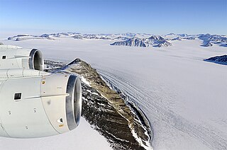
Explorers Range is a large mountain range in the Bowers Mountains of Victoria Land, Antarctica, extending from Mount Bruce in the north to Carryer Glacier and McLin Glacier in the south. Named by the New Zealand Antarctic Place-Names Committee (NZ-APC) for the northern party of New Zealand Geological Survey Antarctic Expedition (NZGSAE), 1963–64, whose members carried out a topographical and geological survey of the area. The names of several party members are assigned to features in and about this range. All of the geographical features listed below lie situated on the Pennell Coast, a portion of Antarctica lying between Cape Williams and Cape Adare.
Ares Cliff is a cliff in Antarctica. It is formed of pale-colored sandstone and rises to about 500 metres (1,600 ft) east of Mars Glacier and 1 nautical mile (2 km) north of Two Step Cliffs on the east side of Alexander Island. It was mapped from trimetrogon air photography taken by the Ronne Antarctic Research Expedition, 1947–48, and from survey by the Falkland Islands Dependencies Survey, 1948–50, and named by the UK Antarctic Place-Names Committee in association with Mars Glacier after the Greek god of war, Ares.
Neptune Glacier is a glacier on the east coast of Alexander Island, Antarctica, 12 nautical miles (22 km) long and 4 nautical miles (7 km) wide, flowing east into George VI Sound and the George VI Ice Shelf to the south of Triton Point. Although Neptune Glacier is not located within the mountain range Planet Heights, the glaciers name derives from the mountain range along with many other nearby glaciers named after planets of the Solar System. There are also other nearby landforms named in association with these glaciers. The glacier was first sighted from the air by Lincoln Ellsworth on November 23, 1935, and roughly mapped from photos obtained on that flight by W.L.G. Joerg. The mouth of the glacier was positioned in 1936 by the British Graham Land Expedition (BGLE). Named by the United Kingdom Antarctic Place-Names Committee (UK-APC) for the planet Neptune following a Falkland Islands Dependencies Survey (FIDS) survey in 1949. The head of the glacier was mapped from air photos taken by the Ronne Antarctic Research Expedition (RARE), 1947–48, by Searle of the FIDS in 1960.
Crume Glacier is a tributary glacier, 5 nautical miles (9 km) long, flowing east to enter Ommanney Glacier near the north coast of Victoria Land, Antarctica. The geographical feature was first mapped by the United States Geological Survey from surveys and from U.S. Navy air photos, 1960–63, and named by the Advisory Committee on Antarctic Names for William R. Crume, AS1, U.S. Navy, Support Equipment Maintenance Supervisor with Squadron VX-6 at McMurdo Station, Hut Point Peninsula, Ross Island, during Operation Deep Freeze 1968. The glacier lies situated on the Pennell Coast, a portion of Antarctica lying between Cape Williams and Cape Adare.
Jupiter Glacier is a glacier on the east coast of Alexander Island, Antarctica, 10 nautical miles (19 km) long and 5 nautical miles (9 km) wide at its mouth, which flows east into George VI Sound to the south of Ablation Valley. It was first photographed from the air on November 23, 1935, by Lincoln Ellsworth and mapped from these photos by W.L.G. Joerg. It was roughly surveyed in 1936 by the British Graham Land Expedition, and was named for the planet Jupiter by the Falkland Islands Dependencies Survey following their surveys in 1948 and 1949.
The Juno Peaks are two steep-sided nunataks with a small rock to the west, forming part of an east-west ridge 6 nautical miles (11 km) southwest of Mimas Peak, lying near the head of Saturn Glacier in southern Alexander Island, Antarctica. They were mapped from trimetrogon air photography taken by the Ronne Antarctic Research Expedition, 1947–48, and from survey by the Falkland Islands Dependencies Survey, 1948–50. The nunataks were named by the UK Antarctic Place-Names Committee after Juno, one of the asteroids lying between the orbits of the planets Mars and Jupiter.
Deimos Ridge is a prominent, narrow rocky spur of sandstone and shales, 3 nautical miles (6 km) southwest of Phobos Ridge and Mars Glacier in the southeast corner of Alexander Island, Antarctica. It was first seen from the air by Lincoln Ellsworth on November 23, 1935, and mapped from photos obtained on that flight by W.L.G. Joerg. It was first surveyed in 1949 by the Falkland Islands Dependencies Survey and named by the UK Antarctic Place-Names Committee for its association with Mars Glacier, Deimos being the outer of two satellites of the planet Mars.
Delius Glacier is a glacier, 6 nautical miles (11 km) long and 2 nautical miles (4 km) wide, flowing west from the Elgar Uplands into Nichols Snowfield, in the northern part of Alexander Island, Antarctica. It was first seen from the air and roughly mapped by the British Graham Land Expedition in 1937. It was more accurately mapped from air photos taken by the Ronne Antarctic Research Expedition, 1947–48, by D. Searle of the Falkland Islands Dependencies Survey in 1960, and from U.S. Landsat imagery of February 1975. It was named by the UK Antarctic Place-Names Committee after Frederick Delius, the British composer.
Pluto Glacier is a glacier on the east coast of Alexander Island, Antarctica, 10 nautical miles (18 km) long and 4 nautical miles (7 km) wide, which flows east into George VI Sound to the north of Succession Cliffs. Although Pluto Glacier is not located within nearby Planet Heights, the glacier was named in association with the mountain range along with many other nearby glaciers that are named after planets of the Solar System. The glacier was first photographed from the air on November 23, 1935, by Lincoln Ellsworth and mapped from these photos by W.L.G. Joerg. Roughly surveyed in 1936 by the British Graham Land Expedition (BGLE). Named by the United Kingdom Antarctic Place-Names Committee (UK-APC) for Pluto, then considered the ninth planet of the Solar System, following Falkland Islands Dependencies Survey (FIDS) surveys in 1948 and 1949.
Palestrina Glacier is a glacier lying in the northern portion of Alexander Island, Antarctica, 11 nautical miles (20 km) long and 8 nautical miles (15 km) wide, flowing west from Nichols Snowfield into Lazarev Bay. The glacier was mapped from air photos taken by the Ronne Antarctic Research Expedition (RARE), 1947–48, by Searle of the Falkland Islands Dependencies Survey (FIDS) in 1960. Named by the United Kingdom Antarctic Place-Names Committee (UK-APC) for Giovanni da Palestrina (1525–1594), Italian composer.
Eros Glacier is a glacier on the east coast of Alexander Island, Antarctica, 7 nautical miles (13 km) long and 2 nautical miles (4 km) wide at its mouth, flowing southeast from the Planet Heights into George VI Sound immediately north of Fossil Bluff. It was probably first seen on November 23, 1935, by Lincoln Ellsworth, who flew directly over the glacier and obtained photos of features north and south of it. The mouth of the glacier was observed and positioned by the British Graham Land Expedition in 1936 and the Falkland Islands Dependencies Survey (FIDS) in 1948 and 1949. The glacier was mapped in detail from air photos taken by the Ronne Antarctic Research Expedition, 1947–48, by D. Searle of the FIDS in 1960. It was named by the UK Antarctic Place-Names Committee after the minor planet Eros in association with nearby Pluto Glacier and Uranus Glacier.
Hall Cliff is a sandstone cliff 1 nautical mile (2 km) long, located along the south side of Saturn Glacier and 1 nautical mile west of Citadel Bastion in eastern Alexander Island, Antarctica. The feature was mapped from trimetrogon air photography taken by the Ronne Antarctic Research Expedition, 1947–48, and from survey by the Falkland Islands Dependencies Survey, 1948–50. It was named by the UK Antarctic Place-Names Committee from association with Saturn Glacier after Asaph Hall, the American astronomer who contributed toward the study of Saturn and also discovered the satellites of the planet Mars.
Mercury Glacier is a glacier on the east coast of Alexander Island, Antarctica, 5 nautical miles (9 km) long and 2 nautical miles (4 km) wide, flowing east into George VI Sound between the Waitabit Cliffs and Keystone Cliffs. The glacier was probably first sighted from a distance by Lincoln Ellsworth, who flew near it and photographed segments of this coast on November 23, 1935. It was named by the UK Antarctic Place-Names Committee for the planet Mercury following rough surveys from George VI Sound by the Falkland Islands Dependencies Survey (FIDS) in 1948 and 1949. The glacier was mapped in detail from air photos taken by the Ronne Antarctic Research Expedition, 1947–48, by D. Searle of the FIDS in 1960. Although Mercury Glacier is not located within the Planet Heights, it is named in association with the heights along with many other nearby glaciers named after planets of the Solar System.

Klebelsberg Glacier is a glacier, 7 nautical miles (13 km) long and 2 nautical miles (4 km) wide, situated at the south side of Finsterwalder Glacier and flowing from Hemimont Plateau northwestward between Armula Peak and Smilyan Bastion on Graham Land, Antarctica, toward the head of Lallemand Fjord. With Finsterwalder Glacier and Haefeli Glacier, its mouth merges with Sharp Glacier where the latter enters the fjord. It was first surveyed from the plateau in 1946–47 by the Falkland Islands Dependencies Survey, and named by them for Raimund von Klebelsberg, an Austrian glaciologist.
Romulus Glacier is a glacier, 7 nautical miles (13 km) long and 2 nautical miles (3.7 km) wide, which flows from the north slopes of Mount Lupa westward to Rymill Bay between the Blackwall Mountains and Black Thumb, on the west coast of Graham Land. First surveyed in 1936 by the British Graham Land Expedition (BGLE) under Rymill. Resurveyed in 1948-49 by the Falkland Islands Dependencies Survey (FIDS), who so named it for its association with Remus Glacier, whose head lies near the head of this glacier.