Indian Lake is a town in Hamilton County, New York, United States. The population was 1,352 at the 2010 census. The name is from a lake of the same name that is largely inside the town. There are no permanent stop lights in the town. Law enforcement is provided by New York State Troopers.

Ohio is a town in Herkimer County, New York, United States. The population was 1,002 at the 2010 census. The town is named after the state of Ohio. The town is in the northern part of the county and northeast of Utica. Part of Ohio is within the Adirondack Park.

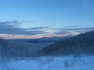
The Berkshires are a highland geologic region located in the western parts of Massachusetts and Connecticut. The term "Berkshires" is normally used by locals in reference to the portion of the Vermont-based Green Mountains that extend south into western Massachusetts; the portion extending further south into northwestern Connecticut is locally referred to as either the Northwest Hills or Litchfield Hills.

The Hills District is a general term for the north-western suburbs of Sydney, in the state of New South Wales, Australia. Situated within the Greater Western Sydney region, its constituent suburbs are generally located in the local government area of The Hills Shire; some parts of the Hornsby Shire, Blacktown and Parramatta Cities are generally given the title.

The Castle Hill rebellion of 1804 was a rebellion by convicts against colonial authority of the British colony of New South Wales in the Castle Hill area, in Sydney. The rebellion culminated in a battle fought between convicts and the colonial forces of Australia on 5 March 1804 at Rouse Hill, dubbed the Second Battle of Vinegar Hill after the first Battle of Vinegar Hill which had taken place in 1798 in Ireland. It was the first and only major convict uprising in Australian history suppressed under martial law.

The Battle of Vinegar Hill, was an engagement during the Irish Rebellion of 1798 on 21 June 1798 when over 13,000 British soldiers launched an attack on Vinegar Hill outside Enniscorthy, County Wexford, the largest camp and headquarters of the Wexford United Irish rebels. It marked a turning point in the rebellion, as it was the last attempt by the rebels to hold and defend ground against the British military. The battle was actually fought in two locations: on Vinegar Hill itself and in the streets of nearby Enniscorthy.
Vinegar Hill could refer to:

The Hudson Highlands are mountains on both sides of the Hudson River in New York state lying primarily in Putnam County on its east bank and Orange County on its west. They continue somewhat to the south in Westchester County and Rockland County, respectively.

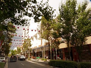
Rouse Hill is a suburb of Sydney, in the state of New South Wales, Australia. Rouse Hill is located in the Greater Western Sydney Region, 43 kilometres north-west of the Sydney central business district and 19 kilometres north-west of the Parramatta central business district. It is in the local government areas of The Hills Shire and City of Blacktown. Rouse Hill Town Centre is at the heart of the suburb, which contains a busy Town Square.

Vinegar Hill is a neighborhood in the borough of Brooklyn in New York City on the East River Waterfront between Dumbo and the Brooklyn Navy Yard. The neighborhood is locally governed by Brooklyn Community Board 2 and is policed by the New York City Police Department's 84th Precinct. The large Irish-American population in Vinegar Hill made it one of several New York areas once known colloquially as Irishtown.
Vinegar Hill is an unincorporated community in Markham, Ontario, Canada bounded by Highway 7 to the north, Highway 407 to the south, and streets just west and east of Main Street South, bordered by the Rouge River. The name of the community is believed to be linked to a cider mill on the east side of the river valley or barrel makers that filled them with vinegar to test their straightness when rolling down Markham Road.

Vly Mountain is a mountain located in the town of Halcott, New York, United States in Greene County. The mountain is part of the Catskill Mountains. Vly Mountain is flanked to the northwest by Bearpen Mountain, to the east by Vinegar Hill, to the northeast by Kipp Hill, and to the southeast by Beech Ridge.

Brace Mountain is the peak of a ridge in the southern Taconic Mountains, near the tripoint of the U.S. states of New York, Connecticut and Massachusetts. Its 2,311-foot (704 m) main summit is located in New York; it is the highest point in that state's Dutchess County.

Alander Mountain, 2,239 feet (682 m), is a prominent peak of the south Taconic Mountains; it is located in southwest Massachusetts and adjacent New York. Part of the summit is grassy and open and part is covered with scrub oak and shrubs; the sides of the mountain are wooded with northern hardwood tree species. Views from the top include the southern Taconic Mountains, the Hudson River Valley including the Catskills. Several trails traverse Alander Mountain, most notably the 15.7 mi (25.3 km) South Taconic Trail, which passes just beneath the summit.

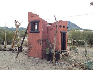
The New River Mountains are a small 14-mi (23 km) long, mountain range in central Arizona, and on the north border of the Phoenix valley; the range is located on the southwest perimeter of the Arizona transition zone. The range is a sub-part of landforms extending south from the Black Hills of Yavapai County. Rivers and canyons border east and west; the south of the range is located in Maricopa County, the location of much of the Phoenix metropolitan area.

Roarback Brook begins on the eastern side of Vly Mountain and travels east, passing to the south of Vinegar Hill before converging with West Kill west-southwest of Lexington, New York.

Beech Ridge is a ridge located in Greene County, New York southwest of Lexington, New York. Located to the northwest is Vly Mountain and to the north of Vinegar Hill. Beech Ridge drains north into Beech Ridge Brook, east into West Kill and south into Condon Hollow.

Van Loan Hill is a mountain in Greene County, New York. It is located in the Catskill Mountains southwest of Maplecrest. Round Hill is located west, Elm Ridge is located north-northeast, and East Jewett Range is located south of Van Loan Hill.


