
Vly Mountain is a mountain located in the town of Halcott, New York, United States in Greene County. The mountain is part of the Catskill Mountains. Vly Mountain is flanked to the northwest by Bearpen Mountain, to the east by Vinegar Hill, to the northeast by Kipp Hill, and to the southeast by Beech Ridge.

Warnerville is a hamlet in Schoharie County, New York, United States. Located along State Route 7 between Cobleskill and Richmondville, it is the municipality containing the majority of the sites of the Battle of Cobleskill.

The Black Hills of Yavapai County are a large mountain range of central Arizona in southeast Yavapai County. It is bordered by the Verde Valley to the east. The northwest section of the range is bisected from the southeast section by Interstate 17, which is the main route connecting Phoenix to Sedona, Oak Creek Canyon, and Flagstaff. This bisection point is the approximate center of the mostly northwest by southeast trending range. The northwest section contains a steep escarpment on the northeast with the Verde Valley, the escarpment being the location of the fault-block that created the historic mining district at Jerome.

The Canelo Hills are a range of low mountains or hills in eastern Santa Cruz County, Arizona. The range consists of a series of northwest–southeast trending ridges extending from the Sonoita Creek valley southwest of Sonoita to the Parker Canyon Lake area in southwest Cochise County, Arizona. The Canelo Hills merge with the Huachuca Mountains to the southeast. The San Rafael Valley lies to the southwest of the range and the Patagonia Mountains lie to the west across the Harshaw Creek valley. The Canelo Hills Cienega Reserve and the ghost town of Canelo, Arizona, are located on the eastern side of the hills.

The Little Rincon Mountains are a small range of mountains, lying to the east of the Rincon Mountains, at Tucson, of eastern Pima County, Arizona. The range is located in northwest Cochise County and is part of the western border of the San Pedro River and Valley, the major valley and river of western Cochise County. The river is northward flowing to meet the Gila River; its headwaters are south of the US-Mexico border in northern Sonora. A small part of the Little Rincon range's southwest lies in Pima County.
The Black Hills of Greenlee County are a 20 mi (32 km) long mountain range of the extreme northeast Sonoran Desert bordering the south of the White Mountains of eastern Arizona's transition zone.
The 5,080-acre (20.6 km2) Coyote Mountains Wilderness of Arizona is part of the Coyote Mountains of southern Arizona in the center of Pima County. The wilderness lies about 40 mi southwest of Tucson, in the northwest of the Altar Valley. Kitt Peak is 4 mi WSW.
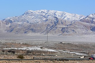
The Date Creek Mountains are a short, arid range in southwest Yavapai County, Arizona. Congress is on its southeast foothills, and Wickenburg lies 15 mi (24 km) southeast.

The New River Mountains are a small 14-mi (23 km) long, mountain range in central Arizona, and on the north border of the Phoenix valley; the range is located on the southwest perimeter of the Arizona transition zone. The range is a sub-part of landforms extending south from the Black Hills of Yavapai County. Rivers and canyons border east and west; the south of the range is located in Maricopa County, the location of much of the Phoenix metropolitan area.
The Beaver Dam Mountains are a 23 miles (37 km) long mountain range located mostly in extreme southwest Washington County, Utah, west of St. George, with the south of the range extending into the Arizona Strip.
Fortification Hill is a prominence adjacent to Lake Mead in the Lake Mead National Recreation Area; it is located at the northwest terminus region of the Black Mountains (Arizona), and specifically the north region of the Black Mountains. It is near a southern section of Lake Mead, and just northeast of Hoover Dam. It can easily be seen eastward across Las Vegas Bay or from the two northern mountain terminuses of Eldorado Mountains (Nevada), or the Black Mountains (Arizona).

Rum Hill is a mountain located in Central New York Region of New York northwest of the Hamlet of Pierstown. Red House Hill is located southeast, Metcalf Hill is located south, Allen Lake and Mohegan Hill are located north-northwest and Otsego Lake is located east of Rum Hill.
Red House Hill is a mountain in the Central New York Region of New York. It is located south-southwest of the Hamlet of Springfield Center, New York, west of Hutter Point and Six Mile Point of Otsego Lake, and southeast of Rum Hill. Mohican Brook flows eastward along the southern edge of the hill.
Cornish Hill is a small mountain chain, made of two main elevations the tallest being 2,231 feet (680 m). Cornish Hill is located in the Central New York region of New York southeast Cooperstown, New York.
Welch Hill is a mountain in the Central New York Region of New York. It is located southeast of Plainfield Center, New York.
Gill Hill is a mountain in the Central New York region of New York. It is located southeast of Ketchum Corners, New York.
Wilders Hill is a mountain located in Central New York Region of New York east of Richfield Springs, New York. Waiontha Mountain is located southeast of Wilders Hill.
Donats Mountain is a mountain located in the Catskill Mountains of New York south of Cobleskill. Mount Shank is located northwest, Warnerville Hill is located south-southeast, and Petersburg Mountain is located southeast of Donats Mountain.
Petersburg Mountain is a mountain located in the Catskill Mountains of New York southeast of Cobleskill. Warnerville Hill is located northwest, and Donats Mountain is located northwest of Petersburg Mountain.

Meadowmere is a neighborhood in Queens, New York City. It is connected to Meadowmere Park in Lawrence, Nassau County, New York, which is part of the Five Towns area of southwestern Nassau County. Meadowmere is surrounded by Nassau County, and comprises just four streets and six blocks, bordered on the west by Hook Creek and on the east by Rockaway Boulevard.

