West Monroe, New York

Last updated

West Monroe, New York
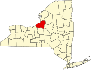
Oswego County New York incorporated and unincorporated areas West Monroe highlighted.svg
Location in Oswego County and the state of New York.
Coordinates: 43°17′45″N76°4′57″W / 43.29583°N 76.08250°W / 43.29583; -76.08250
Country United States
State New York
County Oswego
Area
[1]
  Total38.59 sq mi (99.94 km2)
  Land33.75 sq mi (87.40 km2)
  Water4.84 sq mi (12.54 km2)
Elevation
446 ft (136 m)
Population
 (2010)
  Total4,252
  Estimate 
(2016) [2]
4,149
  Density122.95/sq mi (47.47/km2)
Time zone UTC-5 (Eastern (EST))
  Summer (DST) UTC-4 (EDT)
ZIP code
13167
Area code 315
FIPS code 36-80500 [3]
GNIS feature ID0979623 [4]

West Monroe is a town in Oswego County, New York, United States. The population was 4,252 at the 2010 census.

Contents

The Town of West Monroe is in the southeastern part of the county.

The area was first settled by non Indigenous people in 1806, when four farmers bought land from George Scriba for $2 – 2.50 per acre. Thirty-three years later, the town was established on March 21, 1839, from the town of Constantia, and by 1850 had 1197 residents. [5]

Geography

The town's boundaries traverse Oneida Lake, with the town's southern boundary located at the mean high-water mark on the south shore of Oneida Lake.

According to the United States Census Bureau, the town has a total area of 38.5 square miles (100 km2), of which 33.7 square miles (87 km2) is land and 4.8 square miles (12 km2) (12.48%) is water.

Demographics

Historical population
CensusPop.Note
1840 918
1850 1,19730.4%
1860 1,41618.3%
1870 1,304−7.9%
1880 1,3140.8%
1890 1,100−16.3%
1900 936−14.9%
1910 915−2.2%
1920 782−14.5%
1930 666−14.8%
1940 7319.8%
1950 1,00237.1%
1960 1,41741.4%
1970 2,53578.9%
1980 3,48237.4%
1990 4,39326.2%
2000 4,4280.8%
2010 4,252−4.0%
2016 (est.)4,149 [2] −2.4%
U.S. Decennial Census [6]

As of the census [3] of 2000, there were 4,428 people, 1,579 households, and 1,206 families residing in the town. The population density was 131.3 inhabitants per square mile (50.7/km2). There were 1,765 housing units at an average density of 52.3 per square mile (20.2/km2). The racial makeup of the town was 97.38% White, 0.14% African American, 0.68% Native American, 0.34% Asian, 0.02% Pacific Islander, 0.18% from other races, and 1.26% from two or more races. Hispanic or Latino of any race were 0.36% of the population.

There were 1,579 households, out of which 39.0% had children under the age of 18 living with them, 61.9% were married couples living together, 8.9% had a female householder with no husband present, and 23.6% were non-families. 16.7% of all households were made up of individuals, and 5.0% had someone living alone who was 65 years of age or older. The average household size was 2.80 and the average family size was 3.16.

In the town, the population was spread out, with 29.2% under the age of 18, 7.0% from 18 to 24, 33.2% from 25 to 44, 23.4% from 45 to 64, and 7.2% who were 65 years of age or older. The median age was 35 years. For every 100 females, there were 108.8 males. For every 100 females age 18 and over, there were 105.4 males.

The median income for a household in the town was $42,043, and the median income for a family was $47,019. Males had a median income of $34,306 versus $25,489 for females. The per capita income for the town was $16,534. About 9.6% of families and 11.8% of the population were below the poverty line, including 14.7% of those under age 18 and 10.8% of those age 65 or over.

Notable people

Communities and locations in West Monroe

Related Research Articles

<span class="mw-page-title-main">Litchfield, New York</span> Town in New York, United States

Litchfield is a town in Herkimer County, New York, United States. The population was 1,513 at the 2010 census. The town is named after Litchfield, Connecticut, the source of some early settlers of the city.

<span class="mw-page-title-main">Schuyler, New York</span> Town in Herkimer County, New York, US

Schuyler is a town in Herkimer County, New York, United States. The population was 3,420 at the 2010 census. The town is in the western part of Herkimer County and is east of Utica.

Leyden is a town in Lewis County, New York, United States. The population was 1,785 at the 2010 census. The town is in the southern part of the county and is north of Rome.

Brookfield is a town in Madison County, New York, United States. The population was 2,403 at the 2000 census.

<span class="mw-page-title-main">Florence, New York</span> Town in New York, United States

Florence is a town in Oneida County, New York, United States. The population was 1,025 at the 2010 census. The town is named after the city Florence in Italy.

<span class="mw-page-title-main">Forestport, New York</span> Town in New York, United States

Forestport is a town in Oneida County, New York, United States. The population was 1,477 at the 2020 census.

<span class="mw-page-title-main">Kirkland, New York</span> Town in Oneida County, New York, United States

Kirkland is a town in Oneida County, New York, United States. The population was 10,075 at the 2020 census. The town is named after Samuel Kirkland, a missionary among the Oneidas.

<span class="mw-page-title-main">Marshall, New York</span> Town in New York, United States

Marshall is a town in Oneida County, New York, United States. The population was 2,131 at the 2010 census.
<span class="mw-page-title-main">Paris, New York</span> Town in New York, United States

Paris is a town in Oneida County, New York, United States. The town is in the southeast part of the county and is south of Utica. The population was 4,332 at the 2020 census. The town was named after an early benefactor, Colonel Isaac Paris.

<span class="mw-page-title-main">Sangerfield, New York</span> Town in New York, United States

Sangerfield is a town in Oneida County, New York, United States. The population was 2,561 at the 2010 census. The town is named after Jedediah Sanger, an early settler.

<span class="mw-page-title-main">Trenton, New York</span> Town in New York, United States

Trenton is a town in Oneida County, New York, United States. The population was 4,297 at the 2020 census.

<span class="mw-page-title-main">Verona, New York</span> Town in New York, United States

Verona is a town in southwestern Oneida County, New York, United States. The population was 6,293 at the 2010 census. The town was named after Verona, Italy.

<span class="mw-page-title-main">Vienna, New York</span> Town in New York, United States

Vienna is a town in Oneida County, New York, United States. The population was 5,440 at the 2010 census. The town is named after the capital of Austria.

<span class="mw-page-title-main">Western, New York</span> Town in New York, United States

Western is a town in Oneida County, New York, United States. The population was 1,951 at the 2010 census.

<span class="mw-page-title-main">Westmoreland, New York</span> Town in New York, United States

Westmoreland is a town in Oneida County, New York, United States. The population was 6,138 at the 2010 census.

<span class="mw-page-title-main">Whitestown, New York</span> Town in New York, United States

Whitestown is a town in Oneida County, New York, United States. The population was 18,667 at the 2010 census. The name is derived from Judge Hugh White, an early settler. The town is immediately west of Utica and the New York State Thruway passes across the town. The offices of the town of Whitestown are in the Village of Whitesboro.

<span class="mw-page-title-main">Hastings, New York</span> Town in New York, United States

Hastings is a town in Oswego County, New York, United States. Its population was 9,450 at the 2010 census. It is named after Hastings Curtiss, a prominent citizen and member of the State Assembly in 1824.
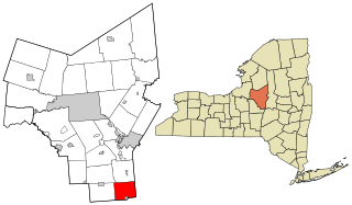
<span class="mw-page-title-main">Bridgewater, New York</span> Town in New York, United States

Bridgewater is a town in Oneida County, New York, United States. The population was 1,522 at the 2010 census.

<span class="mw-page-title-main">Constantia, New York</span> Town in New York, United States

Constantia is a town in Oswego County, New York, United States. The population was 4,973 at the 2010 census. The town is located in the southeastern part of the county. Within the town is a hamlet and census-designated place of the same name.
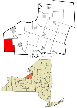
<span class="mw-page-title-main">Hannibal, New York</span> Town in New York, United States

Hannibal is a town in Oswego County, New York, United States. The population was 4,854 at the 2010 census. The name is derived from the hero of ancient Carthage, Hannibal.

References

  1. "2016 U.S. Gazetteer Files". United States Census Bureau. Retrieved July 5, 2017.
  2. 1 2 "Population and Housing Unit Estimates" . Retrieved June 9, 2017.
  3. 1 2 "U.S. Census website". United States Census Bureau . Retrieved January 31, 2008.
  4. "US Board on Geographic Names". United States Geological Survey. October 25, 2007. Retrieved January 31, 2008.
  5. "Town Of West Monroe: History: History [Digital Towpath]". townofwestmonroe-ny.us. Retrieved March 5, 2018.
  6. "Census of Population and Housing". Census.gov. Retrieved June 4, 2015.