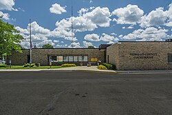
White Cloud, Michigan

Last updated

White Cloud, Michigan
Newago County Courthouse (White Cloud).jpg
Newaygo County Courthouse
Newaygo County Michigan Incorporated and Unincorporated areas White Cloud Highlighted.svg
Location of White Cloud, Michigan
Coordinates: 43°33′4″N85°46′21″W / 43.55111°N 85.77250°W / 43.55111; -85.77250
Country United States
State Michigan
County Newaygo
Area
[1]
  Total
1.99 sq mi (5.15 km2)
  Land1.93 sq mi (5.01 km2)
  Water0.06 sq mi (0.14 km2)
Elevation
[2]
873 ft (266 m)
Population
 (2020)
  Total
1,479
  Density765.13/sq mi (295.38/km2)
Time zone UTC-5 (Eastern (EST))
  Summer (DST) UTC-4 (EDT)
ZIP code
49349
Area code 231
FIPS code 26-86680 [3]
GNIS feature ID1622135 [2]
Website www.cityofwhitecloud.org

White Cloud is a city in the U.S. state of Michigan, a small town on the bank of the White River. As of the 2020 census, the city population was 1,479. It is the county seat of Newaygo County. [4] Being designated a trail town, [5] the outdoors are a big part of life in White Cloud, with the 4,600 mile North Country Trail stretching nearby, the Mill Pond Park with a beach and playground, and the White Cloud County Park and Campground, being major draws to the area. White Cloud was recognized by the North Country Trail Association as a "Trail Town". [6]

Contents

Geography

According to the United States Census Bureau, the city has a total area of 2.00 square miles (5.18 km2), of which 1.95 square miles (5.05 km2) is land and 0.05 square miles (0.13 km2) is water. [7]

Economy

The Newaygo County government, White Cloud Public schools, and the North American Refractories Co. NARCO are the major employers in White Cloud.

The $13 million state-of-the-art White Cloud Feed Mill opened in April 2018 to serve as the area's leader in supplying nutritional products and technologies. [8] Ceres Solutions Cooperative chose to build the mill in the White Cloud Industrial Park given its proximity to the airport, major highway access, as well as access to Marquette Rail. [9]

Arts and culture

The Purple Heart Pow Wow is held in White Cloud every August for families sponsored by the Military Order of the Purple Heart. [10]

Library

The White Cloud Community Library serves as a center of civic, cultural, educational, and recreational information. The library maintains a local history department providing research assistance for patrons as well as many non-residents including genealogy research for Newaygo County. An extensive range of events for adults and children are put on for the community.

Major highways

Airport

White Cloud Airport is a publicly owned and operated airport with a single 2,917 foot runway. As of 2019 it has a new terminal building, self-service fuel terminal, and is walking distance to downtown White Cloud. Also, it is located next to a new industrial park. [11]

Demographics

Historical population
CensusPop.Note
1880 440
1890 74368.9%
1900 595−19.9%
1910 6488.9%
1920 618−4.6%
1930 615−0.5%
1940 81131.9%
1950 97720.5%
1960 1,0012.5%
1970 1,0444.3%
1980 1,1015.5%
1990 1,1474.2%
2000 1,42023.8%
2010 1,408−0.8%
2020 1,4795.0%
U.S. Decennial Census [12]

2010 census

As of the census [13] of 2010, there were 1,408 people, 467 households, and 294 families residing in the city. The population density was 722.1 inhabitants per square mile (278.8/km2). There were 537 housing units at an average density of 275.4 per square mile (106.3/km2). The racial makeup of the city was 83.7% White, 7.0% African American, 0.6% Native American, 0.5% Asian, 3.1% from other races, and 5.2% from two or more races. Hispanic or Latino of any race were 6.5% of the population.

There were 467 households, of which 34.5% had children under the age of 18 living with them, 38.5% were married couples living together, 18.4% had a female householder with no husband present, 6.0% had a male householder with no wife present, and 37.0% were non-families. 30.2% of all households were made up of individuals, and 12.7% had someone living alone who was 65 years of age or older. The average household size was 2.59 and the average family size was 3.20.

The median age in the city was 32.5 years. 25.9% of residents were under the age of 18; 11.3% were between the ages of 18 and 24; 29.1% were from 25 to 44; 22.1% were from 45 to 64; and 11.6% were 65 years of age or older. The gender makeup of the city was 53.8% male and 46.2% female.

2000 census

As of the census [3] of 2000, there were 1,420 people, 494 households, and 320 families residing in the city. The population density was 736.7 inhabitants per square mile (284.4/km2). There were 553 housing units at an average density of 286.9 per square mile (110.8/km2). The racial makeup of the city was 86.41% White, 7.25% African American, 1.06% Native American, 0.28% Asian, 0.14% Pacific Islander, 1.90% from other races, and 2.96% from two or more races. Hispanic or Latino of any race were 4.65% of the population.

There were 494 households, out of which 33.0% had children under the age of 18 living with them, 42.7% were married couples living together, 17.4% had a female householder with no husband present, and 35.2% were non-families. 30.8% of all households were made up of individuals, and 14.8% had someone living alone who was 65 years of age or older. The average household size was 2.47 and the average family size was 3.07.

In the city, the population was spread out, with 26.9% under the age of 18, 11.1% from 18 to 24, 29.5% from 25 to 44, 19.1% from 45 to 64, and 13.4% who were 65 years of age or older. The median age was 34 years. For every 100 females, there were 104.9 males. For every 100 females age 18 and over, there were 111.0 males.

The median income for a household in the city was $2,313, and the median income for a family was $31,797. Males had a median income of $2,417 versus $1,417 for females. The per capita income for the city was $11,369. About 19.1% of families and 21.8% of the population were below the poverty line, including 29.7% of those under age 18 and 13.0% of those age 65 or over.

Related Research Articles

<span class="mw-page-title-main">Newaygo County, Michigan</span> County in Michigan, United States

Newaygo County is a county in the U.S. state of Michigan. As of the 2020 United States Census, the population was 49,978. The county seat is White Cloud. The county was created in 1840, and was organized in 1851. It was either named for an Ojibwe leader who signed the Treaty of Saginaw in 1819 or for an Algonquian word meaning "much water".

<span class="mw-page-title-main">New Burnside, Illinois</span> Village in Illinois, United States

New Burnside is a village in Johnson County, Illinois, United States. The population was 211 at the 2010 census.

<span class="mw-page-title-main">Sheldahl, Iowa</span> City in Iowa, United States

Sheldahl is a city in Polk, Boone, and Story counties in the U.S. state of Iowa. The population was 297 at the time of the 2020 census.

<span class="mw-page-title-main">Tiffin, Iowa</span> City in Iowa, United States

Tiffin is a city in Johnson County, Iowa, United States. It is part of the Iowa City, Iowa Metropolitan Statistical Area. The population was 4,512 at the time of the 2020 census. F. W. Kent County Park is located just to the west of Tiffin, and is a popular site for outdoor recreation in Johnson County, being noted for its lake, camping facilities, resident whitetail deer herd and wild turkeys, and its cross-country ski trails through rolling acres of oak and hickory forest.

<span class="mw-page-title-main">Howard City, Michigan</span> Village in Michigan, United States

Howard City is a village in Montcalm County in the U.S. state of Michigan. The population was 1,835 at the 2020 census. The village is within Reynolds Township.

Beaver Township is a civil township of Newaygo County in the U.S. state of Michigan. As of the 2020 census, the township population was 463.

Ensley Township is a civil township of Newaygo County in the U.S. state of Michigan. The population was 2,603 at the 2020 census.

Garfield Township is a civil township of Newaygo County in the U.S. state of Michigan. The population was 2,486 at the 2020 census.

Grant Township is a civil township of Newaygo County in the U.S. state of Michigan. As of the 2020 census, the township population was 3,298. The city of Grant is adjacent to the township.

Lincoln Township is a civil township of Newaygo County in the U.S. state of Michigan. The population was 1,292 at the 2020 census.

Merrill Township is a civil township of Newaygo County in the U.S. state of Michigan. The population was 741 at the 2020 census.

<span class="mw-page-title-main">Newaygo, Michigan</span> City in Michigan, United States

Newaygo is a rural city in Newaygo County in the U.S. state of Michigan. The population was 2,471 at the 2020 census.

Sherman Township is a civil township of Newaygo County in the U.S. state of Michigan. The population was 2,105 at the 2020 census.

<span class="mw-page-title-main">Manchester, Missouri</span> City in Missouri, United States

Manchester is a city in St. Louis County, Missouri, United States. The population was 18,333 at the 2020 census.

<span class="mw-page-title-main">Emory-Meadowview, Virginia</span> Former CDP in Virginia, United States

Emory-Meadowview was a census-designated place (CDP) in Washington County, Virginia, United States. The population was 2,266 at the 2000 census. It is part of the Kingsport–Bristol (TN)–Bristol (VA) Metropolitan Statistical Area, which is a component of the Johnson City–Kingsport–Bristol, TN-VA Combined Statistical Area – commonly known as the "Tri-Cities" region. As of the 2010 census it was split into Emory and Meadow View CDPs.

<span class="mw-page-title-main">Strum, Wisconsin</span> Village in Wisconsin, United States

Strum is a village in Trempealeau County, Wisconsin, United States, along the Buffalo River. The population was 1,114 at the 2010 census.

Dayton Township is a civil township of west central Newaygo County in the U.S. state of Michigan. The population was 1,994 at the 2020 census.

Denver Township is a civil township of Newaygo County in the U.S. state of Michigan. The population was 2,008 at the 2020 census.

Home Township is a civil township of Newaygo County in the U.S. state of Michigan. The population was 238 at the 2020 census.

Norwich Township is a civil township of Newaygo County in the U.S. state of Michigan. The population was 547 at the 2020 census.

References

  1. "2020 U.S. Gazetteer Files". United States Census Bureau. Retrieved May 21, 2022.
  2. 1 2 U.S. Geological Survey Geographic Names Information System: White Cloud, Michigan
  3. 1 2 "U.S. Census website". United States Census Bureau . Retrieved January 31, 2008.
  4. "Find a County". National Association of Counties. Retrieved June 7, 2011.
  5. "Parks and Recreation – City of White Cloud".
  6. "White Cloud Trail Town". northcountrytrail.org. Archived from the original on May 27, 2019. Retrieved March 15, 2023.
  7. "US Gazetteer files 2010". United States Census Bureau. Archived from the original on February 20, 2011. Retrieved November 25, 2012.
  8. "White Cloud Feed Mill hosts grand opening celebration".
  9. "North Central Co-op plans $10M expansion in Newaygo". November 20, 2016.
  10. "August is Pow Wow Time in White Cloud!".
  11. "White Cloud Airport – City of White Cloud".
  12. "Census of Population and Housing". Census.gov. Retrieved June 4, 2015.
  13. "U.S. Census website". United States Census Bureau . Retrieved November 25, 2012.

43°33′01″N85°46′19″W / 43.55028°N 85.77194°W / 43.55028; -85.77194