Winchester Repeating Arms Company Historic District

Last updated
Winchester Repeating Arms Company Historic District
Winchester3.jpg
Front of Winchester Repeating Arms Company (1870s), 275 Winchester Ave., New Haven, Connecticut.
USA Connecticut location map.svg
Red pog.svg
Usa edcp location map.svg
Red pog.svg
LocationRoughly bounded by Sherman Pkwy., Ivy St., Mansfield St., Admiral St., and Sachem St., New Haven, Connecticut
Coordinates 41°19′16″N72°55′55″W / 41.32111°N 72.93194°W / 41.32111; -72.93194 Coordinates: 41°19′16″N72°55′55″W / 41.32111°N 72.93194°W / 41.32111; -72.93194
Area255 acres (103 ha) (excludes increase of 2015)
Built1912
ArchitectRobinson, Leoni W.; Et al.
Architectural styleColonial Revival, Italianate, Queen Anne
NRHP reference No. 87002552 [1]  (original)
13000898  (increase)
Significant dates
Added to NRHPJanuary 28, 1988
Boundary increaseApril 21, 2015

The Winchester Repeating Arms Company Historic District is a historic district in New Haven, Connecticut that was listed on the National Register of Historic Places in 1988. [1] It includes 867 properties, which "include 858 major structures and 131 notable outbuildings." [2] :2 Of these structures, 876 are buildings deemed to contribute to the historical and/or architectural significance of the area, and most of these are residential. However the center of the district is "dominated" by the 75-acre (30 ha) tract of the former Winchester Repeating Arms Company, which contains industrial buildings. [2] :2

Contents

The district includes and surrounds the old Winchester plant later run by U.S. Repeating Arms; the plant was important to both of its adjoining residential neighborhoods. Some of the plant has been operated by Science Park at Yale, a business incubator with Yale University associations.

Significance

According to the district's 1987 nomination document:

The district is historically significant for two reasons. First its core encompasses the extensive surviving portions of the industrial complex developed by the former Winchester Repeating Arms Company, one of the nation's foremost late 19th- and early 20th-century armament manufacturers. Second, the district as a whole forms New Haven's most nearly intact and cohesive surviving example of the inherent relationship between the growth of modern industry and the emergence of large working-class residential neighborhoods, a relationship typically associated with the development of many of the nation's northeastern urban communities during the late 19th and early 20th centuries (Criterion A). The district is architecturally significant for three reasons. First, its core embraces numerous examples of period industrial structures. Second, the majority of these structures were built for the Winchester Repeating Arms Company according to designs provided by Leoni W. Robinson, one of New Haven's premier late 19/early 20th-century architects. Finally, the district's predominantly residential perimeter areas encompass a host of relatively intact single- and multi-family workers' houses as well as several significant examples of commercial, religious, and municipal buildings dating from this same era. As a group, these perimeter-area buildings represent a variety of important and popular vernacular architectural styles of the era, including late Greek Revival, Italianate, Gothic Revival, Queen Anne and Colonial Revival (Criterion C). [2] :45

Residential development

Residential development in the district included development of tenement buildings for one, two or three families. [2] :48 Examples are as depicted in accompanying photo 2 (134-36, 138-40, 142-44, 146-48 Mansfield St.), photo 4 (166-68, 162-64, 156-58, 152-54, 146-48 Sheffield St., photo 5 (220-30 Division St.), photo 13 (567 Dixwell Ave.), photo 16 (552-54, 558 Winchester Ave.) and photo 20 (368, 370, 374, 378 Dixwell Ave.). Two speculators who were very successful with such residential development were Joseph Sheldon and John W. Bishop: "these men were the moving force behind the 19th-century development of virtually all of the properties which currently line both sides of Admiral and most of Henry Streets, as well as the construction of most of the houses along the southwestern side of Munson Street directly opposite the Winchester complex. Their work is depicted in accompanying photo 22 (51, 49, 43, 41, 39 Henry St.), photo 12 (49, 53, 55, 59 Admiral St.) and accompanying photo 9 (206, 208, 210, 212, 214, 216, 218, and 220-22 Munson St.). [2] :48

Industrial development

The Winchester firm had started operations on Union Street in the Wooster Square neighborhood of New Haven, and moved to Bridgeport in 1866. It relocated from Bridgeport to New Haven in 1870, to the current location in the district. The original buildings which it built no longer exist. The firm grew to more than 600 employees by 1887 and "well in excess of 1,000" by the early 1900s. [2] :47

Streets

Streets in the district include:

Accompanying photo 1 depicts houses at 72, 76, 82 Mansfield St.
Accompanying photo 2 depicts 134-36, 138-40, 142-44, 146-48 Mansfield St.
Accompanying photo 3 depicts 182, 184 Mansfield St.
Accompanying photo 4 depicts 166-68, 162-64, 156-58, 152-54, 146-48 Sheffield St.
Accompanying photo 6 depicts the Shelton Avenue School, at 155 Sheffield St.
Accompanying photo 5 depicts 220-30 Division St.
Accompanying photos 7, 8, 24, 25, 26, 27 and 28 depict the Winchester Repeating Arms Company complex, at 275 Winchester Ave., with some other properties also in view in some of the photos
Accompanying photo 16 depicts 552-54, 558 Winchester Ave.
Accompanying photo 23 depicts the McKesson and Robbins factory building, at 182 Winchester Ave.
Accompanying photo 9 depicts 206, 208, 210, 212, 214, 216, 218, 220-22 Munson St.
Accompanying photo 10 depicts Newhall's Boarding House, built in 1860, at 55-57 Thompson St.
Accompanying photo 11 depicts the Ivy Street School, at 1-41 Ivy St.
Accompanying photo 12 depicts 49, 53, 55, 59 Admiral St.
Accompanying photo 13 depicts 567 Dixwell Ave.
Accompanying photo 14 depicts 495 Dixwell Ave.
Accompanying photo 17 depicts 459 Dixwell Ave., with decorative bargeboard
Accompanying photo 20 depicts 368, 370, 374, 378 Dixwell Ave.
Accompanying photo 21 depicts 287-89, 297-301 Dixwell Ave.
Accompanying photo 15 depicts 140 Shelton Ave.
Accompanying photo 19 depicts 7-11, 13-15 Shelton Ave.
Accompanying photo 18 depicts 141, 145-47 Newhall St.
Accompanying photo 22 depicts 51, 49, 43, 41, 39 Henry St.

Relationship to neighborhoods

The district is located in the Newhallville and Dixwell neighborhoods defined by the city of New Haven, Connecticut. [3]

The 1987 NRHP nomination document reads: the "255-acre district includes most of the southern and northern portions of the city's Newhallville and Dixwell neighborhoods, respectively." [2]

See also

Related Research Articles

Downtown New Haven Neighborhood of New Haven in Connecticut, United States

Downtown New Haven is the neighborhood located in the heart of the city of New Haven, Connecticut. It is made up of the original nine squares laid out in 1638 to form New Haven, including the New Haven Green, and the immediate surrounding central business district, as well as a significant portion of the Yale University campus. The area includes many restaurants, cafes, theaters and stores. Downtown is bordered by Wooster Square to the east, Long Wharf to the southeast, the Hill neighborhood to the south, the Dwight neighborhood to the west, the Dixwell neighborhood to the northwest, the Prospect Hill area to the north, and East Rock to the northeast.

Mott Haven, Bronx Neighborhood of the Bronx in New York City

Mott Haven is a primarily residential neighborhood in the southwestern section of the New York City borough of the Bronx. Its boundaries, starting from the north and moving clockwise, are East 149th Street to the north, the Bruckner Expressway to the east, the Bronx Kill waterway to the south, and the Harlem River to the west. East 138th Street is the primary east–west thoroughfare through Mott Haven.

The U.S. Repeating Arms Company. Inc. (USRAC) is the current business name of the Winchester Repeating Arms Company, famous for making Winchester rifles.

The Winchester Repeating Arms Company was a prominent American maker of repeating firearms, located in New Haven, Connecticut. The Winchester brand is today owned by the Olin Corporation and the name is used under license by two subsidiaries of the Herstal Group: Fabrique Nationale (FN) of Belgium and the Browning Arms Company of Ogden, Utah, United States.

City Point, New Haven United States historic place

City Point is an area in what is now The Hill neighborhood of the city of New Haven, Connecticut, located in the southwestern portion of the city. The City Point area was, when settled and through the 18th century, a relatively narrow peninsula extending south into New Haven Harbor, located where the West River empties into the harbor. Areas adjacent to the original peninsula have since been filled in, broadening its shoulders, and Interstate 95 has cut across it. The Oyster Point Historic District is a 26-acre (11 ha) historic district encompassing an area of relatively old buildings in City Point south of I-95.

Richard C. Lee

Richard Charles Lee was a Democrat and a longtime Mayor of New Haven (1954–70) and the youngest when he held the position in 1954 at age 37. Lee is best known for his leading role in urban redevelopment in the 1950s and 1960s.

Westville Village Historic District United States historic place

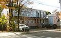
Westville Village Historic District is a historic district representing most of the commercial center of the Westville neighborhood of New Haven, Connecticut. This center developed in the 19th century as an industrial mill village distinct from the city center, and retains many architectural features of that period. The district was listed on the National Register of Historic Places in 2003, and its boundaries were increased slightly in 2006.

Dixwell is a neighborhood of New Haven, Connecticut. Named for Dixwell Avenue, the main thoroughfare of the neighborhood which in turn was named for regicide judge John Dixwell, it is situated generally northwest of and adjacent to Downtown New Haven.

Newhallville is a neighborhood in the city of New Haven, Connecticut, named for industrialist George Newhall.

Howard Avenue Historic District United States historic place

The Howard Avenue Historic District is a 32-acre (13 ha) historic district in The Hill neighborhood of the city of New Haven, Connecticut. Extending along Howard Avenue between Minor Street and Interstate 95, it contains an unusually high concentration of well-preserved late 19th-century middle class vernacular architecture, reflecting the area's growth at that time. It was listed on the National Register of Historic Places in 1985.

Prospect Hill, New Haven

Prospect Hill is a neighborhood of the city of New Haven, Connecticut located in the north central portion of the city, directly north of Downtown New Haven. The neighborhood contains residences, institutional buildings of Albertus Magnus University and a portion of the main campus of Yale University, including the Science Hill area, the Hillhouse Avenue area and the Yale Peabody Museum. The City of New Haven defines the neighborhood to be the region bounded by the town of Hamden in the north, Winchester Avenue in the west, Munson Street/Hillside Place/Prospect Street in the southwest, Trumbull Street in the south, and Whitney Avenue in the east. Prospect Street is the main thoroughfare through the neighborhood.

Prospect Hill Historic District (New Haven, Connecticut) United States historic place

The Prospect Hill Historic District is an irregularly-shaped 185-acre (75 ha) historic district in New Haven, Connecticut. The district encompasses most of the residential portion of the Prospect Hill neighborhood.

Whitney Avenue Historic District United States historic place

The Whitney Avenue Historic District is a historic district in the East Rock neighborhood of New Haven, Connecticut. It is a 203-acre (82 ha) district which included 1,084 contributing buildings when it was listed on the National Register of Historic Places in 1989.

National Register of Historic Places listings in New Haven, Connecticut

This is a list of National Register of Historic Places listings in New Haven, Connecticut.

Beaver Hills Historic District United States historic place

The Beaver Hills Historic District is a 97-acre (39 ha) historic district in the Beaver Hills neighborhood of New Haven, Connecticut. It was listed on the National Register of Historic Places in 1986. In 1986, it included 235 contributing buildings.

Dwight Street Historic District United States historic place

The Dwight Street Historic District is an irregularly shaped 135-acre (55 ha) historic district in New Haven, Connecticut. The district is located immediately west of the center of Downtown New Haven and is generally bounded by Elm Street on the north, Park Street on the east, North Frontage Road on the south, and Sherman Avenue on the west. It contains one of the city's highest concentrations of well-preserved 19th and early 20th-century residential architecture, much of which was developed for the working classes in the city's factories. It was listed on the National Register of Historic Places in 1983. The historic district includes most of the Dwight neighborhood and several blocks of the northeast corner of the West River neighborhood.

The city of New Haven, Connecticut has many distinct neighborhoods. In addition to Downtown, centered on the central business district and the Green, are the following neighborhoods: the west central neighborhoods of Dixwell and Dwight; the southern neighborhoods of The Hill, historic water-front City Point, and the harborside district of Long Wharf; the western neighborhoods of Edgewood, West River, Westville, Amity, and West Rock; East Rock, Cedar Hill, Prospect Hill, and Newhallville in the northern side of town; the east central neighborhoods of Mill River and Wooster Square, an Italian-American neighborhood; Fair Haven, an immigrant community located between the Mill and Quinnipiac rivers; Quinnipiac Meadows and Fair Haven Heights across the Quinnipiac River; and facing the eastern side of the harbor, The Annex and East Shore.

Leoni W. Robinson

Leoni W. Robinson was a leading architect in New Haven, Connecticut.

Sand Hills Historic District United States historic place

The Sand Hills Historic District in Augusta, Georgia is a historic district which was listed on the National Register of Historic Places in 1997. The district included 334 contributing buildings and a contributing site in a 231 acres (0.93 km2) area roughly bounded by Monte Sano and North View Aves., Mount Auburn St., Johns Rd., and the Augusta Country Club.

Highwood, Hamden neighborhood in New Haven, Connecticut, United States

Highwood is a neighborhood in the south-central portion of the town of Hamden, Connecticut. It is primarily residential, with a mixture of small apartment buildings and single-family, two- and three-family homes. Commercial development is concentrated on its principal street, Dixwell Avenue. Immigrants from Germany were the first to settle the area extensively in the 1860s, followed by others from Ireland, Italy, and Eastern Europe later in the nineteenth century. Today it is predominantly African American.

References

  1. 1 2 "National Register Information System". National Register of Historic Places . National Park Service. March 13, 2009.
  2. 1 2 3 4 5 6 7 J. Paul Loether and John Herzan (June 28, 1987). "National Register of Historic Places Inventory-Nomination: Winchester Repeating Arms Company Historic District". National Park Service. and Accompanying 28 photos from 1987 (photo captions pages 59-65 of text document)
  3. Maps of the New Haven Neighborhoods (PDF) are available from the City of New Haven's City Plan Department. There are also quick traces from the above PDFs in Google Earth/Map Shapes of the New Haven Neighborhoods (KML).