This article needs additional citations for verification .(November 2007) |
Arnold's Cove | |
|---|---|
Town | |
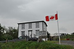 Drake House | |
 Seal | |
 Arnold's Cove Location of Arnold's Cove in Newfoundland | |
| Coordinates: 47°45′42″N53°58′57″W / 47.76167°N 53.98250°W | |
| Country | |
| Province | |
| Census division | 1 |
| Incorporated | 1967 |
| Government | |
| • Mayor | John Barrett |
| Area | |
• Total | 4.79 km2 (1.85 sq mi) |
| Population (2021) | |
• Total | 916 |
| Time zone | UTC-3:30 (Newfoundland Time) |
| • Summer (DST) | UTC-2:30 (Newfoundland Daylight) |
| Area code | 709 |
| Highways | |
Arnold's Cove (2021 Population 916 [1] ) is a town on Newfoundland's Avalon Peninsula in the province of Newfoundland and Labrador, Canada. It is in Division 1 on Placentia Bay.
Contents
- Demographics
- Attractions
- Hiking trails
- Lookout points
- Historic buildings
- Religious buildings and cemeteries
- See also
- References
The name is found in population returns of 1836, and may have been given after the forename of a fisherman. [2] In 1864 there was one family, and by 1893 there was a post office. It was a fishing settlement located approximately two kilometers from the Newfoundland Railway, located 35 miles from Placentia Junction.
It was a Local Improvement District in 1967 and incorporated as a town the same year. It had a population of 100 in 1911 and 1,160 in 1976. It has been a center of economic growth recently, due to its proximity to projects involved with the Hibernia offshore oil platform.
