The Hopi are Native Americans who primarily live in northeastern Arizona. The majority are enrolled in the Hopi Tribe of Arizona and live on the Hopi Reservation in northeastern Arizona; however, some Hopi people are enrolled in the Colorado River Indian Tribes of the Colorado River Indian Reservation at the border of Arizona and California.

Mesa Verde National Park is an American national park and UNESCO World Heritage Site located in Montezuma County, Colorado. The park protects some of the best-preserved Ancestral Puebloan archaeological sites in the United States.
The Pecos Classification is a chronological division of all known Ancestral Puebloans into periods based on changes in architecture, art, pottery, and cultural remains. The original classification dates back to consensus reached at a 1927 archæological conference held in Pecos, New Mexico, which was organized by the United States archaeologist Alfred V. Kidder.

Navajo National Monument is a National Monument located within the northwest portion of the Navajo Nation territory in northern Arizona, which was established to preserve three well-preserved cliff dwellings of the Ancestral Puebloan people: Keet Seel, Betatakin, and Inscription House. The monument is high on the Shonto plateau, overlooking the Tsegi Canyon system, west of Kayenta, Arizona. It features a visitor center with a museum, three short self-guided trails, two small campgrounds, and a picnic area.

Zuñi Salt Lake, also Zuni Salt Lake is a rare high desert lake, and a classic maar, located in Catron County, New Mexico, United States, about 60 miles (97 km) south of the Zuni Pueblo, New Mexico.

Canyons of the Ancients National Monument is a national monument protecting an archaeologically significant landscape located in the southwestern region of the U.S. state of Colorado. The monument's 176,056 acres (71,247 ha) are managed by the Bureau of Land Management, as directed in the presidential proclamation which created the site on June 9, 2000. Canyons of the Ancients National Monument is part of the National Landscape Conservation System, better known as the National Conservation Lands. This system comprises 32 million acres managed by the Bureau of Land Management to conserve, protect, and restore these nationally significant landscapes recognized for their outstanding cultural, ecological, and scientific values. Canyons of the Ancients encompasses and surrounds three of the four separate sections of Hovenweep National Monument, which is administered by the National Park Service. The monument was proclaimed in order to preserve the largest concentration of archaeological sites in the United States, primarily Ancestral Puebloan ruins. As of 2022, over 8,500 individual archeological sites had been documented within the monument.

Oasisamerica is a cultural region of Indigenous peoples in North America. Their precontact cultures were predominantly agrarian, in contrast with neighboring tribes to the south in Aridoamerica. The region spans parts of Northwestern Mexico and Southwestern United States and can include most of Arizona and New Mexico; southern parts of Utah and Colorado; and northern parts of Sonora and Chihuahua. During some historical periods, it might have included parts of California and Texas as well.

Casa Malpaís is an archaeological site of the Ancestral Puebloans located near the town of Springerville, Arizona. The site is a nationally recognized archaeological site and was declared a National Historic Landmark in 1964.

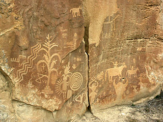
The Crow Canyon Archaeological District is located in the heart of the Dinétah region of the American Southwest in Rio Arriba and San Juan counties in New Mexico approximately 30 miles southeast of the city of Farmington. This region, known to be the ancestral homeland of the Navajo people, contains the most extensive collection of Navajo and Ancient Pueblo petroglyphs or rock art in the United States. Etched into rock panels on the lower southwest walls of the canyon are petroglyphs or rock art depicting what is believed to be ceremonial scenes and symbolic images that represent the stories, traditions and beliefs of the Navajo people. Dating back to the 16th, 17th, and 18th centuries, the petroglyphs have maintained their integrity despite the environmental conditions of the canyon and the effects of tourism. Among the ruins in the Crow Canyon Archaeological District there is also a cluster of Navajo defensive structures or pueblitos, which were built in the 18th century during periods of conflict with the Utes and the beginnings of Spanish Colonialism.

Homolovi State Park is a state park of Arizona, United States, preserving over 300 Ancestral Puebloan archaeological sites. Homolovi or Homol'ovi is a Hopi word meaning "place of the little hills". The park is located just over a mile north of Winslow, Arizona, and features historical exhibits, interpretive programs, birdwatching, and hiking. There is a year-round campground, restrooms with showers and an RV dump station. The park was closed to visitors from February 22, 2010 to March 18, 2011 due to state budget cuts.

The Awatovi Ruins, spelled Awat'ovi in recent literature, are an archaeological site on the Hopi Reservation in northeastern Arizona, United States. The site contains the ruins of a pueblo estimated to be 500 years old, as well as those of a 17th-century Spanish mission. It was visited in the 16th century by members of Francisco Vázquez de Coronado's exploratory expedition. In the 1930s, Hopi artist Fred Kabotie was commissioned by the Peabody Museum of Archaeology and Ethnology of Harvard University to reproduce the prehistoric murals found during the excavation of the Awatovi Ruins. The site was designated a National Historic Landmark in 1964.

The Trail of the Ancients is a collection of National Scenic Byways located in the U.S. Four Corners states of Utah, Colorado, New Mexico, and Arizona. These byways comprise:

Art of the American Southwest is the visual arts of the Southwestern United States. This region encompasses Arizona, New Mexico, and parts of California, Colorado, Nevada, Texas, and Utah. These arts include architecture, ceramics, drawing, filmmaking, painting, photography, sculpture, printmaking, and other media, ranging from the ancient past to the contemporary arts of the present day.
Wide Ruins is a chapter of the Navajo Nation and a census-designated place (CDP) in Apache County, Arizona, United States. The population was 176 at the 2010 census.

The Trail of the Ancients is a New Mexico Scenic Byway to prehistoric archaeological and geological sites of northwestern New Mexico. It provides insight into the lives of the Ancestral Puebloans and the Navajo, Ute, and Apache peoples. Geological features include canyons, volcanic rock features, and sandstone buttes. Several of the sites are scenic and wilderness areas with recreational opportunities.

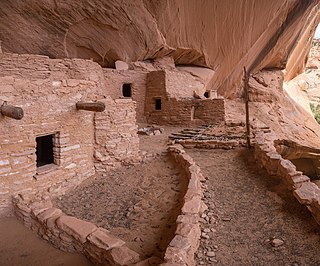
The Ancestral Puebloans, also known as the Anasazi, were an ancient Native American culture that spanned the present-day Four Corners region of the United States, comprising southeastern Utah, northeastern Arizona, northwestern New Mexico, and southwestern Colorado. They are believed to have developed, at least in part, from the Oshara tradition, which developed from the Picosa culture. The people and their archaeological culture are often referred to as Anasazi, meaning "ancient enemies", as they were called by Navajo. Contemporary Puebloans object to the use of this term, with some viewing it as derogatory.

Bears Ears National Monument is a United States national monument located in San Juan County in southeastern Utah, established by President Barack Obama by presidential proclamation on December 28, 2016. The monument protects 1,351,849 acres of public land surrounding the Bears Ears—a pair of buttes—and the Indian Creek corridor rock climbing area. The Native American names for the buttes have the same meaning in each of the languages represented in the region. The names are listed in the presidential proclamation as "Hoon’Naqvut, Shash Jáa [sic], Kwiyaghatʉ Nükavachi/Kwiyagatu Nukavachi, Ansh An Lashokdiwe"—all four mean "Bears Ears".

Puerco Ruin and Petroglyphs are the ruins of a large Indian pueblo, which reached its peak around 1300 CE, containing over 100 rooms. It is the largest known archeological site within the Petrified Forest National Park.

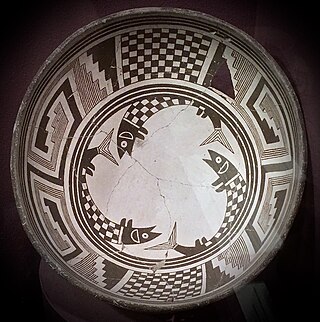
Pueblo pottery are ceramic objects made by the indigenous Pueblo people and their antecedents, the Ancestral Puebloans and Mogollon cultures in the Southwestern United States and Northern Mexico. For centuries, pottery has been central to pueblo life as a feature of ceremonial and utilitarian usage. The clay is locally sourced, most frequently handmade, and fired traditionally in an earthen pit. These items take the form of storage jars, canteens, serving bowls, seed jars, and ladles. Some utility wares were undecorated except from simple corrugations or marks made with a stick or fingernail, however many examples for centuries were painted with abstract or representational motifs. Some pueblos made effigy vessels, fetishes or figurines. During modern times, pueblo pottery was produced specifically as an art form to serve an economic function. This role is not dissimilar to prehistoric times when pottery was traded throughout the Southwest, and in historic times after contact with the Spanish colonialists.

The Dark Canyon Ruins are a collection of ancient Puebloan ruins in southeastern Utah found in Dark Canyon Wilderness, part of Bears Ears National Monument. At least 72 archaeological sites have been identified in the Beef Basin-Dark Canyon Plateau area. The ruins mostly consist of cliff dwellings, ceramics, and petroglyph art. Ceramic collections in the area indicate that the structures may have been occupied during the Pueblo II and Pueblo III periods. However, there is evidence of earlier human habitation in the canyons by the Pueblo/Anasazi, starting in 600 CE. Most of the ruins are cliff houses or storerooms, with the region abandoned around 1300 CE. Later, other native groups like the Ute and Navajo moved into the region, although they did not significantly contribute the structures.


