Andale, Kansas

Last updated

Andale, Kansas
Sedgwick County Kansas Incorporated and Unincorporated areas Andale Highlighted.svg
Location within Sedgwick County and Kansas
Map of Sedgwick Co, Ks, USA.png
Coordinates: 37°47′28″N97°37′45″W / 37.79111°N 97.62917°W / 37.79111; -97.62917 [1]
Country United States
State Kansas
County Sedgwick
Founded1880s
Incorporated 1901
Area
[2]
  Total0.57 sq mi (1.49 km2)
  Land0.57 sq mi (1.49 km2)
  Water0.00 sq mi (0.00 km2)
Elevation
[1]
1,431 ft (436 m)
Population
 (2020) [3]
  Total941
  Density1,700/sq mi (630/km2)
Time zone UTC-6 (CST)
  Summer (DST) UTC-5 (CDT)
ZIP code
67001
Area code 316
FIPS code 20-01775 [1]
GNIS ID 473809 [1]
Website cityofandale.com

Andale is a city in Sedgwick County, Kansas, United States. [1] As of the 2020 census, the population of the city was 941. [3]

Contents

History

Andale was founded in the early 1880s. [4] The city's name is an amalgamation of the surnames of two families of pioneer settlers, the Andersons and Dales. [5]

The fist post office in Andale was estiblished in January, 1899

Andale was a station and shipping point on the Missouri Pacific Railroad. [6]

Geography

Andale is located at 37°47′28″N97°37′45″W / 37.79111°N 97.62917°W / 37.79111; -97.62917 (37.791221, -97.629156). [7] According to the United States Census Bureau, the city has a total area of 0.57 square miles (1.48 km2), all of it land. [8]

Demographics

Historical population
CensusPop.Note
1910 237
1920 2599.3%
1930 255−1.5%
1940 28913.3%
1950 3169.3%
1960 43236.7%
1970 50015.7%
1980 5387.6%
1990 5665.2%
2000 76635.3%
2010 92821.1%
2020 9411.4%
U.S. Decennial Census

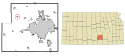
Andale is part of the Wichita, KS Metropolitan Statistical Area.

2020 census

The 2020 United States census counted 941 people, 307 households, and 244 families in Andale. [9] [10] The population density was 1,639.4 per square mile (633.0/km2). There were 325 housing units at an average density of 566.2 per square mile (218.6/km2). [10] [11] The racial makeup was 95.96% (903) white or European American (94.05% non-Hispanic white), 0.32% (3) black or African-American, 0.0% (0) Native American or Alaska Native, 0.0% (0) Asian, 0.0% (0) Pacific Islander or Native Hawaiian, 0.43% (4) from other races, and 3.29% (31) from two or more races. [12] Hispanic or Latino of any race was 3.4% (32) of the population. [13]

Of the 307 households, 45.3% had children under the age of 18; 65.5% were married couples living together; 19.2% had a female householder with no spouse or partner present. 17.9% of households consisted of individuals and 8.1% had someone living alone who was 65 years of age or older. [10] The average household size was 3.3 and the average family size was 3.9. [14] The percent of those with a bachelor’s degree or higher was estimated to be 23.4% of the population. [15]

33.2% of the population was under the age of 18, 8.5% from 18 to 24, 24.4% from 25 to 44, 22.7% from 45 to 64, and 11.2% who were 65 years of age or older. The median age was 31.1 years. For every 100 females, there were 100.2 males. [10] For every 100 females ages 18 and older, there were 104.2 males. [10]

The 2016-2020 5-year American Community Survey estimates show that the median household income was $79,000 (with a margin of error of +/- $10,603) and the median family income was $85,000 (+/- $6,837). [16] Males had a median income of $51,375 (+/- $3,807) versus $30,943 (+/- $1,998) for females. The median income for those above 16 years old was $40,391 (+/- $10,764). [17] Approximately, 5.2% of families and 6.6% of the population were below the poverty line, including 9.5% of those under the age of 18 and 3.0% of those ages 65 or over. [18] [19]

2010 census

As of the census [20] of 2010, there were 928 people, 290 households, and 236 families living in the city. The population density was 1,628.1 inhabitants per square mile (628.6/km2). There were 301 housing units at an average density of 528.1 per square mile (203.9/km2). The racial makeup of the city was 98.7% White, 0.2% from other races, and 1.1% from two or more races. Hispanic or Latino of any race were 2.3% of the population.

There were 290 households, of which 52.4% had children under the age of 18 living with them, 63.1% were married couples living together, 12.4% had a female householder with no husband present, 5.9% had a male householder with no wife present, and 18.6% were non-families. 17.2% of all households were made up of individuals, and 7.6% had someone living alone who was 65 years of age or older. The average household size was 3.20 and the average family size was 3.67.

The median age in the city was 27.2 years. 38.7% of residents were under the age of 18; 8.8% were between the ages of 18 and 24; 25.6% were from 25 to 44; 18.9% were from 45 to 64; and 8.1% were 65 years of age or older. The gender makeup of the city was 48.7% male and 51.3% female.

2000 census

As of the census [21] of 2000, there were 766 people, 241 households, and 186 families living in the city. The population density was 1,514.2 inhabitants per square mile (584.6/km2). There were 247 housing units at an average density of 488.3 per square mile (188.5/km2). The racial makeup of the city was 98.69% White, 0.13% Native American, 0.52% from other races, and 0.65% from two or more races. Hispanic or Latino of any race were 1.57% of the population.

There were 241 households, out of which 49.0% had children under the age of 18 living with them, 68.5% were married couples living together, 5.4% had a female householder with no husband present, and 22.8% were non-families. 20.3% of all households were made up of individuals, and 11.6% had someone living alone who was 65 years of age or older. The average household size was 3.18 and the average family size was 3.78.

In the city, the population was spread out, with 39.2% under the age of 18, 7.6% from 18 to 24, 27.3% from 25 to 44, 14.5% from 45 to 64, and 11.5% who were 65 years of age or older. The median age was 28 years. For every 100 females, there were 102.1 males. For every 100 females age 18 and over, there were 100.9 males.

The median income for a household in the city was $47,333, and the median income for a family was $53,702. Males had a median income of $40,909 versus $30,875 for females. The per capita income for the city was $17,439. About 2.7% of families and 1.1% of the population were below the poverty line, including none of those under age 18 and 6.8% of those age 65 or over.

Education

The community is served by Renwick USD 267 public school district. Andale has one high school and one elementary school. Andale High School is the home of the Andale Indians. The school colors are black and gold. [22]

Notable people

Related Research Articles

<span class="mw-page-title-main">Atlanta, Kansas</span> City in Cowley County, Kansas

Atlanta is a city in Cowley County, Kansas, United States. As of the 2020 census, the population of the city was 168.

<span class="mw-page-title-main">Arcadia, Kansas</span> City in Crawford County, Kansas

Arcadia is a city in northeast Crawford County, Kansas, United States. As of the 2020 census, the population of the city was 254.

<span class="mw-page-title-main">McCune, Kansas</span> City in Crawford County, Kansas

McCune is a city in Crawford County, Kansas, United States. As of the 2020 census, the population of the city was 370.

<span class="mw-page-title-main">Mulberry, Kansas</span> City in Crawford County, Kansas

Mulberry is a city in Crawford County, Kansas, United States. As of the 2020 census, the population of the city was 409.

<span class="mw-page-title-main">Gove City, Kansas</span> City in Gove County, Kansas

Gove City, more commonly known as Gove, is a city in and the county seat of Gove County, Kansas, United States. As of the 2020 census, the population of the city was 80.

<span class="mw-page-title-main">Edgerton, Kansas</span> City in Kansas, United States

Edgerton is a city in Johnson County, Kansas, United States, and part of the Kansas City metropolitan area. As of the 2020 census, the population of the city was 1,748. It is home to a large BNSF intermodal train facility named Logistics Park Kansas City.

<span class="mw-page-title-main">Cunningham, Kansas</span> City in Kingman County, Kansas

Cunningham is a city in Kingman County, Kansas, United States. As of the 2020 census, the population of the city was 444. The city was named in honor of J.D. Cunningham, a pioneer settler.

<span class="mw-page-title-main">Norwich, Kansas</span> City in Kingman County, Kansas

Norwich is a city in Kingman County, Kansas, United States. As of the 2020 census, the population of the city was 444.

<span class="mw-page-title-main">Oketo, Kansas</span> City in Marshall County, Kansas

Oketo is a city in Marshall County, Kansas, United States. As of the 2020 census, the population of the city was 64.

<span class="mw-page-title-main">Meade, Kansas</span> City in Meade County, Kansas

Meade is a city in and the county seat of Meade County, Kansas, United States. As of the 2020 census, the population of the city was 1,505.

<span class="mw-page-title-main">Ness City, Kansas</span> City in Ness County, Kansas

Ness City is a city in and the county seat of Ness County, Kansas, United States. As of the 2020 census, the population of the city was 1,329. Ness City is famous for its four-story Old Ness County Bank Building located downtown and nicknamed Skyscraper of the Plains.

<span class="mw-page-title-main">Lyndon, Kansas</span> City in Osage County, Kansas

Lyndon is a city in, and the county seat of Osage County, Kansas, United States. As of the 2020 census, the population of the city was 1,037.

<span class="mw-page-title-main">Agra, Kansas</span> City in Phillips County, Kansas

Agra is a city in Phillips County, Kansas, United States. As of the 2020 census, the population of the city was 208.

<span class="mw-page-title-main">Atwood, Kansas</span> City in Rawlins County, Kansas

Atwood is a city in and the county seat of Rawlins County, Kansas, United States. As of the 2020 census, the population of the city was 1,290.

<span class="mw-page-title-main">Belleville, Kansas</span> City in Republic County, Kansas

Belleville is a city in and the county seat of Republic County, Kansas, United States. As of the 2020 census, the population of the city was 2,007.

<span class="mw-page-title-main">Alden, Kansas</span> City in Rice County, Kansas

Alden is a city in Rice County, Kansas, United States. As of the 2020 census, the population of the city was 122.

<span class="mw-page-title-main">Assaria, Kansas</span> City in Saline County, Kansas

Assaria is a city in Saline County, Kansas, United States. As of the 2020 census, the population of the city was 428.

<span class="mw-page-title-main">Mount Hope, Kansas</span> City in Sedgwick County, Kansas

Mount Hope is a city in Sedgwick County, Kansas, United States. As of the 2020 census, the population of the city was 806.

<span class="mw-page-title-main">Argonia, Kansas</span> City in Sumner County, Kansas

Argonia is a city in Sumner County, Kansas, United States. As of the 2020 census, the population of the city was 456.

<span class="mw-page-title-main">Alma, Kansas</span> City in Wabaunsee County, Kansas

Alma is a city in and the county seat of Wabaunsee County, Kansas, United States. As of the 2020 census, the population of the city was 802.

References

  1. 1 2 3 4 5 "Andale, Kansas", Geographic Names Information System , United States Geological Survey, United States Department of the Interior
  2. "2019 U.S. Gazetteer Files". United States Census Bureau. Retrieved July 24, 2020.
  3. 1 2 "Profile of Andale, Kansas in 2020". United States Census Bureau. Archived from the original on November 14, 2021. Retrieved November 14, 2021.
  4. Kansas State Historical Society (1916). Biennial Report of the Board of Directors of the Kansas State Historical Society. Kansas State Printing Plant. pp.  285.
  5. Bentley, Orsemus Hills (1910). History of Wichita and Sedgwick County, Kansas: Past and Present. Windmill Publications. p. 617.
  6. Blackmar, Frank Wilson (1912). Kansas: A Cyclopedia of State History, Embracing Events, Institutions, Industries, Counties, Cities, Towns, Prominent Persons, Etc. Standard Publishing Company. pp.  69.
  7. "US Gazetteer files: 2010, 2000, and 1990". United States Census Bureau. February 12, 2011. Retrieved April 23, 2011.
  8. "US Gazetteer files 2010". United States Census Bureau. Archived from the original on January 25, 2012. Retrieved July 6, 2012.
  9. "US Census Bureau, Table P16: HOUSEHOLD TYPE". data.census.gov. Retrieved December 31, 2023.
  10. 1 2 3 4 5 "US Census Bureau, Table DP1: PROFILE OF GENERAL POPULATION AND HOUSING CHARACTERISTICS". data.census.gov. Retrieved December 31, 2023.
  11. Bureau, US Census. "Gazetteer Files". Census.gov. Retrieved December 30, 2023.
  12. "US Census Bureau, Table P1: RACE". data.census.gov. Retrieved December 31, 2023.
  13. "US Census Bureau, Table P2: HISPANIC OR LATINO, AND NOT HISPANIC OR LATINO BY RACE". data.census.gov. Retrieved December 31, 2023.
  14. "US Census Bureau, Table S1101: HOUSEHOLDS AND FAMILIES". data.census.gov. Retrieved December 31, 2023.
  15. "US Census Bureau, Table S1501: EDUCATIONAL ATTAINMENT". data.census.gov. Retrieved December 31, 2023.
  16. "US Census Bureau, Table S1903: MEDIAN INCOME IN THE PAST 12 MONTHS (IN 2020 INFLATION-ADJUSTED DOLLARS)". data.census.gov. Retrieved December 31, 2023.
  17. "US Census Bureau, Table S2001: EARNINGS IN THE PAST 12 MONTHS (IN 2020 INFLATION-ADJUSTED DOLLARS)". data.census.gov. Retrieved December 31, 2023.
  18. "US Census Bureau, Table S1701: POVERTY STATUS IN THE PAST 12 MONTHS". data.census.gov. Retrieved December 31, 2023.
  19. "US Census Bureau, Table S1702: POVERTY STATUS IN THE PAST 12 MONTHS OF FAMILIES". data.census.gov. Retrieved December 31, 2023.
  20. "U.S. Census website". United States Census Bureau . Retrieved July 6, 2012.
  21. "U.S. Census website". United States Census Bureau . Retrieved January 31, 2008.
  22. "Andale High School". Archived from the original on October 2, 2013. Retrieved September 27, 2013.

Further reading