
Marikina, officially the City of Marikina, is a 1st class highly urbanized city in the National Capital Region of the Philippines. According to the 2015 census, it has a population of 450,741 people.

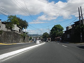
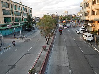
The Sumulong Highway, constructed in 1960, is the highway in the Philippines that connects Marikina with Antipolo and the municipalities of Cainta, Teresa, and Morong in the province of Rizal. It was named after Don Juan Sumulong, a former President of the Democrata Party.
The Marcos Highway, also known as Marikina–Infanta Highway, or Marilaque Road or Marikina-Infanta Road, is a scenic mountain 117.5-kilometer (73.0 mi) highway that connects Metro Manila with Infanta, Quezon in the Philippines.
The Batasan–San Mateo Road, also known as the IBP–San Mateo Road and formerly as the Constitutional Road, is a four-lane east–west highway connecting Quezon City and San Mateo, Rizal in the Philippines.

Riverbanks Center is an integrated development complex for shopping, recreational, business and commercial along A. Bonifacio Avenue adjacent to Marikina River in Barangka, Marikina, Metro Manila, Philippines. It is home of the Philippine's biggest outdoor amphitheater and outlet center, and the location of once the world's largest pair of shoes.

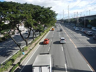
Ortigas Avenue is a 15.5 km (9.6 mi) highway running from eastern Metro Manila to western Rizal. It is one of the busiest highways in Metro Manila, serving as the main thoroughfare of the metro's east-west corridor, catering mainly to the traffic coming to and from the Rizal province.

Aurora Boulevard is a four-to-ten lane major thoroughfare in Quezon City and San Juan in Metro Manila, Philippines. It was named after Doña Aurora Quezon, the consort of Commonwealth President Manuel Luis Quezon. It is one of the major roads in the commercial district of Araneta City in Cubao. Line 2 follows the alignment of the boulevard.
Senator Gil J. Puyat Avenue, also known simply as Gil Puyat Avenue and formerly and still referred to as Buendia Avenue, is a major arterial thoroughfare which travels east–west through the cities of Makati and Pasay in western Metro Manila, Philippines. It is one of the busiest avenues in Metro Manila linking the Makati Central Business District with the rest of the metropolis. Its western end begins at Roxas Boulevard and continues through the district of San Isidro, Pasay until intersecting with Taft Avenue. Past the intersection with the elevated Gil Puyat LRT Station, the road runs through Tramo Street and Barangays Palanan and San Isidro in Makati. East of Osmeña Highway, Gil Puyat intersects with the busy streets of the Makati Central Business District before finally reaching its terminus at Epifanio de los Santos Avenue (EDSA). The avenue also has an extension into Forbes Park in Makati as Buendia Avenue Extension.

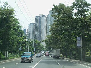
Kalayaan Avenue is a major east–west route in Makati, Metro Manila, Philippines. For most of its length, it runs parallel to J.P. Rizal Avenue to the north from East Rembo near Fort Bonifacio to Barangay Singkamas by the border with San Andres, Manila. It is interrupted by Bel-Air Village between Rockwell Drive and Epifanio de los Santos Avenue (EDSA). The avenue is designated as a component of Radial Road 4 (R-4) of the Metro Manila Arterial Road System and its segment east of EDSA is designated as a component of National Route 190 of the Philippine highway network.

McKinley Road is a tree-lined avenue linking the central business districts of Makati and Bonifacio Global City, Taguig in Metro Manila, Philippines. It is a continuation of Ayala Avenue, south of Epifanio de los Santos Avenue (EDSA), which runs for approximately 1.9 kilometers (1.2 mi) through the affluent neighborhoods of Forbes Park and Dasmariñas Village. It is home to the exclusive Manila Polo Club and the Manila Golf and Country Club.
Lawton Avenue, also known as Fort Bonifacio-Nichols Field Road, is the main road in Fort Bonifacio, Taguig, Metro Manila, Philippines. It follows a part of the alignment of the old Nichols route running roughly southwest to northeast from Sales Interchange to 5th Avenue and the Manila American Cemetery and Memorial. It was named after Henry Ware Lawton, US Army general during the Philippine–American War.

Zobel Roxas Street is an east-west street that forms the southeastern limit of the City of Manila, the northwestern city limit of Makati, and the northern city limit of Pasay, all in Metro Manila, Philippines. It stretches across western Metro Manila from Tramo Street in the Singalong area of Malate to Tejeron Street at the district boundary of San Andres Bukid and Santa Ana. It has a short extension northeast of the Tejeron Street–J.P. Rizal Avenue junction as Del Pan Street.

Bonifacio Drive is a road running for approximately 1 kilometer (0.62 mi) in a north-south direction between Intramuros and Port Area in Manila, Philippines. The boulevard is also designated as Radial Road 1 (R-1) of Manila's arterial road network, National Route 120 (N120) of the Philippine highway network and an auxiliary route of Asian Highway 26 (AH26).

Colonel Bonny Serrano Avenue, formerly called and still referred to as Santolan Road, is a major east–west thoroughfare in the Eastern Manila District of Metro Manila, Philippines, running between San Juan and Quezon City. It forms the northern limit of San Juan and the southern limit of Quezon City's New Manila and Cubao districts and links the Philippine National Police headquarters in Camp Crame with the Armed Forces of the Philippines headquarters in Camp Aguinaldo. The avenue runs from the border of barangays Corazon de Jesus, St. Joseph, and Little Baguio in San Juan in the west to barangays Libis and Blue Ridge B near Quezon City's border with Marikina in the east. It was named after the decorated Korean War hero, Venancio "Bonny" Serrano.

The following is an alphabetical list of articles related to the Philippine capital region of Metro Manila.
The Andres Bonifacio Avenue, also known as A. Bonifacio Avenue, is a 3.784-kilometer (2.351 mi), national secondary road connecting the North Luzon Expressway and Epifanio de los Santos Avenue at Balintawak Interchange in Quezon City and Blumentritt Road at the city's boundary with Manila in a north-south direction.

The Makati Park and Garden, sometimes called Fort Bonifacio Riverside Park and Liwasang Bonifacio by local residents, is an urban riverfront park along the south bank of the Pasig River in Makati, Metro Manila, Philippines. It is the largest public park in Makati with an area of 35,433 square metres (381,400 sq ft). The park is under the management of the Parks and Green Division of Makati's Department of Environmental Services. It was created in 2001 as part of the Linear Parks Project of the Pasig River Rehabilitation Commission.
General Luis Street is a two-to-four lane, major east-west thoroughfare situated in the cities of Valenzuela, North Caloocan and Quezon City. Heavy traffic is usually expected when traversing this road due to concentration of tricycles and jeepneys, commercial establishments, warehouses and factories along and near the vicinity, although there have been multiple plans to alleviate traffic congestion such as obstruction removal, road widening and improvement, and construction of additional roads like the Mindanao Avenue extension.
National Route 59 (N59) is a primary national route that forms part of the Philippine highway network, running from Antipolo, Rizal to Cubao, Quezon City, Metro Manila.