
Waldo Rudolph Tobler was an American-Swiss geographer and cartographer. Tobler is regarded as one of the most influential geographers and cartographers of the late 20th century and early 21st century. He is most well known for coining what has come to be referred to as Tobler's first law of geography. He also coined what has come to be referred to as Tobler's second law of geography.
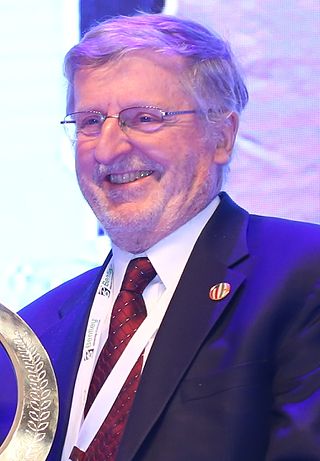
Michael Frank Goodchild is a British-American geographer. He is an Emeritus Professor of Geography at the University of California, Santa Barbara. After nineteen years at the University of Western Ontario, including three years as chair, he moved to Santa Barbara in 1988, as part of the establishment of the National Center for Geographic Information and Analysis, which he directed for over 20 years. In 2008, he founded the UCSB Center for Spatial Studies.
Geographic information science or geoinformation science is a scientific discipline at the crossroads of computational science, social science, and natural science that studies geographic information, including how it represents phenomena in the real world, how it represents the way humans understand the world, and how it can be captured, organized, and analyzed. It is a sub-field of geography, specifically part of technical geography. It has applications to both physical geography and human geography, although its techniques can be applied to many other fields of study as well as many different industries.

Jack Dangermond is an American billionaire businessman and environmental scientist, who in 1969 co-founded, with Laura Dangermond, the Environmental Systems Research Institute (Esri), a privately held geographic information systems (GIS) software company. As of July 2023, his net worth was estimated at US$9.3 billion.
William Louis Garrison (1924–2015) was an American geographer, transportation analyst and professor at the University of California, Berkeley. While at the Department of Geography, University of Washington in the 1950s, Garrison led the "quantitative revolution" in geography, which applied computers and statistics to the study of spatial problems. As such, he was one of the founders of regional science. Many of his students went on to become noted professors themselves, including: Brian Berry, Ronald Boyce, Duane Marble, Richard Morrill, John Nystuen, William Bunge, Michael Dacey, Arthur Getis, and Waldo Tobler. His transportation work focused on innovation, the deployment of modes and logistic curves, alternative vehicles and the future of the car.

Spatial analysis is any of the formal techniques which studies entities using their topological, geometric, or geographic properties. Spatial analysis includes a variety of techniques using different analytic approaches, especially spatial statistics. It may be applied in fields as diverse as astronomy, with its studies of the placement of galaxies in the cosmos, or to chip fabrication engineering, with its use of "place and route" algorithms to build complex wiring structures. In a more restricted sense, spatial analysis is geospatial analysis, the technique applied to structures at the human scale, most notably in the analysis of geographic data. It may also be applied to genomics, as in transcriptomics data.
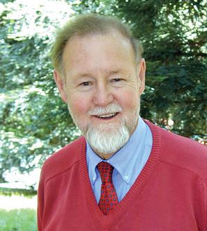
Roger Frank Tomlinson was an English-Canadian geographer and the primary originator of modern geographic information systems (GIS), and has been acknowledged as the "father of GIS."

The American Association of Geographers (AAG) is a non-profit scientific and educational society aimed at advancing the understanding, study, and importance of geography and related fields. Its headquarters is located in Washington, D.C. The organization was founded on December 29, 1904, in Philadelphia, as the Association of American Geographers, with the American Society of Professional Geographers later amalgamating into it in December 1948 in Madison, Wisconsin. As of 2020, the association has more than 10,000 members, from nearly 100 countries. AAG members are geographers and related professionals who work in the public, private, and academic sectors.
Indicators of spatial association are statistics that evaluate the existence of clusters in the spatial arrangement of a given variable. For instance, if we are studying cancer rates among census tracts in a given city local clusters in the rates mean that there are areas that have higher or lower rates than is to be expected by chance alone; that is, the values occurring are above or below those of a random distribution in space.

In statistics, Moran's I is a measure of spatial autocorrelation developed by Patrick Alfred Pierce Moran. Spatial autocorrelation is characterized by a correlation in a signal among nearby locations in space. Spatial autocorrelation is more complex than one-dimensional autocorrelation because spatial correlation is multi-dimensional and multi-directional.
Quantitative geography is a subfield and methodological approach to geography that develops, tests, and uses scientific, mathematical, and statistical methods to analyze and model geographic phenomena and patterns. It aims to explain and predict the distribution and dynamics of human and physical geography through the collection and analysis of quantifiable data. The approach quantitative geographers take is generally in line with the scientific method, where a falsifiable hypothesis is generated, and then tested through observational studies. This has received criticism, and in recent years, quantitative geography has moved to include systematic model creation and understanding the limits of their models. This approach is used to study a wide range of topics, including population demographics, urbanization, environmental patterns, and the spatial distribution of economic activity. The methods of quantitative geography are often contrasted by those employed by qualitative geography, which is more focused on observing and recording characteristics of geographic place. However, there is increasing interest in using combinations of both qualitative and quantitative methods through mixed-methods research to better understand and contextualize geographic phenomena.

CrimeStat is a crime mapping software program. CrimeStat is Windows-based program that conducts spatial and statistical analysis and is designed to interface with a geographic information system (GIS). The program is developed by Ned Levine & Associates under the direction of Ned Levine, with funding by the National Institute of Justice (NIJ), an agency of the United States Department of Justice. The program and manual are distributed for free by NIJ.
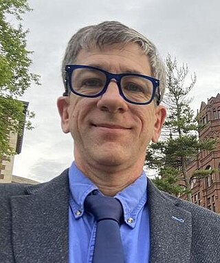
Joseph Kerski is a geographer with a focus on the use of Geographic Information Systems (GIS) in education.

Manfred M. Fischer is an Austrian and German regional scientist, Emeritus Professor of economic geography at the WU-Vienna University of Economics and Business, and Adjunct Professor at the Institute of Geographic Sciences and Natural Resources Research, Chinese Academy of Sciences in Beijing.

Technical geography is the branch of geography that involves using, studying, and creating tools to obtain, analyze, interpret, understand, and communicate spatial information.
George Frederick Jenks (1916–1996) was an American geographer known for his significant contributions to cartography and geographic information systems (GIS). With a career spanning over three decades, Jenks played a vital role in advancing map-making technologies, was instrumental in enhancing the visualization of spatial data, and played foundational roles in developing modern cartographic curricula. The Jenks natural breaks optimization, based on his work, is still widely used in the creation of thematic maps, such as choropleth maps.
Alexander Stewart Fotheringham is a British-American geographer known for his contributions to quantitative geography, geographic information science (GIScience), and spatial analysis. He holds a Ph.D. in geography from McMaster University and is a Regents professor of computational spatial science in the School of Geographical Sciences and Urban Planning at Arizona State University. He has contributed to the literature surrounding spatial analysis and spatial statistics, particularly in the development of geographically weighted regression (GWR) and multiscale geographically weighted regression (MGWR).
Duane Francis Marble was an American geographer known for his significant contributions to quantitative geography and geographic information science (GIScience). Marble had a 40-year career as a professor at multiple institutions, retiring from the Ohio State University and holding a courtesy appointment as Professor of Geosciences at Oregon State University afterward. His early work was highly influential in computer cartography and is regarded as a significant contributor to the quantitative revolution in geography. His work on constructing a "Model Curricula" in GIScience is listed as the starting foundation built upon by the Geographic Information Science and Technology Body of Knowledge.
Michael Francis Dacey was an American geographer known for his significant contributions to mathematical models in quantitative geography. Dacey founded the department of Mathematical Methods in the Social Sciences at Northwestern University, where he served as a senior associate dean in the College of Arts and Science, as well as a professor of geography, anthropology, and geological sciences. His publications were instrumental in establishing quantitative geography in mainstream geography.
Getis–Ord statistics, also known as Gi*, are used in spatial analysis to measure the local and global spatial autocorrelation. Developed by statisticians Arthur Getis and J. Keith Ord they are commonly used for Hot Spot Analysis to identify where features with high or low values are spatially clustered in a statistically significant way. Getis-Ord statistics are available in a number of software libraries such as CrimeStat, GeoDa, ArcGIS, PySAL and R.


