Asansol–Gaya section

Last updated • 4 min readFrom Wikipedia, The Free Encyclopedia

Asansol–Gaya section
Dbd.jpg
Dhanbad Junction, an important railway station on Asansol–Gaya section
Overview
StatusOperational
Owner Indian Railways
Locale West Bengal, Jharkhand, Bihar
Termini
Stations38
Service
SystemElectrified
Operator(s) Eastern Railway, East Central Railway
History
Opened1907
Technical
Line length267 km (166 mi)
Number of tracks2
Track gauge 5 ft 6 in (1,676 mm) broad gauge
Electrification Yes
Operating speed130 km/h
Route map

Contents

km
BSicon CONTg.svg
Arrow Blue Up 001.svg
BSicon BHF.svg
0
Gaya Junction
BSicon ABZgl.svg
BSicon CONTfq.svg
Arrow Blue Right 001.svg
BSicon hbKRZWae.svg
Falgu River
BSicon pHST.svg
3
Saheed Iswar Choudhery
(halt)
BSicon HST.svg
5
Manpur
BSicon ABZgl.svg
BSicon CONTfq.svg
Arrow Blue Right 001.svg
BSicon HST.svg
12
Bandhua
BSicon HST.svg
19
Tankuppa
BSicon HST.svg
25
Bansinala
BSicon HST.svg
32
Paharpur
BSicon HST.svg
34
Gurpa
BSicon HST.svg
39
Dilwa
BSicon STR+GRZq.svg
BSicon HST.svg
46
Gujhandi
BSicon BHF.svg
56
Koderma
BSicon CONTgq.svg
BSicon ABZgr.svg
Arrow Blue Left 001.svg
to Hazaribagh & Barkakana
BSicon ABZgl.svg
BSicon CONTfq.svg
Arrow Blue Right 001.svg
BSicon HST.svg
64
Hirodih
BSicon HST.svg
72
Samatanr
BSicon HST.svg
77
Jadudih
BSicon HST.svg
81
Parsabd
BSicon hbKRZWae.svg
BSicon HST.svg
92
Chaube
BSicon BHF.svg
103
Hazaribagh Road
BSicon HST.svg
113
Chichaki
BSicon HST.svg
121
Chaudhuribandh
BSicon BHF.svg
130
Parasnath
BSicon GIPl.svg
Parasnath Hill (
1350 m
1476 yd
)
BSicon cRP2q.svg
BSicon SKRZ-G2o.svg
BSicon cRP2q.svg
BSicon HST.svg
138
Nimiaghat
BSicon BHF.svg
148
Netaji Subhas Chandra
Bose Gomoh
BSicon CONTgq.svg
BSicon ABZgr.svg
Arrow Blue Left 001.svg
to Bokaro & Barkakana
BSicon KRWl.svg
BSicon LKRW+r.svg
 
BSicon CONTg.svg
Arrow Blue Up 001.svg
Tatanagar-Barkakana section
BSicon BHF.svg
72
Barkakana
BSicon ABZgl.svg
BSicon CONTfq.svg
Arrow Blue Right 001.svg
BSicon ABZgl.svg
BSicon CONTfq.svg
Arrow Blue Right 001.svg
to Hazaribagh
BSicon hbKRZWae.svg
BSicon HST.svg
69
Argada
BSicon BHF.svg
63
Ranchi Road
BSicon cRP2q.svg
BSicon SKRZ-G2o.svg
BSicon cRP2q.svg
BSicon pHST.svg
55
Karmahat
BSicon HST.svg
51
Chainpur
BSicon HST.svg
46
Jogeshwar
BSicon hbKRZWae.svg
BSicon HST.svg
38
Danea
BSicon KBSTaq.svg
BSicon ABZg+r.svg
Tenughat Thermal Power Station
BSicon HST.svg
27
Dumari
BSicon ABZg+l.svg
BSicon KBSTeq.svg
Indian Explosives Limited
BSicon BHF.svg
20
Gomia
BSicon FLUG.svg
BSicon STR.svg
Gomia Airport
BSicon hbKRZWae.svg
BSicon BHF.svg
15
Bokaro (Thermal)
BSicon KBSTaq.svg
BSicon ABZg+r.svg
BSicon HST.svg
9
Jarangdih
BSicon BHF.svg
6
Bermo
BSicon pHST.svg
3
Amlo
(halt)
BSicon ABZg+l.svg
BSicon KBSTeq.svg
Kargali colliery and washery
BSicon HST.svg
0
Phusro
BSicon HST.svg
5
Bhandaridah
BSicon CONTg.svg
BSicon STR.svg
Arrow Blue Up 001.svg
BSicon FLUG.svg
BSicon STR.svg
BSicon STR.svg
Bokaro airport
BSicon KBSTaq.svg
BSicon ABZg+r.svg
BSicon STR.svg
BSicon BHF.svg
BSicon STR.svg
0
Bokaro Steel City
BSicon CONTgq.svg
BSicon ABZgr.svg
BSicon STR.svg
Arrow Blue Left 001.svg
BSicon HST.svg
BSicon STR.svg
5
Tupkadih
BSicon dWASSERq.svg
BSicon hKRZWae.svg
BSicon STR.svg
BSicon HST.svg
BSicon STR.svg
12
Rajabera
BSicon STRl.svg
BSicon ABZgr+r.svg
BSicon KBSTa.svg
BSicon STR.svg
BSicon ABZl+l.svg
BSicon ABZgr+r.svg
BSicon STR.svg
BSicon BHF.svg
16
12
Chandrapura
BSicon lHST~L.svg
BSicon KRWg+l.svg
BSicon lHST~R.svg
BSicon KRWgr.svg
Dugda
BSicon CONTgq.svg
BSicon STRr.svg
BSicon STR.svg
Arrow Blue Left 001.svg
BSicon HST.svg
23
Telo
BSicon dWASSERq.svg
BSicon hKRZWae.svg
BSicon LSTR.svg
BSicon STR.svg
BSicon BHF.svg
33
Netaji Subhas Chandra
Bose Gomoh
BSicon ABZl+l.svg
BSicon STRr.svg
BSicon HST.svg
157
Matari
BSicon HST.svg
162
Nichitpur
BSicon CONTgq.svg
BSicon ABZg+r.svg
Arrow Blue Left 001.svg
to Katrasgarh (
Jharia Coalfield
rail network
)
BSicon HST.svg
168
Tetulmari
BSicon pHST.svg
173
Bhuli
(halt)
BSicon CONTgq.svg
BSicon ABZg+r.svg
Arrow Blue Left 001.svg
BSicon BHF.svg
177
Dhanbad Junction
BSicon pHST.svg
182
Dokra
(halt)
BSicon CONTgq.svg
BSicon ABZg+r.svg
Arrow Blue Left 001.svg
to Katrasgarh (
Jharia Coalfield
rail network
)
BSicon HST.svg
187
Pradhankhunta
BSicon CONTgq.svg
BSicon ABZg+r.svg
Arrow Blue Left 001.svg
BSicon HST.svg
193
Chota Ambana
BSicon HST.svg
202
Kalubathan
BSicon HST.svg
206
Thapar Nagar
BSicon HST.svg
212
Mugma
BSicon cRP2q.svg
BSicon SKRZ-G2o.svg
BSicon cRP2q.svg
BSicon HST.svg
216
Kumardhubi
BSicon hbKRZWae.svg
BSicon STR+GRZq.svg
BSicon HST.svg
219
Barakar
BSicon HST.svg
222
Kulti
BSicon ABZg+l.svg
BSicon CONTfq.svg
Arrow Blue Right 001.svg
BSicon BHF.svg
227
Sitarampur
BSicon HST.svg
231
Barachak
BSicon CONTgq.svg
BSicon ABZg+r.svg
Arrow Blue Left 001.svg
BSicon BHF.svg
236
Asansol Junction
BSicon CONTf.svg
Arrow Blue Down 001.svg
km

Sources:

The Asansol–Gaya section is a railway line connecting Asansol and Gaya in India. This 267-kilometre long (166 mi) track is part of the Grand Chord, Howrah–Gaya–Delhi line and Howrah–Allahabad–Mumbai line. This section includes the NSC Bose Gomoh–Barkakana line. It is under the jurisdiction of Eastern Railway and East Central Railway. The section links to South Eastern Railway through Bokaro Steel City and Adra.

History

Main line

The Bardhaman–Asansol line was first extended to Barakar in 1858 and then in 1894 East Indian Railway Company extended the line to Jharia and Katras, opening up the Jharia Coalfield. Dhanbad emerged as a premier coal loading area. [1] One railway-related source says that the line from Sitarampur to Dhanbad was built in 1880. [2]

Gurpa-Gujhandi

Once the rail link from Howrah to Delhi was completed in 1866, the East Indian Railway was making constant endeavour to reduce the distance of the Howrah–Delhi main line. After several surveys, one in 1888–89 and two more subsequently, a route was determined from Dhanbad to Mughal Sarai via Koderma and Gaya. The major works in this section were a bridge across the Son River at Dehri, and tunnelling and ghat line construction between Gurpa and Gujhandi. [2]

The 22-kilometre (14 mi) Gujhandi (altitude 370 m)–Gurpa (altitude 193 m) section, 10 kilometres (6.2 mi) west of Koderma, is a ghat (mountain/hill slope), with the Koderma Plateau sloping down to the Gaya plain. [3]

The Grand Chord was opened on 6 December 1906 by Lord Minto, then Viceroy and Governor General of India with a function at Gujahandi. The Viceroy and Lady Minto travelled to Gaya, from where they travelled in a special observation car to Gujhandi. Two special trains, running from Howrah, carried the invitees. The Viceroy screwed on a silver bolt with a silver spanner to formally complete the line. [2]

A repeat of the historic event was organized by East Central Railway on 6 December 2006, with a special heritage train "Grand Chord ki Rani", pulled by a 1965 steam engine, carrying the guests from Gaya to Gujhandi. [4]

Branch lines

Several years before the Grand Chord was built, a connection from the Howrah–Delhi main line to Gaya was developed in 1900 (presumably the Patna–Gaya line) and the South Bihar Railway Company (operated by EIR) had laid a line from Lakhisarai to Gaya in 1879. [1] Track doubling of the 130-kilometre long (81 mi) Kiul–Gaya section was announced in the Railway Budget for 2010–2011. [5]

The Bengal Nagpur Railway system was connected to the East Indian Railway Company lines in 1889, thus connecting Asansol to Adra. In 1907 Adra was connected to the Grand Chord at Gomoh. [1]

The construction of the 143-kilometre long (89 mi) Chandrapura–Muri–Ranchi–Hatia line started in 1957 and was completed in 1961. [6]

In 1902, a branch line of EIR was opened from Sone East Bank (later renamed Son Nagar) to Daltonganj. With the development of South Karanpura Coalfield, the Central India Coalfields Railway opened a line from Gomoh to Barkakana in 1927 and from Barkakana to Daltonganj in 1929. These lines were subsequently taken over by EIR. [1]

Electrification

Electrification of the stretch of mainline of this section from Asansol to Netaji SC Bose Gomoh was completed in 1960–61. Electrification of the stretch from Netaji SC Bose Gomoh to Gaya was completed in 1961–62. [7]

On the Gomoh–Barkakana branch line electrification was done from both ends: Gomoh to Phusro in 1986–87, Barkakana to Danea in 1996–97, Danea to Gomia and Gomia to Jarandih in 1997–98. [7]

In 1965, Asansol–Bareilly Passenger was the first long-distance train on Eastern Railway to be hauled by an AC loco. [8]

The Gaya–Jahanabad sector was electrified in 2002–2003. [7] Completion of electrification of the 97-kilometre long (60 mi) Patna–Gaya rail route before the end of 2003 was announced by the railway minister Nitish Kumar. [9]

Loco sheds

Asansol is home to the oldest electric loco shed of Indian Railways. It houses WAG-5 and WAM-4 electric locomotives. [10]

Netaji SC Bose Gomoh has an electric loco shed with capacity to hold 125+ locos. Locos housed at the shed include WAG-7, WAG-9, WAG-9I, WAP-7. WAP-7 locos serve the prestigious Howrah Rajdhani Express. [10]

Bokaro Steel City has a diesel loco shed with WDM-2 and WDM-3A locos. It has a large yard for Bokaro Steel Plant. [10]

Speed limits

Most of the Asansol–Gaya section is classified as ‘A’ class line where trains can run up to 160 km per hour but in certain sections speeds may be limited to 120–130 km per hour. The Howrah Rajdhani (between Howrah and New Delhi) travels at an average speed of 85.8 km per hour and the Sealdah Rajdhani (between Sealdah and New Delhi) travels at an average speed of 84.70 km per hour. [11] [12]

Railway reorganisation

In 1952, Eastern Railway, Northern Railway and North Eastern Railway were formed. Eastern Railway was formed with a portion of East Indian Railway Company, east of Mughalsarai and Bengal Nagpur Railway. Northern Railway was formed with a portion of East Indian Railway Company west of Mughalsarai, Jodhpur Railway, Bikaner Railway and Eastern Punjab Railway. North Eastern Railway was formed with Oudh and Tirhut Railway, Assam Railway and a portion of Bombay, Baroda and Central India Railway. [13] East Central Railway was created in 1996–97. [14]

Related Research Articles

<span class="mw-page-title-main">Grand Chord</span> Indian railway route

Grand Chord is part of the Howrah–Gaya–Delhi line and Howrah–Prayagraj–Mumbai line. It acts as a link between Sitarampur, (Asansol), and Pt. Deen Dayal Upadhyay Junction,, previously known as Mughalsarai Junction, and covers a stretch of 450.7 km (280.1 mi). The Coal India Corridor line that branches off from Dhanbad Junction and rejoins the Grand Chord at Son Nagar Junction is another major coal loading hub. It is a fully electrified, quadruple line section from Pt. Deen Dayal Upadhyay to Son Nagar and double line section from Son Nagar to Sitarampur. There are plans to triple the lines from Son Nagar to Dhanbad to accommodate the increasing traffic.. The entire line lies under the jurisdiction of three divisions, Mughalsarai railway division, Dhanbad railway division and Asansol railway division. The Grand chord section is the lifeline of the country, 2nd busiest railway section of India after Ghaziabad, Uttar Pradesh to Pt. Deen Dayal Upadhyay Junction, Uttar Pradesh Main Line section, on which coal, steel and other important goods are moved from Eastern section to Western and Northern sections of the country. In the down direction, the traffic consists of mostly food grains, fertilizers and empty wagons for coal loading in the Jharkhand and West Bengal coal fields. Pt. Deen Dayal Upadhyay Junction is a transit division and the main objective is to maintain mobility of high density traffic. The present capacity of the Grand Chord is being optimally utilized. Traversing through Chota Nagpur Plateau of Jharkhand as well as parts of the fertile Gangetic plains of Bihar, the Grand Chord covers a stretch of 450.7 km (280.1 mi). The Grand Chord is renowned for its remarkable controlling of passenger traffic, despite being burdened with freight traffic.

<span class="mw-page-title-main">Eastern Railway zone</span> Railway zone of India

The Eastern Railway is among the 19 zones of the Indian Railways. Its headquarters is at Fairley Place, Kolkata and comprises four divisions: Howrah, Malda, Sealdah, and Asansol. Each division is headed by a Divisional Railway Manager (DRM). The name of the division denotes the name of the city where the divisional headquarters is located. Eastern Railway oversees the largest and second largest rail complexes in the country, Howrah Junction and Sealdah railway station, and also contains the highest number of A1 and A Category Stations like Howrah, Malda Town, Sealdah, Asansol, Kolkata, Durgapur, Barddhaman, Rampurhat Junction, Bhagalpur,Jamalpur, Jasidih, Bandel and Naihati. Eastern Railways operates India's oldest train, Kalka Mail.

<span class="mw-page-title-main">Asansol Junction railway station</span> Railway station in West Bengal, India

Asansol Junction is a railway station of Eastern Railway in Asansol of Paschim Bardhaman district in the Indian state of West Bengal. The station is on the Howrah–Delhi main line. It is the 8th busiest railway station in India in terms of frequency of trains after Kanpur Central, Vijayawada Junction, Delhi Junction, New Delhi, Ambala Cant, Howrah and Patna Junction. Around 171 trains pass through the station daily. It serves Asansol and the surrounding areas.

<span class="mw-page-title-main">Howrah–New Delhi main line</span> Railway line connecting Delhi and Kolkata

The Howrah–New Delhi main line is a railway line connecting Delhi and Kolkata cutting across northern India. The 1,531 km (951 mi) railway line was opened to traffic in 1866 with the introduction of the "1 Down/2 Up Mail" train.

The Howrah–Barddhaman chord line is a broad-gauge rail line connecting Howrah and Bardhaman. The 95-kilometre-long (59 mi) railway line operates in Howrah, Hooghly and Purba Bardhaman districts in the state of West Bengal. It is part of the Howrah–Gaya–Delhi line, Howrah–Delhi main line, Howrah–Prayagraj–Mumbai line and the Kolkata Suburban Railway system.

<span class="mw-page-title-main">Bardhaman–Asansol section</span> Railway route in West Bengal, India

The Barddhaman–Asansol section is a railway line connecting Bardhaman and Asansol. This 106 kilometres (66 mi) track is part of the Howrah–Delhi main line, Howrah–Gaya–Delhi line and Howrah–Allahabad–Mumbai line. It is under the jurisdiction of Eastern Railway, and is connected to the South Eastern Railway through Asansol–Adra line at Asansol Jn and Kalipahari–Damodar connector at Kalipahari.

<span class="mw-page-title-main">Gaya–Pandit Deen Dayal Upadhyaya Junction section</span> Railway route in India

The Gaya–Pandit Deen Dayal Upadhyaya Junction section, formerly Gaya–Mughalsarai section , is a railway line connecting Gaya Junction and Pandit Deen Dayal Upadhyaya Junction. This 197-kilometre (122 mi) track is part of the Grand Chord, Howrah–Gaya–Delhi line and Howrah–Prayagraj–Mumbai line. This section includes Arrah-Sasaram and Son Nagar branch lines. It is under the jurisdiction of East Central Railway.

<span class="mw-page-title-main">Dhanbad Junction railway station</span> Railway station in Jharkhand

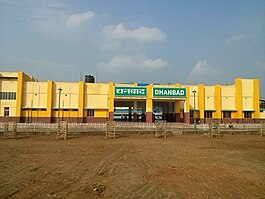
Dhanbad Junction railway station, station code DHN, is a railway station of the Indian railway serving the city of Dhanbad, the headquarters of Dhanbad district in the Indian state of Jharkhand. It is the largest railway station in Jharkhand, handling over 100 trains and 100000+ passengers every day. Dhanbad is also the headquarters of the Dhanbad Rail Division of the East Central Railway zone. Grand Chord rail-line that connects Howrah and New Delhi passes through Dhanbad junction. Dhanbad is located at 23°47′32″N86°25′42″E. It has an elevation of 235 metres (771 ft).

<span class="mw-page-title-main">Sitarampur Junction railway station</span> Railway station in West Bengal, India

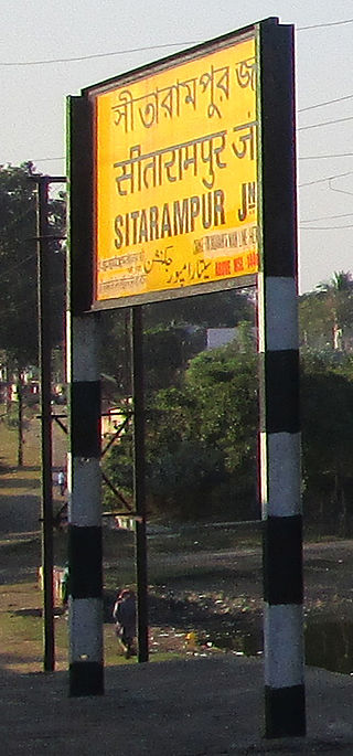
Sitarampur Junction, station code STN, is the railway station serving the neighbourhood of Neamatpur and Sitarampur in Asansol, Paschim Bardhaman district in the Indian state of West Bengal. Sitarampur Junction is part of the Asansol Division of the Eastern Railway zone of the Indian Railways. Sitarampur Junction is connected to metropolitan areas of India, Delhi–Kolkata main line via the Mugalsarai–Patna route as well as the Grand Chord route. It has an average elevation of 99 metres (325 ft).

<span class="mw-page-title-main">Koderma Junction railway station</span> Railway station in Jharkhand

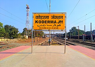
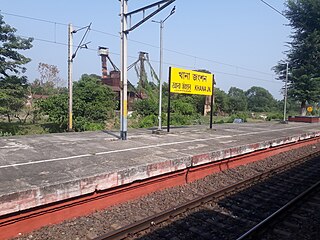
Koderma Junction railway station, station code KQR, is railway station of the Indian railway under Dhanbad railway division of East Central Railway zone serving the city of Jhumri Telaiya near by Koderma city, the headquarters of Koderma district in the Indian state of Jharkhand. Grand Chord rail-line that connects Howrah and New Delhi passes through Koderma Junction. In this station, 4 Vande Bharat Express, 2 Rajdhani Express & 1 Duronto Express halts here.

<span class="mw-page-title-main">Asansol–Tatanagar–Kharagpur line</span> Railway route in India

The Asansol–Adra–Tatanagar–Kharagpur line is part of Howrah and eastern India's links with Mumbai and Chennai. It is also a major freight line for transporting iron ore, coal and steel products. This page includes the Adra–Bokaro Steel City branch line, the Adra-Gomoh branch line, the Adra-Dhanbad branch line and Tatanagar–Badampahar branch lines.

<span class="mw-page-title-main">Durgapur railway station</span> Railway Station in West Bengal, India

Durgapur is a model railway station on the Bardhaman–Asansol section. It is located in Paschim Bardhaman district in the Indian state of West Bengal. It serves Durgapur, the third most populous city in West Bengal, and the surrounding industrial areas. It was ranked the third-cleanest railway station in India in 2019.

<span class="mw-page-title-main">Bokaro Steel City railway station</span> Railway station in Jharkhand

Bokaro Steel City Railway Station is a railway station on the Gomoh–Muri branch line and Adra–Bokaro Steel City branch line under Adra division of South Eastern Railways. It is located in Bokaro district in the Indian state of Jharkhand. It lies at the edge of Jharia Coalfield and serves Bokaro Steel City, and the surrounding mining-industrial area.

<span class="mw-page-title-main">Netaji Subhas Chandra Bose Gomoh railway station</span> Railway station in Jharkhand, India

Gomoh Junction, officially known as Netaji Subhas Chandra Bose Gomoh, is a railway junction station in the Indian state of Jharkhand. Several branch lines start here: Gomoh–Barkakana branch line, Gomoh–Muri branch line and Adra–Gomoh line. It is located in Dhanbad district in the Indian state of Jharkhand.

<span class="mw-page-title-main">Railways in Jharia Coalfield</span> Series of railway lines

Jharia Coalfield has a series of railway lines covering the region lying between the Grand Chord line on the north and the Damodar river in the south. It consists of five lines of which four are managed by East Central Railway's Dhanbad railway division and one is managed by the South Eastern Railway's Adra railway division.

<span class="mw-page-title-main">Barachak railway station</span> Railway station in West Bengal, India

Barachak is a railway station in Asansol, Paschim Bardhaman district, West Bengal, India. This is a railway station between Asansol and Sitarampur railway stations.

<span class="mw-page-title-main">Howrah–Gaya–Delhi line</span> Railway line in India

The Howrah–Gaya–Delhi is a railway line connecting Howrah and Delhi cutting across Indo-Gangetic Plain and a comparatively small stretch of the line crossing over the Chota Nagpur Plateau. It covers a distance of 1,452 kilometres (902 mi) across, West Bengal, Jharkhand, Bihar, Uttar Pradesh and Delhi. The Grand Chord is a part of this line and as such is referred to by many as Howrah–Delhi line.

<span class="mw-page-title-main">Netaji S.C.Bose Gomoh–Hatia line</span> Railway route in India

The Netaji S.C.Bose Gomoh–Hatia line is a railway line connecting NSC Bose Gomoh and Hatia in the Indian state of Jharkhand. It is under the jurisdiction of East Central Railway and South Eastern Railway.

<span class="mw-page-title-main">Mahuda Junction railway station</span> Railway station in Jharkhand, India

Mahuda Junction railway station is a railway station near NH 18 previously NH32, Mahuda Bazaar in Dhanbad district, Jharkhand state. It is operated by South Eastern Railway Adra division. Its code is MHQ. It is one of cleanest stations of Dhanbad despite its use for coal transportation. It is nearest to the Katras Baghmara and Dhanbad as it became the other substitute station for Dhanbad Junction. Ii is just 19 km from the area main junction. It is nearest to Bokaro Steel City. It is a good location both for Bokaro and Dhanbad. The important train is Nandan Kanan Express (ndls-puri). It is mainly in function for Washeries i.e. Mahuda, Moonidih . The direct trains for major city like Ranchi, Rourkela, Nagpur, Kharagpur, Howrah, New Delhi, Kanpur, Fatehpur, Allahabad, Puri, Bhubaneswar, Cuttack, Surat, Bokaro, Adra, Gaya, Mughalsarai, Asansol, Malda

<span class="mw-page-title-main">Barkakana–Netaji S.C.Bose Gomoh line</span> Railway line in India

The Barkakana–Netaji S.C.Bose Gomoh line is a railway line connecting Barkakana and Gomoh in India. This 105-kilometre long (65 mi) track is under the jurisdiction of East Central Railway. The section links to South Eastern Railway through Bokaro Steel City and Adra.

References

  1. 1 2 3 4 Saxena, R. P. "Indian Railway History Time line". Irse.bravehost.com. Archived from the original on 29 February 2012. Retrieved 3 January 2014.
  2. 1 2 3 "As the traffic continued to grow even beyond the capacity of the". Tripod. Retrieved 20 November 2011.
  3. "Satellite Map of Koderma railway station". India Rail Info. Retrieved 18 November 2011.
  4. Mukherjee, Resham (7 December 2006). "Grand rerun of Raj rail route – Railways enact Lord Minto's flag-off at Gujhandi to celebrate 100 years of Dhanbad-Gaya chord line". The Telegraph . Kolkata. Archived from the original on 4 January 2013.
  5. "Rain Budget 2010-2011: Bihar's gain". Jai Bihar. 25 February 2010. Retrieved 20 November 2011.[ dead link ]
  6. Raza, Moonis; Aggarwal, Yash (1999) [1986]. Transport Geography of India: Commodity Flow and the Regional Structure of Indian Economy. Concept Publishing Company. p. 60. ISBN   81-7022-089-0 . Retrieved 20 April 2013 via Google Books.
  7. 1 2 3 "History of Electrification". IRFCA. Retrieved 24 April 2013.
  8. "IR History Part IV (1947–1970)". IRFCA (Indian Railways Fan Club). Retrieved 12 November 2011.
  9. "Patna–Gaya rail electrification by end of 2003". The Times of India . 15 February 2002. Archived from the original on 10 July 2012. Retrieved 20 November 2011.
  10. 1 2 3 "Sheds and Workshops". IRFCA. Retrieved 10 April 2013.
  11. "Track Classifications: Permanent Way". IRFCA. Retrieved 15 January 2012.
  12. "Trivia: Highest speed sections of track". IRFCA. Retrieved 15 January 2012.
  13. "Geography: Railway Zones". IRFCA. Retrieved 28 March 2014.
  14. "East Central Railway". ECR. Archived from the original on 19 May 2016. Retrieved 28 March 2014.
External videos
Nuvola apps kaboodle.svg Gurpa Gajhandi Ghat Section (Part I)
Nuvola apps kaboodle.svg Gurpa Gajhandi Ghat Section (Part II)

|