The Colville National Forest is a U.S. National Forest located in northeastern Washington state. It is bordered on the west by the Okanogan–Wenatchee National Forest and the Kaniksu National Forest to the east. The forest also borders Little Pend Oreille National Wildlife Refuge and the Lake Roosevelt National Recreation Area.

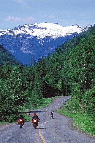
Mount Spokane [elevation 5,887 feet (1,794 m)]—previously known as Mount Baldy until 1912 due to its pronounced bald spot—is a mountain in the northwest United States, located northeast of Spokane, Washington. Its summit is the highest point in Spokane County, and it is one of the tallest peaks in the Inland Northwest. Mount Spokane is surrounded by Mount Spokane State Park, Washington's largest at 13,919 acres (56.3 km2). One of the well-known features is a bald spot on the corner of the west and south parts of the mountain.

Tiger Mountain is a mountain in the U.S. state of Washington. It is at the center of the Issaquah Alps, a small range in the Eastside region of King County, Washington southeast of Seattle. The mountain is part of a designated protected area, the Tiger Mountain State Forest, and has several recreational areas used for hiking, mountain biking, and paragliding.

Devil's Courthouse is a mountain in the Appalachian Mountains of western North Carolina in the United States of America. The mountain is located at the Western edge of the Pisgah National Forest about 10 miles northwest of Brevard and 28 miles southwest of Asheville. Located at milepost 422.4 of the Blue Ridge Parkway, the Devil's Courthouse has a moderate/strenuous trail climbing a half mile to its peak where panoramic views can be seen.

Tussey Mountain is a stratigraphic ridge in central Pennsylvania, United States, trending east of the Bald Eagle, Brush, Dunning and Evitts Mountain ridges. Its southern foot just crosses the Mason–Dixon line near Flintstone, Maryland, running north 130 km (80 mi) to the Seven Mountains of central Pennsylvania, near Tusseyville, making it one of the longest named ridges in this section of the Ridge-and-valley Appalachians.

Roan Mountain is a 6,277 ft (1,913 m) mountain straddling the North Carolina/Tennessee border in the Unaka Range of the Southern Appalachian Mountains in the Southeastern United States. The range's highpoint, Roan is clad in a dense stand of Southern Appalachian spruce-fir forest, and includes the world's largest natural rhododendron garden, and the longest stretch of grassy bald in the Appalachian range. The Roan Highlands also contain the highest quality remaining stretch of Fraser fir forest throughout the tree's entire range. The Cherokee National Forest and Pisgah National Forest converge atop the mountain, with Roan Mountain State Park located near its northern base. The Appalachian Trail traverses most of the Roan's crest. The Roan High Knob Shelter is the highest back-country shelter on the entire 2,174-mile (3,499 km) trail.
Salt Pond Mountain is a mountain located in Giles County, Virginia. The mountain, which is part of the Ridge-and-valley province of the Appalachian Mountains, extends about seven miles (12 km) from southwest to northeast. The highest peak is Bald Knob, at the southeast end, south of Mountain Lake. Salt Pond Mtn. joins Johns Creek Mountain at the southwest end, and the Big Mountain – Potts Mountain ridge at the northeast end, just south of West Virginia.

Berlin Mountain is a 2,818-foot-tall (859 m) prominent peak in the Taconic Mountains of western New England and is located adjacent to Massachusetts's border with New York State. It is the highest point in Rensselaer County. The summit and west side of the mountain are located in New York; the east side lies within Williamstown, Massachusetts. The mountain is a bald, notable for its grassy summit and expansive views of the Hudson River Valley to the west. The 37-mile (60 km) Taconic Crest Trail traverses the mountain. Several other hiking trails approach the summit from the east. Much of the upper slopes and summit are within protected conservation land. Historically the lower slopes of the mountain were farmed heavily throughout the 19th Century. In addition to agriculture, there are several remnants of charcoal kilns located on the mountain that produced fuel for iron smelting.
Bald Mountain Ski Area is a small ski area in north central Idaho, located ten miles (16 km) northwest of Pierce in Clearwater County. The area first opened 65 years ago in January 1960, with a cotton rope tow powered by a gasoline engine. Originally for employees of the Potlatch Corporation in the village of Headquarters, it opened to the public in the 1960s.

Shenipsit State Forest is a state forest located in northeastern Connecticut with 11 parcels scattered between the towns of Somers, Ellington, and Stafford. The forest's headquarters is home to the Civilian Conservation Corps Museum, which houses memorabilia from CCC camps throughout the eastern United States. The forest is managed for forestry products and offers various recreational pursuits.

Cooper Mountain Nature Park is a 231 acres (93 ha) nature park in the Portland metropolitan area in the U.S. state of Oregon. Opened in 2009, the park is owned and operated by Metro, the regional government in the Oregon portion of the metro area. The park is named after Cooper Mountain, the primary geological feature in the area near Beaverton. Maintained by the regional Tualatin Hills Park and Recreation District, the natural area has 3.5 miles (5.6 km) of hiking trails. It is one of THPRD's two nature parks, along with the Tualatin Hills Nature Park.

Bald Peak is a mountain top and highest point in the Chehalem Mountains in the Northwest area of the U.S. state of Oregon. Located in Yamhill County near the county line with Washington County, the summit at 1624+ feet is the highest point in the Willamette Valley. Bald Peak State Scenic Viewpoint is a 26-acre (11 ha) state park located on the peak.
The Little Rincon Mountains are a small range of mountains, lying to the east of the Rincon Mountains, at Tucson, of eastern Pima County, Arizona. The range is located in northwest Cochise County and is part of the western border of the San Pedro River and Valley, the major valley and river of western Cochise County. The river is northward flowing to meet the Gila River; its headwaters are south of the US-Mexico border in northern Sonora. A small part of the Little Rincon range's southwest lies in Pima County.
South Bald Mountain is the highest summit of the Laramie Mountains in the Rocky Mountains of North America. The summit in Roosevelt National Forest southwest of Red Feather Lakes is the highest of five peaks forming Bald Mountain.

Bald Mountain is a high and prominent mountain summit in the Front Range of the Rocky Mountains of North America. The 13,690-foot (4,173 m) thirteener is located in Arapaho National Forest, 5.5 miles (8.9 km) southeast of the Town of Breckenridge in Summit County, Colorado, United States.
Bismuth is a ghost town in the Black Hills of Custer County, South Dakota, United States.
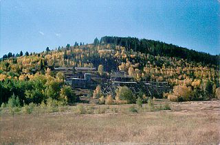
Trojan, also known as Portland, is a ghost town in the Black Hills of Lawrence County, South Dakota. It was established by and named after the Trojan Mining Company.

Hager Mountain is a volcanic peak in Oregon in the northwest corner of the Basin and Range Province in the United States. The mountain is located south of the small unincorporated community of Silver Lake in south-central Oregon, and it is in the Fremont–Winema National Forest. On the summit, there is a fire lookout operated during the summer and fall by the United States Forest Service. There are several hiking trails that lead to the lookout station.
Bald Mountain is a mountain located in the Catskill Mountains of New York west-northwest of Gilboa. Mount Jefferson is located north-northwest, and Mine Hill is located north of Bald Mountain.
Mine Hill is a mountain in Schoharie County, New York. It is located northwest of South Gilboa. Bald Mountain is located south and Woodchuck Hill is located north-northwest of Mine Hill.

