Bilari | |
|---|---|
city | |
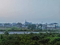 Sugar Mill, Raja ka Sahaspur | |
 Bilari Location in Uttar Pradesh, India  Bilari Bilari (India) | |
| Coordinates: 28°37′19″N78°48′07″E / 28.622°N 78.802°E | |
| Country | |
| State | Uttar Pradesh |
| District | Moradabad |
| Government | |
| • MLA | Shri Mo Faeem Irfan [1] |
| Elevation | 184 m (604 ft) |
| Population (2001) [2] | |
• Total | 30,246 |
| Languages | |
| • Official | Hindi |
| • Spoken languages | Hindi, Urdu |
| Time zone | UTC+5:30 (IST) |
| PIN | 244411 [3] |
| Telephone code | 5921 [4] |
| Vehicle registration | UP 21 |
| Website | up |
Bilari is a city and a municipal board in Moradabad district in the state of Uttar Pradesh, India. It is connected by road as well as Indian Railways.