Related Research Articles

Gladstone is a city in the Gladstone Region, Queensland, Australia. It is approximately 550 km (340 mi) by road north-west of the state capital, Brisbane, and 100 km (62 mi) south-east of Rockhampton. Situated between the Calliope and Boyne Rivers, Gladstone is home to Queensland's largest multi-commodity shipping port.

Mount Morgan is a town and locality in Rockhampton Region, Queensland, Australia. The town was the administrative centre of the Mount Morgan Shire until March 2008, when it was amalgamated with neighbouring local government areas to form the Rockhampton Region.

Westwood is a town in the Rockhampton Region and a locality split between the Rockhampton Region and the Shire of Banana in Queensland, Australia. It was the first town gazetted by the Queensland Government. In the 2016 census, Westwood had a population of 174 people.

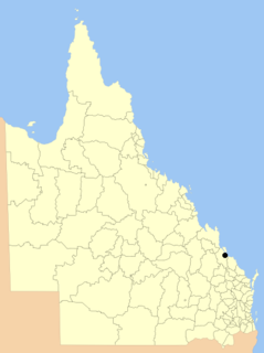
Mount Larcom is the name of a mountain, a township and a locality in the Gladstone Region, Queensland, Australia. The township/locality is at the junction of the Bruce Highway and Gladstone Mount Larcom Road approximately 70 kilometres (43 mi) south of the city of Rockhampton.

Miles is a town and a locality in the Western Downs Region, Queensland, Australia. In the 2016 census, Miles had a population of 1,746 people.
The City of Gladstone is a former local government area in central Queensland, Australia. It covered the urban locality of Gladstone and parts of the surrounding area.

Wallaville is a rural town and locality in the Bundaberg Region, Queensland, Australia. It is 372 kilometres (231 mi) north of the state capital, Brisbane and 43 kilometres (27 mi) south west of the regional centre of Bundaberg. In the 2016 census, Wallaville had a population of 410 people.
Kawana is a suburb of Rockhampton in the Rockhampton Region, Queensland, Australia. At the 2011 census, Kawana had a population of 4,657.

Jambin is a town and locality in the Shire of Banana, Central Queensland, Australia.
Raglan is a town and locality in the Gladstone Region of Queensland, Australia.

Parkhurst is a suburb of Rockhampton in the Rockhampton Region, Queensland, Australia.

Ambrose is a rural town and locality in the Gladstone Region, Queensland, Australia. In the 2016 census, Ambrose had a population of 218 people..

Booie is a rural locality on the boundary of Kingaroy and Nanango in the South Burnett Region, Queensland, Australia.
Kabra is a town and rural locality in the Rockhampton Region, Queensland, Australia.

Toolooa is a suburb of Gladstone in the Gladstone Region, Queensland, Australia.

Gladstone Central is a coastal suburb of Gladstone in the Gladstone Region, Queensland, Australia. It is the historic centre and central business district of the city of Gladstone and the seat of the Gladstone Regional Council.
Mount Murchison is a locality in the Shire of Banana, Queensland, Australia.
Bajool is a rural town and locality in the Rockhampton Region, Queensland, Australia. In the 2016 census, Bajool had a population of 455 people.

Park Avenue is a suburb of Rockhampton in the Rockhampton Region, Queensland, Australia.
Lawgi Dawes is a locality in the Shire of Banana, Queensland, Australia. It contains the neighbourhood of Lawgi, a former town.
References
- 1 2 Australian Bureau of Statistics (31 October 2012). "Bracewell (SSC)". 2011 Census QuickStats. Retrieved 20 April 2014.

- ↑ "Bracewell (entry 46595)". Queensland Place Names. Queensland Government . Retrieved 20 April 2014.
- ↑ "MOUNT LARCOM". Morning Bulletin (Rockhampton, Qld. : 1878 - 1954) . Rockhampton, Qld.: National Library of Australia. 20 January 1914. p. 8. Retrieved 20 April 2014.
- ↑ "Opening and closing dates of Queensland Schools". Queensland Government . Retrieved 20 April 2014.
- ↑ "Agency ID5003, Bracewell State School". Queensland State Archives . Retrieved 20 April 2014.