
Mount Larcom is the name of a mountain, a rural town and locality in the Gladstone Region, Queensland, Australia. In the 2021 census, the locality of Mount Larcom had a population of 332 people.
North Arm is a rural town and locality in the Sunshine Coast Region, Queensland, Australia. In the 2021 census, the locality of North Arm had a population of 734 people.

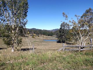
Cracow is a rural town and locality in the Shire of Banana, Queensland, Australia. In the 2021 census, the locality of Cracow had a population of 114 people.

Marmor is a rural town and locality in the Rockhampton Region, Queensland, Australia. In the 2021 census, the locality of Marmor had a population of 208 people.

Port Alma is a coastal town, locality and port in the Rockhampton Region, Queensland, Australia. In the 2021 census, Port Alma had "no people or a very low population".

Raglan is a rural town and locality in the Gladstone Region, Queensland, Australia. In the 2021 census, the locality of Raglan had a population of 143 people.

Colinton is a rural locality in the Somerset Region, Queensland, Australia. In the 2021 census, Colinton had a population of 60 people.

Ambrose is a rural town and locality in the Gladstone Region, Queensland, Australia. In the 2021 census, the locality of Ambrose had a population of 217 people.

East End is a rural locality in the Gladstone Region, Queensland, Australia. In the 2021 census, East End had a population of 88 people.
Bracewell is a rural locality in the Gladstone Region, Queensland, Australia. In the 2021 census, Bracewell had a population of 178 people.

Bajool is a rural town and locality in the Rockhampton Region, Queensland, Australia. In the 2021 census, the locality of Bajool had a population of 447 people.

Yarwun is a rural town and coastal locality in the Gladstone Region, Queensland, Australia. In the 2021 census, the locality of Yarwun had a population of 89 people.
Sandy Creek is a rural locality in the Somerset Region, Queensland, Australia. In the 2021 census, Sandy Creek had a population of 593 people.
Harrami is a rural locality in the North Burnett Region, Queensland, Australia. In the 2021 census, Harrami had a population of 22 people.
The Narrows is a coastal locality in the Gladstone Region, Queensland, Australia. In the 2021 census, The Narrows had "no people or a very low population".

Boulder Creek is a rural locality in the Rockhampton Region, Queensland, Australia. In the 2021 census, Boulder Creek had a population of 13 people.
Darts Creek is a rural locality in the Gladstone Region, Queensland, Australia. In the 2021 census, Darts Creek had a population of 165 people.

Mount Alma is a rural locality in the Gladstone Region, Queensland, Australia. In the 2021 census, Mount Alma had a population of 59 people.
Lake Mary is a rural locality in the Livingstone Shire, Queensland, Australia. In the 2021 census, Lake Mary had a population of 96 people.
Wura is a rural locality in the Rockhampton Region, Queensland, Australia. In the 2021 census, Wura had "no people or a very low population".
