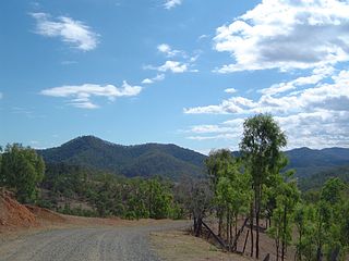
England Creek is a rural locality split between Somerset Region and City of Brisbane, Queensland, Australia. In the 2021 census, England Creek had a population of 39 people.

Rosedale is a rural town and locality split between the Gladstone Region and the Bundaberg Region in central Queensland, Australia. In the 2021 census, the locality of Rosedale had a population of 452 people.
Eurimbula is a coastal rural locality in the Gladstone Region, Queensland, Australia. In the 2021 census, Eurimbula had "no people or a very low population".

Ambrose is a rural town and locality in the Gladstone Region, Queensland, Australia. In the 2021 census, the locality of Ambrose had a population of 217 people.
Machine Creek is a rural locality in the Gladstone Region, Queensland, Australia. In the 2021 census, Machine Creek had a population of 131 people.
Baffle Creek is a rural locality in the Gladstone Region, Queensland, Australia. In the 2021 census, Baffle Creek had a population of 155 people.
River Ranch is a rural locality in the Gladstone Region, Queensland, Australia. In the 2021 census, River Ranch had a population of 269 people.
Brush Creek is a rural locality in the Goondiwindi Region, Queensland, Australia. In the 2021 census, Brush Creek had a population of 39 people.
Taragoola is a rural locality in the Gladstone Region, Queensland, Australia. In the 2021 census, Taragoola had "no people or a very low population".
Burua is a rural locality in the Gladstone Region, Queensland, Australia. In the 2021 census, Burua had a population of 849 people.
Rules Beach is a coastal town and a locality in the Gladstone Region, Queensland, Australia. In the 2021 census, the locality of Rules Beach had a population of 56 people.
Rodds Bay is a coastal locality in the Gladstone Region, Queensland, Australia. In the 2021 census, Rodds Bay had a population of 133 people.

Captain Creek is a rural locality in the Gladstone Region, Queensland, Australia. In the 2021 census, Captain Creek had a population of 452 people.
Sunshine Acres is a rural locality in the Fraser Coast Region, Queensland, Australia. In the 2021 census, Sunshine Acres had a population of 1,009 people.
Beelbi Creek is a rural locality in the Fraser Coast Region, Queensland, Australia. In the 2021 census, Beelbi Creek had a population of 143 people.
Nahrunda is a rural locality in the Gympie Region, Queensland, Australia. In the 2021 census, Nahrunda had a population of 192 people.
Diglum is a rural locality in the Gladstone Region, Queensland, Australia. In the 2021 census, Diglum had a population of 56 people.
Round Hill is a rural locality in the Gladstone Region, Queensland, Australia. In the 2021 census, Round Hill had a population of 189 people.
Brandy Creek is a rural locality in the Whitsunday Region, Queensland, Australia. In the 2021 census, Brandy Creek had a population of 114 people.
Silver Creek is a rural locality in the Whitsunday Region, Queensland, Australia. In the 2021 census, Silver Creek had a population of 18 people.


