Ubobo

Last updated

Map all coordinates using: OpenStreetMap  
Download coordinates as: KML
Ubobo
Queensland
Ubobo Railway Terrace 001.JPG
Railway Terrace, 2017. From the left the buildings shown are the Ubobo Memorial Hall, the QCWA rest rooms, the former Station Mistress' house and a private dwelling
Australia Queensland location map.svg
Red pog.svg
Ubobo
Coordinates 24°24′17″S151°19′16″E / 24.4047°S 151.3211°E / -24.4047; 151.3211 (Ubobo (town centre)) Coordinates: 24°24′17″S151°19′16″E / 24.4047°S 151.3211°E / -24.4047; 151.3211 (Ubobo (town centre))
Postcode(s) 4680
Time zone AEST (UTC+10:00)
Location
LGA(s) Gladstone Region
State electorate(s) Callide
Federal division(s) Flynn

Ubobo is a rural town in the locality of Boyne Valley in the Gladstone Region, Queensland, Australia. [1]

Contents

Geography

Ubobo is located south of Gladstone and Calliope along Highway 69 in Central Queensland, Australia. It is one of four small townships within the locality of Boyne Valley, along with Nagoorin, Builyan, and Many Peaks.

Ubobo is a small town found in the middle of the Boyne Valley, which is mostly made up of family farms that have been passed on to the next generation over the years.

History

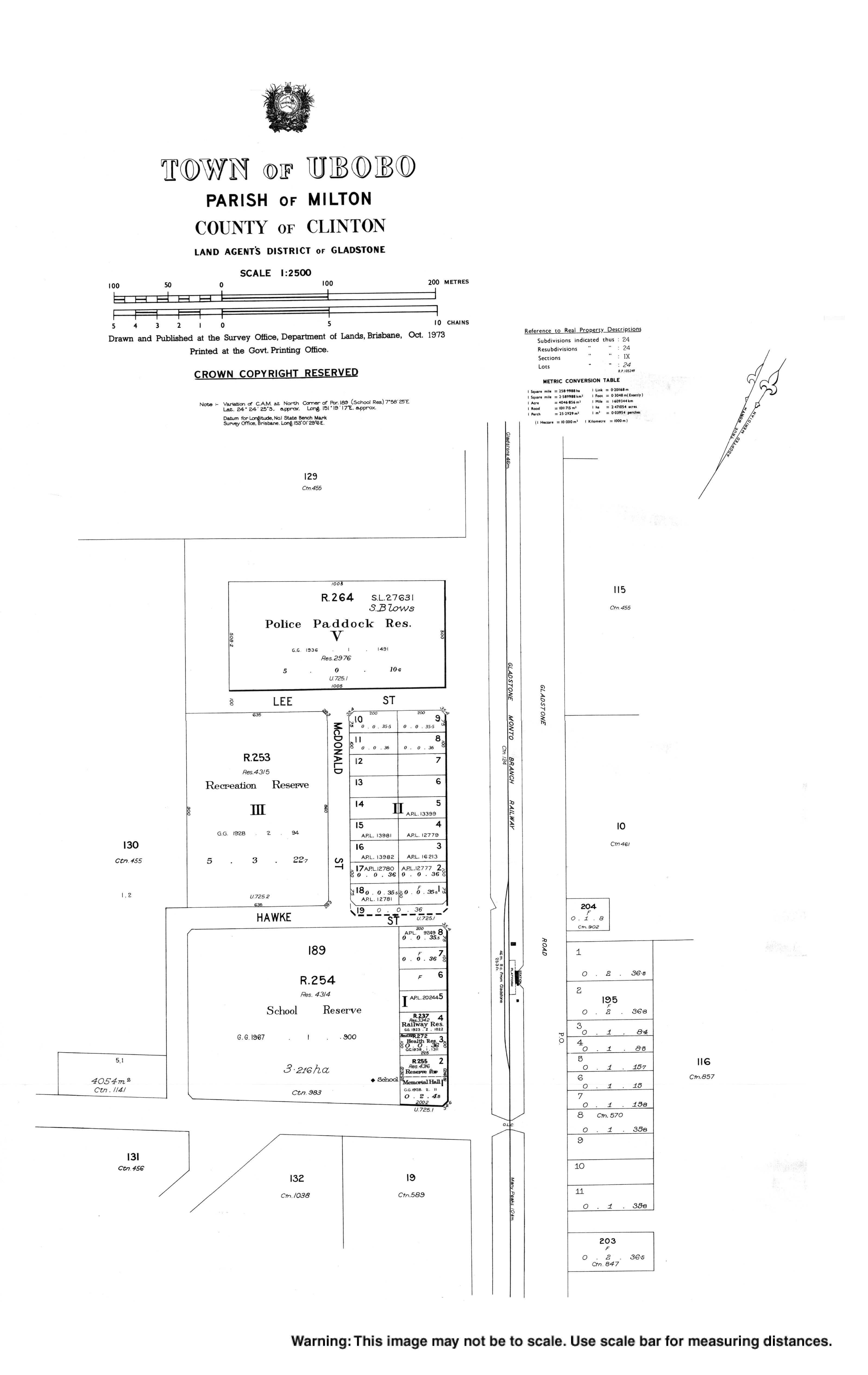
The Town of Ubobo appears on a 1921 survey plan U7251. It was established as one of the soldier settlements created after World War I. [2]

The name comes from the railway station name, assigned in 1910 by the Queensland Railways Department and is believed to be an Aboriginal word meaning wild arrowroot. [1] The railway station was on the Gladstone to Monto railway line.

The first school building was originally built as the Glassford Creek State School at the end of the 19th century, and was dismantled and moved to Ubobo where it opened as Ubobo State School 23 March 1927. [3] A larger building was opened in 1932 and the original building offered for sale. [4]

Circa August 1931, Sunday School classes began in the Ubobo Hall organised by St Saviour's Anglican Church in Gladstone. Circa May 1934, William Alexander Fancourt McDonald, of Wietalaba, donated land for an Anglican church in Ubobo. [5] Later,[ when? ] St Luke's Anglican Church was opened at 4995 Gladstone Monto Road ( 24°24′26″S151°19′26″E / 24.4071°S 151.3240°E / -24.4071; 151.3240 (St Luke's Anglican Church) ). It is now closed and is used for commercial purposes. [6] [7]

The Boyne Valley branch of the Queensland Country Women's Association (QCWA) was established on 21 November 1935. [8]

On 24 December 1953, the Ububo Memorial Hall was burned down in a fire. In January 1955, a new memorial hall was opened. [2]

The QCWA hall in Ububo was officially opened in April 1959. The building was originally built in 1914 as the post office at Many Peaks. It was later moved to Littlemore (approx 5 kilometres (3.1 mi) south of Ubobo) and become the Littlemore Memorial Hall. The QCWA branch had been using the old Ububo Memorial Hall until it was destroyed. The QCWA were gifted the Littlemore Memorial Hall which was relocated to 5 Railway Terrace, Ububo in 1958. [8]

In 1985, a building was relocated from Calliope to Ubobo to become St Mary's Catholic Church. [9]

The Ubobo Post Office was closed on the 4th of August 1993. [10]

Amenities

The town is made up of

Education

Ubobo State School is a government primary (Prep-6) school for boys and girls at Cedarvale Road ( 24°24′24″S151°19′18″E / 24.4067°S 151.3217°E / -24.4067; 151.3217 (Ubobo State School) ). [16] [17] In 2017, the school had an enrolment of 12 students with 3 teachers (2 full-time equivalent) and 4 non-teaching staff (2 full-time equivalent). [18] Enrolments had been declining for several years, and at the start of 2019 the school had only 2 students. After both students left to attend other schools, the school was temporarily closed and remains so as of January 2022. [17] [19]

There are no secondary schools in the Boyne Valley. The nearest government secondary school is Calliope State High School in Calliope to the north, which offers secondary schooling to Year 10. For Years 11 and 12, the nearest government schools are Gladstone State High School in West Gladstone and Tannum Sands State High School in Tannum Sands, both to the north; however, the distances involved are sufficiently large that distance education and boarding school are other options. [14]

Heritage listings

Soldier Settler House, 2009 Soldier Settler House (2009).jpg
Soldier Settler House, 2009
Boyne Valley QCWA Hall, 2017 Ubobo Boyne Valley CWA Building 001.JPG
Boyne Valley QCWA Hall, 2017

Ubobo has a number of heritage-listed sites, including:

Related Research Articles

<span class="mw-page-title-main">Gladstone, Queensland</span> City in Queensland, Australia

Gladstone is a coastal city in the Gladstone Region, Queensland, Australia. Gladstone, together with Boyne Island and Tannum Sands, had an estimated urban population of 50,317 at August 2021. This urban area covers 246.1 km2 (95.0 sq mi).

<span class="mw-page-title-main">Calliope, Queensland</span> Town in Queensland, Australia

Calliope is a rural town and locality in the Gladstone Region, Queensland, Australia. In the 2016 census, Calliope had a population of 3,438 people.

<span class="mw-page-title-main">Yarraman, Queensland</span> Town in Queensland, Australia

Yarraman is a rural town and locality in the Toowoomba Region, Queensland, Australia. In the 2016 census, Yarraman had a population of 1,064 people.

<span class="mw-page-title-main">Tannum Sands, Queensland</span> Town in Queensland, Australia

Tannum Sands is a coastal town and locality in the Gladstone Region, Queensland, Australia.

<span class="mw-page-title-main">Mount Larcom, Queensland</span> Town in Queensland, Australia

Mount Larcom is the name of a mountain, a rural town and locality in the Gladstone Region, Queensland, Australia. In the 2016 census, the locality of Mount Larcom had a population of 361 people.

<span class="mw-page-title-main">Pittsworth, Queensland</span> Town in Queensland, Australia

Pittsworth is a rural town and locality in the Toowoomba Region, Queensland, Australia. In the 2016 census, the locality of Pittsworth had a population of 3,294 people.

<span class="mw-page-title-main">Monto, Queensland</span> Town in Queensland, Australia

Monto is a rural town and locality in the North Burnett Region, Queensland, Australia. In the 2021 census, Monto had a population of 1,156 people.

<span class="mw-page-title-main">Shire of Calliope</span> Local government area in Queensland, Australia

The Shire of Calliope was a local government area in the Capricornia region of Queensland, Australia. It was centred on the town of Calliope.

<span class="mw-page-title-main">Boyne Island, Queensland</span> Town in Queensland, Australia

Boyne Island is a coastal town and locality in the Gladstone Region, Queensland, Australia. In the 2016 census the locality of Boyne Island had a population of 4,760 people.

<span class="mw-page-title-main">Boyne Valley, Queensland</span> Suburb of Gladstone Region, Queensland, Australia

The Boyne Valley is a rural locality in Gladstone Region, Queensland, Australia. The locality contains four small towns: Nagoorin, Ubobo, Builyan, and Many Peaks. In the 2016 census, Boyne Valley had a population of 358 people. At the 2021 census the population had dropped to 301.

<span class="mw-page-title-main">Nagoorin</span> Town in Queensland, Australia

Nagoorin is a rural town in Gladstone Region, Queensland, Australia. It is one of four small townships within the locality of Boyne Valley along with Ubobo, Builyan, and Many Peaks.

<span class="mw-page-title-main">Builyan, Queensland</span> Town in Queensland, Australia

Builyan is a town in Gladstone Region, Central Queensland, Australia. It is one of four small townships within the locality of Boyne Valley along with Nagoorin, Ubobo, and Many Peaks.

<span class="mw-page-title-main">Many Peaks, Queensland</span> Town in Queensland, Australia

Many Peaks is a town in Gladstone Region in Queensland, Australia. It is one of four small townships within the locality of Boyne Valley along with Nagoorin, Builyan and Ubobo.

Byellee to Monto Branch Railway was a branch railway that branched off the Boyne Valley west of Gladstone in Queensland, Australia.The Boyne Valley region was predominantly a dairying region and a railway had little justification. However a branch was justified in 1906 on the basis of large traffic in timber, fuel, limestone and flexing ores. Progressively opened between 1910 and 1931 the line branched from the North Coast line at Byellee a short distance west of Gladstone and struck a south-westerly route via Many Peaks and Mungungo to Monto.

<span class="mw-page-title-main">Amiens, Queensland</span> Town in Queensland, Australia

Amiens is a rural locality in the Southern Downs Region, Queensland, Australia. In the 2016 census, Amiens had a population of 293 people.

Boynedale is a rural locality in the Gladstone Region, Queensland, Australia. In the 2016 census, Boynedale had a population of 17 people.

Glen Aplin is a rural locality in the Southern Downs Region, Queensland, Australia. In the 2016 census, Glen Aplin had a population of 503 people.

<span class="mw-page-title-main">Kalpowar</span> Town in Queensland, Australia

Kalpowar is a town in the North Burnett Region and a locality split between the North Burnett Region and the Bundaberg Region, in Queensland, Australia. In the 2016 census, the locality of Kalpowar had a population of 67 people.

Gladstone–Monto Road is a 132 kilometres (82 mi) road route in the Gladstone and North Burnett regions of Queensland, Australia. The entire route is signed as State Route 69.

The Boyne Burnett Inland Rail Trail is a recreational route for walkers, cyclists and horse riders from Taragoola to Gayndah. It uses the closed Gladstone to Monto and Mungar Junction to Monto railway corridors in Queensland, Australia.

References

  1. 1 2 "Ubobo – town in Gladstone Region (entry 35710)". Queensland Place Names. Queensland Government . Retrieved 27 December 2020.
  2. 1 2 "New Memorial Hall At Ubobo". The Central Queensland Herald . Vol. 22, no. 1302. Queensland, Australia. 20 January 1955. p. 10. Retrieved 1 January 2019 via National Library of Australia.
  3. "Opening and closing dates of Queensland Schools". Queensland Government . Retrieved 18 April 2019.
  4. "History". Ubobo State School. 21 January 2020. Retrieved 13 October 2021.
  5. "ANGLICAN SYNOD OF R'TON DIOCESE". The Evening News . No. 3926. Queensland, Australia. 15 May 1934. p. 5. Retrieved 29 January 2022 via National Library of Australia.
  6. Blake, Thom. "St Luke's Anglican Church". Queensland religious places database. Retrieved 29 January 2022.
  7. "St Luke's Anglican Church - Former". Churches Australia. Retrieved 29 January 2022.
  8. 1 2 "Boyne Valley Branch, Queensland Country Women's Association". Boyne Valley. Archived from the original on 1 January 2019. Retrieved 1 January 2019.
  9. Blake, Thom. "St Mary's Catholic Church". Queensland religious places database. Retrieved 29 January 2022.
  10. "ParlInfo - QUESTIONS ON NOTICE : Postal Services". parlinfo.aph.gov.au. Retrieved 2 February 2022.
  11. "Home - Boyne Valley Community Discovery Centre". Boyne Valley Community Discovery Centre Inc. 13 April 2020. Retrieved 9 October 2022.
  12. "Gladstone". Catholic Diocese of Rockhampton. Retrieved 29 January 2022.
  13. "St Mary's Catholic Church". Churches Australia. Retrieved 29 January 2022.
  14. 1 2 "Queensland Globe". State of Queensland . Retrieved 29 January 2022.
  15. "Boyne Valley Historical Society". www.facebook.com. Retrieved 3 October 2022.
  16. "State and non-state school details". Queensland Government. 9 July 2018. Archived from the original on 21 November 2018. Retrieved 21 November 2018.
  17. 1 2 "Ubobo State School". Ubobo State School. 21 January 2020. Retrieved 29 January 2022.
  18. "ACARA School Profile 2017". Archived from the original on 22 November 2018. Retrieved 22 November 2018.
  19. "Temporary Closure of Ubobo State School". Queensland Government. 17 September 1919. Retrieved 29 January 2022.
  20. "Soldier Settler House (entry 602229)". Queensland Heritage Register . Queensland Heritage Council. Retrieved 8 July 2013.
  21. "Ubobo QCWA". Gladstone Heritage Register. Gladstone Regional Council. Archived from the original on 1 January 2019. Retrieved 1 January 2019.
  22. Billing, Amy. "Local Heritage Register". Gladstone Regional Council . Ubobo Station Mistress's Residence. Retrieved 3 October 2022.