Calliope is a rural town and locality in the Gladstone Region, Queensland, Australia. In the 2021 census, Calliope had a population of 5,263 people.

Tannum Sands is a coastal town and locality in the Gladstone Region, Queensland, Australia. In the 2021 census, the locality of Tannum Sands had a population of 5,227 people.

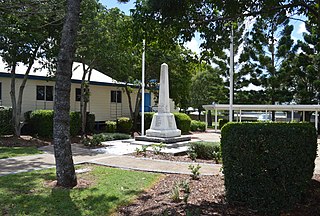
Mount Larcom is the name of a mountain, a rural town and locality in the Gladstone Region, Queensland, Australia. In the 2021 census, the locality of Mount Larcom had a population of 332 people.

Mulgildie is a rural town and locality in the North Burnett Region, Queensland, Australia. In the 2021 census, the locality of Mulgildie had a population of 147 people.

Lake Awoonga was formed on the Boyne River by the dam located 30 km (19 mi) from Gladstone, in Central Queensland, Australia. It is approximately 30 minutes drive from Gladstone, via Benaraby.

The Boyne Valley is a rural locality in Gladstone Region, Queensland, Australia. The locality contains four small towns: Nagoorin, Ubobo, Builyan, and Many Peaks. In the 2021 census, Boyne Valley had a population of 301 people.

Ubobo is a rural town in the locality of Boyne Valley in the Gladstone Region, Queensland, Australia.

Builyan is a town in Gladstone Region, Central Queensland, Australia. It is one of four small townships within the locality of Boyne Valley along with Nagoorin, Ubobo, and Many Peaks.

Benaraby is a rural town and locality in the Gladstone Region, Queensland, Australia. In the 2021 census, the locality of Benaraby had a population of 1,166 people.

Ideraway is a rural town and locality in the North Burnett Region, Queensland, Australia. In the 2021 census, the locality of Ideraway had a population of 31 people.

East End is a rural locality in the Gladstone Region, Queensland, Australia. In the 2021 census, East End had a population of 88 people.

Yarwun is a rural town and coastal locality in the Gladstone Region, Queensland, Australia. In the 2021 census, the locality of Yarwun had a population of 89 people.

Didcot is a rural locality in the North Burnett Region, Queensland, Australia. In the 2021 census, Didcot had a population of 85 people.

Kalpowar is a town in the North Burnett Region and a locality split between the North Burnett Region and the Bundaberg Region, in Queensland, Australia. In the 2021 census, the locality of Kalpowar had a population of 53 people.

Bancroft is a rural locality in the North Burnett Region, Queensland, Australia. In the 2021 census, Bancroft had a population of 98 people.
Kapaldo is a rural town and locality in the North Burnett Region, Queensland, Australia. In the 2021 census, the locality of Kapaldo had a population of 41 people.

Mungungo is a rural town and locality in the North Burnett Region, Queensland, Australia. In the 2021 census, the locality of Mungungo had a population of 84 people.
Byellee is an industrial suburb of Gladstone in the Gladstone Region, Queensland, Australia. In the 2021 census, Byellee had "no people or a very low population".

Mount Alma is a rural locality in the Gladstone Region, Queensland, Australia. In the 2021 census, Mount Alma had a population of 59 people.
Gladstone–Monto Road is a 132 kilometres (82 mi) road route in the Gladstone and North Burnett regions of Queensland, Australia. The entire route is signed as State Route 69.
