Beecher, Queensland

Last updated

Beecher
Queensland
Australia Queensland location map.svg
Red pog.svg
Beecher
Coordinates 23°54′40″S151°12′17″E / 23.9111°S 151.2047°E / -23.9111; 151.2047 Coordinates: 23°54′40″S151°12′17″E / 23.9111°S 151.2047°E / -23.9111; 151.2047
Population863 (2016 census) [1]
 • Density45.66/km2 (118.3/sq mi)
Postcode(s) 4680
Area18.9 km2 (7.3 sq mi)
LGA(s) Gladstone Region
State electorate(s) Gladstone
Federal Division(s) Flynn
Suburbs around Beecher:
West Stowe Byellee Kirkwood
West Stowe Beecher Kirkwood
Burua Burua Burua

Beecher is a rural locality in the Gladstone Region, Queensland, Australia. [2] In the 2016 census, Beecher had a population of 863 people. [1]

Contents

Geography

The Calliope River forms the western boundary of the locality. Clyde Creek flows through the locality from the south towards the north-west where it flows into the Calliope River at the most north-western part of the locality. The residential and farming mainly occurs on the lower land (0–10 metres above sea level) surrounding the creek. The Dawson Highway and the Moura railway line also passes from north to south through the locality in this lower-lying area. [3]

The land in the east of the suburb is hillier (rising to 130 metres) and is protected as the Mount Maurice State Forest. Mount Beecher (156 metres) in the south-west of the locality, much of which is protected as the Beecher State Forest. [3]

History

Beecher is named after Mount Beecher, which was named in 1853 by surveyor Francis MacCabe apparently after Harriet Beecher Stowe, author of the novel Uncle Tom's Cabin . McCabe also named Mount Tom and Mount Stowe in the same area. [4]

Calliope River State School opened on 11 August 1874 and closed in December 1881. Calliope River Provisional School on 1 November 1882 and closed in 1893. Calliope River Provisional School opened in 1897 but closed in 1905. Calliope River State School opened on 27 May 1912, it was renamed Beecher State School in 1919, and closed on 4 July 1943. [5]

Education

There are no schools in Beecher. The locality is within the catchment of Clinton State School and Gladstone State High School. [3]

Related Research Articles

Sarina, Queensland Town in Queensland, Australia

Sarina is a rural town and coastal locality in the Mackay Region, Queensland, Australia. In the 2016 census, Sarina had a population of 5,522 people.

Calliope, Queensland Town in Queensland, Australia

Calliope is a rural town and locality in the Gladstone Region, Queensland, Australia. In the 2016 census, Calliope had a population of 5,101 people.

Woocoo, Queensland Suburb of Fraser Coast Region, Queensland, Australia

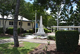
Woocoo is a locality in the Fraser Coast Region, Queensland, Australia.

Many Peaks, Queensland Town in Queensland, Australia

Many Peaks is a town in Gladstone Region in Queensland, Australia. It is one of four small townships within the locality of Boyne Valley along with Nagoorin, Builyan and Ubobo.

Byellee to Monto Branch Railway was a branch railway that branched off the Boyne Valley west of Gladstone in Queensland, Australia. However, the Boyne Valley region was predominantly a dairying region and a railway had little justification. However a branch was justified in 1906 on the basis of large traffic in timber, fuel, limestone and flexing ores. Progressively opened between 1910 and 1931 the line branched from the North Coast line at Byellee a short distance west of Gladstone and struck a south-westerly route via Many Peaks and Mungungo to Monto.

Machine Creek, Queensland Suburb of Gladstone Region, Queensland, Australia

Machine Creek is a rural locality in the Gladstone Region, Queensland, Australia. In the 2016 census, Machine Creek had a population of 120 people.

Gogango Town in Queensland, Australia

Gogango is a small town and a locality in the Rockhampton Region, Queensland, Australia.

Palen Creek, Queensland Suburb of Scenic Rim Region, Queensland, Australia

Palen Creek is a rural locality in the Scenic Rim Region, Queensland, Australia. It borders New South Wales. In the 2016 census, Palen Creek had a population of 280 people.

Bauple, Queensland Town in Queensland, Australia

Bauple is a rural town and locality in the Fraser Coast Region, Queensland, Australia. In the 2016 census, Bauple had a population of 644 people.

Kogan, Queensland Suburb of Western Downs Region, Queensland, Australia

Kogan is a rural town and locality in the Western Downs Region, Queensland, Australia.

Oakview, Queensland Suburb of Gympie Region, Queensland, Australia

Oakview is a locality in the Gympie Region, Queensland, Australia. It is an historic mining area and now grazing country.

Mount French, Queensland Suburb of Scenic Rim Region, Queensland, Australia

Mount French is a locality in the Scenic Rim Region, Queensland, Australia.

Mount Ossa, Queensland Town in Queensland, Australia

Mount Ossa is a town and a coastal locality in the Mackay Region, Queensland, Australia.

Wondecla, Queensland Suburb of Tablelands Region, Queensland, Australia

Wondecla is a locality in the Tablelands Region, Queensland, Australia.

Lakes Creek, Queensland Suburb of Rockhampton Region, Queensland, Australia

Lakes Creek is a suburb split between Rockhampton Region and Shire of Livingstone, Queensland, Australia.

Duingal, Queensland Suburb of Bundaberg Region, Queensland, Australia

Duingal is a locality in the Bundaberg Region, Queensland, Australia. In the 2016 census, Duingal had a population of 77 people.

Old Cooranga, Queensland Suburb of North Burnett Region, Queensland, Australia

Old Cooranga is a rural locality in the North Burnett Region, Queensland, Australia. In the 2016 census, Old Cooranga had a population of 27 people.

Dirnbir, Queensland Suburb of North Burnett Region, Queensland, Australia

Dirnbir is a rural locality in the North Burnett Region, Queensland, Australia. In the 2016 census, Dirnbir had a population of 49 people.

Woowoonga, Queensland Suburb of North Burnett Region, Queensland, Australia

Woowoonga is a locality in the North Burnett Region, Queensland, Australia. In the 2016 census, Woowoonga had a population of 92 people.

Mount Alma, Queensland Suburb of Gladstone Region, Queensland, Australia

Mount Alma is a rural locality in the Gladstone Region, Queensland, Australia. In the 2016 census, Mount Alma had a population of 47 people.

References

  1. 1 2 Australian Bureau of Statistics (27 June 2017). "Beecher (SSC)". 2016 Census QuickStats. Retrieved 20 October 2018. OOjs UI icon edit-ltr-progressive.svg
  2. "Beecher - locality in Gladstone Region (entry 46588)". Queensland Place Names. Queensland Government . Retrieved 12 November 2018.
  3. 1 2 3 "Queensland Globe". State of Queensland . Retrieved 11 November 2018.
  4. "Gladstone localities". Queensland Places. University of Queensland. Archived from the original on 11 November 2018. Retrieved 12 November 2018.
  5. Queensland Family History Society (2010), Queensland schools past and present (Version 1.01 ed.), Queensland Family History Society, ISBN   978-1-921171-26-0