
The Gemfields is a locality in the Central Highlands Region, Queensland, Australia. In the 2016 census, The Gemfields had a population of 1,449 people.
Calliope is a rural town and locality in the Gladstone Region, Queensland, Australia. In the 2016 census, Calliope had a population of 5,101 people.

Mount Larcom is the name of a mountain, a township and a locality in the Gladstone Region, Queensland, Australia. The township/locality is at the junction of the Bruce Highway and Gladstone Mount Larcom Road approximately 70 kilometres (43 mi) south of the city of Rockhampton.

The Shire of Calliope was a local government area in the Capricornia region of Queensland, Australia. It was centred on the town of Calliope.

Many Peaks is a town in Gladstone Region in Queensland, Australia. It is one of four small townships within the locality of Boyne Valley along with Nagoorin, Builyan and Ubobo.

Wowan is a rural town and locality in the Shire of Banana, Queensland, Australia. The town of Deeford is also within the locality. In the 2016 census, the locality of Wowan had a population of 216 people.
Glengallan is a rural locality in the Southern Downs Region, Queensland, Australia. In the 2016 census, Glengallan had a population of 54 people.

Ambrose is a rural town and locality in the Gladstone Region, Queensland, Australia. In the 2016 census, Ambrose had a population of 218 people..
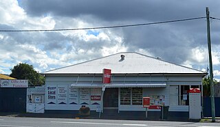
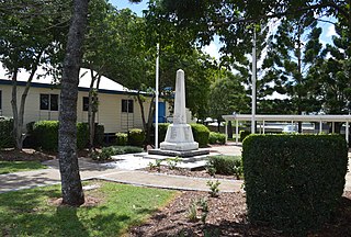
Bororen is a town and locality in the Gladstone Region, Queensland, Australia. In the 2016 census, Bororen had a population of 398 people.

Mount Whitestone is a locality in the Lockyer Valley Region, Queensland, Australia. In the 2016 census, Mount Whitestone had a population of 154 people.

Linthorpe is a rural locality in the Toowoomba Region, Queensland, Australia. In the 2016 census, Linthorpe had a population of 440 people.

Sheep Station Creek is a rural locality in the Somerset Region, Queensland, Australia. In the 2016 census, Sheep Station Creek had a population of 108 people.
Mount Marshall is a locality in the Southern Downs Region, Queensland, Australia. In the 2011 census, Mount Marshall had a population of 231 people.
Kennedy is a coastal locality in the Cassowary Coast Region, Queensland, Australia. In the 2016 census, Kennedy had a population of 161 people.
The Caves is a small community and a locality in the Livingstone Shire, Queensland, Australia.

Kalpowar is a town in the North Burnett Region and a locality split between the North Burnett Region and the Bundaberg Region, in Queensland, Australia.

Bancroft is a locality in the North Burnett Region, Queensland, Australia. At the 2016 census, Bancroft and the surrounding rural area had a population of 96.
Tablelands is a rural locality in the Gladstone Region, Queensland, Australia. In the 2016 census, Tablelands had a population of 0 people.
Beecher is a rural locality in the Gladstone Region, Queensland, Australia. In the 2016 census, Beecher had a population of 863 people.
Ottaba is a rural locality in the Somerset Region, Queensland, Australia. In the 2016 census, Ottaba had a population of 54 people.
