Gladstone Central

Last updated

Gladstone Central
Gladstone,  Queensland
Looking up Goondoon Street (main street), Gladstone, 2014.JPG
Looking up Goondoon Street, 2014
Australia Queensland location map.svg
Red pog.svg
Gladstone Central
Coordinates 23°50′30″S151°14′53″E / 23.8416°S 151.2480°E / -23.8416; 151.2480 (Gladstone Central (centre of suburb)) Coordinates: 23°50′30″S151°14′53″E / 23.8416°S 151.2480°E / -23.8416; 151.2480 (Gladstone Central (centre of suburb))
Population1,550 (2021 census) [1]
 • Density500/km2 (1,295/sq mi)
Postcode(s) 4680
Area3.1 km2 (1.2 sq mi)
Time zone AEST (UTC+10:00)
Location
LGA(s) Gladstone Region
State electorate(s) Gladstone
Federal division(s) Flynn
Suburbs around Gladstone Central:
Callemondah Callemondah Gladstone Harbour
Callemondah Gladstone Central Barney Point
Callemondah West Gladstone South Gladstone

Gladstone Central is a coastal suburb of Gladstone in the Gladstone Region, Queensland, Australia. [2] It is the historic centre and central business district of the city of Gladstone and the seat of the Gladstone Regional Council. In the 2021 census, Gladstone Central had a population of 1,550 people. [3]

Contents

Geography

Gladstone Central is bounded by Auckland Inlet on the north, Auckland Creek and Side Street on the west, the railway line on the east and a combination of Scenery Street and Tank Street on the south.

Auckland Point is the northernmost part of the suburb ( 23°50′00″S151°15′00″E / 23.8333°S 151.25°E / -23.8333; 151.25 (Auckland Point) ). [4]

The main business and shopping street is Goondoon Street which runs over a hill, its apex being at the intersection with Roseberry Street.

History

The Gladstone Post Office opened on 1 July 1854. [5]

Gladstone State School opened on 1 April 1861 and is one of the oldest state primary schools in Queensland. [6] [7] On 14 November 1968, its name was changed to be Gladstone Central State School. [8] [9]

Star of the Sea Catholic Primary School opened on 19 January 1902. [8]

Gladstone City Library opened in 2003. [10]

In the 2011 census, Gladstone Central had a population of 1,529 people. [11]

In the 2016 census, Gladstone Central had a population of 1,547 people. [12]

In the 2021 census, Gladstone Central had a population of 1,550 people. [13]

Amenities

Entrance to Gladstone City Library, 2014 Gladstone City Library entrance, 39 Goondoon Street, 2014.JPG
Entrance to Gladstone City Library, 2014

The Gladstone City Library is at 39 Goondoon Street; it is operated by the Gladstone Regional Council. [14]

Gladstone Entertainment & Convention Centre, 2014 Gladstone Entertainment & Convention Centre, 58 Goondoon Street, 2014.JPG
Gladstone Entertainment & Convention Centre, 2014

The Gladstone Entertainment Convention Centre is at 58 Goondoon Street; it is operated by the Gladstone Regional Council. It features an auditorium seating 674 people, a flat floor space which can accommodate 1,500 people standing, an outdoor 600 square metres (6,500 sq ft) marquee on a hard stand, and a number of meeting rooms. [15]

Gladstone Regional Council offices, 2014 Gladstone Regional Council offices, 101 Goondoon Street, Gladstone Central, 2014.JPG
Gladstone Regional Council offices, 2014

There is a Gladstone Regional Council administration centre at 101 Goondoon Street. [16]

The Gladstone branch of the Queensland Country Women's Association meets at the QCWA Hall at 88 Oaka Lane. [17]

Churches

St Andrew's Presbyterian Church

St Andrew's Presbyterian Church, 149 Goondoon Street, Gladstone Central, 2014 St Andrew's Presbyterian Church, 149 Goondoon Street, Gladstone Central, 2014.JPG
St Andrew's Presbyterian Church, 149 Goondoon Street, Gladstone Central, 2014
Foundation stone of original St Andrew's Presbyterian Church laid 1867 Foundation stone of original St Andrew's Presbyterian Church laid 1867, 149 Goondoon Street, Gladstone, 2014.JPG
Foundation stone of original St Andrew's Presbyterian Church laid 1867

St Andrew's Presbyterian Church is located at 149 Goondoon Street on the corner of Bramston Street. [18] This is the second church built on this site.

A Presbyterian minister, Alexander Proudfoot, arrived in Gladstone in September 1865; he was the first religious leader in Gladstone. [19] However, for two years, there were not sufficient funds to build a church until a generous donation of £200 was received from a local settler. The church was designed by Mr Ramsay, the town surveyor in Maryborough. The foundation stone of the first church was laid on 30 October 1867 by Mrs Proudfoot, wife of Rev. Proudfoot. The brick Gothic church to accommodate 250 worshippers were built by local contractors, Smith, Hay and Day, at a cost of £457; it could accommodate 250 worshippers. [20] In April 1870, W. S. Robertson donated a marble font which he designed and executed using marble from his own quarry on the Calliope River. [21] This was the first church to be built in Gladstone.

Still the only religious leader in Gladstone, Alexander Proudfoot died on 11 April 1873 aged 42 years in Rockhampton (where he had been taken for medical treatment as Gladstone had no doctor). [19] [22] His widow established a ladies' school in Rockhampton 4 months later. [23] The Rev. A. A. Laing took charge of the parish from 8 February 1874. [24] Rev. Laing was replaced by Rev. J. Blaine in June 1875. [25]

The church was destroyed by a cyclone on 2 March 1949. [26] On 11 September 1955, the Governor of Queensland, Sir John Lavarack laid the foundation stone for the new St Andrew's church. The original foundation stone, font and pulpit were recovered from the demolished church and were incorporated into the new church. [27]

Our Lady Star of the Sea Catholic Church

Our Lady Star of the Sea Catholic Church, 2014 Our Lady Star of the Sea Catholic Church, corner of Goondoon Street and Herbert Street (view from Herbert St), Gladstone, 2014 (portrait).JPG
Our Lady Star of the Sea Catholic Church, 2014

Our Lady Star of the Sea Catholic church is located at 181-185 Goondoon street (south-west corner with Herbert Street). It has an adjoining school. [28] It is the third Catholic church to be built in Gladstone.

The first Catholic church in Gladstone was St Mary's Church in Auckland Street. It was opened on 1 March 1874 by the Rev. Dean Murlay, [29] but did not have a resident priest until 1885. However, in 1902, the land was resumed to build a new railway line between Gladstone and Rockhampton. [28] [30]

A site of 2 acres (0.81 ha) bounded by Goondoon Street, Herbert Street and Glenlyon Road was purchased with a plan to build a precinct to eventually comprise a church, a school, a convent and a monastery. The monastery would serve as both a presbytery and a sanitorium for missionaries working in the Pacific islands. The architects for the new church and school were Eaton and Bates; the builders were Robinson & Freeman. [31] The new church was opened on 19 January 1902 by the Bishop of Rockhampton, Joseph Higgins. [32]

A larger church was required to meet the growing parish, leaving to the current church being built in 1924 at a cost of £2700. The foundation stone was laid on 13 April 1924 by the Bishop of Rockhampton, Rev. Joseph Sheil. It was officially opened on 16 November 1924. The second church continued to be used as part of the school. [28] [33]

In the cyclone of 2 March 1949, the convent and school were destroyed but the church survived. [28] [34]

Education

Gladstone Central State School is a government primary (Prep-6) school for boys and girls at 74 Auckland Street ( 23°50′30″S151°15′27″E / 23.8418°S 151.2576°E / -23.8418; 151.2576 (Gladstone Central State School) ). [35] [36] In 2017, the school had an enrolment of 342 students with 24 teachers (22 full-time equivalent) and 16 non-teaching staff (12 full-time equivalent). [37] In 2018, the school had an enrolment of 356 students with 25 teachers (23 full-time equivalent) and 16 non-teaching staff (11 full-time equivalent). [38] It includes a special education program. [35]

Star of the Sea Catholic Primary School is a Catholic primary (Prep-6) school for boys and girls at 181 Goondoon Street ( 23°50′51″S151°15′28″E / 23.8474°S 151.2579°E / -23.8474; 151.2579 (Star of the Sea Catholic Primary School) ). [39] [40] In 2018, the school had an enrolment of 261 students with 24 teachers (17 full-time equivalent) and 17 non-teaching staff (9 full-time equivalent). [41]

Related Research Articles

<span class="mw-page-title-main">Gladstone, Queensland</span> City in Queensland, Australia

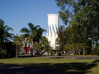
Gladstone is a coastal city in the Gladstone Region, Queensland, Australia. Gladstone, together with Boyne Island and Tannum Sands, had an estimated urban population of 50,317 at August 2021. This urban area covers 246.1 km2 (95.0 sq mi).

Yeppoon Town in Queensland, Australia

Yeppoon is a coastal town and locality in the Shire of Livingstone, Queensland, Australia. Yeppoon is renowned for its beaches, tropical climate, and the islands out on the bay. Located 41 kilometres (25 mi) from the city of Rockhampton, Yeppoon is the seat of the Shire of Livingstone and the principal town on the Capricorn Coast, a string of seaside communities stretching more than 150 kilometres (93 mi) from north to south. The beaches and shallow coves provide a destination both for tourists and retirees settling down in Central Queensland. Offshore, there are 27 islands including Great Keppel Island which is 20 kilometres (12 mi) from Yeppoon. In the 2021 census, the locality of Yeppoon had a population of 7,037 people; this does not include any neighbouring suburbs.

Biloela Town in Queensland, Australia

Biloela is a rural town and locality in Shire of Banana, Central Queensland, Australia. It is situated 120 kilometres (75 mi) inland from the port city of Gladstone at the junction of the Burnett and Dawson highways. Biloela is the administrative centre of Banana Shire, which has an area of 15,729 square kilometres (6,073 sq mi). In the 2021 census, the locality of Biloela had a population of 5,692 people.

Emerald, Queensland Town in Queensland, Australia

Emerald is a rural town and locality in the Central Highlands Region, Queensland, Australia. In the 2021 census, Emerald had a population of 14,906 people.

Mount Morgan, Queensland City in Queensland, Australia

Mount Morgan is a rural town and locality in the Rockhampton Region, Queensland, Australia. In the 2016 census the locality of Mount Morgan had a population of 1,963 people.

Westwood is a town in the Rockhampton Region and a locality split between the Rockhampton Region and the Shire of Banana in Queensland, Australia. It was the first town that was gazetted by the Queensland Government. In the 2016 census, Westwood had a population of 174 people.

Springsure Town in Queensland, Australia

Springsure is a town and a locality in the Central Highlands Region, Queensland, Australia. It is 66 kilometres (41 mi) south of Emerald on the Gregory Highway. It is the southern terminus of the Gregory Highway and the northern terminus of the Dawson Highway. It is 765 kilometres (475 mi) northwest of Brisbane. At the 2021 census, Springsure had a population of 950 people.

Mount Larcom, Queensland Town in Queensland, Australia

Mount Larcom is the name of a mountain, a rural town and locality in the Gladstone Region, Queensland, Australia. In the 2016 census, the locality of Mount Larcom had a population of 361 people.

<span class="mw-page-title-main">Rockhampton City, Queensland</span> Suburb of Rockhampton, Queensland, Australia

Rockhampton City is the central suburb of the city of Rockhampton in the Rockhampton Region, Queensland, Australia. In the 2016 census. Rockhampton City had a population of 1,953 people. It is informally known as Rockhampton central business district (CBD).

City of Gladstone Local government area in Queensland, Australia

The City of Gladstone is a former local government area in central Queensland, Australia. It covered the urban locality of Gladstone and parts of the surrounding area.

Gladstone Region Local government area in Queensland, Australia

Gladstone Region is a local government area in Queensland, Australia. The council covers an area of 10,484 square kilometres (4,048 sq mi), had an estimated resident population at 30 June 2018 of 62,979, and has an estimated operating budget of A$84 million.

Wallaville Town in Queensland, Australia

Wallaville is a rural town and locality in the Bundaberg Region, Queensland, Australia. It is 372 kilometres (231 mi) north of the state capital, Brisbane and 43 kilometres (27 mi) south west of the regional centre of Bundaberg. In the 2016 census, Wallaville had a population of 410 people.

Allenstown, Queensland Suburb of Rockhampton, Queensland, Australia

Allenstown is a suburb of Rockhampton, Rockhampton Region, Queensland, Australia. It is situated 1.6 kilometres (0.99 mi) by road south-west of the Rockhampton CBD. In the 2016 census, Allenstown had a population of 2,790 people.

Jambin, Queensland Town in Queensland, Australia

Jambin is a rural town and locality in the Shire of Banana, Queensland, Australia.

Rosedale, Queensland Town in Queensland, Australia

Rosedale is a rural town and locality split between the Gladstone Region and the Bundaberg Region in central Queensland, Australia. In the 2016 census, the locality of Rosedale had a population of 438 people.

Toolooa Suburb of Gladstone, Queensland, Australia

Toolooa is a suburb of Gladstone in the Gladstone Region, Queensland, Australia. In the 2021 census, Toolooa had a population of 992 people.

South Gladstone is a suburb of Gladstone in the Gladstone Region, Queensland, Australia. In the 2021 census, South Gladstone had a population of 3,476 people.

<span class="mw-page-title-main">Our Lady Star of the Sea Church & School</span> Historic site in Queensland, Australia

Our Lady Star of the Sea Church & School is a heritage-listed Roman Catholic church and school at Goondoon Street, Gladstone, Gladstone Region, Queensland, Australia. It was built from 1924 to 1950. It was added to the Queensland Heritage Register on 21 October 1992.

Yaamba Suburb of Shire of Livingstone, Queensland, Australia

Yaamba is a rural town and locality in the Livingstone Shire, Queensland, Australia. In the 2016 census, the locality of Yaamba had a population of 62 people.

<span class="mw-page-title-main">Lawgi Dawes</span> Suburb of Shire of Banana, Queensland, Australia

Lawgi Dawes is a rural locality in the Shire of Banana, Queensland, Australia. In the 2016 census Lawgi Dawes had a population of 144 people. It contains the neighbourhood of Lawgi, a former town.

References

  1. "2021 Gladstone Central, Census All persons QuickStats | Australian Bureau of Statistics".
  2. "Gladstone Central – suburb in Gladstone Region (entry 46724)". Queensland Place Names. Queensland Government . Retrieved 20 July 2021.
  3. "2021 Gladstone Central, Census All persons QuickStats | Australian Bureau of Statistics".
  4. "Auckland Point – point in Gladstone Regional (entry 1002)". Queensland Place Names. Queensland Government . Retrieved 27 December 2020.
  5. Phoenix Auctions History. "Post Office List". Phoenix Auctions. Archived from the original on 16 December 2021. Retrieved 5 March 2021.
  6. "Opening and closing dates of Queensland Schools". Queensland Government . Retrieved 18 April 2019.
  7. "The oldest state primary schools in Queensland". education.qld.gov.au. Archived from the original on 23 January 2018. Retrieved 23 January 2018.
  8. 1 2 Queensland Family History Society (2010), Queensland schools past and present (Version 1.01 ed.), Queensland Family History Society, ISBN   978-1-921171-26-0
  9. "Gladstone Central State School, Block B (entry 602001)". Queensland Heritage Register . Queensland Heritage Council. Retrieved 1 August 2014.
  10. "Public Libraries Statistical Bulletin 2016-17" (PDF). Public Libraries Connect. State Library of Queensland. November 2017. p. 13. Archived (PDF) from the original on 30 January 2018. Retrieved 30 January 2018.
  11. Australian Bureau of Statistics (31 October 2012). "Gladstone Central (SSC)". 2011 Census QuickStats. Retrieved 21 June 2014. OOjs UI icon edit-ltr-progressive.svg
  12. Australian Bureau of Statistics (27 June 2017). "Gladstone Central (SSC)". 2016 Census QuickStats. Retrieved 20 October 2018. OOjs UI icon edit-ltr-progressive.svg
  13. "2021 Gladstone Central, Census All persons QuickStats | Australian Bureau of Statistics".
  14. "Contact us". Gladstone Regional Libraries. Gladstone Regional Council. Archived from the original on 14 July 2014. Retrieved 23 June 2014.
  15. "About the centre". Gladstone Entertainment Convention Centre. Gladstone Entertainment Convention Centre. Archived from the original on 3 November 2013. Retrieved 23 June 2014.
  16. "Contact us". Gladstone Regional Council. Gladstone Regional Council. Archived from the original on 13 June 2014. Retrieved 23 June 2014.
  17. "Branch Locations". Queensland Country Women's Association. Archived from the original on 26 December 2018. Retrieved 26 December 2018.
  18. "Gladstone, St Andrew's Presbyterian Church". Find A Presbyterian Church in Australia. Archived from the original on 4 March 2016. Retrieved 24 June 2014.
  19. 1 2 "Untitled". Rockhampton Bulletin . Qld.: National Library of Australia. 12 April 1873. p. 2. Archived from the original on 16 December 2021. Retrieved 24 June 2014.
  20. "RELIGIOUS". The Brisbane Courier . National Library of Australia. 19 November 1867. p. 3. Archived from the original on 16 December 2021. Retrieved 24 June 2014.
  21. "GLADSTONE". The Queenslander . National Library of Australia. 2 April 1870. p. 10. Archived from the original on 16 December 2021. Retrieved 24 June 2014.
  22. "Family Notices". Rockhampton Bulletin . Qld.: National Library of Australia. 3 May 1873. p. 1. Archived from the original on 16 December 2021. Retrieved 24 June 2014.
  23. "SYDNEY". Rockhampton Bulletin . Qld.: National Library of Australia. 22 August 1873. p. 2. Archived from the original on 16 December 2021. Retrieved 24 June 2014.
  24. "Telegraphic". The Brisbane Courier . National Library of Australia. 16 February 1874. p. 2. Archived from the original on 16 December 2021. Retrieved 24 June 2014.
  25. "GLADSTONE". Maryborough Chronicle, Wide Bay and Burnett Advertiser . Qld.: National Library of Australia. 5 June 1875. p. 2. Archived from the original on 16 December 2021. Retrieved 24 June 2014.
  26. "Cyclone moves west fast". The Courier-Mail . Brisbane: National Library of Australia. 4 March 1949. p. 1. Archived from the original on 23 December 2020. Retrieved 24 June 2014.
  27. "Gladstone News". The Central Queensland Herald . Rockhampton, Qld.: National Library of Australia. 15 September 1955. p. 25. Archived from the original on 16 December 2021. Retrieved 24 June 2014.
  28. 1 2 3 4 "Our Lady Star of the Sea Church & School (entry 600521)". Queensland Heritage Register . Queensland Heritage Council. Retrieved 25 June 2014.
  29. "WEEKLY SUMMARY". Rockhampton Bulletin . Qld.: National Library of Australia. 14 March 1874. p. 2. Archived from the original on 16 December 2021. Retrieved 25 June 2014.
  30. "THE ROMAN CATHOLIC CHURCH AT GLADSTONE". The Morning Bulletin . Rockhampton, Qld.: National Library of Australia. 22 June 1901. p. 4. Archived from the original on 16 December 2021. Retrieved 25 June 2014.
  31. "GLADSTONE ROMAN CATHOLIC CHURCH". The Morning Bulletin . Rockhampton, Qld.: National Library of Australia. 30 September 1901. p. 4. Archived from the original on 16 December 2021. Retrieved 25 June 2014.
  32. "NEW CHURCH AT GLADSTONE". The Morning Bulletin . Rockhampton, Qld.: National Library of Australia. 20 January 1902. p. 6. Archived from the original on 16 December 2021. Retrieved 25 June 2014.
  33. "IMPRESSIVE CEREMONY". The Morning Bulletin . Rockhampton, Qld.: National Library of Australia. 21 November 1924. p. 11. Archived from the original on 16 December 2021. Retrieved 25 June 2014.
  34. "£150,000 DAMAGE AT GLADSTONE". The Central Queensland Herald . Rockhampton, Qld.: National Library of Australia. 3 March 1949. p. 24. Archived from the original on 16 December 2021. Retrieved 25 June 2014.
  35. 1 2 "State and non-state school details". Queensland Government. 9 July 2018. Archived from the original on 21 November 2018. Retrieved 21 November 2018.
  36. "Gladstone Central State School". Archived from the original on 27 April 2013. Retrieved 21 November 2018.
  37. "Annual Report 2017" (PDF). Gladstone Central State School. Archived from the original (PDF) on 10 November 2018. Retrieved 10 November 2018.
  38. "ACARA School Profile 2018". Australian Curriculum, Assessment and Reporting Authority. Archived from the original on 27 August 2020. Retrieved 28 January 2020.
  39. "State and non-state school details". Queensland Government. 9 July 2018. Archived from the original on 21 November 2018. Retrieved 21 November 2018.
  40. "Star of the Sea Catholic Primary School". Archived from the original on 26 December 2018. Retrieved 21 November 2018.
  41. "ACARA School Profile 2018". Australian Curriculum, Assessment and Reporting Authority. Archived from the original on 27 August 2020. Retrieved 28 January 2020.

Further reading