Brookline, Vermont

Last updated

Brookline, Vermont
BrooklineVT ValleyView.jpg
View of the Grassy Brook valley in Brookline
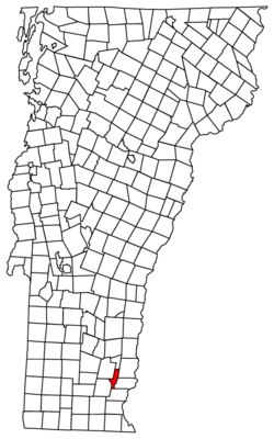
Brookline vt highlight.png
Brookline, Vermont
Usa edcp location map.svg
Red pog.svg
Brookline, Vermont
Location in the United States
Coordinates: 43°1′26″N72°36′19″W / 43.02389°N 72.60528°W / 43.02389; -72.60528
Country United States
State Vermont
County Windham
Settled1777
Incorporated1794
Area
  Total12.9 sq mi (33.4 km2)
  Land12.9 sq mi (33.4 km2)
  Water0.0 sq mi (0.0 km2)
Elevation
525 ft (160 m)
Population
 (2020)
  Total540
  Density42/sq mi (16.2/km2)
Time zone UTC-5 (Eastern (EST))
  Summer (DST) UTC-4 (EDT)
ZIP code
05345
Area code 802
FIPS code 50-09475 [1]
GNIS feature ID1462055 [2]
Website brooklinevt.com

Brookline is a town in Windham County, Vermont, United States. The population was 540 at the 2020 census. [3]

Contents

Geography

According to the United States Census Bureau, the town has a total area of 12.9 square miles (33.4 km2), all land. The West River flows along the southwestern boundary of the town. [4]

Demographics

Historical population
CensusPop.Note
1800 472
1810 431−8.7%
1820 391−9.3%
1830 376−3.8%
1840 328−12.8%
1850 285−13.1%
1860 243−14.7%
1870 203−16.5%
1880 2051.0%
1890 162−21.0%
1900 1715.6%
1910 137−19.9%
1920 105−23.4%
1930 101−3.8%
1940 1043.0%
1950 13226.9%
1960 127−3.8%
1970 18041.7%
1980 31072.2%
1990 40330.0%
2000 46715.9%
2010 53013.5%
2020 5401.9%
U.S. Decennial Census [5]

As of the census [1] of 2000, there were 467 people and 124 families residing in the town. The population density was 36.2 people per square mile (14.0/km2). There were 274 housing units at an average density of 21.2 per square mile (8.2/km2). The racial makeup of the town was 99.36% White, 0.21% Native American, 0.43% from other races. Hispanic or Latino of any race were 0.64% of the population.

There were 186 households, out of which 34.4% had children under the age of 18 living with them, 59.1% were married couples living together, 4.8% had a female householder with no husband present, and 32.8% were non-families. 23.1% of all households were made up of individuals, and 9.1% had someone living alone who was 65 years of age or older. The average household size was 2.51 and the average family size was 3.00.

27.2% of the population were under the age of 18, 4.5% were 18 to 24, 29.8% were 25 to 44, 27.8% were 45 to 64, and 10.7% were 65 years of age or older. The median age was 39 years. For every 100 females, there were 97.9 males. For every 100 females age 18 and over, there were 93.2 males.

The median income for a household in the town was $39,125, and the median income for a family was $44,375. Males had a median income of $31,094 versus $20,893 for females. The per capita income for the town was $18,082. About 5.0% of families and 8.5% of the population were below the poverty line, including 10.6% of those under age 18 and 11.7% of those age 65 or over.

Related Research Articles

<span class="mw-page-title-main">Windham County, Vermont</span> County in Vermont, United States

Windham County is a county located in the U.S. state of Vermont. As of the 2020 census, the population was 45,905. The shire town is Newfane, and the largest municipality is the town of Brattleboro.

<span class="mw-page-title-main">Hampton, Connecticut</span> Town in Connecticut, United States

Hampton is a town in Windham County, Connecticut, United States. The town is part of the Northeastern Connecticut Planning Region. The population was 1,728 at the 2020 census.

<span class="mw-page-title-main">Winhall, Vermont</span> Town in Vermont, United States

Winhall is a town in Bennington County, Vermont, United States. The population was 1,182 at the 2020 census. In the southeastern corner of the town is the unincorporated village of Bondville. Half of the community of Stratton Mountain, part of Stratton Mountain Resort, is in the southern part of the town.

<span class="mw-page-title-main">Strafford, Vermont</span> Town in Vermont, United States

Strafford is a town in Orange County, Vermont, United States. The population was 1,094 at the 2020 census. The town of Strafford was created on August 12, 1761 by way of a royal charter which King George III of Great Britain issued to Governor Benning Wentworth of New Hampshire. The town was named after the Earl of Strafford. Its town house is one of the most famous in Vermont, sitting atop a hill in the historic town square.

<span class="mw-page-title-main">Topsham, Vermont</span> Town in Vermont, United States

Topsham is a town in Orange County, Vermont, United States. The population was 1,199 at the 2020 census. It contains four villages: East Topsham, Topsham Four Corners, Waits River, and West Topsham.

<span class="mw-page-title-main">Vershire, Vermont</span> Town in Vermont, United States

Vershire is a town in Orange County, Vermont, United States, created under Vermont Charter of August 3, 1781. The population was 672 at the 2020 census. The name Vershire is a portmanteau of Vermont and New Hampshire.

<span class="mw-page-title-main">Killington, Vermont</span> Town in Vermont, United States

Killington is a town in Rutland County, Vermont, United States. The population was 1,407 at the 2020 census. Killington Ski Resort and numerous vacation lodges are located here. The town was previously named Sherburne, but was renamed to its original name, "Killington", in 1999.

<span class="mw-page-title-main">Dover, Vermont</span> Town in Vermont, United States

Dover is a town in Windham County, Vermont, United States. The population was 1,798 at the 2020 census. It is famed for being the location of the Mount Snow ski area.

<span class="mw-page-title-main">Dummerston, Vermont</span> Town in Vermont, United States

Dummerston is a town in Windham County, Vermont, United States. The population was 1,865 at the 2020 census. It is home to the longest covered bridge still in use in Vermont. Its borders include three main villages: Dummerston Center, West Dummerston, and East Dummerston.

<span class="mw-page-title-main">Halifax, Vermont</span> Town in Vermont, United States

Halifax is a town in Windham County, Vermont, in the United States. As of the 2020 census, the town population was 771.

<span class="mw-page-title-main">Jacksonville, Vermont</span> Village in Vermont, United States

Jacksonville is a village in the town of Whitingham, Windham County, Vermont, United States. The population was 213 at the 2020 census.

<span class="mw-page-title-main">Londonderry, Vermont</span> Town in Vermont, United States

Londonderry is a town in Windham County, Vermont, United States. It is bounded on the north by Landgrove and Weston, on the east by Windham, on the south by Jamaica and on the west by Winhall and Landgrove. The population was 1,919 in the 2020 census. The town contains the villages of Londonderry and South Londonderry.

<span class="mw-page-title-main">Putney, Vermont</span> Town in Vermont, United States

Putney is a town in Windham County, Vermont, United States. The population was 2,617 at the 2020 census.

<span class="mw-page-title-main">Stratton, Vermont</span> Town in Vermont, United States

Stratton is a town in Windham County, Vermont, United States. The population was 440 at the 2020 census.

<span class="mw-page-title-main">Vernon, Vermont</span> Town in Vermont, United States

Vernon is a town in Windham County, Vermont, in the United States. The population was 2,192 at the 2020 census. Vernon is the site of the now-defunct Vermont Yankee, the state of Vermont's only nuclear power plant, which closed in December 2014.

<span class="mw-page-title-main">Windham, Vermont</span> Town in Vermont, United States

Windham is a town in Windham County, Vermont, United States. The population was 449 at the 2020 census. The town center village is designated as the Windham Village Historic District.

<span class="mw-page-title-main">Bridgewater, Vermont</span> Town in Vermont, United States

Bridgewater is a town in Windsor County, Vermont, United States. The population was 903 at the 2020 census. Bridgewater contains the hamlets of Bridgewater Village, Bridgewater Corners, West Bridgewater, and Bridgewater Center.

<span class="mw-page-title-main">Brattleboro (CDP), Vermont</span> CDP in Vermont, United States

Brattleboro is a census-designated place (CDP) corresponding to the densely populated core of the town of Brattleboro in Windham County, Vermont, United States. The population was 8,289 at the 2000 census.

<span class="mw-page-title-main">Newfane (village), Vermont</span> Village in Vermont, United States

Newfane is an incorporated village in the town of Newfane in Windham County, Vermont, United States. The population was 87 at the 2020 census.

<span class="mw-page-title-main">Newfane, Vermont</span> Town in Vermont, United States

Newfane is the shire town of Windham County, Vermont, United States. The population was 1,645 at the 2020 census. The town includes the villages of Newfane, Williamsville, and South Newfane.

References

  1. 1 2 "U.S. Census website". United States Census Bureau . Retrieved January 31, 2008.
  2. "US Board on Geographic Names". United States Geological Survey. October 25, 2007. Retrieved January 31, 2008.
  3. "Census - Geography Profile: Brookline town, Windham County, Vermont" . Retrieved December 28, 2021.
  4. DeLorme (1996). Vermont Atlas & Gazetteer. Yarmouth, Maine: DeLorme. ISBN   0-89933-016-9
  5. "U.S. Decennial Census". United States Census Bureau. Retrieved May 16, 2015.

Commons-logo.svg Media related to Brookline, Vermont at Wikimedia Commons