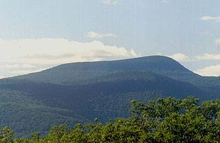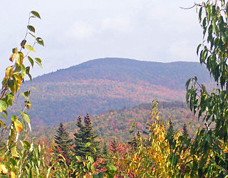
Hunter is a town located in Greene County, New York, United States. The population was 3,035 at the time of the 2020 census. The town contains two villages, one named Hunter on the west, and the second called Tannersville, as well as a number of hamlets such as Haines Falls, Platte Clove, Lanesville and Edgewood. Additionally, there are three residential parks location within town limits: Onteora Park, Twilight Park and Elka Park. The town is on the southern border of Greene County and abuts the towns of Woodstock and Saugerties, located in Ulster County.

The Catskill Mountains, also known as the Catskills, are a physiographic province and subrange of the larger Appalachian Mountains, located in southeastern New York. As a cultural and geographic region, the Catskills are generally defined as those areas close to or within the borders of the Catskill Park, a 700,000-acre (2,800 km2) forest preserve protected from many forms of development under New York state law.

John Burroughs was an American naturalist and nature essayist, active in the conservation movement in the United States. The first of his essay collections was Wake-Robin in 1871.

Slide Mountain is the highest peak in the Catskill Mountains of the U.S. state of New York. It is located in the town of Shandaken in Ulster County. While the 4,180-foot (1,270 m) contour line on topographic maps is generally accepted as its height, the exact elevation of the summit has never been officially determined by the U.S. National Geodetic Survey or its predecessors, and many informal surveys suggest the mountain may actually top 4,200 feet (1,280 m) above sea level. Geographically, it is the highest natural point within the New York Metropolitan Area.

The Blackhead Mountains range is located near the northern end of the Catskill Mountains, in Greene County, New York, United States, where it divides the towns of Windham and Jewett. The three named peaks in the range — Thomas Cole Mountain, Black Dome, and Blackhead Mountain — are the fourth-, third-, and fifth-highest peaks in the Catskills, respectively. The gap between Thomas Cole and Black Dome is, at 3,700 feet, the highest in the Catskills.

Black Dome is a mountain located in Greene County, New York. The mountain is the highest peak of the Blackhead Mountains range of the Catskills. Black Dome is flanked to the east by Blackhead, and to the west by Thomas Cole Mountain.

Blackhead is a mountain located in Greene County, New York.
West Kill Mountain, or Westkill Mountain, is located in Greene County, New York. The mountain is named after the West Kill stream which flows along its northern side, and is part of the Devil's Path range of the Catskill Mountains. To the east, West Kill Mountain faces Southwest Hunter Mountain across 800-foot-deep (240 m) Diamond Notch; to the west, West Kill faces North Dome across Mink Hollow.

Indian Head Mountain is a 3,573 ft (1,089 m) mountain located in the southeast corner of Greene County, New York. The mountain, named for the appearance of its profile, is part of the Devil's Path range of the Catskill Mountains. To the northwest, Indian Head is separated from Twin Mountain by Jimmy Dolan Notch; to the southeast, Indian Head is flanked by Plattekill Mountain.

Sugarloaf Mountain is a mountain located in Greene County, New York. The mountain is part of the Devil's Path range of the Catskill Mountains. To the northwest, Sugarloaf is separated from Plateau Mountain by Mink Hollow Notch; to the southeast, Sugarloaf is separated from Twin Mountain by Pecoy Notch.

Plateau Mountain is located in the town of Hunter in Greene County, New York, United States. It is part of the Devil's Path range of the Catskill Mountains. Plateau has a two-mile-long (3.2 km) summit ridge above 3,500 feet (1,100 m). The highest point, at least 3,840 feet (1,170 m), is at the southeast end, facing Sugarloaf Mountain to the east across Mink Hollow Notch. It is the 12th-highest peak in the range Devils Tombstone is located west of Plateau Mountain. The northwest end faces Hunter Mountain to the west across 1,400-foot deep (430 m) Stony Clove Notch.

Balsam Mountain is one of the High Peaks of the Catskill Mountains in the U.S. state of New York. Its exact height has not been determined, so the highest contour line, 3,600 feet (1,100 m), is usually given as its elevation. It is located in western Ulster County, on the divide between the Hudson and Delaware watersheds. The summit and western slopes of the peak are within the Town of Hardenburgh and its eastern slopes are in Shandaken. The small community of Oliverea is near its base on that side. Most of the mountain is publicly owned, managed by the New York State Department of Environmental Conservation as part of the state Forest Preserve, part of the Big Indian-Beaverkill Range Wilderness Area in the Catskill Park. The summit is on a small corner of private land.
Big Indian Mountain is a mountain located in Ulster County, New York. The mountain is part of the Catskill Mountains. It is flanked to the northwest by Eagle Mountain, to the southeast by Fir Mountain, and to the southwest by Doubletop Mountain.
Doubletop Mountain is a mountain located in Ulster County, New York. The mountain is part of the Catskill Mountains. Doubletop Mountain is flanked to the northwest by Graham Mountain, to the east by Big Indian Mountain, and to the southwest by the Beaver Kill Range.

Graham Mountain is the seventh highest of the Catskill High Peaks and the highest privately owned mountain in the range. It is located in the town of Hardenburgh, New York, United States.

Cornell Mountain is a mountain located in Ulster County, New York. The mountain is part of the Burroughs Range of the Catskill Mountains. Cornell Mountain is flanked to the northeast by Wittenberg Mountain, to the southwest by Friday Mountain, and to the west by 4,180-foot (1,270 m) Slide Mountain — the highest peak in the Catskills.

Wittenberg Mountain, locally "the Wittenberg'', is a mountain in Ulster County, New York. It is part of the Burroughs Range of the Catskill Mountains. Wittenberg is flanked to the southwest by Cornell Mountain and to the northeast by Terrace Mountain.

Overlook Mountain is the southernmost peak of the Catskill Escarpment in the central Catskill Mountains near Woodstock, New York. The centerpiece of the 590-acre (240 ha) Overlook Mountain Wild Forest area of Catskill Park, the mountain is the site of one of the remaining five Catskill Mountain fire towers and the Overlook Mountain House, a hotel which was built at a higher elevation than any other in the range.
Irish Mountain is a mountain located in the Catskill Mountains of New York southwest of Grand Gorge. Irish Mountain is located southeast of Moresville Range and north of Schultice Mountain.
Van Loan Hill is a mountain in Greene County, New York. It is located in the Catskill Mountains southwest of Maplecrest. Round Hill is located west, Elm Ridge is located north-northeast, and East Jewett Range is located south of Van Loan Hill.


