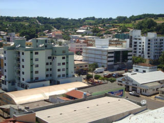
| Campo Erê | ||
|---|---|---|
| Municipality | ||
| ||
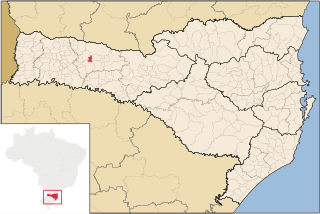
 Campo Erê Location in Brazil | ||
| Coordinates: 26°23′S53°03′W / 26.383°S 53.050°W Coordinates: 26°23′S53°03′W / 26.383°S 53.050°W | ||
| Country | ||
| Region | South | |
| State | Santa Catarina | |
| Mesoregion | Oeste Catarinense | |
| Time zone | UTC -3 | |

Campo Erê is a municipality in the state of Santa Catarina in the South region of Brazil. [1] [2] [3] [4]

The municipalities of Brazil are administrative divisions of the Brazilian states. At present, Brazil has 5,570 municipalities, making the average municipality population 34,361. The average state in Brazil has 214 municipalities. Roraima is the least subdivided state, with 15 municipalities, while Minas Gerais is the most subdivided state, with 853.

The Federative Republic of Brazil is a union of 27 federated units : 26 states and one federal district. The states are generally based on historical, conventional borders which have developed over time. The Federal District cannot be divided into municipalities, according to the Brazilian Constitution, the Federal District assumes the same constitutional and legal powers, attributions and obligations of the states and municipalities, instead, it is divided by administrative regions.
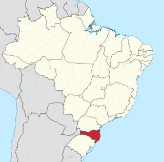
Santa Catarina is a state in the southern region of Brazil. According to the Index of Economic Well-Being calculated between 2002 and 2008, Santa Catarina was the Brazilian state that consistently showed the highest economic well-being in relation to any other state in Brazil.