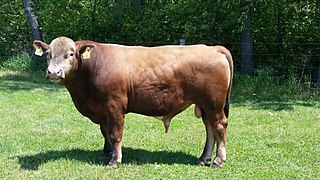
Beefalo constitutes a hybrid offspring of domestic cattle, usually a male in managed breeding programs, and the American bison, usually a female in managed breeding programs. The breed was created to combine the characteristics of both animals for beef production.

Cimarron is a village in Colfax County, New Mexico, United States, which sits on the eastern slopes of the Sangre de Cristo Mountains. The population was 792 at the 2020 census, making it the fourth most populous municipality in Colfax County.

Wells is a town in Hamilton County, New York, United States. The population was 674 at the 2010 census. The town is named after Joshua Wells, a land agent, who built the first mills in the area. It is in the Adirondack Park and on the eastern border of the county. It is northwest of Schenectady.

Chino Hills State Park is a state park of California, in the United States. It is located in the Chino Hills, foothills of the Santa Ana Mountains. It is a critical link in the Chino–Puente Hills wildlife corridor, and a major botanical habitat reserve for resident and migrating wildlife.

A cur was a dog breed used by cattle drovers in England. The breed is now extinct. In the United States, a short-haired dog used in hunting and herding is called "cur-tailed", or "cur" for short.

A chalet, also called Swiss chalet, is a type of building or house, typical of the Alpine region in Europe. It is made of wood, with a heavy, gently sloping roof and wide, well-supported eaves set at right angles to the front of the house.

The Malheur National Forest is a National Forest in the U.S. state of Oregon. It contains more than 1.4 million acres (5,700 km2) in the Blue Mountains of eastern Oregon. The forest consists of high desert grasslands, sage, juniper, pine, fir, and other tree species. Elevations vary from about 4,000 feet (1,200 m) to the 9,038-foot (2,755 m) peak of Strawberry Mountain. The Strawberry Mountains of eastern Oregon extend east to west through the center of the forest. U.S. Route 395 runs south to north through the forest, while U.S. Route 26 runs east to west.

Sheyenne National Grassland is a National Grassland located in southeastern North Dakota in the United States, comprising 70,446 acres (28,508 ha) of public land amid 64,769 acres (26,211 ha) of privately owned land in a region of sandy soils in the vicinity of the Sheyenne River in Ransom and Richland Counties. It is the only National Grassland in the tallgrass prairie region of the U.S. The grassland provides habitat for the largest population of greater prairie chickens in North Dakota, as well as the Dakota skipper butterfly, the western prairie fringed orchid, and numerous ferns, as well as grazing land for approximately 83 cattle ranchers.

Donna's Ranch is a legal, licensed brothel located in Nevada, United States. Donna's Ranch is situated in Wells, in Elko County, on 8th Street. The ranch traces its history back to 1867 and is owned by Geoff Arnold. The boxer Jack Dempsey was a previous owner.

Llandegla or Llandegla-yn-Iâl is a village and community in the county of Denbighshire in Wales. In the 2011 census, the community had a population of 567.
The Steens Mountain Wilderness is a wilderness area surrounding a portion of Steens Mountain of southeastern Oregon in the United States. The reserve falls within the Steens Mountain Cooperative Management and Protection Area (CMPA). Both the reserve and the CMPA are administered by the Bureau of Land Management. The wilderness area encompasses 170,166 acres (68,864 ha) of the CMPA's total 428,156 acres (173,269 ha). 98,859 acres (40,007 ha) of the Wilderness are protected from grazing and free of cattle.

There is evidence of prehistoric human habitation in the region known today as the U.S. state of Wyoming stretching back roughly 13,000 years. Stone projectile points associated with the Clovis, Folsom and Plano cultures have been discovered throughout Wyoming. Evidence from what is now Yellowstone National Park indicates the presence of vast continental trading networks since around 1,000 years ago.

The Trout Creek Mountains are a remote, semi-arid Great Basin mountain range mostly in southeastern Oregon and partially in northern Nevada in the United States. The range's highest point is Orevada View Benchmark, 8,506 feet (2,593 m) above sea level, in Nevada. Disaster Peak, elevation 7,781 feet (2,372 m), is another prominent summit in the Nevada portion of the mountains.
The Agua Dulce Mountains are a mountain range in the north-central Sonoran Desert of southwestern Arizona. The range is located in the extreme southwestern portion of Pima County, Arizona, immediately north of the international boundary with Mexico and about 30 mi (48 km) southwest of Ajo, Arizona. The range has three main sections that total about 15 miles in length and about nine miles in width. The range is located entirely within the Cabeza Prieta National Wildlife Refuge. The highpoint of the range is 2,852 feet (869 m) above sea level and is located at 32°01'32"N, 113°08'44"W. The summit is unnamed, but is marked on U.S. Geological Survey (USGS) maps for the "Quitovaquita" benchmark that was placed on the summit in 1920. The original surveyed height was 2,850 feet above sea level, but recent datum adjustments calculate the summit to be two feet higher.

The P Ranch is a historic ranch in Harney County in southeastern Oregon, United States. The remaining ranch structures are located on the west bank of the Donner und Blitzen River in the Malheur National Wildlife Refuge. The ranch was built by Peter French, a well known 19th-century cattle baron. The P Ranch became headquarters for the French-Glenn Livestock Company, which eventually covered over 140,000 acres (570 km2). After French was murdered in 1897, the French-Glenn Livestock Company slowly sold off the P Ranch property. In 1935, the United States Government purchased the remaining P Ranch property to add to an adjacent wildlife refuge. The Civilian Conservation Corps demolished most of the original ranch buildings in the 1930s, and a fire destroyed the main ranch house in 1947. The few remaining P Ranch structures are now listed on the National Register of Historic Places.
The animals in the Henry Mountains bison herd are of the plains bison subspecies. Yellowstone National Park may be the only location in the United States where free-ranging bison were never exterminated since they continued to exist in the wild and were not re-introduced as has been done in most other bison herd areas. As a result, the Yellowstone Park bison herd became the foundation herd for many others in the United States, including the Henry Mountains bison herd.

The Whitehorse Ranch is a historic cattle ranch in Harney and Malheur counties in the southeastern corner of Oregon, United States. The ranch was started in 1869 by John S. Devine, a well-known 19th-century cattle baron. It was originally the headquarters for the Todhunter and Devine Cattle Company. The ranch has been in the cattle business continuously since it was founded. Today, the Whitehorse Ranch includes 63,222 acres (255.85 km2) of deeded property and grazing rights on an additional 287,205 acres (1,162.28 km2) of public range land administered by the Bureau of Land Management.

Mount Madonna is a prominent peak located near the southern end of the Santa Cruz Mountains in southwest Santa Clara County, California. The iconic landmark is surrounded by a county park, and is viewable along U.S. Route 101 in South Santa Clara Valley, and California State Route 152 near Watsonville in south Santa Cruz County.
RCAF Station Puntzi Mountain is a closed United States Air Force (USAF) and Royal Canadian Air Force (RCAF) General Surveillance radar station. It was located in Canada 200 miles north of Vancouver, British Columbia.

Wood Mountain Post Provincial Park is a 5.48-hectare historical provincial park in the Canadian province of Saskatchewan. The site was designated as an historic site in the 1960s and became a provincial park in 1986. Originally, it was the location of a North-West Mounted Police (NWMP) post that operated from 1887 to 1918. The post was established to develop relations with local Indians, patrol the Canada–United States border, and to perform general policing duties.

