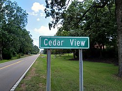
Cedarview, Mississippi | |
|---|---|
 | |
 Cedarview, Mississippi  Cedarview, Mississippi | |
| Coordinates: 34°54′49″N89°45′55″W / 34.91361°N 89.76528°W | |
| Country | United States |
| State | Mississippi |
| County | Desoto |
| Elevation | 387 ft (118 m) |
| Time zone | UTC-6 (Central (CST)) |
| • Summer (DST) | UTC-5 (CDT) |
| ZIP code | 38654 |
| Area code | 662 |
| GNIS feature ID | 6902242 [1] |
Cedarview is an unincorporated community located in Desoto County, Mississippi, United States, south of Olive Branch along Mississippi Highway 305.


