Central City West, Los Angeles

Last updated
Central City West
City West, Los Angeles, CA, USA - panoramio (6).jpg
Central City West
Location map Los Angeles.png
Red pog.svg
Central City West
Location within Central Los Angeles
Coordinates: 34°02′47″N118°16′21″W / 34.046386°N 118.272485°W / 34.046386; -118.272485
Country Flag of the United States.svg  United States
State Flag of California.svg  California
County Flag of Los Angeles County, California.svg Los Angeles
CityFlag of Los Angeles, California.svg  Los Angeles
Time zone Pacific
Zip Code
90017
Area code 213

Central City West, sometimes known as City West or The West Bank, is a neighborhood in Downtown Los Angeles.

Contents

History

One of the earliest uses of the name "Central City West" was in 1986, when the city exempted the area from a slow-growth initiative. [1] In 1987, the Los Angeles Times reported that the "bet on the wrong side of the Harbor Freeway" was paying off with the construction of new office towers, including the $170 million Transpacific Center. [2] The area was now being referred "The West Bank" and the Los Angeles Times noted that Asian financing was behind the highrise construction in the neighborhood. [3] In October 1988, consultants were hired to develop a strategy to create an identifiable community out of a "confused no-man's land between the Harbor Freeway and the Westlake District". Consultants stated that the area was a "twin" to downtown, rather than a "challenge". [4]

In 2007, developer Geoff Palmer was attracting criticism for his apartment complexes because they did not include a low-income housing component. [5] In 2006, he had applied for the Piero II, and requested that the City waive the affordable housing requirements. [6] The City denied the waiver and Palmer sued the city (Palmer/Sixth Street Properties LP v. City of Los Angeles), claiming the affordable housing zoning requirements in the Central City West specific plan violated the Costa-Hawkins Act. [7] In 2009, Palmer won his case when the California Court of Appeal ruled that "as applied to Palmer's proposed project, the affordable housing ordinance conflicts with and is preempted by the vacancy decontrol provisions of the Costa-Hawkins Rental Housing Act." [7]

In 2006, the Los Angeles Times reported that with Dreamgirls and Numb3rs filming at Los Angeles Center Studios, the city’s decades-old vision for City West was finally being fulfilled. [8] In 2007, an economic downturn halted construction in the area, but by 2011, construction of apartment buildings in the neighborhood resumed. [9]

Beaudry Center
333 S. Beaudry LAUSD HQ Bldg.jpg
Beaudry Center
333 S. Beaudry

Geography

According to the Los Angeles Times , Central City West is a 465-acre area downtown designed as a "self-contained urban village." It is bounded by the Harbor Freeway on the east, the Hollywood Freeway on the north and Olympic Boulevard on the south. The western border consists of Glendale Boulevard, Whitmer Street, Union Street, and Albany Street. [10] [11]

Notable Buildings

Related Research Articles

<span class="mw-page-title-main">Downtown Los Angeles</span> Neighborhood in Los Angeles, California

Downtown Los Angeles (DTLA) contains the central business district of Los Angeles. In addition, it contains a diverse residential area of some 85,000 people, and covers 5.84 sq mi (15.1 km2). A 2013 study found that the district is home to over 500,000 jobs. It is also part of Central Los Angeles.

<span class="mw-page-title-main">Koreatown, Los Angeles</span> Neighborhood of Los Angeles in California, United States

Koreatown is a neighborhood in central Los Angeles, California, centered near Eighth Street and Irolo Street.

<span class="mw-page-title-main">Pico-Union, Los Angeles</span> Neighborhood of Los Angeles in California, United States of America

Pico-Union is a neighborhood in Central Los Angeles, California. The name "Pico-Union" refers to the neighborhood that surrounds the intersection of Pico Boulevard and Union Avenue. Located immediately west of Downtown Los Angeles, it is home to over 40,000 residents.

West Los Angeles is an area within the city of Los Angeles, California, United States. The residential and commercial neighborhood is divided by the Interstate 405 freeway, and each side is sometimes treated as a distinct neighborhood, mapped differently by different sources. Each lies within the larger Westside region of Los Angeles County.

<span class="mw-page-title-main">Westlake, Los Angeles</span> Neighborhood of Los Angeles in California, United States

Westlake, also known as the Westlake District, is a residential and commercial neighborhood in Central Los Angeles, California, United States. It was developed in the 1920s. Many of its elegant mansions have been turned into apartments and many new multiple-occupancy buildings have been constructed.

<span class="mw-page-title-main">Transportation in Los Angeles</span> Complex multimodal regional, national and international hub for passenger and freight traffic

Los Angeles has a complex multimodal transportation infrastructure, which serves as a regional, national and international hub for passenger and freight traffic. The system includes the United States' largest port complex; an extensive freight and passenger rail infrastructure, including light rail lines and rapid transit lines; numerous airports and bus lines; vehicle for hire companies; and an extensive freeway and road system. People in Los Angeles rely on cars as the dominant mode of transportation, but since 1990 the Los Angeles County Metropolitan Transportation Authority has built over one hundred miles (160 km) of light and heavy rail serving more and more parts of Los Angeles and the greater area of Los Angeles County. As a result, Los Angeles was the last major city in the United States to get a permanent rail system installed.

Bunker Hill is a neighborhood in Los Angeles, California. It is part of Downtown Los Angeles.

<span class="mw-page-title-main">East Hollywood, Los Angeles</span> Neighborhood of Los Angeles in California, United States

East Hollywood is a densely populated neighborhood of 78,000+ residents that is part of the Hollywood area of the central region of Los Angeles, California. It is notable for being the site of Los Angeles City College, Barnsdall Park, and a hospital district. There are seven public and five private schools, a Los Angeles Public Library branch, and three hospitals. Almost two-thirds of the people living there were born outside the United States, and 90% were renters. In 2000, the neighborhood had high percentages of never-married people and single parents.

<span class="mw-page-title-main">Wilshire Boulevard</span> Major thoroughfare in the metropolitan Los Angeles area, United States

Wilshire Boulevard (['wɪɫ.ʃɚ]) is a prominent 15.83 mi (25.48 km) boulevard in the Los Angeles area of Southern California, extending from Ocean Avenue in the city of Santa Monica east to Grand Avenue in the Financial District of downtown Los Angeles. One of the principal east–west arterial roads of Los Angeles, it is also one of the major city streets through the city of Beverly Hills. Wilshire Boulevard runs roughly parallel to Santa Monica Boulevard from Santa Monica to the west boundary of Beverly Hills. From the east boundary, it runs a block south of Sixth Street to its terminus.

Mid-Wilshire is a neighborhood in the central region of Los Angeles, California. It is known for the Los Angeles County Museum of Art, the Petersen Automotive Museum, and the Miracle Mile shopping district.

Central Los Angeles is the historical urban region of the City of Los Angeles, California.

<span class="mw-page-title-main">Harbor Gateway, Los Angeles</span> Neighborhood of Los Angeles in California, United States

The Harbor Gateway is a 5.14-square-mile residential and industrial area (13.3 km2) in the South Bay and Los Angeles Harbor Region, in the southern part of the city. The neighborhood is narrow and long, running along a north-south axis. Its unusual shape has given it the alternative name of "the Shoestring Strip". The northern limit of the neighborhood is Imperial Highway, a city street just north of I-105.

<span class="mw-page-title-main">Figueroa Street</span> Street in Los Angeles County, California

Figueroa Street is a major north-south street in Los Angeles County, California, spanning from the Los Angeles neighborhood of Wilmington north to Eagle Rock. A short, unconnected continuation of Figueroa Street runs just south of Marengo Drive in Glendale to Chevy Chase Drive in La Cañada Flintridge.

<span class="mw-page-title-main">Vermont Avenue</span> Major thoroughfare in Los Angeles, CA

Vermont Avenue is one of the longest running north–south streets in City of Los Angeles and Los Angeles County, California. With a length of 23.3 miles (37.5 km), is the third longest of the north–south thoroughfares in the region. For most of its length between its southern end in San Pedro and south of Downtown Los Angeles, it runs parallel to the west of the Harbor Freeway (I-110).

<span class="mw-page-title-main">ARCO Tower (Los Angeles)</span> Skyscraper in Los Angeles

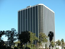
ARCO Tower is a high-rise office building located at 1055 West Seventh Street in Los Angeles, California.

<span class="mw-page-title-main">South Los Angeles</span> Region of Los Angeles County in California, United States

South Los Angeles, also known as South Central Los Angeles or simply South Central, is a region in southwestern Los Angeles County, lying mostly within the city limits of Los Angeles, south of downtown. It is "defined on Los Angeles city maps as a 16-square-mile rectangle with two prongs at the south end.” In 2003, the Los Angeles City Council renamed this area "South Los Angeles".

Los Angeles Center Studios, is a 20-acre film production studio located in the City West neighborhood of Los Angeles, California, United States.

<span class="mw-page-title-main">Vermont Vista, Los Angeles</span> Neighborhood of Los Angeles in California, United States

Vermont Vista is a neighborhood in Los Angeles, California, within the South Los Angeles area.

References

  1. Thomas, Tracy (September 18, 1986). "Exempting Areas from Growth Limits". Los Angeles Times . Retrieved 4 October 2023.
  2. Rivera Brooks, Nancy (November 23, 1987). "Downtown's West Bank". Los Angeles Times . Retrieved 4 October 2023.
  3. "City Hall". LA Weekly. March 10, 1988. Retrieved 4 October 2023.
  4. "City West: Planning Areas Density". Los Angeles Times. March 20, 1988. Retrieved 4 October 2023.
  5. Tamaki, Julie (June 7, 2003). "Builder attracts praise and criticism". Los Angeles Times . Retrieved 4 October 2023.
  6. CP&DR. "Court Rules L.A. Inclusionary Housing Mandate Violates State Law". www.cp-dr.com. Retrieved 2021-05-30.
  7. 1 2 "FindLaw's California Court of Appeal case and opinions". Findlaw. Retrieved 2021-05-30.
  8. 1 2 Mia DiMassa, Cara (March 15, 2006). "City West Catches Up With the Vision". Los Angeles Times . Retrieved 6 October 2023. How the studios went from an abandoned corporate headquarters to a flourishing center of industry is a dramatic example of a transformation unfolding on the west side of Harbor Freeway. The wave of gentrification that started in the rest of downtown in the late 1990s has finally reached the area known as City West.
  9. Smith, Dakota (February 14, 2011). "Downtown's 1111 Wilshire Will Break Ground in April". Curbed.com . Retrieved 4 October 2023.
  10. "Development Gets Go-Ahead". Los Angeles Times. January 30, 1991. Retrieved 4 October 2023.
  11. "Central City West (Map)". Los Angeles Times. May 22, 1990. Retrieved 4 October 2023.
  12. "City West - Beaudry Center". DowntownLA.com. Retrieved 5 October 2023.
  13. "City West - 1055 W. 7th Street". DowntownLA.com. Retrieved 5 October 2023.
  14. "City West- 1100 Wilshire". DowntownLA.com. Retrieved 5 October 2023.