Related Research Articles

A coast – also called the coastline, shoreline, or seashore – is the land next to the sea or the line that forms the boundary between the land and the ocean or a lake. Coasts are influenced by the topography of the surrounding landscape, as well as by water induced erosion, such as waves. The geological composition of rock and soil dictates the type of shore that is created. Earth contains roughly 620,000 km (390,000 mi) of coastline.

Downwelling is the downward movement of a fluid parcel and its properties within a larger fluid. It is closely related to upwelling, the upward movement of fluid.

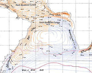
Upwelling is an oceanographic phenomenon that involves wind-driven motion of dense, cooler, and usually nutrient-rich water from deep water towards the ocean surface. It replaces the warmer and usually nutrient-depleted surface water. The nutrient-rich upwelled water stimulates the growth and reproduction of primary producers such as phytoplankton. The biomass of phytoplankton and the presence of cool water in those regions allow upwelling zones to be identified by cool sea surface temperatures (SST) and high concentrations of chlorophyll a.

Kasaragod is a municipal town and administrative headquarters of Kasaragod district in the state of Kerala, India. Established in 1966, Kasaragod was the first municipal town in the district. It is the northernmost district of Kerala and is also known as Sapta Bhasha Sangama Bhumi.
The Benguela Current is the broad, northward flowing ocean current that forms the eastern portion of the South Atlantic Ocean gyre. The current extends from roughly Cape Point in the south, to the position of the Angola-Benguela Front in the north, at around 16°S. The current is driven by the prevailing south easterly trade winds. Inshore of the Benguela Current proper, the south easterly winds drive coastal upwelling, forming the Benguela Upwelling System. The cold, nutrient rich waters that upwell from around 200–300 m (656–984 ft) depth in turn fuel high rates of phytoplankton growth, and sustain the productive Benguela ecosystem.

The Humboldt Current, also called the Peru Current, is a cold, low-salinity ocean current that flows north along the western coast of South America. It is an eastern boundary current flowing in the direction of the equator, and extends 500–1,000 km (310–620 mi) offshore. The Humboldt Current is named after the German naturalist Alexander von Humboldt even though it was discovered by José de Acosta 250 years before Humboldt. In 1846, von Humboldt reported measurements of the cold-water current in his book Cosmos.

Thalassery, formerly Tellicherry, is a municipality and commercial city on the Malabar Coast in Kannur district in the state of Kerala, India, bordered by the districts of Mahe, Kozhikode, Wayanad, Kasaragod and Kodagu (Karnataka). Thalassery municipality has a population of just under 100,000 as of 2011 census. Thalassery Heritage City has an area of 23.98 square kilometres (9.26 sq mi). Thalassery has an altitude ranging from 2.5 to 30 metres above mean sea-level. It is located 25 km from Vadakara, 15 km from Mahé and 22 km from Kannur.

Malabar Muslims or Muslim Mappilas are members of the Muslim community found predominantly in Kerala and the Lakshadweep islands in Southern India. The term Mappila (Ma-Pilla) is used to describe Malabar Muslims in Northern Kerala. Muslims share the common language of Malayalam with the other religious communities of Kerala.

The California Current is a cold water Pacific Ocean current that moves southward along the western coast of North America, beginning off southern British Columbia and ending off southern Baja California Sur. It is considered an Eastern boundary current due to the influence of the North American coastline on its course. It is also one of six major coastal currents affiliated with strong upwelling zones, the others being the Humboldt Current, the Canary Current, the Benguela Current, the Oyashio Current, and the Somali Current. The California Current is part of the North Pacific Gyre, a large swirling current that occupies the northern basin of the Pacific.

Ezhimala, a hill reaching a height of 286 metres (938 ft), is located near Payyanur, in Kannur district of Kerala, South India. It is a part of a conspicuous and isolated cluster of hills, forming a promontory, 38 km (24 mi) north of Kannur (Cannanore). The Indian Naval Academy at Ezhimala is Asia's largest, and the world's third-largest, naval academy.

Kerala is situated between the Lakshadweep Sea to the west and the Western Ghats to the east. Kerala's coast runs some 590 km in length, while the state itself varies between 35–120 km in width. Geologically, pre-Cambrian and Pleistocene formations comprise the bulk of Kerala's terrain. The topography consists of a hot and wet coastal plain gradually rising in elevation to the high hills and mountains of the Western Ghats. Kerala lies between northern latitude of 8°.17'.30" N and 12°. 47'.40" N and east longitudes 74°.27'.47" E and 77°.37'.12" E. Kerala's climate is mainly wet and maritime tropical, heavily influenced by the seasonal heavy rains brought up by the monsoon Weather.

The Somali Current is a cold ocean boundary current that runs along the coast of Somalia and Oman in the Western Indian Ocean and is analogous to the Gulf Stream in the Atlantic Ocean. This current is heavily influenced by the monsoons and is the only major upwelling system that occurs on a western boundary of an ocean. The water that is upwelled by the current merges with another upwelling system, creating one of the most productive ecosystems in the ocean.

A marine habitat is a habitat that supports marine life. Marine life depends in some way on the saltwater that is in the sea. A habitat is an ecological or environmental area inhabited by one or more living species. The marine environment supports many kinds of these habitats.

The Malabar Coast is the southwestern region of the Indian subcontinent. It generally refers to the western coastline of India stretching from Konkan to Kanyakumari. Geographically, it comprises one of the wettest regions of the subcontinent, which includes the Kanara region of Karnataka, all of Kerala and Kanyakumari region of Tamil Nadu.

The Thalassery cuisine refers to the distinct cuisine from Thalassery city of northern Kerala, which has blended in Arabian, Persian, Indian and European styles of cooking as a result of its long history as a maritime trading post.
Pallithode is a village in the Alappuzha district, in the state of Kerala, India, on the shores of the Arabian Sea. Pallithode is within the Gram Panchayat of Kuthiathode, Pattanakad Block, of Cherthala Taluk. During the 20th century, more than half of its width was eroded away by the action of river backwaters and the sea. The village is very densely populated and has a wet, maritime tropical climate. It has an important role in the fishing industry.

Kayamkulam Kayal, Kayamkulam Lake or Kayamkulam Estuary is a shallow brackish water lagoon stretching between Panmana and Karthikapally. It has an outlet to the Arabian sea at Kayamkulam barrage. The Kayal used to be connected to the sea most of the time except during dry season when a bar like formation separates it from the sea. Now the bar has been opened up permanently for construction of Kayamkulam Fishing Harbor. Kayamkulam boat race is conducted in Kayamkulam Kayal. Kayamkulam Kayal is the third largest back water or kayal in Kerala.

The exclusive economic zone of Somalia covers 830,389 km2 in the Indian Ocean. It extends to a distance of 200 nautical miles from the baselines, from which the breadth of the nation's territorial waters is measured. In accordance with Law No. 37 passed in 1972, Somalia's EEZ falls under its territorial sovereignty.

The Marine biodiversity of South Africa is the variety of living organisms that live in the seas off the coast of South Africa. It includes genetic, species and ecosystems biodiversity in a range of habitats spread over a range of ecologically varied regions, influenced by the geomorphology of the seabed and circulation of major and local water masses, which distribute both living organisms and nutrients in complex and time-variable patterns.
The Monsoon trawl ban is a regulatory measure implemented by the Indian government to protect marine biodiversity, conserve aquatic lives, and support sustainability of livelihood in coastal communities. Introduced in the 1980s, the ban restricts fishing activities during the Monsoon of South Asia, coinciding with the breeding and Spawning period of many Marine life. With its extensive coastline of over 8,100 kilometres, India has made the monsoon trawling ban a critical strategy for sustainable fishery management.
References
- ↑ Prabhakaran, M. P.; Menon, M. D.; Pillai, V. K. (2016). "Upwelling Phenomena Along the Malabar Coast". Journal of Marine Science. 12 (3): 45–52.
- ↑ Nair, R. V.; Rao, K. V. (2008). "Coastal Upwelling and Its Impact on Fisheries in the Arabian Sea". Indian Fisheries Journal. 56 (2): 112–118.
- ↑ "Mathrubhumi - Travel and Tourism". Archived from the original on 2010-10-21. Retrieved 2010-10-27.
- ↑ Menon, A. G. (2010). "The Socio-Economic Impact of Chakara on Malabar Communities". Kerala Coastal Studies. 18 (1): 29–40.
- ↑ Kumar, P. R.; Sreenivasan, S. (2021). "Human Activities and Their Impact on Marine Phenomena in the Arabian Sea". Ecological Studies in India. 34 (2): 78–91.