Charlton Island, Antarctica

Last updated
Charlton Island
Antarctica location map.svg
Red pog.svg
Charlton Island
Location in Antarctica
Geography
Location Antarctica
Coordinates 66°13′S110°9′E / 66.217°S 110.150°E / -66.217; 110.150 Coordinates: 66°13′S110°9′E / 66.217°S 110.150°E / -66.217; 110.150
Administration
Administered under the Antarctic Treaty System
Demographics
PopulationUninhabited

Charlton Island is the westernmost of the Frazier Islands, lying in Vincennes Bay off Wilkes Land in East Antarctica.

Frazier Islands

The Frazier Islands are a group of three rocky islands - Nelly, Dewart and Charlton - in the eastern part of Vincennes Bay, East Antarctica, 15 km (9 mi) west-north-west of Clark Peninsula, and 16 km offshore from Australia's Casey Station.

Vincennes Bay bay of the Southern Ocean on the coast of Wilkes Land, Antarctica

Vincennes Bay is a large V-shaped bay, 105 km (65 mi) wide at its entrance between Cape Nutt and Cape Folger in Antarctica, marked by several large, steep glaciers near its head, lying along Knox and Budd Coasts. It was photographed from the air by US Navy Operation Highjump in 1946-47. The bay was entered in January 1948 by US Navy Operation Windmill icebreakers Burton Island and stations in the Windmill Islands in the NE portion of the bay. Named by the US-ACAN for the sloop of war USS Vincennes, flagship of the USEE under Wilkes, from which a series of coastal landfalls along Wilkes Land were discovered and plotted during January–February 1840. Wilkes' chart suggests a possible coastal recession corresponding closely with the longitudinal limits for Vincennes Bay, although pack ice conditions prevented close reconnaissance by the USEE of the coast in this immediate area.

Wilkes Land geographic region

Wilkes Land is a large district of land in eastern Antarctica, formally claimed by Australia as part of the Australian Antarctic Territory, though the validity of this claim has been placed for the period of the operation of the Antarctic Treaty, to which Australia is a signatory. It fronts on the southern Indian Ocean between Queen Mary Coast and Adelie Land, extending from Cape Hordern in 100°31' E to Pourquoi Pas Point, in 136°11' E. The region extends as a sector about 2600 km towards the South Pole, with an estimated land area of 2,600,000 km², mostly glaciated. It is further subdivided in the following coastal areas which can also be thought of as sectors extending to the South Pole:

  1. Knox Land: 100°31' E to 109°16' E
  2. Budd Land: 109°16' E to 115°33' E
  3. Sabrina Land: 115°33' E to 122°05' E
  4. Banzare Land: 122°05' E to 130°10' E
  5. Clarie Land: 130°10' E to 136°11' E

Contents

History

The island was mapped from air photographs taken in the course of the US Navy's Operations Highjump (1946–47) and Windmill (1947-48). It was named by Carl R. Eklund for Chief Electronics Technician Frederick E. Charlton, of the Wilkes Station party, 1957.

United States Navy Naval warfare branch of the United States Armed Forces

The United States Navy (USN) is the naval warfare service branch of the United States Armed Forces and one of the seven uniformed services of the United States. It is the largest and most capable navy in the world and it has been estimated that in terms of tonnage of its active battle fleet alone, it is larger than the next 13 navies combined, which includes 11 U.S. allies or partner nations. with the highest combined battle fleet tonnage and the world's largest aircraft carrier fleet, with eleven in service, and two new carriers under construction. With 319,421 personnel on active duty and 99,616 in the Ready Reserve, the Navy is the third largest of the service branches. It has 282 deployable combat vessels and more than 3,700 operational aircraft as of March 2018, making it the second largest and second most powerful air force in the world.

Operation Highjump United States Navy operation to establish an Antarctic research base

Operation Highjump, officially titled The United States Navy Antarctic Developments Program, 1946–1947, was a United States Navy operation organized by Rear Admiral Richard E. Byrd, Jr., USN (Ret), Officer in Charge, Task Force 68, and led by Rear Admiral Richard H. Cruzen, USN, Commanding Officer, Task Force 68. Operation Highjump commenced 26 August 1946 and ended in late February 1947. Task Force 68 included 4,700 men, 13 ships, and 33 aircraft. Operation Highjump's primary mission was to establish the Antarctic research base Little America IV.

Operation Windmill US Navy Antarctica expedition

Operation Windmill (OpWml) was the United States Navy's Second Antarctica Developments Project, an exploration and training mission to Antarctica in 1947–1948. This operation was a follow up to the First Antarctica Development Project known as Operation Highjump. The expedition was commanded by Commander Gerald L. Ketchum, USN, and the flagship of Task Force 39 was the icebreaker USS Burton Island.

Antarctic Specially Protected Area

The island forms part of the Frazier Islands Antarctic Specially Protected Area (ASPA) No.160 because it supports one of only four known breeding colonies of southern giant petrels on continental Antarctica. [1]

An Antarctic Specially Protected Area (ASPA) is an area on the continent of Antarctica, or on nearby islands, which is protected by scientists and several different international bodies. The protected areas were established in 1961 under the Antarctic Treaty System, which governs all the land and water south of 60 latitude and protects against human development. A permit is required for entry into any ASPA site. The ASPA sites are protected by the governments of Australia, New Zealand, United States, United Kingdom, Chile, France, Argentina, Poland, Russia, Norway, Japan, India, Italy, and Republic of Korea. There are currently 72 sites.

Bird colony large congregation of birds at a particular location

A bird colony is a large congregation of individuals of one or more species of bird that nest or roost in proximity at a particular location. Many kinds of birds are known to congregate in groups of varying size; a congregation of nesting birds is called a breeding colony. Colonial nesting birds include seabirds such as auks and albatrosses; wetland species such as herons; and a few passerines such as weaverbirds, certain blackbirds, and some swallows. A group of birds congregating for rest is called a communal roost. Evidence of colonial nesting has been found in non-neornithine birds (Enantiornithes), in sediments from the Late Cretaceous (Maastrichtian) of Romania.

Southern giant petrel species of bird

The southern giant petrel, also known as the Antarctic giant petrel, giant fulmar, stinker, and stinkpot, is a large seabird of the southern oceans. Its distribution overlaps broadly with the similar northern giant petrel, though it overall is centered slightly further south. Adults of the two species can be distinguished by the colour of their bill-tip: greenish in the southern and reddish in the northern.

See also

Related Research Articles

Scullin Monolith is a crescent-shaped rock fronting the sea 6 km (3.7 mi) west of the similar Murray Monolith, and 8 km (5.0 mi) from Torlyn Mountain, in Mac. Robertson Land, Antarctica. Early in January 1930 the British Australian New Zealand Antarctic Research Expedition (BANZARE) under Douglas Mawson made an aerial flight from the ship over the area. Mawson set foot on the rock on 13 February 1931 and named it for James Scullin, Prime Minister of Australia in 1929 - 31. The rock was charted in January and February 1931 from Norwegian whale catchers exploring the coast, and named "Mount Klarius Mikkelsen" for Captain Klarius Mikkelsen, master of the whale catcher Torlyn. Mikkelsen Peak is retained as the name of the highest peak of the outcrop.

East Antarctica geographic region

East Antarctica, also called Greater Antarctica, constitutes the majority (two-thirds) of the Antarctic continent, lying on the Indian Ocean side of the continent, separated from West Antarctica by the Transantarctic Mountains. It lies almost entirely within the Eastern Hemisphere and its name has been accepted for more than a century. It is generally higher than West Antarctica and includes the Gamburtsev Mountain Range in the centre.

Windmill Islands island

The Windmill Islands are an Antarctic group of rocky islands and rocks about 11.1 kilometres (6 nmi) wide, paralleling the coast of Wilkes Land for 31.5 kilometres (17 nmi) immediately north of Vanderford Glacier along the east side of Vincennes Bay. Kirkby Shoal is a small shoal area with depths of less than 18 metres (59 ft) extending about 140 metres (459 ft) westwards and SSW, about 3.4 kilometres (2.1 mi) from the summit of Shirley Island, Windmill Islands, and 0.24 kilometres (0.15 mi) NW of Stonehocker Point, Clark Peninsula.

Ardery Island geographical object

Ardery Island is a steep, rocky island, about 1 km (0.62 mi) long, lying 1.8 km (1.1 mi) west of Odbert Island in the Windmill Islands of Antarctica.

Herring Island

Herring Island is an Antarctic rocky island, 3.7 km (2 nmi) long, lying 1.9 km (1 nmi) east of Cloyd Island in the south part of the Windmill Islands. It was first mapped from air photos taken by USN Operation Highjump and Operation Windmill in 1947 and 1948. Named by the US-ACAN for Lt. Charles C. Herring, USN, photographic officer with Operation Windmill parties which obtained air and ground photos of the area in January 1948.

Odbert Island

Odbert Island is a rocky island, 2.4 km (1.5 mi) long, between Ardery Island and Robinson Ridge in the Windmill Islands of Antarctica.

Murray Monolith is a detached part of Torlyn Mountain in Mac.Robertson Land, Antarctica. It was discovered during the British Australian New Zealand Antarctic Research Expedition (BANZARE), led by Mawson, 1929–1931, and named after Sir George Murray, Chancellor of the University of Adelaide and a patron of the expedition.

Clark Peninsula is a rocky peninsula, about 3 km (2 mi) long and wide, lying 5 km north-east of Australia's Casey Station at the north side of Newcomb Bay on the Budd Coast of Wilkes Land in Antarctica.

Rookery Islands group of rocks and small islands in Antarctica

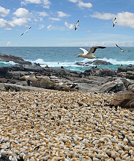
The Rookery Islands are a group of rocks and small islands in western Holme Bay, north of the David and Masson Ranges in Mac.Robertson Land in East Antarctica. The group contains breeding colonies of Adélie penguins, Cape petrels, snow petrels, southern giant petrels, Wilson's storm petrels and Antarctic skuas. The islands are protected under the Antarctic Treaty System as Antarctic Specially Protected Area (ASPA) No.102.

Nelly Island

Nelly Island is the largest and easternmost of the Frazier Islands, lying in Vincennes Bay off Wilkes Land, East Antarctica.

Dewart Island

Dewart Island is the central island in the Frazier Islands, in Vincennes Bay, Wilkes Land, East Antarctica.

Moutonnée Lake is a sub-glacial lake that lies within Moutonnee Valley, marginal to the George VI Ice Shelf, 7 km (4.3 mi) south of Ablation Point indenting the east coast of Alexander Island, facing the west coast of Palmer Land, Antarctica. Following limnological and tidal studies by the British Antarctic Survey (BAS) from 1971, it was named by the United Kingdom Antarctic Place-Names Committee (UK-APC) from the presence of roche moutonnées on its shores. As with nearby Ablation and Hodgson Lakes, Moutonnée receives large masses of ice from the adjacent George VI Ice Shelf in George VI Sound, making life in the lake unsustainable. The site lies within Antarctic Specially Protected Area (ASPA) No.147.

Haswell Island island off the coast of Antarctica

Haswell Island is the largest of the Haswell Islands, lying off the coast of Antarctica, about 3 kilometres (1.5 nmi) north of Mabus Point in Queen Mary Land. It was discovered by the Western Base Party of the Australasian Antarctic Expedition, 1911–14, under Mawson, and named by him for Professor William A. Haswell, a zoologist at Sydney University and a member of the expedition's Advisory Committee.

Hawker Island

Hawker Island is an irregularly shaped island about 2 km (1.2 mi) long, lying some 7 km south-west of Davis Station between Mule Island and Mule Peninsula, Vestfold Hills, in the eastern part of Prydz Bay, Antarctica. It was mapped by Norwegian cartographers from aerial photographs taken by the Lars Christensen Expedition, 1936–37. It was remapped by the Australian National Antarctic Research Expeditions (1957–58) and named after Alan Charles Hawker, a radio supervisor at Davis Station in 1957.

Marion Nunataks Antarctic Specially Protected Area

The Marion Nunataks are a small group of nunataks rising to about 600 m (2,000 ft) on Charcot Island, in the eastern Bellinghausen Sea of Antarctica. They form a 12 km chain of rocky outcrops on the mid-north coast of the island, stretching from Mount Monique at the western end to Mount Martine in the east.

Lamarck Island (Antarctica)

Lamarck Island is a rocky island 250 m (820 ft) long, lying 300 m (980 ft) east of Petrel Island and 300 m (980 ft) north-east of Rostand Island in the Géologie Archipelago, off the Adélie Coast of Antarctica. It was charted in 1951 by the French Antarctic Expedition and named by them after Jean-Baptiste Lamarck, the French naturalist.

Amanda Bay Antarctic Specially Protected Area

Amanda Bay, also sometimes known as Hovde Cove, lies in southern Prydz Bay on the Ingrid Christensen Coast of Princess Elizabeth Land, East Antarctica. It is best known for its breeding colony of several thousand pairs of emperor penguins on sea ice at the south-west corner of the bay.

Bailey Peninsula is a rocky peninsula, about 2.6 km (2 mi) long and 1.5 km (1 mi) wide, on the Budd Coast of Wilkes Land in Antarctica. It is the site of Australia’s Casey Station.

References

  1. "Frazier Islands, Windmill Islands, Wilkes Land, East Antarctica" (PDF). Management Plan for Antarctic Specially Protected Area No. 160: Measure 13, Annex. Antarctic Treaty Secretariat. 2008. Retrieved 2013-03-11.

PD-icon.svg This article incorporates  public domain material from the United States Geological Survey document "Charlton Island, Antarctica" (content from the Geographic Names Information System ).

United States Geological Survey scientific agency of the United States government

The United States Geological Survey is a scientific agency of the United States government. The scientists of the USGS study the landscape of the United States, its natural resources, and the natural hazards that threaten it. The organization has four major science disciplines, concerning biology, geography, geology, and hydrology. The USGS is a fact-finding research organization with no regulatory responsibility.

Geographic Names Information System geographical database

The Geographic Names Information System (GNIS) is a database that contains name and locative information about more than two million physical and cultural features located throughout the United States of America and its territories. It is a type of gazetteer. GNIS was developed by the United States Geological Survey in cooperation with the United States Board on Geographic Names (BGN) to promote the standardization of feature names.