The Ross Sea is a deep bay of the Southern Ocean in Antarctica, between Victoria Land and Marie Byrd Land and within the Ross Embayment, and is the southernmost sea on Earth. It derives its name from the British explorer James Ross who visited this area in 1841. To the west of the sea lies Ross Island and Victoria Land, to the east Roosevelt Island and Edward VII Peninsula in Marie Byrd Land, while the southernmost part is covered by the Ross Ice Shelf, and is about 200 miles (320 km) from the South Pole. Its boundaries and area have been defined by the New Zealand National Institute of Water and Atmospheric Research as having an area of 637,000 square kilometres (246,000 sq mi).

Ross Island is an island formed by four volcanoes in the Ross Sea near the continent of Antarctica, off the coast of Victoria Land in McMurdo Sound. Ross Island lies within the boundaries of Ross Dependency, an area of Antarctica claimed by New Zealand.
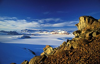
The Transantarctic Mountains comprise a mountain range of uplifted sedimentary rock in Antarctica which extend, with some interruptions, across the continent from Cape Adare in northern Victoria Land to Coats Land. These mountains divide East Antarctica and West Antarctica. They include a number of separately named mountain groups, which are often again subdivided into smaller ranges.

McMurdo Sound and its ice-clogged waters extends about 55 kilometres (34 mi) long and wide. The sound connects the Ross Sea to the north with the Ross Ice Shelf cavity to the south via Haskell Strait. The strait is largely covered by the McMurdo Ice Shelf. The Royal Society Range rises from sea level to 4,205 metres (13,796 ft) on the western shoreline. Ross Island, an historic jumping-off point for polar explorers, designates the eastern boundary. The active volcano Mount Erebus at 3,794 metres (12,448 ft) dominates Ross Island. Antarctica's largest scientific base, the United States' McMurdo Station, as well as the New Zealand Scott Base are on the southern shore of the island. Less than 10 percent of McMurdo Sound's shoreline is free of ice. It is the southernmost navigable body of water in the world.

Iceberg B-15 was the world's largest recorded iceberg. It measured around 295 kilometres (183 mi) long and 37 kilometres (23 mi) wide, with a surface area of 11,000 square kilometres (4,200 sq mi)—larger than the whole island of Jamaica. Calved from the Ross Ice Shelf of Antarctica in March 2000, Iceberg B-15 broke up into smaller icebergs, the largest of which was named Iceberg B-15A. In 2003, B-15A drifted away from Ross Island into the Ross Sea and headed north, eventually breaking up into several smaller icebergs in October 2005.
This is a list of extreme points in Antarctica.

Beaufort Island is an island in Antarctica's Ross Sea. It is the northernmost feature of the Ross Archipelago, lying 21 kilometres north of Cape Bird, Ross Island. It is approximately 18.4 km2 in area. It was first charted by James Clark Ross in 1841. Ross named the island for Sir Francis Beaufort, hydrographer to the British Royal Navy.
The McMurdo Ice Shelf is the portion of the Ross Ice Shelf bounded by McMurdo Sound and Ross Island on the north and Minna Bluff on the south. Studies show this feature has characteristics quite distinct from the Ross Ice Shelf and merits individual naming. A.J. Heine, who made investigations in 1962–63, suggested the name for the ice shelf bounded by Ross Island, Brown Peninsula, Black Island and White Island. The Advisory Committee on Antarctic Names has extended the application of this name to include the contiguous ice shelf southward to Minna Bluff.
Minna Bluff is a rocky promontory at the eastern end of a volcanic Antarctic peninsula projecting deep into the Ross Ice Shelf at 78°30′S169°0′E. It forms a long, narrow arm which culminates in a south-pointing hook feature, and is the subject of research into Antarctic cryosphere history, funded by the National Science Foundation, Office of Polar Programs.

Cape Crozier is the most easterly point of Ross Island in Antarctica. It was discovered in 1841 during James Clark Ross's expedition of 1839 to 1843 with HMS Erebus and HMS Terror, and was named after Francis Crozier, captain of HMS Terror. The extinct volcano Mount Terror, also named during the Ross expedition, rises sharply from the Cape to a height of 3,230 m (10,600 ft), and the edge of the Ross Ice Shelf stretches away to its east.
Dibble Bluff is a conspicuous rock bluff, 1 nautical mile (2 km) south of Marshall Cirque on the west side of White Island, Ross Archipelago. It rises abruptly from McMurdo Ice Shelf to over 400 metres (1,300 ft). It was named by the Advisory Committee on Antarctic Names (1999) after Raymond R. Dibble of the Department of Geology, Victoria University of Wellington, who investigated volcanic eruptions and the seismicity of nearby Mount Erebus in five seasons, 1980–81 through 1984–85.

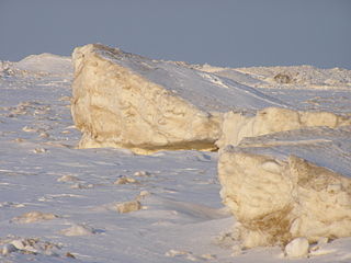
An iceport is a more-or-less permanent indentation in the front of an ice shelf, that can serve as a natural ice harbor. Though useful, they are not always reliable, as calving of surrounding ice shelves can render an iceport temporarily unstable and unusable.
Barwick Valley is an ice-free valley north of Apocalypse Peaks, extending from Webb Glacier to Victoria Valley in Victoria Land, Antarctica. It was named by the Victoria University of Wellington Antarctic Expedition (VUWAE) (1958–59) for R.E. Barwick, summer biologist with the New Zealand party of the Commonwealth Trans-Antarctic Expedition (1956–58) who worked in this area in 1957–58 and as a member of the VUWAE, 1958–59.
Edmonson Point is a rounded, largely ice-free point lying below Mount Melbourne along the west side of Wood Bay, Victoria Land, Antarctica. It was mapped by the United States Geological Survey from surveys and from US Navy air photographs, 1955–63, and was named by the Advisory Committee on Antarctic Names for Larry Edmonson, a satellite geodesy scientist at McMurdo Station, winter party 1966.
Moutonnée Lake is a sub-glacial lake that lies within Moutonnee Valley, marginal to the George VI Ice Shelf, 7 km (4.3 mi) south of Ablation Point indenting the east coast of Alexander Island, facing the west coast of Palmer Land, Antarctica. Following limnological and tidal studies by the British Antarctic Survey (BAS) from 1971, it was named by the United Kingdom Antarctic Place-Names Committee (UK-APC) from the presence of roche moutonnées on its shores. As with nearby Ablation and Hodgson Lakes, Moutonnée receives large masses of ice from the adjacent George VI Ice Shelf in George VI Sound, making life in the lake unsustainable. The site lies within Antarctic Specially Protected Area (ASPA) No.147.

Haskell Strait refers to the ocean passage in southern McMurdo Sound, running between Cape Armitage, Ross Island and Cape Spencer-Smith, White Island, Antarctica. Oceanographically, it separates McMurdo Sound from the ocean basin beneath the Ross Ice Shelf. The Strait itself is around 25 km wide and in places over 900 m deep. Currents of nearly half a knot have been measured in the Strait, although typical flows are lower. It is mostly covered by the ice of the McMurdo Ice Shelf and fast ice in southern McMurdo Sound. On rare occasions sea-ice breakout exposes the north-west corner of the Strait which becomes navigable and vessels can actually moor off Scott Base.
Castellini Bluff is a rock bluff rising to c. 500 m between Dibble Bluff and Mount Nesos in west White Island, Ross Archipelago. Named by the Advisory Committee on Antarctic Names in 2005 after Michael A. Castellini, Institute of Marine Sciences, University of Alaska, Fairbanks, who studied the Weddell seal in McMurdo Sound sea ice areas from 1977 to 2004, including winter season research at White Island with Randall William Davis in 1981.
Davis Bluff is a rock bluff that rises to 400 m in height. It is located 2 nautical miles (3.7 km) northeast of Isolation Point in east White Island, Ross Archipelago. Davis Bluff was named by the United States Board of Geographic names following the recommendation of its Advisory Committee on Antarctic Names in 2005 after Randall William Davis, Department of Marine Biology, Texas A&M University, Galveston, Texas. Dr. Davis studied the Weddell seal in McMurdo Sound sea ice areas from 1977 to 2003, including winter season research at White Island with his wife Ana Maria Davis, Michael A. Castellini and Markus Horning.