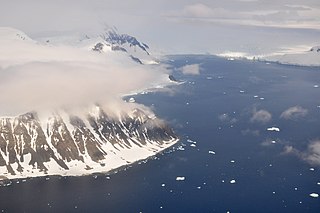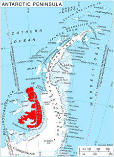
Laubeuf Fjord is a sound in Antarctica, 40 kilometres long in a north-south direction and averaging 16 km (10 mi) wide, lying between the east-central portion of Adelaide Island and the southern part of Arrowsmith Peninsula, Graham Land. It connects Hanusse Bay to the north with Marguerite Bay to the south. The southern 'border' between Laubeuf Fjord and Marguerite Bay is formed by the line between Rothera Point, Adelaide Island, and Cape Sáenz, which is the southernmost point of the Arrowsmith Peninsula. The fjord was discovered by the French Antarctic Expedition, 1908–10, under Jean-Baptiste Charcot, and named by him for Maxime Laubeuf, a French marine engineer who supervised building the engine for the ship Pourquoi-Pas.

Sheldon Glacier is a glacier flowing southeast from Mount Mangin into Ryder Bay, Adelaide Island, Antarctica. Named by the United Kingdom Antarctic Place-Names Committee (UK-APC) in 1977 for Ernest B. Sheldon, British Antarctic Survey (BAS) meteorological observer, Adelaide Station, 1968–69, and Stonington Island, 1969–70; Base Commander, Adelaide Station, 1975–76, and Rothera Station, 1976-77.
Ablation Lake is a proglacial tidal lake in Ablation Valley, Alexander Island, Antarctica, with stratified saline and fresh water and depths exceeding 117 m (384 ft). The feature is dammed in the upper portion by ice that pushes into the lake from the adjacent George VI Ice Shelf. It is named after Ablation Valley following British Antarctic Survey (BAS) limnological research from 1973. The site lies within Antarctic Specially Protected Area (ASPA) No.147.
Ablation Point, also known as Punta Ablación, is the eastern extremity of a hook-shaped rock ridge marking the north side of the entrance to Ablation Valley, on the east coast of Alexander Island, Antarctica. It was first photographed from the air on 23 November 1935 by Lincoln Ellsworth and mapped from these photographs by W.L.G. Joerg. It was roughly surveyed in 1936 by the British Graham Land Expedition (BGLE) and resurveyed in 1949 by the Falkland Islands Dependencies Survey (FIDS). It was named by FIDS for nearby Ablation Valley. The site lies within Antarctic Specially Protected Area (ASPA) No.147.

Jewell Glacier is a short glacier flowing south-southwest from Mount Grant into Jossac Bight on the south coast of South Georgia. It was named by the UK Antarctic Place-Names Committee in 1982 after John A. Jewell, a British Antarctic Survey field assistant in this area in 1976–77, at Rothera Research Station in 1977–78, and Base Commander at Rothera, 1978–80.

The Wormald Ice Piedmont is an ice piedmont covering the eastern part of Wright Peninsula, Adelaide Island, Antarctica, between Rothera Point and Sighing Peak. It was surveyed by the Falkland Islands Dependencies Survey (FIDS) in 1961–62, and by the British Antarctic Survey (BAS) from 1976.

Wright Peninsula is a peninsula lying between Ryder Bay and Stonehouse Bay on the east coast of Adelaide Island, Antarctica. Named by the United Kingdom Antarctic Place-Names Committee (UK-APC) in 1964 for Alan F. Wright, British Antarctic Survey (BAS) surveyor at nearby Adelaide station, 1960-63.
Back Cirque is an east-facing cirque to the north of Sloman Glacier in southeast Adelaide Island. The cirque indents the south side of the ridge that extends from the southeast part of Mount Liotard. It was named by the UK Antarctic Place-Names Committee in 1982 after Eric K.P. Back of the British Antarctic Survey (BAS), who in addition to service at Adelaide Station and Grytviken from 1964–65, also served as BAS Base Commander, Signy, 1974–75, Halley, 1975–76, Faraday, 1977–78, and Rothera, 1978-79.
Striation Valley is a valley trending south-east towards George VI Sound, lying immediately north of Jupiter Glacier, near the east coast of Alexander Island, Antarctica. The valley was first surveyed by a field party from the Department of Geography at the University of Aberdeen, with British Antarctic Survey support, in 1978-79. The name derives from glacial striations found on rocks in the valley. The site lies within Antarctic Specially Protected Area (ASPA) No.147.

Turner Glacier is a glacier on the east side of Mount Liotard flowing northeast into Ryder Bay, Adelaide Island. The glacier was surveyed by Falkland Islands Dependencies Survey (FIDS), 1948, and photographed from the air by Falkland Islands and Dependencies Aerial Survey Expedition (FIDASE), 1956-57. Named by the United Kingdom Antarctic Place-Names Committee (UK-APC) in 1977 after Andrew John Turner, British Antarctic Survey (BAS) builder, Halley Station, 1973–74; Signy Island, 1974–75; Rothera Station, 1976–77, 1978–80; and Faraday Station, 1982-83.
Fitton Rock is a flat-topped rock lying southeast of Cape Alexandra, off the south end of Adelaide Island. It was first charted by the French Antarctic Expedition, 1908–10, under Jean-Baptiste Charcot, and was named by the UK Antarctic Place-Names Committee in 1963 for Gordon F. Fitton, a British Antarctic Survey general assistant at Adelaide Station, 1961–62, and a member of the first party to winter on Adelaide Island.
Fletcher Bluff is a rock-faced, snow-backed bluff, about 800 metres (2,600 ft) high, located 3 nautical miles (6 km) west-northwest of the summit of Mount Liotard on the eastern margin of Fuchs Ice Piedmont, Adelaide Island. It was named in 1983 by the UK Antarctic Place-Names Committee after David D.W. Fletcher, a British Antarctic Survey general assistant at Halley Station, 1972–73, and Station Commander at Signy Station, 1973–76, and Rothera Station, 1976–81.
Moutonnée Lake is a sub-glacial lake that lies within Moutonnee Valley, marginal to the George VI Ice Shelf, 7 km (4.3 mi) south of Ablation Point indenting the east coast of Alexander Island, facing the west coast of Palmer Land, Antarctica. Following limnological and tidal studies by the British Antarctic Survey (BAS) from 1971, it was named by the United Kingdom Antarctic Place-Names Committee (UK-APC) from the presence of roche moutonnées on its shores. As with nearby Ablation and Hodgson Lakes, Moutonnée receives large masses of ice from the adjacent George VI Ice Shelf in George VI Sound, making life in the lake unsustainable. The site lies within Antarctic Specially Protected Area (ASPA) No.147.

McManus Glacier is a glacier flowing north into Palestrina Glacier, in northwestern Alexander Island, Antarctica. It separates Lassus Mountains on the west from Sofia University Mountains on the east. The glacier was surveyed by the British Antarctic Survey (BAS), 1975–76, and was named by the UK Antarctic Place-Names Committee in 1980 after Alan James McManus, a BAS cook at Grytviken and Faraday Research Station, 1971–73, and at Adelaide Island and Rothera Research Station, 1975–78.

Hawker Island is an irregularly shaped island about 2 km (1.2 mi) long, lying some 7 km south-west of Davis Station between Mule Island and Mule Peninsula, Vestfold Hills, in the eastern part of Prydz Bay, Antarctica. It was mapped by Norwegian cartographers from aerial photographs taken by the Lars Christensen Expedition, 1936–37. It was remapped by the Australian National Antarctic Research Expeditions (1957–58) and named after Alan Charles Hawker, a radio supervisor at Davis Station in 1957.
Himalia Ridge is a ridge running east–west on the north side of the Ganymede Heights massif, north-east of Jupiter Glacier, in the east of Alexander Island, Antarctica. It was photographed from the air by the Ronne Antarctic Research Expedition in 1947 and mapped from these photographs by D. Searle of the Falkland Islands Dependencies Survey in 1960. The ridge was named by the UK Antarctic Place-Names Committee following British Antarctic Survey geological work, 1983–84, after Himalia, a satellite of the planet Jupiter, in association with Jupiter Glacier. The site lies within Antarctic Specially Protected Area (ASPA) No.147.

Hurley Glacier is a glacier between Mount Gaudry and Mount Liotard, flowing east into Ryder Bay, Adelaide Island, Antarctica. It was named by the UK Antarctic Place-Names Committee in 1977 after Alec J. Hurley, a British Antarctic Survey mechanic at Halley Station, 1975–76, and Rothera Station, 1976–77.

Mackay Point is a point on the southeast coast of Adelaide Island, Antarctica, about 2 nautical miles (4 km) to the north-northeast of Rothera Point. It was surveyed by the Falkland Islands Dependencies Survey, 1961–62, and by a Royal Navy Hydrographic Survey Unit from HMS Endurance, 1976–77. The point was named by the UK Antarctic Place-Names Committee in 1978 for Donald C. Mackay, a British Antarctic Survey builder at Halley Station (1972–73), Signy Island (1974–75), and Rothera Research Station (1976-78).

Horton Glacier is a glacier at the east side of Mount Barre and Mount Gaudry, flowing southeast from Adelaide Island into Ryder Bay, Antarctica. It was named by the UK Antarctic Place-Names Committee in 1977 for Colin P. Horton, a British Antarctic Survey builder at the nearby Rothera Station, 1976–77.
Reptile Ridge is a ridge over 2 nautical miles (3.7 km) long, rising to about 250 m and extending northwest from the vicinity of Rothera Point, Adelaide Island. The name is descriptive of its appearance when viewed in profile from north or south. Named by the United Kingdom Antarctic Place-Names Committee (UK-APC) in 1977.


