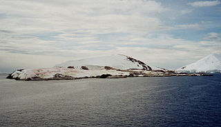
Signy Island is a small subantarctic island in the South Orkney Islands of Antarctica. It was named by the Norwegian whaler Petter Sørlle (1884–1933) after his wife, Signy Therese.
Petermann Island is a small, low and rounded island, lying off the northwest coast of Kyiv Peninsula in Graham Land, Antarctica, a short distance south of Booth Island and the Lemaire Channel. It is a popular tourist destination.

Admiralty Bay is an irregular bay, 8 km (5 mi) wide at its entrance between Demay Point and Martins Head, indenting the southern coast of King George Island for 16 km (10 mi), in the South Shetland Islands of Antarctica. The name appears on a map of 1822 by Captain George Powell, a British sailor, and is now established in international usage. The Henryk Arctowski Polish Antarctic Station is situated on the bay, as is the Comandante Ferraz Brazilian Antarctic Base. It has been designated an Antarctic Specially Managed Area.

Litchfield Island is a rocky island 0.9 kilometres (0.5 nmi) long and rising to 50 m (164 ft), lying in Arthur Harbour, 0.9 kilometres (0.5 nmi) south of Norsel Point, off the south-west coast of Anvers Island in the Palmer Archipelago of Antarctica.
Beall Island is a rocky island with small coves indenting the eastern and western sides, lying 600 m (660 yd) south-west of the Bailey Peninsula, in the Windmill Islands on the Budd Coast of Antarctica. There are several small lakes on the island. It was first mapped from aerial photos taken by the USN's Operation Highjump and Operation Windmill in 1947 and 1948. It was named by the US-ACAN for James M. Beall, U.S. Weather Bureau observer with Operation Windmill who assisted staff aerology officers with forecasting duties. The Beall Reefs are submarine ridges with depths of less than 1.8 metres, located 1 kilometre (0.6 mi) west of the island; they were discovered at the establishment of Wilkes Station in 1961 and named by ANCA after the island. Connors Point is the north-western point of the island; it was named by the US-ACAN for Aerographer's Mate William J. Connors, USN, a member of the Wilkes Station party of 1958.

Half Moon Island is a minor Antarctic island, lying in McFarlane Strait 1.35 km (0.84 mi) north of Burgas Peninsula, Livingston Island in the South Shetland Islands of the Antarctic Peninsula region. Its surface area is 171 hectares. The Argentine Cámara Base is located on the island. It is only accessible by sea and by helicopter; there is no airport of any kind. The naval base is operational occasionally during the summer, but is closed during the winter.
Devil Island is a 128 ha, ice-free island about 2 km long, in the James Ross Island group near the north-eastern tip of the Antarctic Peninsula. It lies in a small cove 1 km north of Vega Island, east of the Trinity Peninsula. It is characterised by several low hills rising to a maximum height of about 150 m.

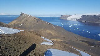
Shingle Cove is a small, sheltered cove in the north-west corner of Iceberg Bay, several kilometres east of Cape Hansen, on the south coast of Coronation Island, in the South Orkney Islands of Antarctica. The nearest research station is the British Signy, about 1.5 km south-west of Cape Hansen.

Cape Shirreff is a prominent cape at the north end of the rocky peninsula which separates Hero Bay and Barclay Bay on the north coast of Livingston Island, in the South Shetland Islands of Antarctica. The cape was named by Edward Bransfield in 1820 after Captain William H. Shirreff, the British commanding officer in the Pacific at that time.

Yankee Harbour is a small inner harbour entered from Shopski Cove between Glacier Bluff and Spit Point, indenting the south-west side of Greenwich Island in the South Shetland Islands, Antarctica. It is 2.35 km (1.46 mi) long in west-south-west to east-north-east direction, and 1.6 km (0.99 mi) wide, and is bounded by Provadiya Hook to the south-west, Parvomay Neck to the north and east, and Kladara Beach to the south.
Avian Island is an island, 1.2 km (0.7 mi) long and 40 metres (130 ft) high, lying close off the south tip of Adelaide Island, Antarctica. It was discovered by the French Antarctic Expedition, 1908–10, under Jean-Baptiste Charcot, and visited in 1948 by the Falkland Islands Dependencies Survey, who so named it because of the large number and variety of birds (avians) found there.

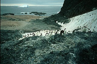
Ardley Island is an island 1.9 kilometres (1 nmi) long, lying in Maxwell Bay close off the south-west end of King George Island, in the South Shetland Islands of Antarctica. It was charted as a peninsula in 1935 by Discovery Investigations personnel of the Discovery II and named for Lieutenant R.A.B. Ardley, Royal Naval Reserve, an officer on the ship in 1929–31 and 1931–33. Aerial photography has since shown that the feature is an island with Braillard Point being the headland forming the northeast end of Ardley Island. It has been designated an Antarctic Specially Protected Area because of the importance of its seabird colonies.

Harmony Point is a point which lies close west of Harmony Cove and forms both the south side of the entrance to Malak Sechko Cove and the western extremity of Guangzhou Peninsula and Nelson Island, in the South Shetland Islands of Antarctica. It was charted in 1935 by Discovery Investigations personnel on the Discovery II, and named from association with Harmony Cove.
Lions Rump is a conspicuous headland 2 km (1.2 mi) north-northeast of Low Head, forming the west side of the entrance to King George Bay, on King George Island, in the South Shetland Islands of Antarctica. It was charted and given its descriptive name in 1937 by Discovery Investigations personnel on the Discovery II. Chopin Ridge runs between Lions Rump and Low Head. The rock feature known as "Martello Tower" lies 4 km (2.5 mi) to the north-northwest.

Point Hennequin is a point forming the eastern side of the entrance to Martel Inlet and Mackellar Inlet, on the east side of Admiralty Bay, King George Island, in the South Shetland Islands. It was named by the French Antarctic Expedition under Jean-Baptiste Charcot, who surveyed Admiralty Bay in 1909.
Lagotellerie Island is an island 1.9 kilometres (1 nmi) long, lying 3.7 kilometres (2 nmi) west of Horseshoe Island in Marguerite Bay, off the west coast of Graham Land, Antarctica. It was discovered and named by the French Antarctic Expedition, 1908–10, under Jean-Baptiste Charcot.

The Cierva Point and offshore islands Important Bird Area is a 6540 ha tract of land and sea on the Danco Coast of the Antarctic Peninsula.

The Southern Powell Island and adjacent islets Specially Protected Area is a 2688 ha site encompassing part of southern Powell Island in the South Orkney Islands of Antarctica. It includes neighbouring Christoffersen, Fredriksen, Michelsen and Grey Islands, along with some other (unnamed) offshore islets. It was designated an Antarctic Specially Protected Area because of its biological values as it supports many plants and animals that exemplify the natural ecology of the South Orkney Islands. It is also a breeding site for Antarctic fur seals.
Narębski Point is a headland on the south-east coast of the Barton Peninsula, at the south-western end of King George Island, in the South Shetland Islands of Antarctica with an average elevation of 0 feet (0 m) above sea level. Korea’s King Sejong Station lies 2 km (1.2 mi) to the north-east.

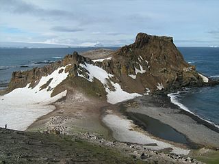
Baily Head is a prominent headland, 160 m high, forming the easternmost extremity of Deception Island, in the South Shetland Islands of Antarctica.
