
Admiralty Bay is an irregular bay, 8 km (5 mi) wide at its entrance between Demay Point and Martins Head, indenting the southern coast of King George Island for 16 km (10 mi), in the South Shetland Islands of Antarctica. The name appears on a map of 1822 by Captain George Powell, a British sailor, and is now established in international usage. The Henryk Arctowski Polish Antarctic Station is situated on the bay, as is the Comandante Ferraz Brazilian Antarctic Base. It has been designated an Antarctic Specially Managed Area.

Penguin Island is one of the smaller of the South Shetland Islands of Antarctica.

Anvers Island or Antwerp Island or Antwerpen Island or Isla Amberes is a high, mountainous island 61 km long, the largest in the Palmer Archipelago of Antarctica. It was discovered by John Biscoe in 1832 and named in 1898 by the Belgian Antarctic Expedition under Adrien de Gerlache after the province of Antwerp in Belgium. It lies south-west of Brabant Island at the south-western end of the group. The south-western coastline of the island forms part of the Southwest Anvers Island and Palmer Basin Antarctic Specially Managed Area. Cormorant Island, an Important Bird Area, lies 1 km off the south coast.
Cormorant Island is a 10 ha island lying in Bismarck Strait 1 km south of Anvers Island, 4 km (2.5 mi) east-south-east of Bonaparte Point, in the Palmer Archipelago of Antarctica. It lies some 5 km to the south-east of the United States' Palmer Station in Arthur Harbour on Anvers Island. It was shown on an Argentine government chart of 1954, but not named. It was named by the United Kingdom Antarctic Place-names Committee (UK-APC) in 1958 because of the large number of cormorants (shags) seen there.
Humble Island is a small rocky island lying 0.74 km (0.4 nmi) south-east of Norsel Point on Amsler Island, off the south-west coast of Anvers Island in the Palmer Archipelago of Antarctica. Humble Island was surveyed by the Falkland Islands Dependencies Survey (FIDS) in 1955. Humble Island was named by the United Kingdom Antarctic Place-names Committee (UK-APC) in 1956 because the island seems to be squeezed insignificantly between Litchfield Island and what was then considered the coast of Anvers Island.
Arthur Harbour is a small harbour entered between Bonaparte Point and Amsler Island on the south-west coast of Anvers Island in the Palmer Archipelago of Antarctica.

Litchfield Island is a rocky island 0.9 kilometres (0.5 nmi) long and rising to 50 m (164 ft), lying in Arthur Harbour, 0.9 kilometres (0.5 nmi) south of Norsel Point, off the south-west coast of Anvers Island in the Palmer Archipelago of Antarctica.
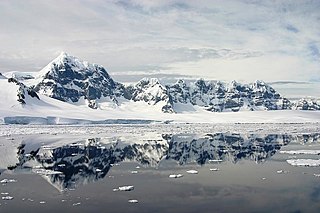
Wiencke Island is an island 26 km (16 mi) long and from 3 to 8 km wide, about 67 km2 (26 sq mi) in area, the southernmost of the major islands of the Palmer Archipelago, lying between Anvers Island to its north across the Neumayer Channel and the west coast of the Antarctic Peninsula to its east across the Gerlache Strait.

Trinity Island or Île de la Trinité or Isla Trinidad is an island 24 km (15 mi) long and 10 km (6 mi) wide in the northern part of the Palmer Archipelago, Antarctica. It lies 37 km (23 mi) east of Hoseason Island, 72.6 km (45 mi) south of Deception Island in the South Shetland Islands, and 10.3 km (6 mi) north-northwest of Cape Andreas on the Antarctic Peninsula. The island was named by Otto Nordenskiöld, leader of the 1901-1904 Swedish Antarctic Expedition (SAE) in commemoration of Edward Bransfield's "Trinity Land" of 1820.
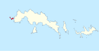
The Larsen Islands are a small group of islands north-west of Moreton Point, the western extremity of Coronation Island, in the South Orkney Islands of Antarctica. They were discovered by Captains George Powell and Nathaniel Palmer on the occasion of their joint cruise in December 1821. The islands were named on Petter Sørlle's chart, based upon his survey of the South Orkney Islands in 1912–1913, in honour of Carl Anton Larsen.

The Inaccessible Islands are a group of small precipitous islands ranging from 120 to 215 m high, the westernmost features of the South Orkney Islands, lying 20 km (12 mi) west of Coronation Island in Antarctica. They were discovered in December 1821 by Captain George Powell, a British sealer in the sloop James Monroe, though it is possible they are the "Seal Islands" seen by Nathaniel Palmer a year earlier. The islands were so named by Powell because of their appearance of inaccessibility. They are considered part of the British Antarctic Territory by the United Kingdom and part of the Province of Tierra del Fuego by Argentina.

Smyley Island is an Antarctic island lying off the Antarctic Peninsula. The island is 61 km (38 mi) long and from 13 to 34 km wide, and lies about 20 km (12 mi) north of Case Island. It connects to the Stange Ice Shelf and is separated from Alexander Island by the Ronne Entrance. Smyley Island is one of the 27 islands of Palmer Land, Antarctica.

The Joubin Islands are a group of small islands lying 6 kilometres (3 nmi) south-west of Cape Monaco, Anvers Island, at the south-western end of the Palmer Archipelago of Antarctica. The islands were discovered by the French Antarctic Expedition, 1903–05, under Jean-Baptiste Charcot, and named by him for Louis Joubin, the French naturalist. They have been designated a Restricted Zone under ASMA 7 — Southwest Anvers Island and Palmer Basin — which includes the marine area extending 50 metres (55 yd) from the shorelines.
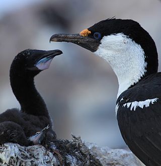
Guépratte Island is an ice-covered island 2.8 km (1.7 mi) long, lying between Anvers Island and Brabant Island at the east side of the entrance to Fournier Bay, in the Palmer Archipelago, Antarctica. The island was first shown on the Ludwig Friederichsen map of 1895, embodying the 1873–74 explorations of a German expedition under Eduard Dallmann. It was later charted by the French Antarctic Expedition, 1903–05, under Jean-Baptiste Charcot, who named it after Captain Guépratte of the French Navy. The name "Discovery Island", applied in 1927 by Discovery Investigations personnel on the Discovery, has been rejected in favour of the earlier name.

Gerlache Island is the largest of the Rosenthal Islands lying off Gerlache Point on the west coast of Anvers Island, in the Palmer Archipelago of Antarctica. It was first roughly charted and named "Pointe de Gerlache" by the French Antarctic Expedition, 1903–05, under Jean-Baptiste Charcot, for Lieutenant Adrien de Gerlache. As a result of surveys by the Falkland Islands Dependencies Survey in 1956–58, this island is considered to be the feature named by Charcot; there is no prominent point in this vicinity which would be visible from seaward.
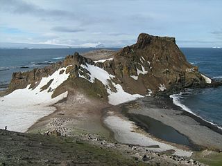
Lions Rump is a conspicuous headland 2 km (1.2 mi) north-northeast of Low Head, forming the west side of the entrance to King George Bay, on King George Island, in the South Shetland Islands of Antarctica. It was charted and given its descriptive name in 1937 by Discovery Investigations personnel on the Discovery II. Chopin Ridge runs between Lions Rump and Low Head. The rock feature known as "Martello Tower" lies 4 km (2.5 mi) to the north-northwest.
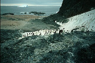
Lagotellerie Island is an island 1.9 kilometres (1 nmi) long, lying 3.7 kilometres (2 nmi) west of Horseshoe Island in Marguerite Bay, off the west coast of Graham Land, Antarctica. It was discovered and named by the French Antarctic Expedition, 1908–10, under Jean-Baptiste Charcot.
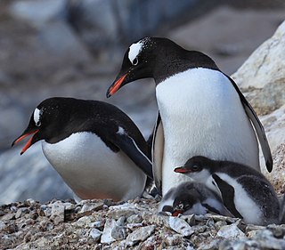
The Rosenthal Islands are a group of about islands fringing the west coast of Anvers Island, 11 km (6.8 mi) north of Cape Monaco, in the Palmer Archipelago of Antarctica.
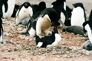
Penguin Point lies on the south-eastern coast of Seymour Island, in the James Ross Island group, near the north-eastern extremity of the Antarctic Peninsula. The Argentine Marambio Base is about 8 km to the north-east. A ridge of exposed dark rock named Blackrock Ridge runs west-southwest–east-northeast, 1.5 nautical miles north of Penguin Point.

Southwest Anvers Island and Palmer Basin is a 3275 km2 Antarctic Specially Managed Area. It lies towards the northern end of the Antarctic Peninsula, encompassing the south-western coastline of Anvers Island, in the Palmer Archipelago, with the adjacent deep marine waters of the Palmer Basin, the shallower Bismarck Strait, and fringing island groups.


