Breaker Island is a small rocky island lying in Arthur Harbour close south-west of Norsel Point, off the south-west coast of Anvers Island in the Palmer Archipelago of Antarctica. It was surveyed by the Falkland Islands Dependencies Survey (FIDS) in 1955 and named by the UK Antarctic Place-Names Committee (UK-APC) because the island causes breakers when the sea is rough.
Dream Island is an island lying 0.7 km (0.43 mi) south-east of Cape Monaco, off the south-west coast of Anvers Island in Wylie Bay, in the Palmer Archipelago of Antarctica. It was surveyed by the British Naval Hydrographic Survey Unit in 1956-1957 and named by the UK Antarctic Place-Names Committee for its natural features including a cave and, in summer, a small waterfall, with mossy patches and grass. It lies about 10 km north-west of the United States' Palmer Station.
The Elephant Rocks in Antarctica are a group of three prominent rocks connected by shoals, located between Torgersen Island and the north-west entrance to Arthur Harbour, off the south-west coast of Anvers Island. The name became established locally among UdARP personnel at nearby Palmer Station in about 1971, as the rocks provide habitat favoured by elephant seals.
Humble Island is a small rocky island lying 0.74 km (0.4 nmi) south-east of Norsel Point in Arthur Harbour, off the south-west coast of Anvers Island in the Palmer Archipelago of Antarctica. Humble Island was surveyed by the Falkland Islands Dependencies Survey (FIDS) in 1955. Humble Island was named by the United Kingdom Antarctic Place-names Committee (UK-APC) in 1956 because the island seems to be squeezed insignificantly between Litchfield Island and the coast of Anvers Island.

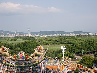
Arthur Harbour is a small harbour entered between Bonaparte Point and Norsel Point on the south-west coast of Anvers Island in the Palmer Archipelago of Antarctica.

Litchfield Island is a rocky island 0.9 kilometres (0.5 nmi) long and rising to 50 m (164 ft), lying in Arthur Harbour, 0.9 kilometres (0.5 nmi) south of Norsel Point, off the south-west coast of Anvers Island in the Palmer Archipelago of Antarctica.
Torgersen Island is a small rocky island lying just east of Litchfield Island in the entrance to Arthur Harbour, off the south-west coast of Anvers Island in the Palmer Archipelago of Antarctica. It was surveyed by the Falkland Islands Dependencies Survey in 1955 and named by the UK-APC for Torstein Torgersen, first mate of the Harbor in late February 1955, preceding the vessel Norsel in one of the ship's boats and making soundings.

Stonington Island is a rocky island lying 1.8 km (1.1 mi) northeast of Neny Island in the eastern part of Marguerite Bay off the west coast of Graham Land, Antarctica. It is 0.75 km (0.47 mi) long from north-west to south-east and 0.37 km (0.23 mi) wide, yielding an area of 20 ha. It was formerly connected by a drifted snow slope to Northeast Glacier on the mainland. Highest elevation is Anemometer Hill which rises to 25 m (82 ft).
Trinity Island or Île de la Trinité or Isla Trinidad is an island 24 km (15 mi) long and 10 km (6 mi) wide. It lies 37 km (23 mi) east of Hoseason Island in the northern part of the Palmer Archipelago, Antarctica. It was named by Otto Nordenskiöld, leader of the Swedish Antarctic Expedition (1901-1904) in commemoration of Edward Bransfield's "Trinity Land" of 1820.

The Seal Islands are a group of small islands and rocky islets lying about 7 km north and north-west of Elephant Island, in the South Shetland Islands of Antarctica. They extend east–west for about 5 km, and are separated from Elephant Island by Sealers Passage. The group takes its name from the largest island, which Captain William Smith named Seal Island in 1820 because of the number of seals killed there.
The Inaccessible Islands are a group of small precipitous islands ranging from 120 to 215 m high, the westernmost features of the South Orkney Islands, lying 20 km (12 mi) west of Coronation Island in Antarctica. They were discovered in December 1821 by Captain George Powell, a British sealer in the sloop James Monroe, though it is possible they are the "Seal Islands" seen by Nathaniel Palmer a year earlier. The islands were so named by Powell because of their appearance of inaccessibility. They are considered part of the British Antarctic Territory by the United Kingdom and part of the Province of Tierra del Fuego by Argentina.
Bates Island is a narrow island 5 km (3.1 mi) long lying east of Jurva Point, Renaud Island, in the Biscoe Islands of Antarctica. It was first accurately shown on an Argentine government chart of 1957, and was named by the UK Antarctic Place-Names Committee in 1959 for Charles C. Bates, an American oceanographer who has specialised in sea ice studies.
Uruguay Island is an island 1 km (0.62 mi) long with a cove indenting its west side, lying between Irizar Island and Corner Island in the Argentine Islands of the Wilhelm Archipelago of Antarctica. It was discovered by the French Antarctic Expedition of 1903–05, under J.B. Charcot who named it after the Argentine corvette ARA Uruguay. The island was recharted in 1935 by the British Graham Land Expedition (BGLE) under John Rymill.
The Joubin Islands are a group of small islands lying 6 kilometres (3 nmi) south-west of Cape Monaco, Anvers Island, at the south-western end of the Palmer Archipelago of Antarctica. The islands were discovered by the French Antarctic Expedition, 1903–05, under Jean-Baptiste Charcot, and named by him for Louis Joubin, the French naturalist. They have been designated a Restricted Zone under ASMA 7 — Southwest Anvers Island and Palmer Basin — which includes the marine area extending 50 metres (55 yd) from the shorelines.

Murray Island, also sometimes known as Bluff Island, is an island 6 km long lying at the south-west side of Hughes Bay, off the west coast of Graham Land, Antarctica. The feature has been known to sealers operating in the area since the 1820s, although it was shown on charts as part of the mainland. In 1922 the whale catcher Graham passed through the channel separating it from the mainland, proving its insularity. It was named in association with Cape Murray, the seaward extremity of the island.
Guépratte Island is an ice-covered island 2.8 km (1.7 mi) long, lying between Anvers Island and Brabant Island at the east side of the entrance to Fournier Bay, in the Palmer Archipelago, Antarctica. The island was first shown on the Ludwig Friederichsen map of 1895, embodying the 1873–74 explorations of a German expedition under Eduard Dallmann. It was later charted by the French Antarctic Expedition, 1903–05, under Jean-Baptiste Charcot, who named it after Captain Guépratte of the French Navy. The name "Discovery Island", applied in 1927 by Discovery Investigations personnel on the Discovery, has been rejected in favour of the earlier name.
Dodman Island is an island 6.5 km (4.0 mi) long, lying 7.4 km (4.6 mi) south-east of Rabot Island and 18.5 km (11.5 mi) west of Ferin Head, off the west coast of Graham Land, Antarctica. The island was charted and named by the British Graham Land Expedition, 1934–37, under John Rymill.

Fredriksen Island is an island 5 km (3.1 mi) long and 1 km (0.62 mi) wide, lying 1 km south-east of Powell Island in the South Orkney Islands of Antarctica. It was discovered by Captains Nathaniel Palmer and George Powell in the course of their joint cruise in December 1821. It was named by Norwegian whaling captain Petter Sorlle, who made a running survey of the island in the 1912–13 summer.

Gerlache Island is the largest of the Rosenthal Islands lying off Gerlache Point on the west coast of Anvers Island, in the Palmer Archipelago of Antarctica. It was first roughly charted and named "Pointe de Gerlache" by the French Antarctic Expedition, 1903–05, under Jean-Baptiste Charcot, for Lieutenant Adrien de Gerlache. As a result of surveys by the Falkland Islands Dependencies Survey in 1956–58, this island is considered to be the feature named by Charcot; there is no prominent point in this vicinity which would be visible from seaward.

The Cierva Point and offshore islands Important Bird Area is a 6540 ha tract of land and sea on the Danco Coast of the Antarctic Peninsula.