Admiralty Bay is an irregular bay, 8 km (5 mi) wide at its entrance between Demay Point and Martins Head, indenting the southern coast of King George Island for 16 km (10 mi), in the South Shetland Islands of Antarctica. The name appears on a map of 1822 by Captain George Powell, a British sailor, and is now established in international usage. The Henryk Arctowski Polish Antarctic Station is situated on the bay, as is the Comandante Ferraz Brazilian Antarctic Base. It has been designated an Antarctic Specially Managed Area.
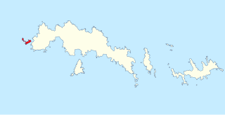
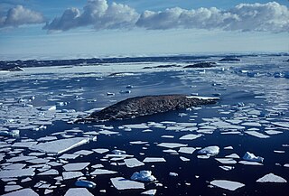
Dream Island is an island lying 0.7 km (0.43 mi) south-east of Cape Monaco, off the south-west coast of Anvers Island in Wylie Bay, in the Palmer Archipelago of Antarctica. It was surveyed by the British Naval Hydrographic Survey Unit in 1956-1957 and named by the UK Antarctic Place-Names Committee for its natural features including a cave and, in summer, a small waterfall, with mossy patches and grass. It lies about 10 km north-west of the United States' Palmer Station.

Litchfield Island is a rocky island 0.9 kilometres (0.5 nmi) long and rising to 50 m (164 ft), lying in Arthur Harbour, 0.9 kilometres (0.5 nmi) south of Norsel Point, off the south-west coast of Anvers Island in the Palmer Archipelago of Antarctica.

The Larsen Islands are a small group of islands north-west of Moreton Point, the western extremity of Coronation Island, in the South Orkney Islands of Antarctica. They were discovered by Captains George Powell and Nathaniel Palmer on the occasion of their joint cruise in December 1821. The islands were named on Petter Sørlle's chart, based upon his survey of the South Orkney Islands in 1912–1913, in honour of Carl Anton Larsen.

The Inaccessible Islands are a group of small precipitous islands ranging from 120 to 215 m high, the westernmost features of the South Orkney Islands, lying 20 km (12 mi) west of Coronation Island in Antarctica. They were discovered in December 1821 by Captain George Powell, a British sealer in the sloop James Monroe, though it is possible they are the "Seal Islands" seen by Nathaniel Palmer a year earlier. The islands were so named by Powell because of their appearance of inaccessibility. They are considered part of the British Antarctic Territory by the United Kingdom and part of the Province of Tierra del Fuego by Argentina.

Holl Island is a rocky, triangular-shaped Antarctic island, 3.1 km (1.7 nmi) long, marking the south-western end of the Windmill Islands.
The Dion Islands are a group of small islands and rocks lying in the northern part of Marguerite Bay, 11 kilometres (6 nmi) south-west of Cape Alexandra, Adelaide Island, off the west coast of the Antarctic Peninsula. They were discovered by the French Antarctic Expedition, 1908–10, and named by Jean-Baptiste Charcot for the Marquis Jules-Albert de Dion, who donated three motor sledges and whose De Dion-Bouton works produced equipment for the expedition.
Avian Island is an island, 1.2 km (0.7 mi) long and 40 metres (130 ft) high, lying close off the south tip of Adelaide Island, Antarctica. It was discovered by the French Antarctic Expedition, 1908–10, under Jean-Baptiste Charcot, and visited in 1948 by the Falkland Islands Dependencies Survey, who so named it because of the large number and variety of birds (avians) found there.
O'Brien Island is a small rocky island in the South Shetland Islands of Antarctica. It lies 4 kilometres (2 nmi) south-west of Aspland Island and rises to 540 m. A strong marine channel, named Tasman Rip, runs between O'Brien Island and Eadie Island.

The Curzon Islands are a small group of rocky islands lying close off Cape Découverte, Adélie Coast. They were probably sighted in January 1840 by a French expedition under Captain Jules Dumont d'Urville, though not identified as islands on d'Urville's maps. The islands were roughly charted in 1912 by Captain J.K. Davis of the Australasian Antarctic Expedition ship Aurora and named by Mawson for Lord Curzon, the President of the Royal Geographical Society, 1911–14. The islands were mapped in detail by the French Antarctic Expedition, 1950–52.
The Joubin Islands are a group of small islands lying 6 kilometres (3 nmi) south-west of Cape Monaco, Anvers Island, at the south-western end of the Palmer Archipelago of Antarctica. The islands were discovered by the French Antarctic Expedition, 1903–05, under Jean-Baptiste Charcot, and named by him for Louis Joubin, the French naturalist. They have been designated a Restricted Zone under ASMA 7 — Southwest Anvers Island and Palmer Basin — which includes the marine area extending 50 metres (55 yd) from the shorelines.

Turner Island is an island in the Donskiye Islands group lying 0.9 km (0.6 mi) north-west of Bluff Island and 4.6 km (2.9 mi) west of Breidnes Peninsula, Vestfold Hills, in Prydz Bay, Princess Elizabeth Land, Antarctica.
Earle Island is a small ice-free island 6 kilometres (3 nmi) south-west of Darwin Island which marks the south-western end of the Danger Islands. Following hydrographic work in the area from HMS Endurance in 1977–78, it was named, in association with Beagle Island and other names in the group, after Augustus Earle, an artist on board HMS Beagle.

Ferguslie Peninsula is a peninsula 2.4 km (1.5 mi) long, lying between Browns Bay and Macdougal Bay on the north coast of Laurie Island, in the South Orkney Islands of Antarctica. The peninsula was charted in 1903 by the Scottish National Antarctic Expedition under William Speirs Bruce, who named it for Ferguslie, the residence of James Coats, chief patron of the expedition.
The Gosling Islands are a scattered group of islands and rocks lying close south and west of Meier Point, off the south coast of Coronation Island in the South Orkney Islands of Antarctica. They were first charted and named "Gestlingen" by Petter Sorlle in 1912–13. This was corrected to "Gjeslingene" on a later chart by Sorlle. The approved name is an anglicized form recommended by the UK Antarctic Place-Names Committee.
Gourdin Island is the largest island (124 ha) in a group of islands and rocks 2 km (1 nmi) north of Prime Head, the northern tip of the Antarctic Peninsula. It was discovered by a French expedition, 1837–40, under Captain Jules Dumont d'Urville, and named by him for Ensign Jean Gourdin of the expedition ship Astrolabe. The island was reidentified and charted by the Falkland Islands Dependencies Survey in 1945–47.

Harmony Point is a point which lies close west of Harmony Cove and forms both the south side of the entrance to Malak Sechko Cove and the western extremity of Guangzhou Peninsula and Nelson Island, in the South Shetland Islands of Antarctica. It was charted in 1935 by Discovery Investigations personnel on the Discovery II, and named from association with Harmony Cove.
The Schaefer Islands are a small group of islands lying close to the north-western end of the Canisteo Peninsula and 4 km (2.5 mi) south-west of the Lindsey Islands. They were mapped from aerial photos taken by the USN's Operation Highjump in December 1946. They were named by the Advisory Committee on Antarctic Names (US-ACAN) for William A. Schaefer, a geologist on the Ellsworth Land Survey, 1968–69.
Lugg Island is a small island in the Donskiye Islands group lying 2 km (1.2 mi) north-west of Lake Island, off the west end of Breidnes Peninsula, Vestfold Hills, Antarctica. It was first plotted from aerial photos taken by the Lars Christensen Expedition, 1936–37, and was named by the Antarctic Names Committee of Australia for Dr. D. Lugg, medical officer at Davis Station in 1963, who visited the island for biological studies.
Magnetic Island is a small island in the Donskiye Islands group in the Donskiye Islands group lying 500 m north-east of Turner Island, off the Breidnes Peninsula, Vestfold Hills, Princess Elizabeth Land, Antarctica.


