Inexpressible Island

Last updated
Inexpressible Island
InexpressibleIsland3.JPG
A view over Inexpressible Island
Antarctica location map.svg
Red pog.svg
Inexpressible Island
Location in Antarctica
Geography
Location Antarctica
Coordinates 74°54′S163°39′E / 74.900°S 163.650°E / -74.900; 163.650
Administration
Administered under the Antarctic Treaty System
Demographics
PopulationSummer: 80, Winter: 30

Inexpressible Island is a small, rocky island in Terra Nova Bay, Victoria Land, Antarctica. Previously uninhabited, the Chinese Qinling research station on the southern edge of the island became operational in 2024.

Contents

Description

The island is bounded in the east by Evans Cove and the Hells Gate Moraine, and in the west by the Nansen Ice Sheet. The eastern side is relatively flat with a few low hills, while a 110 m high ridge marks the western side. Several lakes are present. [1]

History

Robert Falcon Scott's Terra Nova Expedition (1910–1913) comprised several groups. One of these, the Northern Party, led by Victor Campbell, did not accompany Scott into the interior but wintered at Cape Adare. In 1912, that group (composed of six men in total), began the long journey homewards and began making their way to Cape Evans (via Hut Point). However, they were dropped at Evans Coves with sledging provisions for six weeks with the intention of completing geological work. After the work was done they were left with rations for about four weeks, as it was not anticipated the ship would have trouble picking them up later in February. But the Terra Nova could not reach them due to heavy pack ice. [2] :xlii Unable to connect with their ship, the Northern Party was forced to winter in Antarctica again. In March 1912 the party excavated a small 3.7-by-2.7-metre (12 by 9 ft) ice cave in a snow drift they nicknamed "Inexpressible Island" where they spent the winter in miserable conditions, supplementing their rations by killing scarce seal and penguins for meat. [3]

Seaweed on Inexpressible Island. InexpressibleIsland7.JPG
Seaweed on Inexpressible Island.

The Northern Party had previously built a supply depot at Hells Gate Moraine (74° 52'S, 163° 50'E) on Inexpressible Island as a form of security should the Terra Nova be unable to collect them. The depot primarily consisted of a sledge loaded with supplies and equipment. Despite the fact that this depot had been built, the winter spent in the ice cave and a partially constructed rock shelter on Inexpressible Island was miserable. The men suffered frostbite, hunger, dysentery, and the abominable winds on the island. As ship doctor George Murray Levick said: [2] :xlv

"The road to hell might be paved with good intentions, but it seemed probable that hell itself would be paved something after the style of Inexpressible Island."

The men started home for Hut Point on September 30, 1912, some two hundred miles down the coast, which would include the crossing of the Drygalski Ice Tongue. Browning was very ill and Dickason almost crippled by dysentery. They reached Hut Point on November 5. [2] :xlviii

Historic site

The site of the ice cave where Victor Campbell's Northern Party wintered has been designated a Historic Site or Monument (HSM 14), following a proposal by New Zealand to the Antarctic Treaty Consultative Meeting. A wooden sign, a plaque and seal bones remain at the site. [4]

Qinling Station

In February 2024, the Qinling research station on the southern edge of the island was opened by the People's Republic of China. [5] [6] [7] The Center for Strategic and International Studies, an American think tank, reported that the station was expected to include an observatory with a satellite ground station, and that the equipment could be used to collect signals intelligence and for tracking rockets launched from the Arnhem Space Centre in Australia. China rejected claims that the station would be used for espionage. [8] [9]

A lone emperor penguin on Inexpressible Island. InexpressibleIsland6.JPG
A lone emperor penguin on Inexpressible Island.

Important Bird Area

A 365-hectare (900-acre) site comprising ice-free ground on the eastern shore of the island has been designated an Important Bird Area (IBA) by BirdLife International, because it supports about 24,000 breeding pairs of Adélie penguins and some 60 pairs of south polar skuas which breed in the vicinity of the penguin colony. Weddell seals have been seen on sea ice near the island. [1]

See also

Related Research Articles

<span class="mw-page-title-main">Ross Island</span> Island in Ross Sea, Antarctica

Ross Island is an island in Antarctica lying on the east side of McMurdo Sound and extending 43 nautical miles from Cape Bird on the north to Cape Armitage on the south, and a like distance from Cape Royds on the west to Cape Crozier on the east. The island is entirely volcanic. Mount Erebus, 3,795 metres (12,451 ft), near the center, is an active volcano. Mount Terror, 3,230 metres (10,600 ft), about 20 nautical miles eastward, is an extinct volcano. Mount Bird rises to 1,765 metres (5,791 ft) just south of Cape Bird. Ross Island lies within the boundary of Ross Dependency, an area of Antarctica claimed by New Zealand.
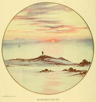
<span class="mw-page-title-main">Framheim</span> Antarctic base

Framheim was the name of explorer Roald Amundsen's base at the Bay of Whales on the Ross Ice Shelf in Antarctica during his successful quest for the South Pole. It was used between January 1911 and February 1912.

<span class="mw-page-title-main">Hope Bay</span> Bay of Antarctica

Hope Bay on Trinity Peninsula, is five kilometres long and three kilometres wide, indenting the tip of the Antarctic Peninsula and opening on Antarctic Sound. It is the site of the Argentinian Antarctic settlement Esperanza Base, established in 1952.

<span class="mw-page-title-main">Terra Nova Bay</span>

Terra Nova Bay is a bay which is often ice free, about 40 nautical miles long, lying between Cape Washington and the Drygalski Ice Tongue along the coast of Victoria Land, Antarctica. It was discovered by the British National Antarctic Expedition under Robert Falcon Scott, 1901–1904, and named by him after Terra Nova, one of the relief ships for the expedition.

<span class="mw-page-title-main">Tom Crean (explorer)</span> Irish Antarctic explorer (1877–1938)

Thomas Crean was an Irish seaman and Antarctic explorer who was awarded the Albert Medal for Lifesaving (AM).

<span class="mw-page-title-main">Scott's Hut</span> Antarctic base

Scott's Hut is a building located on the north shore of Cape Evans on Ross Island in Antarctica. It was erected in 1911 by the British Antarctic Expedition of 1910–1913 led by Robert Falcon Scott.

<i>Terra Nova</i> Expedition 1910–13 British Antarctic expedition

The Terra NovaExpedition, officially the British Antarctic Expedition, was an expedition to Antarctica which took place between 1910 and 1913. Led by Captain Robert Falcon Scott, the expedition had various scientific and geographical objectives. Scott wished to continue the scientific work that he had begun when leading the Discovery Expedition from 1901 to 1904, and wanted to be the first to reach the geographic South Pole.

<span class="mw-page-title-main">George Murray Levick</span> British explorer and naval surgeon (1876–1956)

George Murray Levick was a British Antarctic explorer, naval surgeon and founder of the Public Schools Exploring Society.

<i>The Worst Journey in the World</i> Memoir by Apsley Cherry-Garrard

The Worst Journey in the World is a 1922 memoir by Apsley Cherry-Garrard of Robert Falcon Scott's Terra Nova expedition to the South Pole in 1910–1913. It has earned wide praise for its frank treatment of the difficulties of the expedition, the causes of its disastrous outcome, and the meaning of human suffering under extreme conditions.

Victor Lindsey Arbuthnot Campbell was an English Royal Navy officer and Antarctic explorer.

<span class="mw-page-title-main">Cape Adare</span> Peninsula of East Antarctica

Cape Adare is a prominent cape of black basalt forming the northern tip of the Adare Peninsula and the north-easternmost extremity of Victoria Land, East Antarctica.

Sir Raymond Edward Priestley was an English geologist and early Antarctic explorer. He was Vice-Chancellor of the University of Birmingham, where he helped found The Raymond Priestley Centre on the shores of Coniston Water in the Lake District National Park.

SY <i>Aurora</i><span class="nowrap" style="padding-left:0.1em;">s</span> drift 1915 event during Shackletons antarctic expedition

The drift of the Antarctic exploration vessel SY Aurora was an ordeal which lasted 312 days, affecting the Ross Sea party of Sir Ernest Shackleton's Imperial Trans-Antarctic Expedition, 1914–1917. It began when the ship broke loose from its anchorage in McMurdo Sound in May 1915, during a gale. Caught in heavy pack ice and unable to manoeuvre, Aurora, with eighteen men aboard, was carried into the open waters of the Ross Sea and Southern Ocean, leaving ten men stranded ashore with meagre provisions.

<span class="mw-page-title-main">Comparison of the Amundsen and Scott expeditions</span> Analysis of two expeditions to the South Pole.

Between December 1911 and January 1912, both Roald Amundsen and Robert Falcon Scott reached the South Pole within five weeks of each other. But while Scott and his four companions died on the return journey, Amundsen's party managed to reach the geographic south pole first and subsequently return to their base camp at Framheim without loss of human life, suggesting that they were better prepared for the expedition. The contrasting fates of the two teams seeking the same prize at the same time invites comparison.

<span class="mw-page-title-main">Discovery Hut</span> Antarctic camp

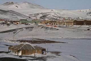
Discovery Hut was built by Robert Falcon Scott during the Discovery Expedition of 1901–1904 in 1902 and is located at Hut Point on Ross Island by McMurdo Sound, Antarctica. Visitors to Antarctica, arriving at either the US Base at McMurdo or New Zealand's Scott Base are likely to encounter Discovery Hut as both are located on Hut Point. Discovery Hut is just 300m from McMurdo Base. The hut has been designated a Historic Site or Monument, following a proposal by New Zealand and the United Kingdom to the Antarctic Treaty Consultative Meeting.

Backdoor Bay is a small bay lying at the east side of Cape Royds, along the west side of Ross Island, Antarctica.

Hells Gate Moraine is a glacial moraine at the head of Evans Cove on the coast of Victoria Land, Antarctica. It extends southward to Hells Gate from nearby Vegetation Island and Cape Confusion.

<span class="mw-page-title-main">Dogs of the Australasian Antarctic Expedition</span>

In common with many of the expeditions of the Heroic Age, Douglas Mawson's Australasian Antarctic Expedition (AAE) employed dog-hauled sledges as a principal means of transportation during exploration of the continent. Dog sledges could carry more weight and travel faster than man-hauled sledges; they were more reliable in the freezing temperatures than motor-sledges; and dogs had proved to be more adaptable to harsh Antarctic conditions than ponies.

Frank V. Browning (1882–1930) was a native of Devonshire and explorer of Antarctica. He was part of the Terra Nova Expedition of 1910–1913. In this service he was one of the castaways of the Northern Party that was marooned overwinter on Victoria Land in 1912.

<span class="mw-page-title-main">Qinling Station (Antarctica)</span> Antarctic base in PRIC


Qinling Station is an Antarctic research station operated by the Polar Research Institute of China. It is situated on the southern edge of Inexpressible Island in Terra Nova Bay, Victoria Land, on the Ross Sea coast of East Antarctica.

References

  1. 1 2 "Inexpressible Island". BirdLife Data Zone. BirdLife International. 2015. Retrieved 11 November 2020.
  2. 1 2 3 Apsley Cherry-Garrard, The Worst Journey in the World , Carrol & Graf, 1922.
  3. "Inexpressible Island". ABC listen. 9 August 2022. Retrieved 21 August 2023.
  4. "List of Historic Sites and Monuments approved by the ATCM (2012)" (PDF). Antarctic Treaty Secretariat. 2012. Retrieved 26 October 2013.
  5. China opens first Antarctic research station due south of Australia and New Zealand ABC News , 8 February 2024. Retrieved 8 February 2024.
  6. China's Qinling Station in Antarctica starts operation Xinhua News Agency, 7 February 2024. Retrieved 8 February 2024.
  7. Zhao Lei, China opens fifth Antarctic research station China Daily via Asia News Network, 8 February 2024. Retrieved 8 February 2024.
  8. "United States Antarctic Inspection February 2020" (PDF). U.S. Department of State. Retrieved 8 February 2024.
  9. "Surveillance fears as China resumes construction on fifth Antarctic base". The Guardian . London. 18 April 2023.

PD-icon.svg This article incorporates public domain material from "Inexpressible Island". Geographic Names Information System . United States Geological Survey.