
Davis Station, commonly called Davis, is one of three permanent bases and research outposts in Antarctica managed by the Australian Antarctic Division (AAD). Davis is situated on the coast of Cooperation Sea in Princess Elizabeth Land, Ingrid Christensen Coast in the Australian Antarctic Territory, a territory claimed by Australia. Davis lies in an Antarctic oasis, a mostly ice-free area known as the Vestfold Hills.

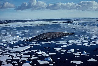
Gardner Island is a largely ice-free island which lies about 3 km west of Broad Peninsula in the southern Vestfold Hills, in Prydz Bay on the Ingrid Christensen Coast of Princess Elizabeth Land, Antarctica. It has been designated an Important Bird Area (IBA) by BirdLife International because it supports about 27,000 breeding pairs of Adélie penguins. Snow petrels also breed on the island. The nearest permanent research station is Australia's Davis Station, 3 km to the east on Broad Peninsula.

The Scullin Monolith is a crescent-shaped rock fronting the sea 6 km (3.7 mi) west of the similar Murray Monolith, and 8 km (5.0 mi) from Torlyn Mountain, in Mac. Robertson Land, Antarctica. It is a steep massif of metasedimentary gneiss and granitic origin, with the adjacent coastline consisting of 40 m high ice cliffs. The monolith rises steeply to extend from 435 m high Mikkelsen Peak westward in a crescent that forms Douglas Bay.

The Amery Ice Shelf is a broad ice shelf in Antarctica at the head of Prydz Bay between the Lars Christensen Coast and Ingrid Christensen Coast. It is part of Mac. Robertson Land. The name "Cape Amery" was applied to a coastal angle mapped on 11 February 1931 by the British Australian New Zealand Antarctic Research Expedition (BANZARE) under Douglas Mawson. He named it for William Bankes Amery, a civil servant who represented the United Kingdom government in Australia (1925–28). The Advisory Committee on Antarctic Names interpreted this feature to be a portion of an ice shelf and, in 1947, applied the name Amery to the whole shelf.

Prydz Bay is a deep embayment of Antarctica between the Lars Christensen Coast and Ingrid Christensen Coast. The Bay is at the downstream end of a giant glacial drainage system that originates in the East Antarctic interior. The Lambert Glacier flows from Lambert Graben into the Amery Ice Shelf on the south-west side of Prydz Bay. Other major glaciers drain into the southern end of the Amery Ice Shelf at 73° S where the marine part of the system starts at the modern grounding zone.

Lambert Glacier is a major glacier in East Antarctica. At about 80 km (50 mi) wide, over 400 km (250 mi) long, and about 2,500 m (8,200 ft) deep, it is the world's largest glacier. It drains 8% of the Antarctic ice sheet to the east and south of the Prince Charles Mountains and flows northward to the Amery Ice Shelf. It flows in part of Lambert Graben and exits the continent at Prydz Bay.
The Vestfold Hills are rounded, rocky, coastal hills, 512 square kilometres (198 sq mi) in extent, on the north side of Sorsdal Glacier on the Ingrid Christensen Coast of Princess Elizabeth Land, Antarctica. The hills are subdivided by three west-trending peninsulas bounded by narrow fjords. Most of the hills range between 30 and 90 metres in height, with the highest summit reaching nearly 160 metres (520 ft).
Clark Peninsula is a rocky peninsula, about 3 km (2 mi) long and wide, lying 5 km (3 mi) north-east of Australia's Casey Station at the north side of Newcomb Bay on the Budd Coast of Wilkes Land in Antarctica.
The Langhovde Hills are an extensive area of bare rocky hills along the eastern shore of Lützow-Holm Bay, in Queen Maud Land, Antarctica. They are located just south of Hovde Bay. They were mapped by Norwegian cartographers from aerial photographs taken by the Lars Christensen Expedition (LCE) in 1936–37, and named descriptively Langhovde. Many other features were mapped from surveys and air photos by the Japanese Antarctic Research Expedition (JARE) of 1957–62, and subsequently named by JARE Headquarters.
Cowell Island is a small island, partly contained by the Flatnes Ice Tongue, on the Ingrid Christensen Coast of Princess Elizabeth Land, Antarctica. It lies 6 kilometres (3 nmi) west-south-west of Hovde Island and Amanda Bay. It was first mapped from aerial photographs by the Lars Christensen Expedition, 1936–37, and first visited by an Australian National Antarctic Research Expeditions (ANARE) survey party led by M.J. Corry in February 1969. It was named by the Antarctic Names Committee of Australia for W.D. Cowell, a cook at Mawson Station in 1969 and a member of the ANARE Prince Charles Mountains survey party in the same year.
Turner Island is an island in the Donskiye Islands group lying 0.9 km (0.6 mi) north-west of Bluff Island and 4.6 km (2.9 mi) west of Breidnes Peninsula, Vestfold Hills, in Prydz Bay, Princess Elizabeth Land, Antarctica.

Matusevich Glacier is a broad glacier about 50 nautical miles long, with a well developed glacier tongue, flowing to the coast of East Antarctica between the Lazarev Mountains and the northwestern extremity of the Wilson Hills.
The Flatnes Ice Tongue is an ice tongue forming the western limit of Amanda Bay in the south-east part of Prydz Bay, Ingrid Christensen Coast, Princess Elizabeth Land, Antarctica. The tongue is nourished by local drainage and extends for 6 kilometres (4 mi) into the bay. It was plotted by Norwegian cartographers from aerial photographs taken by the Lars Christensen Expedition of 1936–37 and named Flatnes. The generic term "ice tongue" has been approved for this feature on the basis of John H. Roscoe's 1952 study of features in the area as identified in air photos taken by the US Navy's Operation Highjump (1946–47).
Hawker Island is an irregularly shaped island about 2 km (1.2 mi) long, lying some 7 km south-west of Davis Station between Mule Island and Mule Peninsula, Vestfold Hills, in the eastern part of Prydz Bay, Antarctica. It was mapped by Norwegian cartographers from aerial photographs taken by the Lars Christensen Expedition, 1936–37. It was remapped by the Australian National Antarctic Research Expeditions (1957–58) and named after Alan Charles Hawker, a radio supervisor at Davis Station in 1957.

Hovde Glacier is a small glacier just west of the Brattstrand Bluffs, and east of Amanda Bay, on the south-eastern shore of Prydz Bay, Antarctica. A short tongue from this glacier extends seaward to nearby Hovde Island. The glacier was first mapped by the Lars Christensen Expedition, 1936–37, which named the island. It was named "Hovde Ice Tongue" by John H. Roscoe in 1952 following his study of aerial photographs of the area taken by U.S. Navy Operation Highjump, 1946–47, but the term glacier is considered appropriate to this small feature.
Rennick Bay is an embayment of the coastline of Antarctica at the terminus of Rennick Glacier. It is bounded on the west and east by Belousov Point and Stuhlinger Ice Piedmont.
Kazak Island lies 1 km south of Hawker Island and 0.5 km west of the Mule Peninsula, in Prydz Bay on the Ingrid Christensen Coast of Princess Elizabeth Land, Antarctica. The nearest permanent research station is Australia's Davis, some 10 km to the north-east on Broad Peninsula, Vestfold Hills.

Zolotov Island lies 1 km south of Hawker Island and 0.5 km west of the Mule Peninsula, in Prydz Bay on the Ingrid Christensen Coast of Princess Elizabeth Land, Antarctica. The nearest permanent research station is Australia's Davis, some 10 km to the north-east on Broad Peninsula, Vestfold Hills. Several small lakes are present on the island.
Waterhouse Island is an island in Prydz Bay on the Ingrid Christensen Coast of Princess Elizabeth Land, Antarctica. It lies just SSW of Lugg Island, and about 3.5 km NNW of Australia's Davis Station on Broad Peninsula in the Vestfold Hills. It was named after R.S. Waterhouse, a Medical Officer at Davis in 1971.

The Ryder Bay Islands Important Bird Area is a 520 ha designated site on the south-east coast of Adelaide Island, Antarctica. It has been identified as an Important Bird Area (IBA) by BirdLife International because it supports significant numbers of breeding seabirds, notably south polar skuas. The site encompasses the Léonie Islands lying at the mouth of Ryder Bay, as well as Rothera Point, the eastern headland of the bay.
