Related Research Articles
Deception Island is an island in the South Shetland Islands close to the Antarctic Peninsula with a large and usually "safe" natural harbor, which is occasionally troubled by the underlying active volcano. This island is the caldera of an active volcano, which seriously damaged local scientific stations in 1967 and 1969. The island previously held a whaling station it is now the most popular tourist destination with over 15,000 visitors per year. Two research stations are operated by Argentina and Spain during the summer season. While various countries have asserted sovereignty, it is still administered under the Antarctic Treaty System.

Start Point is a point marking the northwest end of Byers Peninsula, Livingston Island in the South Shetland Islands, Antarctica and forming the southwest side of the entrance to Svishtov Cove and the northeast side of the entrance to the New Plymouth bay. Discovered by Edward Bransfield in January 1820, and so named by him because of its resemblance to a point on the south coast of England by the same name and because it was the place where his operations began.
Pendulum Cove is a cove at the north-east side of Port Foster, Deception Island, in the South Shetland Islands of Antarctica. The name of the cove derives from the pendulum and magnetic observations made there by the British expedition under Henry Foster in 1829.

Cape Shirreff is a prominent cape at the north end of the rocky peninsula which separates Hero Bay and Barclay Bay on the north coast of Livingston Island, in the South Shetland Islands of Antarctica. The cape was named by Edward Bransfield in 1820 after Captain William H. Shirreff, the British commanding officer in the Pacific at that time.

Telefon Bay is a small bay on the north-west coast of Port Foster, Deception Island, in the South Shetland Islands of Antarctica. It is surmounted by Telefon Ridge. The name appears on the chart of the French Antarctic Expedition under Charcot, 1908–10.
Byers Peninsula is a mainly ice-free peninsula forming the west end of Livingston Island in the South Shetland Islands of Antarctica. It occupies 60 km2 (23 sq mi), borders Ivanov Beach to the northeast and is separated from Rotch Dome on the east by the ridge of Urvich Wall. The peninsula features more than 60 meltwater streams and as many lakes, notably Midge Lake, Limnopolar Lake and Basalt Lake. Byers Peninsula has a regime of special environmental protection under the Antarctic Treaty System and requires a permit to enter.

Hero Bay is a bay, 17 nautical miles (31 km) wide, which indents for 6 nautical miles (11 km) the northern side of Livingston Island between Cape Shirreff and Williams Point, in the South Shetland Islands. The glaciers Saedinenie Snowfield, Tundzha, Berkovitsa, Medven and Urdoviza feed the bay.
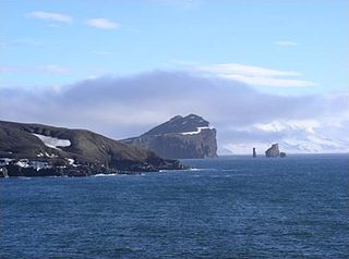
Port Foster is one of the safest harbours in Antarctica, located in Deception Island in the South Shetland Islands.
Nedelya Point is a sharp ice-free point at the southwest extremity of Ivanov Beach on the north coast of Livingston Island in the South Shetland Islands, Antarctica projecting 300 m into Barclay Bay. It is linked by a chain of rocks to Cutler Stack located 310 m to the north-northwest. The feature was visited by a field party from the British base camp Station P during the summer season 1957/58. It is part of the Antarctic Specially Protected Area ASPA 126 Byers Peninsula, situated in one of its two restricted zones.
Essex Point is a point at the northwest end of Byers Peninsula, Livingston Island in the South Shetland Islands, Antarctica. It forms the west side of the entrance to Barclay Bay and the northeast side of the entrance to Svishtov Cove, and is surmounted by Drong Hill.
Collins Point is a small but prominent headland 1.4 km (0.87 mi) west-south-west of Fildes Point, on the south side of Port Foster, Deception Island, in the South Shetland Islands of Antarctica. It was charted by a British expedition under Foster, 1828–31. It was named by Lieutenant Commander D.N. Penfold, Royal Navy, following his survey of the island in 1948–49, for Rear Admiral Kenneth Collins of the Hydrographic Department of the Admiralty.
Kroner Lake is a circular lake 370 m (1,210 ft) in diameter, lying immediately west of Whalers Bay, on Deception Island in the South Shetland Islands of Antarctica. Its old name, "Tokroningen", meaning the two kroner piece, was given by whalers during the period 1905–31. The original name was altered to Kroner Lake in 1950, by the UK Antarctic Place-Names Committee following a survey of Deception Island by Lieutenant Commander D.N. Penfold, Royal Navy, in 1948–49.
Stonethrow Ridge is a snow-covered ridge rising west of Fumarole Bay on Deception Island, in the South Shetland Islands of Antarctica. Vapour Col lies to the south of the ridge.
Mount Pond is a peak, 550 m (1,800 ft) in height, standing 2.8 km (1.7 mi) east-south-east of Pendulum Cove, on Deception Island in the South Shetland Islands of Antarctica. The name appears on an 1829 chart based upon survey work by the British expedition under Foster, 1828–31. It was probably named for John Pond, noted English astronomer and director of the Royal Observatory at Greenwich at that time.

Fredriksen Island is an island 5 km (3.1 mi) long and 1 km (0.62 mi) wide, lying 1 km south-east of Powell Island in the South Orkney Islands of Antarctica. It was discovered by Captains Nathaniel Palmer and George Powell in the course of their joint cruise in December 1821. It was named by Norwegian whaling captain Petter Sorlle, who made a running survey of the island in the 1912–13 summer.
Vapour Col is a col lying south of Stonethrow Ridge on the west side of Deception Island in the South Shetland Islands of Antarctica. The name given by the United Kingdom Antarctic Place-Names Committee (UK-APC) in 1959 originates from the fumaroles in the col. This is the only locality on Deception Island where there is a complete cross section through the stratigraphy of volcanic succession. Having a similar name in the same island is the Fumarole Bay.

Whalers Bay is a small bay entered between Fildes Point and Penfold Point at the east side of Port Foster, Deception Island, in the South Shetland Islands of Antarctica. The bay was so named by the French Antarctic Expedition, 1908–10, under Charcot, because of its use at that time by whalers.
Crater Lake is a volcanic crater, now filled with water, lying north-west of Mount Kirkwood on the south side of Deception Island, in the South Shetland Islands of Antarctica. The descriptive name was given by the United Kingdom Antarctic Place-Names Committee (UK-APC) in 1959.
Ronald Hill is a rocky, ice-free hill, 105 m in height, standing north of Kroner Lake on Deception Island, in the South Shetland Islands of Antarctica. It was charted, photographed and named by Olaf Holtedahl of the Norwegian expedition 1927–28, after the floating factory SS Ronald, which belonged to the Hektor Whaling Company. and was anchored at Deception Island in 1911-12 and many later seasons.
Ivanov Beach is a mostly ice-free beach on the Drake Passage stretching 5 km (3.1 mi) in southwest–northeast direction on the southeast coast of Barclay Bay in western Livingston Island, South Shetland Islands in Antarctica. It extends to Nedelya Point and Byers Peninsula on the southwest, Rowe Point and Etar Snowfield on the northeast, and the slopes of Rotch Dome on the southeast. Its ice-free area is ca. 144 hectares. The beach features Bilyar Point 1.7 km (1.1 mi) northeast of Nedelya Point, Mneme Lake just west of Rowe Point and a minor point 1.1 km (0.68 mi) southwest of the latter. The beach is protected by shallows, and numerous offshore rocks and islets with the largest of them being Cutler Stack off Nedelya Point.
References
- ↑ "Parts of Deception Island, South Shetland Islands" (PDF). Management Plan for Antarctic Specially Protected Area No. 140: Measure 3, Appendix 1. Antarctic Treaty Secretariat. 2005. Retrieved 28 September 2013.
![]() This article incorporates public domain material from the United States Geological Survey document: "South East Point (South Shetland Islands)".(content from the Geographic Names Information System )
This article incorporates public domain material from the United States Geological Survey document: "South East Point (South Shetland Islands)".(content from the Geographic Names Information System )
Coordinates: 62°59′S60°31′W / 62.983°S 60.517°W
| | This Deception Island location article is a stub. You can help Wikipedia by expanding it. |