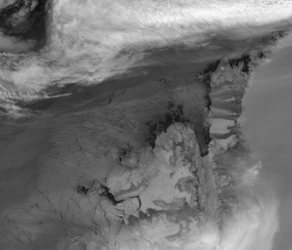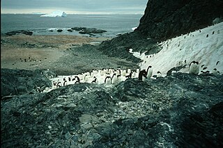
Hut Point Peninsula is a long, narrow peninsula from 3 to 5 km wide and 24 km (15 mi) long, projecting south-west from the slopes of Mount Erebus on Ross Island, Antarctica. McMurdo Station (US) and Scott Base (NZ) are Antarctic research stations located on the Hut Point Peninsula.
Ablation Point, also known as Punta Ablación, is the eastern extremity of a hook-shaped rock ridge marking the north side of the entrance to Ablation Valley, on the east coast of Alexander Island, Antarctica. It was first photographed from the air on 23 November 1935 by Lincoln Ellsworth and mapped from these photographs by W.L.G. Joerg. It was roughly surveyed in 1936 by the British Graham Land Expedition (BGLE) and resurveyed in 1949 by the Falkland Islands Dependencies Survey (FIDS). It was named by FIDS for nearby Ablation Valley. The site lies within Antarctic Specially Protected Area (ASPA) No.147.

Clark Peninsula is a rocky peninsula, about 3 km (2 mi) long and wide, lying 5 km (3 mi) north-east of Australia's Casey Station at the north side of Newcomb Bay on the Budd Coast of Wilkes Land in Antarctica.

Bernard Island is a rocky island 400 m long lying 500 m east of the Petrel Island in the Géologie Archipelago of Antarctica. It was charted in 1951 by a French Antarctic Expedition and named by them for Claude Bernard, a noted French physiologist.
Bon Docteur Nunatak, also known as Good Doctor Nunatak, is a small coastal nunatak, 28 metres (92 ft) high, standing at the west side of the Astrolabe Glacier Tongue, 400 m (1,300 ft) south of Rostand Island in the Geologie Archipelago of Antarctica. It was photographed from the air by U.S. Navy Operation Highjump, 1946–47, charted by the French Antarctic Expedition, 1952–53, and named for Dr Jean Cendron, the "good doctor", medical officer and biologist with the French Antarctic Expedition, 1951–52.

Carrel Island, also known as Le Mauguen Island, is a small, rocky island 400 metres (1,300 ft) long lying 200 metres (660 ft) south of Petrel Island in the Géologie Archipelago of Antarctica. It was charted in 1950 by the French Antarctic Expedition and named by them for Alexis Carrel, noted French surgeon and physiologist.

Nelly Island is the largest and easternmost of the Frazier Islands, lying in Vincennes Bay off Wilkes Land, East Antarctica.
Davis Valley is an ice-free valley just east of Forlidas Ridge in north-east Dufek Massif, in the Pensacola Mountains of Queen Elizabeth Land, Antarctica. It was mapped by the United States Geological Survey from surveys and U.S. Navy air photos in 1956–66, and was named by the Advisory Committee on Antarctic Names for Edward H. Davis, a construction mechanic with the Ellsworth Station winter party, 1957.

Forlidas Pond is a round frozen pond, 100 metres (110 yd) in diameter, lying in a morainal valley east of the north end of Forlidas Ridge, Dufek Massif, Queen Elizabeth Land, Antarctica. The only pond in the northern Pensacola Mountains, it is of much interest to biologists. The pond was discovered and briefly investigated in December 1957 by a United States – International Geophysical Year party from Ellsworth Station. The name is in association with Forlidas Ridge and was suggested by Arthur B. Ford of the United States Geological Survey following geological work in the area, 1978–79.

The Frazier Islands are a group of three rocky islands - Nelly, Dewart and Charlton - in the eastern part of Vincennes Bay, East Antarctica, 15 km (9 mi) west-north-west of Clark Peninsula, and 16 km offshore from Australia's Casey Station.

Moutonnée Lake is a sub-glacial lake that lies within Moutonnee Valley, marginal to the George VI Ice Shelf, 7 km (4.3 mi) south of Ablation Point indenting the east coast of Alexander Island, facing the west coast of Palmer Land, Antarctica. Following limnological and tidal studies by the British Antarctic Survey (BAS) from 1971, it was named by the United Kingdom Antarctic Place-Names Committee (UK-APC) from the presence of roche moutonnées on its shores. As with nearby Ablation and Hodgson Lakes, Moutonnée receives large masses of ice from the adjacent George VI Ice Shelf in George VI Sound, making life in the lake unsustainable. The site lies within Antarctic Specially Protected Area (ASPA) No.147.
Midas Island is an island lying north-west of Apéndice Island in Hughes Bay, off the west coast of Graham Land, Antarctica. It was first seen by the Belgian Antarctic Expedition under Gerlache in 1898 and described as an island with two summits "like the ears of an ass". The name, given by the UK Antarctic Place-Names Committee in 1960, derives from this description; Midas, King of Phrygia, was represented in Greek satyric drama with the ears of an ass.

Haswell Island is the largest of the Haswell Islands, lying off the coast of Antarctica, about 3 kilometres (1.5 nmi) north of Mabus Point in Queen Mary Land. It was discovered by the Western Base Party of the Australasian Antarctic Expedition, 1911–14, under Mawson, and named by him for Professor William A. Haswell, a zoologist at Sydney University and a member of the expedition's Advisory Committee.

Hawker Island is an irregularly shaped island about 2 km (1.2 mi) long, lying some 7 km south-west of Davis Station between Mule Island and Mule Peninsula, Vestfold Hills, in the eastern part of Prydz Bay, Antarctica. It was mapped by Norwegian cartographers from aerial photographs taken by the Lars Christensen Expedition, 1936–37. It was remapped by the Australian National Antarctic Research Expeditions (1957–58) and named after Alan Charles Hawker, a radio supervisor at Davis Station in 1957.
Mount Martine is a massive mountain, about 800 metres (2,600 ft) high, with a prominent rocky north face and ice-covered south slopes, overlooking the north shore of Charcot Island, south of Cheesman Island, in the east Bellinghausen Sea of Antarctica.
Himalia Ridge is a ridge running east–west on the north side of the Ganymede Heights massif, north-east of Jupiter Glacier, in the east of Alexander Island, Antarctica. It was photographed from the air by the Ronne Antarctic Research Expedition in 1947 and mapped from these photographs by D. Searle of the Falkland Islands Dependencies Survey in 1960. The ridge was named by the UK Antarctic Place-Names Committee following British Antarctic Survey geological work, 1983–84, after Himalia, a satellite of the planet Jupiter, in association with Jupiter Glacier. The site lies within Antarctic Specially Protected Area (ASPA) No.147.

The Marion Nunataks are a small group of nunataks rising to about 600 m (2,000 ft) on Charcot Island, in the eastern Bellinghausen Sea of Antarctica. They form a 12 km chain of rocky outcrops on the mid-north coast of the island, stretching from Mount Monique at the western end to Mount Martine in the east.

Lagotellerie Island is an island 1.9 kilometres (1 nmi) long, lying 3.7 kilometres (2 nmi) west of Horseshoe Island in Marguerite Bay, off the west coast of Graham Land, Antarctica. It was discovered and named by the French Antarctic Expedition, 1908–10, under Jean-Baptiste Charcot.

Lamarck Island is a rocky island 250 m (820 ft) long, lying 300 m (980 ft) east of Petrel Island and 300 m (980 ft) north-east of Rostand Island in the Géologie Archipelago, off the Adélie Coast of Antarctica. It was charted in 1951 by the French Antarctic Expedition and named by them after Jean-Baptiste Lamarck, the French naturalist.

Charlton Island is the westernmost of the Frazier Islands, lying in Vincennes Bay off Wilkes Land in East Antarctica.


