
Scott Island is a small uninhabited island of volcanic origin in the Ross Sea, Southern Ocean, 505 kilometres (310 mi) northeast of Cape Adare, the northeastern extremity of Victoria Land, Antarctica. It is 565 metres (618 yd) long north–south, and between 130 metres (140 yd) and 340 metres (370 yd) wide, reaching a height of 54 metres (177 ft) and covering an area of 4 hectares. Haggits Pillar, a stack reaching 62 metres (203 ft) in height and measuring 50 metres (55 yd) in diameter, yielding an area of less than 0.2 hectares, is located 250 metres (270 yd) west of the island. The island has two small coves with beaches, the rest of the island being surrounded by high cliffs. One of the coves is on the northeastern coast and the other opposite Haggitts Pillar on the western coast of the island.
The Transantarctic Mountains comprise a mountain range of uplifted rock in Antarctica which extend, with some interruptions, across the continent from Cape Adare in northern Victoria Land to Coats Land. These mountains divide East Antarctica and West Antarctica. They include a number of separately named mountain groups, which are often again subdivided into smaller ranges.
This is a list of extreme points in Antarctica.

King Edward VII Land or King Edward VII Peninsula is a large, ice-covered peninsula which forms the northwestern extremity of Marie Byrd Land in Antarctica. The peninsula projects into the Ross Sea between Sulzberger Bay and the northeast corner of the Ross Ice Shelf, and forms part of the Ross Dependency. Edward VII Peninsula is defined by the Ross Ice Shelf on the southwest, Okuma Bay on the west, and to the east by Sulzberger Bay and the Saunders Coast, all essentially on the Ross Sea / Southern Ocean in Antarctica. The northwest extremity of the peninsula is Cape Colbeck. Edward VII Peninsula is located at 77°40′S155°00′W.

Beaufort Island is an island in Antarctica's Ross Sea. It is the northernmost feature of the Ross Archipelago, lying 21 kilometres north of Cape Bird, Ross Island. It is approximately 18.4 km2 in area. It was first charted by James Clark Ross in 1841. Ross named the island for Sir Francis Beaufort, hydrographer to the British Royal Navy.

Bernacchi Head is a precipitous cliff forming the southern extremity of Franklin Island in the Ross Sea of Antarctica. It was named "Cape Bernacchi" by the British Antarctic Expedition, 1898–1900, for Louis C. Bernacchi, a member of the expedition. The generic name has been changed to "Head" by the Advisory Committee on Antarctic Names to avoid duplication with Cape Bernacchi on the coast of Victoria Land.

Cape Denison is a rocky point at the head of Commonwealth Bay in George V Land, Antarctica. It was discovered in 1912 by the Australasian Antarctic Expedition (1911–14) under Douglas Mawson, who named it for Sir Hugh Denison of Sydney, a patron of the expedition. The cape was the site of the expedition's main base. Called by Mawson "the windiest place on Earth", the site experiences fierce katabatic winds.
Hut Point Peninsula is a long, narrow peninsula from 3 to 5 km wide and 24 km (15 mi) long, projecting south-west from the slopes of Mount Erebus on Ross Island, Antarctica. McMurdo Station (US) and Scott Base (NZ) are Antarctic research stations located on the Hut Point Peninsula.

Between 1997 and 1999 the international Cape Roberts Project (CRP) has recovered up to 1,000 m (3,300 ft) long drill cores in the Ross Sea, Antarctica to reconstruct the glaciation history of Antarctica. Scientists from various institutes in seven countries have participated: Australia, Germany, United Kingdom, The Netherlands, Italy, New Zealand, and USA. After a seismic pre-site survey the area off Cape Roberts in the Ross Sea at the margin of the Transantarctic Mountains was found to be suitable.
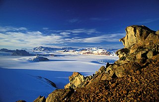
Cape Crozier is the most easterly point of Ross Island in Antarctica. It was discovered in 1841 during James Clark Ross's expedition of 1839 to 1843 with HMS Erebus and HMS Terror, and was named after Francis Crozier, captain of HMS Terror. The extinct volcano Mount Terror, also named during the Ross expedition, rises sharply from the Cape to a height of 3,230 m (10,600 ft), and the edge of the Ross Ice Shelf stretches away to its east.
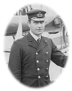
William Colbeck was a British seaman who distinguished himself on two Antarctic expeditions.

Caughley Beach is the northernmost beach on the ice-free coast south-west of Cape Bird, Ross Island, Antarctica. It was mapped by the New Zealand Geological Survey Antarctic Expedition, 1958–59, and named for Graeme Caughley, biologist with the party that visited Cape Bird. New College Valley, Antarctic Specially Protected Area (ASPA) No.116, lies above the beach.

Gregory Island is a small ice-free island lying just off the east coast of Victoria Land, Antarctica, 5 km (3.1 mi) north-east of Cape Archer and 8 km (5.0 mi) south of Cape Ross. It was discovered by the British National Antarctic Expedition (1901–04), at which time it was thought to be a coastal point and was named "Gregory Point," for John Walter Gregory, director of the civilian staff of the expedition. It was determined to be an island by the British Antarctic Expedition, 1910–13.
The Downshire Cliffs are a line of precipitous basalt cliffs rising to 2,000 m above the Ross Sea and forming much of the eastern side of the Adare Peninsula, along the Borchgrevink Coast of northern Victoria Land, Antarctica. The nearest permanent research stations are the Italian Mario Zucchelli and South Korean Jang Bogo Stations some 400 km to the south in Terra Nova Bay.
Hamilton Glacier is a glacier about 5 nautical miles (9 km) long draining northwest from Edward VII Peninsula south of Cape Colbeck, Antarctica. It was named by the Advisory Committee on Antarctic Names after Gordon S. Hamilton of the faculty, University of Maine, who was a theoretical and field researcher of ice motion in the West Antarctic ice stream area from the 1980s.

McDonald Beach is an extensive beach lying west of Inclusion Hill and 6 nautical miles (11 km) southwest of Cape Bird on Ross Island, Antarctica. It was named by the New Zealand Geological Survey Antarctic Expedition (NZGSAE), 1958–59, after Captain Edwin A. McDonald, then Deputy Commander, US Naval Support Force, Antarctica, who provided extensive transport and other facilities to the NZGSAE in support of the survey of the Cape Bird area.

Haswell Island is the largest of the Haswell Islands, lying off the coast of Antarctica, about 3 kilometres (1.5 nmi) north of Mabus Point in Queen Mary Land. It was discovered by the Western Base Party of the Australasian Antarctic Expedition, 1911–14, under Mawson, and named by him for Professor William A. Haswell, a zoologist at Sydney University and a member of the expedition's Advisory Committee.

Cape Roget is a steep rock cape at the southern end of the east coast of the Adare Peninsula, marking the northern side of the entrance to Moubray Bay, in northern Victoria Land, Antarctica. It was discovered in 1841 by Captain James Clark Ross, who named it for Peter Mark Roget, British physician, lexicographer and Secretary of the Royal Society.

Cape Melville, is a low-lying, ice-free headland at the eastern end of King George Island in the South Shetland Islands of Antarctica. Some 388 ha of the site has been identified as an Important Bird Area (IBA) by BirdLife International because it supports a large breeding colony of about 16,000 pairs of chinstrap penguins.
Rocky Point is a 40 m high headland between Horseshoe Bay and Maumee Bight, about 4 km north of Cape Royds on Ross Island, Antarctica.

