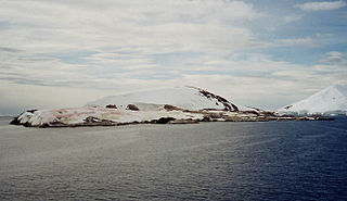
Petermann Island is a small, low and rounded island, lying off the northwest coast of Kyiv Peninsula in Graham Land, Antarctica, a short distance south of Booth Island and the Lemaire Channel. It is a popular tourist destination.

Arthur Harbour is a small harbour entered between Bonaparte Point and Amsler Island on the south-west coast of Anvers Island in the Palmer Archipelago of Antarctica.

Welch Island is an island, 1.8 km (1.1 mi) long with a prominent pinnacle rock of 130 m (427 ft), lying north of the Rouse Islands and 2 km (1.2 mi) off the eastern side of Holme Bay in Mac. Robertson Land, Antarctica. It lies 1 km (0.6 mi) south of Welch Rocks.
Emperor Island is a small island in Marguerite Bay, lying close north-east of the Courtier Islands in the Dion Islands. The islands in this group were discovered and roughly charted in 1909 by the French Antarctic Expedition. This island was surveyed in 1948 by the Falkland Islands Dependencies Survey and so named by the UK Antarctic Place-Names Committee because a low rock and shingle isthmus at the south-eastern end of the island was the winter breeding site of emperor penguins.

Cape Batterbee is a small, rocky point on the coast, the most northerly cape of Enderby Land. It is located 92 km north of Mount Elkins.
Andersen Island is an island 7 kilometres (4 nmi) west of Thorgaut Island, and 4 kilometres (2 nmi) east of Child Rocks, in the Robinson Group, Antarctica. It was mapped by the British Australian New Zealand Antarctic Research Expedition under Douglas Mawson in February 1931. The island was also charted from the whaler Thorgaut about the same time. It was named after Captain Lars Andersen of the whaler Falk who had assisted the Discovery with coal.
Eadie Island is an island 2 km (1.2 mi) long which lies between Aspland Island and O'Brien Island, in the South Shetland Islands of Antarctica. A strong marine channel, named Tasman Rip, runs between Eadie Island and O'Brien Island.
Filla Island is a rocky island about 5.5 kilometres (3.4 mi) long, located in the northern part of the Rauer Islands and being the largest island in the group. It was charted by Norwegian cartographers from air photos taken by the Lars Christensen Expedition (1936–37). They gave the name Filla to a larger island here, presumably for the ragged outline of the feature as shown on the Norwegian chart. In 1952, John Roscoe made a study of this area as revealed in aerial photographs taken by U.S. Navy Operation Highjump (1946–47). He found that what the Norwegians had named Filla was in fact a cluster of small islands. He applied the name Filla Island to the largest of these as described.

Moe Island is an island 2 km (1.2 mi) long in the South Orkney Islands off Antarctica, separated from the south-west end of Signy Island by Fyr Channel. It was charted by Captain Petter Sørlle in 1912–13, and named after M. Thoralf Moe of Sandefjord, Norway, a contemporary whaling captain who worked in this area. The northernmost point of the island is Spaull Point, named by United Kingdom Antarctic Place-Names Committee (UK-APC) after Vaughan W. Spaull, British Antarctic Survey (BAS) biologist on Signy Island, 1969.
Gibbney Island is a small island on the west side of Holme Bay, off Mac. Robertson Land, Antarctica. It was mapped by Norwegian cartographers from air photos taken by the Lars Christensen Expedition, 1936–37, and named "Bryggeholmen". It was renamed by the Antarctic Names Committee of Australia for L.F. Gibbney, officer in charge at Heard Island station in 1952.
Gourdin Island is the largest island (124 ha) in a group of islands and rocks 2 km (1 nmi) north of Prime Head, the northern tip of the Antarctic Peninsula. It was discovered by a French expedition, 1837–40, under Captain Jules Dumont d'Urville, and named by him for Ensign Jean Gourdin of the expedition ship Astrolabe. The island was reidentified and charted by the Falkland Islands Dependencies Survey in 1945–47.
Lucas Island is a small island lying just west of the Vestfold Hills, Antarctica, 4 kilometres (2 nmi) north-west of Plog Island. It was mapped by Norwegian cartographers from air photos taken by the Lars Christensen Expedition (1936–37) and called "Plogsteinen". It was mapped by the Australian National Antarctic Research Expeditions in 1958 and renamed for W.C. Lucas, a diesel mechanic at Davis Station, 1957.
Haswell Island is the largest of the Haswell Islands, lying off the coast of Antarctica, about 3 kilometres (1.5 nmi) north of Mabus Point in Queen Mary Land. It was discovered by the Western Base Party of the Australasian Antarctic Expedition, 1911–14, under Mawson, and named by him for Professor William A. Haswell, a zoologist at Sydney University and a member of the expedition's Advisory Committee.
The Klung Islands are a group of small islands lying 1 kilometre (0.5 nmi) east of Welch Island and the Welch Rocks in the northeastern part of Holme Bay, Antarctica. They were mapped by Norwegian cartographers from aerial photographs taken by the Lars Christensen Expedition, 1936–37, and called Klungholmane. Klung Island is the largest island in the group.
Kirton Island is a small coastal island of the Robinson Group, lying 6 kilometres (3 nmi) west of Cape Daly, Mac. Robertson Land, Antarctica, and about 3 kilometres (1.5 nmi) south of Macklin Island. It was mapped by Norwegian cartographers from air photos taken by the Lars Christensen Expedition, 1936–37, and was named by the Antarctic Names Committee of Australia for M. Kirton, a geophysicist at Mawson Station in 1959.
Macklin Island is a small island in the eastern part of the Robinson Group, about 3 kilometres (1.5 nmi) north of Kirton Island, and 6 kilometres (3 nmi) northwest of Cape Daly, Mac. Robertson Land, Antarctica. It was mapped by Norwegian cartographers from air photos taken by the Lars Christensen Expedition, 1936–37, and was named by the Antarctic Names Committee of Australia for E.L. Macklin, a radio officer at Mawson Station in 1955 and 1959.
Hop Island is one of the largest of the Rauer Islands, lying 2 km (1.2 mi) west-south-west of Filla Island. It was charted by Norwegian cartographers from aerial photos taken by the Lars Christensen Expedition (1936–37), who gave the name Hopoy. They charted the feature as being even larger, including a southern arm enclosing a cove. The feature was more accurately delineated by John H. Roscoe in 1952 from air photos taken by U.S. Navy Operation Highjump (1946–47). The name Hop Island has been retained for the largest segment of the feature as suggested by Roscoe.
Thurston Glacier is a glacier about 28 km (17 mi) long which drains the south-eastern slopes of Mount Siple on Siple Island. The glacier trends eastward and then east-north-eastward to reach the northern shore of the island. It was mapped by the United States Geological Survey (USGS) from surveys and United States Navy aerial photography, 1959–65.
Lugg Island is a small island in the Donskiye Islands group lying 2 km (1.2 mi) north-west of Lake Island, off the west end of Breidnes Peninsula, Vestfold Hills, Antarctica. It was first plotted from aerial photos taken by the Lars Christensen Expedition, 1936–37, and was named by the Antarctic Names Committee of Australia for Dr. D. Lugg, medical officer at Davis Station in 1963, who visited the island for biological studies.
Bluff Island is an island lying 1 kilometre (0.5 nmi) south of Magnetic Island and 4 kilometres (2 nmi) west of the Breidnes Peninsula, Vestfold Hills, in Prydz Bay, Antarctica. It was mapped from aerial photos taken by the Lars Christensen Expedition, 1936–37, re-emapped by the Australian National Antarctic Research Expeditions (1957–58) and so named because the south end of the island is marked by a steep cliff face.
